
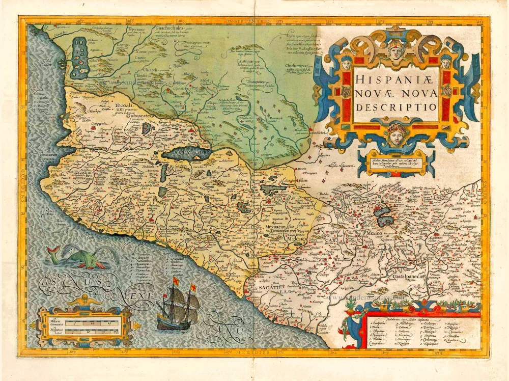
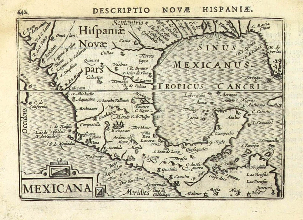
New Spain (Mexico) by Abraham Ortelius. 1595


Abraham Ortelius (1527-1598)
The maker of the 'first atlas', the Theatrum Orbis Terrarum (1570), was born on 4 April 1527 into an old Antwerp family. He learned Latin and studied Greek and mathematics.
Abraham and his sisters Anne and Elizabeth took up map colouring. He was admitted to the Guild of St. Luke as an "illuminator of maps." Besides colouring maps, Ortelius was a dealer in antiques, coins, maps, and books, with the book and map trade gradually becoming his primary occupation.
Business went well because his means permitted him to start an extensive collection of medals, coins, antiques, and a library of many volumes. In addition, he travelled a lot and visited Italy and France, made contacts everywhere with scholars and editors, and maintained extensive correspondence with them.
In 1564 he published his first map, a large and ambitious world wall map. The inspiration for this map may well have been Gastaldi's large world map. In 1565 he published a map of Egypt and a map of the Holy Land, a large map of Asia followed.
In 1568 the production of individual maps for his atlas Theatrum Orbis Terrarum was already in full swing. He completed the atlas in 1569, and in May of 1570, the Theatrum was available for sale. It was one of the most expensive books ever published.
This first edition contained seventy maps on fifty-three sheets. Franciscus Hogenberg engraved the maps.
Later editions included Additamenta (additions), resulting in Ortelius' historical atlas, the Parergon, mostly bound together with the atlas. The Parergon can be called a truly original work of Ortelius, who drew the maps based on his research.
The importance of the Theatrum Orbis Terrarum for geographical knowledge in the last quarter of the sixteenth century is difficult to overemphasize. Nothing was like it until Mercator's atlas appeared twenty-five years later. Demand for the Theatrum was remarkable. Some 24 editions appeared during Ortelius's lifetime and another ten after his death in 1598. Editions were published in Dutch, German, French, Spanish, English, and Italian. The number of map sheets grew from 53 in 1570 to 167 in 1612 in the last edition.
In 1577, engraver Philip Galle and poet-translator Pieter Heyns published the first pocket-sized edition of the Theatrum, the Epitome. The work was trendy. Over thirty editions of this Epitome were published in different languages.
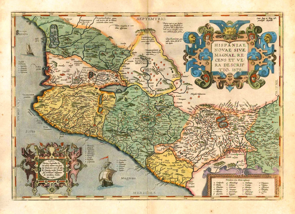
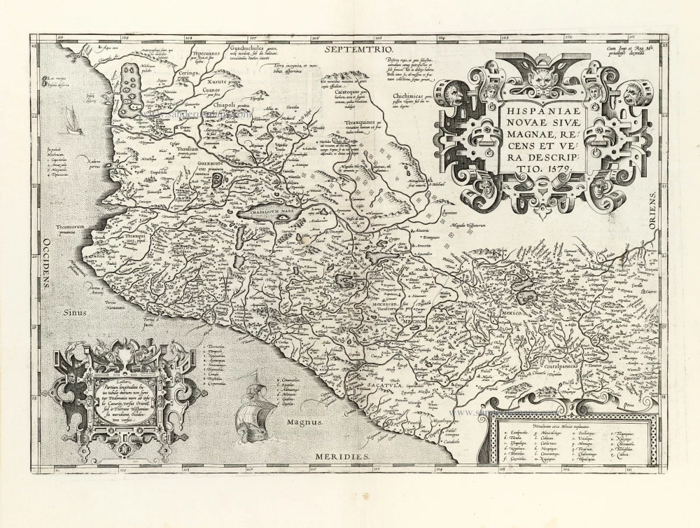
Hispaniae Novae sivae Magnae, recens et vera descriptio. 1579.
Item Number: 26297 Authenticity Guarantee
Category: Antique maps > America > North America
New Spain (Mexico) by Abraham Ortelius.
Title: Hispaniae Novae sivae Magnae, recens et vera descriptio. 1579.
Cum Imp. et Reg. Mts privilegio decennali.
Date of the first edition: 1579.
Date of this map: 1595.
Date on map: 1579.
Copper engraving, printed on paper.
Size (not including margins): 350 x 505mm (13.78 x 19.88 inches).
Verso: Latin text.
Condition: Original coloured, excellent.
Condition Rating: A+.
From: Theatrum Orbis Terrarum Antwerp, Plantin Press, 1595. (Van der Krogt 3, 31:051)
Abraham Ortelius (1527-1598)
The maker of the 'first atlas', the Theatrum Orbis Terrarum (1570), was born on 4 April 1527 into an old Antwerp family. He learned Latin and studied Greek and mathematics.
Abraham and his sisters Anne and Elizabeth took up map colouring. He was admitted to the Guild of St. Luke as an "illuminator of maps." Besides colouring maps, Ortelius was a dealer in antiques, coins, maps, and books, with the book and map trade gradually becoming his primary occupation.
Business went well because his means permitted him to start an extensive collection of medals, coins, antiques, and a library of many volumes. In addition, he travelled a lot and visited Italy and France, made contacts everywhere with scholars and editors, and maintained extensive correspondence with them.
In 1564 he published his first map, a large and ambitious world wall map. The inspiration for this map may well have been Gastaldi's large world map. In 1565 he published a map of Egypt and a map of the Holy Land, a large map of Asia followed.
In 1568 the production of individual maps for his atlas Theatrum Orbis Terrarum was already in full swing. He completed the atlas in 1569, and in May of 1570, the Theatrum was available for sale. It was one of the most expensive books ever published.
This first edition contained seventy maps on fifty-three sheets. Franciscus Hogenberg engraved the maps.
Later editions included Additamenta (additions), resulting in Ortelius' historical atlas, the Parergon, mostly bound together with the atlas. The Parergon can be called a truly original work of Ortelius, who drew the maps based on his research.
The importance of the Theatrum Orbis Terrarum for geographical knowledge in the last quarter of the sixteenth century is difficult to overemphasize. Nothing was like it until Mercator's atlas appeared twenty-five years later. Demand for the Theatrum was remarkable. Some 24 editions appeared during Ortelius's lifetime and another ten after his death in 1598. Editions were published in Dutch, German, French, Spanish, English, and Italian. The number of map sheets grew from 53 in 1570 to 167 in 1612 in the last edition.
In 1577, engraver Philip Galle and poet-translator Pieter Heyns published the first pocket-sized edition of the Theatrum, the Epitome. The work was trendy. Over thirty editions of this Epitome were published in different languages.
Related items
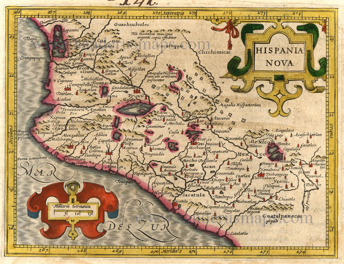
Hispania Nova. 1607
New Spain (Mexico) by G. Mercator.
[Item number: 362]

Nova Hispania, Et Nova Galicia. 1633
New Spain (Mexico) by J. Janssonius.
[Item number: 7787]
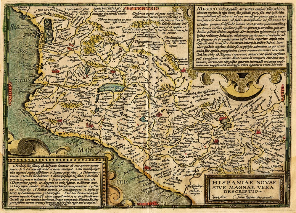
Hispaniae Novae sive Magnae Vera Descriptio. 1608
Mexico, by Quad M.-Bussemacher J.
[Item number: 15869]

Pas Kaart van de Boght van Florida met de Canaal tusschen Florida en Cuba ... 1680-1694
Sea chart of the Gulf of Mexico, Yucatan Channel, by J. Van Keulen.
[Item number: 16285]
Hispaniae Novae sivae Magnae, recens et vera descriptio. 1612
New Spain (Mexico) by Abraham Ortelius.
[Item number: 23112]
Nova Hispania et Nova Galicia. 1641
New Spain (Mexico), by Johannes Janssonius.
[Item number: 26463]
Hispania Nova. 1607
Mexico, by C. van Wytfliet.
[Item number: 26501]
Nova Hispania et Nova Galicia. 1643-50
New Spain (West Mexico), by Willem & Joan Blaeu.
[Item number: 26738]
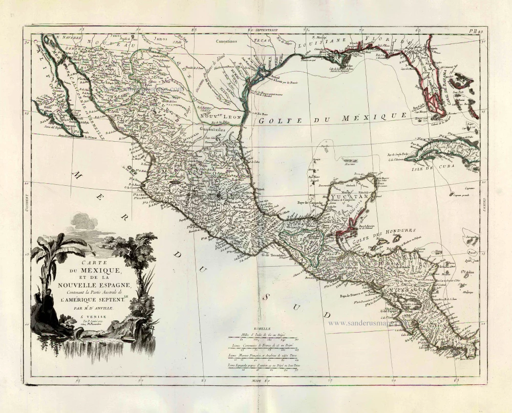
Carte du Mexique, et de la Nouvelle Espagne, Contenant la Partie Australe de l'Amérique Septentle. 1776-79
Mexico, by Paolo Santini.
[Item number: 27009]
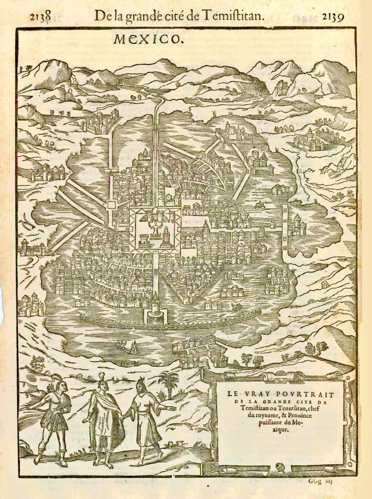
Mexico. [Above the map :] De la grande cité de Temistitan. [In cartouche :] Le vray pourtrait de la grande cité de Temistitan ou Tenutlitan, chef du royaume, & Province puissante du Mexique. 1575
Mexico City, by François de Belleforest.
[Item number: 27369]
Hispaniae Novae Nova Descriptio. 1623
New Spain (Mexico) by Jodocus Hondius.
[Item number: 27817]
Mexico sive N. Hispania. 1661
Mexico, by Pierre Duval.
[Item number: 27839]
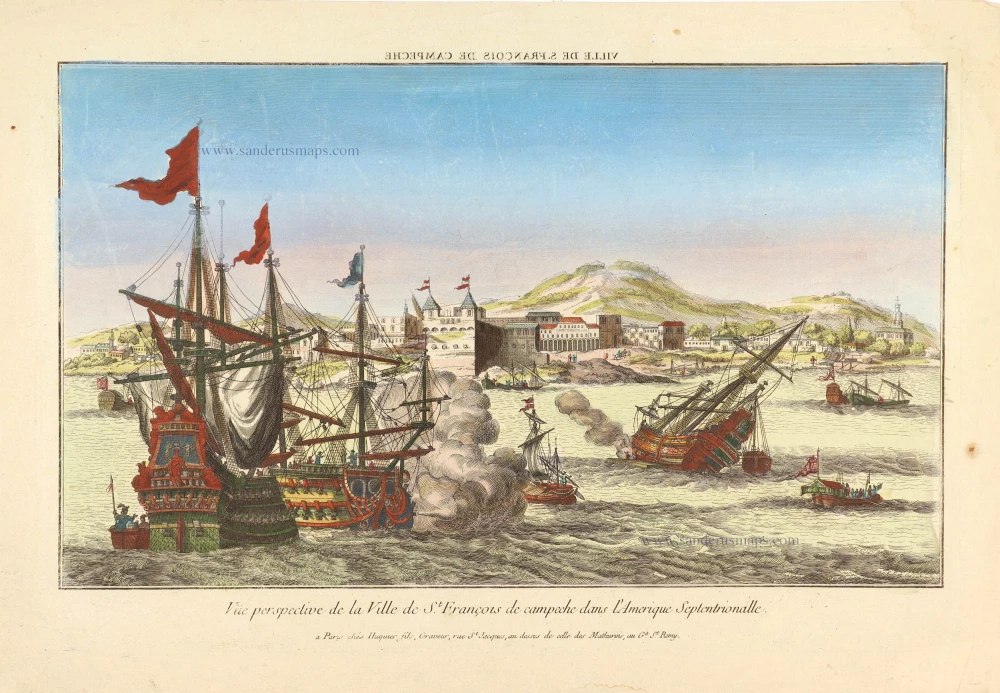
Vue prespective de la Ville de St. François de campech dans L'Amerique Septentrionalle. ca. 1780
Perspective view of a naval battle off the town of St. François (Campeche - Mexico).
[Item number: 28994]
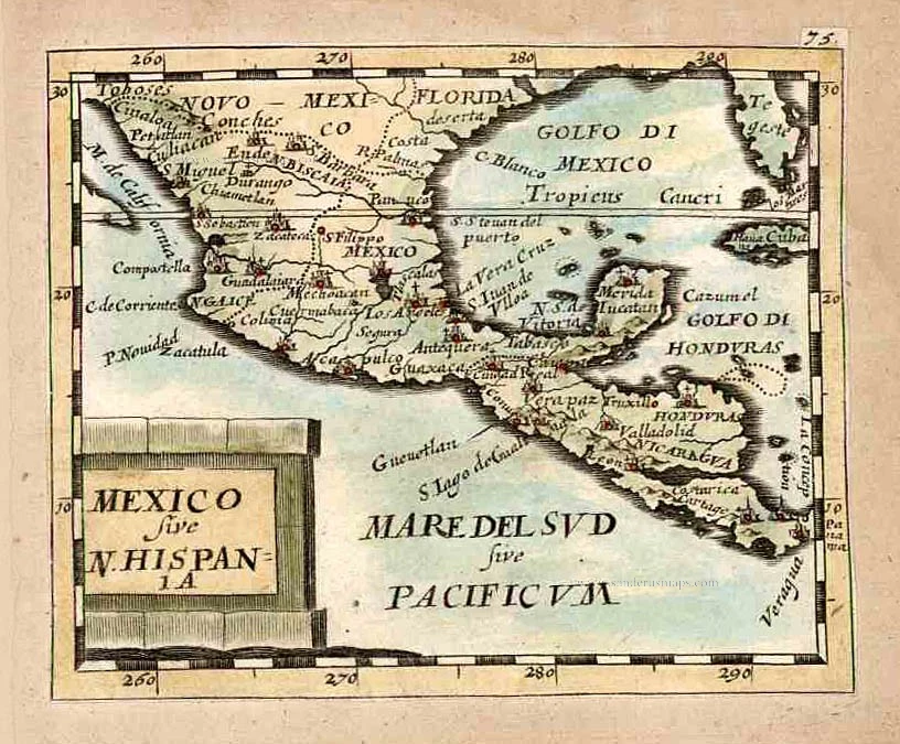
Mexicana. 1602
Mexico, Texas & Florida by Bertius Petrus
[Item number: 29492]
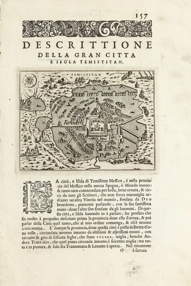
Temistitan - [Above map :] Descrittione della Gran Citta e Isola Temistitan. 1590
Mexico City by Tommaso Porcacchi.
[Item number: 29826]
Very rare.
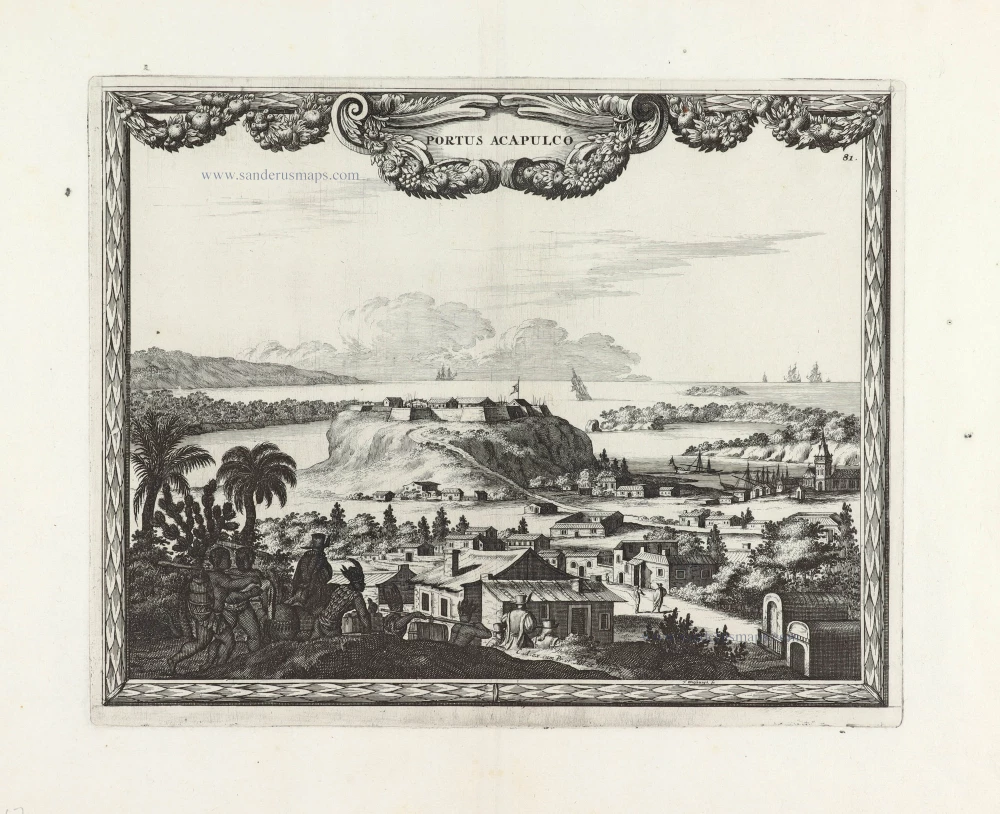
Portus Acapulco. 1685/90
View of Acapulco (Mexico) by Carel Allard.
[Item number: 30548]