Exeter, by Braun and Hogenberg. 1617
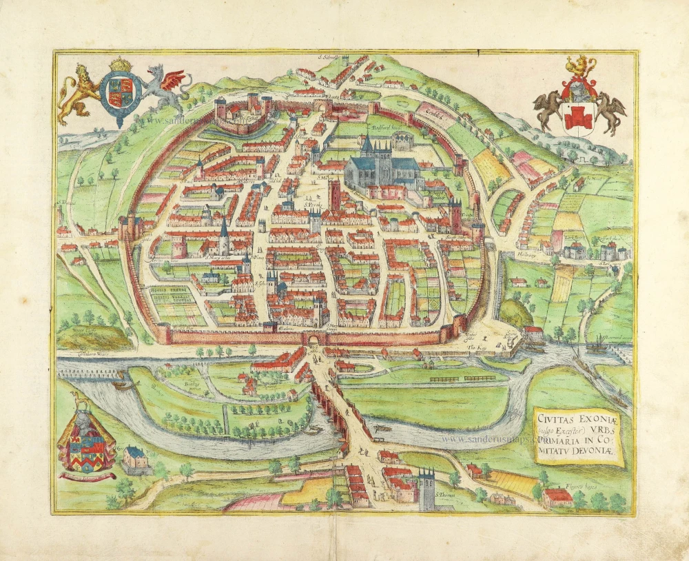


CARTOUCHE: The city of Exonia (in English Exeter), the capital of Devonshire.
COMMENTARY BY BRAUN (on verso): "In the city, there are 15 parish churches, among which the most distinguished was built in honour of the holy Apostle Peter and now is embellished with fine houses all around it. In respect of the history of this city, it is worth mentioning that the Britons resisted the Saxons but finally were defeated by Athelstan. The latter fortified the city with walls, ramparts and bastions. An ancient castle called Rougemont can be seen on top of the city's hill."
This bird's-eye view from the southwest shows the intact fortifications of the city and the grid-like arrangement of the Roman town of Isca Dumnoniorum. Situated almost in the same place as in Roman times is the harbour in the south, accessible through the Quay Gate. In this view, the houses on the exaggeratedly wide streets appear very small beside the tall church towers, which underline the city's character as an episcopal see. The Gothic cathedral of St Peter dominates Exeter. Further to the left can be seen the 12th-century Guild Hall, courthouse and meeting place of the guilds and the city council seat. At the top left, the 11th-century Norman castle of Rougemont can be identified. (Taschen)
Braun G. & Hogenberg F. and the Civitates Orbis Terrarum.
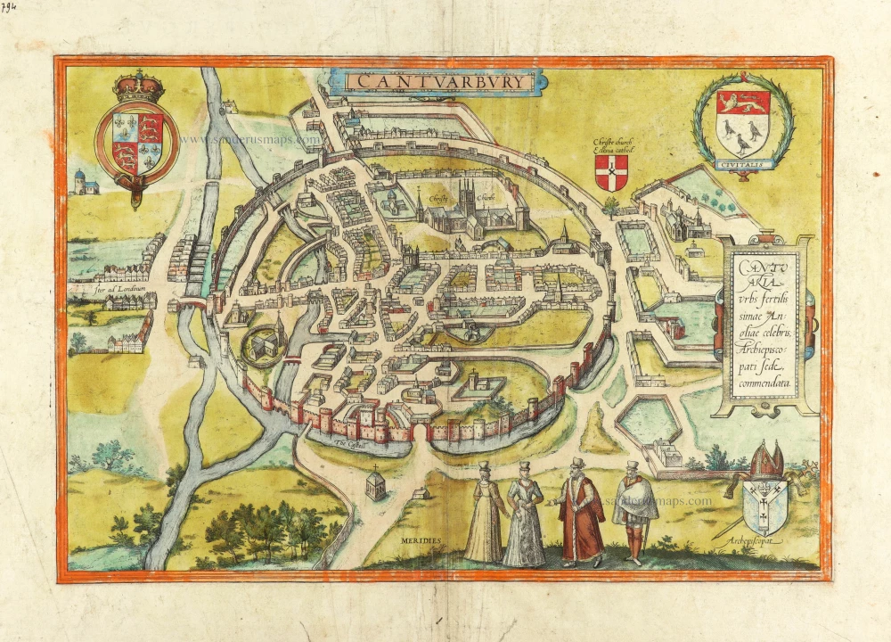
The Civitates Orbis Terrarum, or the "Braun & Hogenberg", is a six-volume town atlas and the most excellent book of town views and plans ever published: 363 engravings, sometimes beautifully coloured. It was one of the best-selling works in the last quarter of the 16th century. Georg Braun wrote the text accompanying the plans and views on the verso. Many plates were engraved after the original drawings of a professional artist, a professional artist, Joris Hoefnagel (1542-1600). The first volume was published in Latin in 1572, and the sixth in 1617. Frans Hogenberg created the tables for volumes I through IV, and Simon van den Neuwel made those for volumes V and VI. Other contributors were cartographers Daniel Freese and Heinrich Rantzau. Works by Jacob van Deventer, Sebastian Münster, and Johannes Stumpf were also used. Translations appeared in German and French.
Following the original publication of Volume 1 of the Civitates in 1572, seven further editions of 1575, 1577, 1582, 1588, 1593, 1599 and 1612 can be identified. Vol.2, first issued in 1575, was followed by further editions in 1597 and 1612. The subsequent volumes appeared in 1581, 1588, 1593, 1599 and 1606. The German translation of the first volume appeared from 1574 on, and the French edition from 1575 on.
Several printers were involved: Theodor Graminaeus, Heinrich von Aich, Gottfried von Kempen, Johannis Sinniger, Bertram Buchholtz and Peter von Brachel, who all worked in Cologne.
Georg Braun (1541-1622)
Georg Braun was born in Cologne in 1541. After his studies in Cologne, he entered the Jesuit Order as a novice. 1561, he obtained his bachelor's degree, and in 1562, he received his Magister Artium. Although he left the Jesuit Order, he studied theology, gaining a licentiate in theology.
Frans Hogenberg (1535-1590)
Frans Hogenberg was a Flemish and German painter, engraver, and mapmaker. He was born in Mechelen as the son of Nicolaas Hogenberg.
By the end of the 1560s, Frans Hogenberg was employed upon Abraham Ortelius's Theatrum Orbis Terrarum, published in 1570; he is named an engraver of numerous maps. In 1568, he was banned from Antwerp by the Duke of Alva and travelled to London, where he stayed a few years before emigrating to Cologne. He immediately embarked on his two most important works, the Civitates, published in 1572 and the Geschichtsblätter, which appeared in several series from 1569 until about 1587.
Thanks to large-scale projects like the Geschichtsblätter and the Civitates, Hogenberg's social circumstances improved with each passing year. He died as a wealthy man in Cologne in 1590.
Civitas Exoniae (vulgo Excester) Urbs Primaria in Comitatu Devoniae.
Item Number: 28937 Authenticity Guarantee
Category: Antique maps > Europe > British Isles - Cities
Antique map - Bird's-eye view plan of the city of Exeter, by Braun and Hogenberg.
Title: Civitas Exoniae (vulgo Excester) Urbs Primaria in Comitatu Devoniae.
Date of the first edition: 1617.
Date of this map: 1617-18.
Copper engraving, printed on paper.
Map size: 320 x 403mm (12.6 x 15.87 inches).
Sheet size: 385 x 475mm (15.16 x 18.7 inches).
Verso: Latin text.
Condition: Original coloured, centrefold reinforced.
Condition Rating: A.
From: Civitates Orbis Terrarum. -. Theatri praecipuarum Totius Mundi Urbium Liber Sextus Anno MDCXVII. Cologne, Anton Hierat, 1617-18. (Van der Krogt 4, 41:1.6)
CARTOUCHE: The city of Exonia (in English Exeter), the capital of Devonshire.
COMMENTARY BY BRAUN (on verso): "In the city, there are 15 parish churches, among which the most distinguished was built in honour of the holy Apostle Peter and now is embellished with fine houses all around it. In respect of the history of this city, it is worth mentioning that the Britons resisted the Saxons but finally were defeated by Athelstan. The latter fortified the city with walls, ramparts and bastions. An ancient castle called Rougemont can be seen on top of the city's hill."
This bird's-eye view from the southwest shows the intact fortifications of the city and the grid-like arrangement of the Roman town of Isca Dumnoniorum. Situated almost in the same place as in Roman times is the harbour in the south, accessible through the Quay Gate. In this view, the houses on the exaggeratedly wide streets appear very small beside the tall church towers, which underline the city's character as an episcopal see. The Gothic cathedral of St Peter dominates Exeter. Further to the left can be seen the 12th-century Guild Hall, courthouse and meeting place of the guilds and the city council seat. At the top left, the 11th-century Norman castle of Rougemont can be identified. (Taschen)
Braun G. & Hogenberg F. and the Civitates Orbis Terrarum.
The Civitates Orbis Terrarum, or the "Braun & Hogenberg", is a six-volume town atlas and the most excellent book of town views and plans ever published: 363 engravings, sometimes beautifully coloured. It was one of the best-selling works in the last quarter of the 16th century. Georg Braun wrote the text accompanying the plans and views on the verso. Many plates were engraved after the original drawings of a professional artist, a professional artist, Joris Hoefnagel (1542-1600). The first volume was published in Latin in 1572, and the sixth in 1617. Frans Hogenberg created the tables for volumes I through IV, and Simon van den Neuwel made those for volumes V and VI. Other contributors were cartographers Daniel Freese and Heinrich Rantzau. Works by Jacob van Deventer, Sebastian Münster, and Johannes Stumpf were also used. Translations appeared in German and French.
Following the original publication of Volume 1 of the Civitates in 1572, seven further editions of 1575, 1577, 1582, 1588, 1593, 1599 and 1612 can be identified. Vol.2, first issued in 1575, was followed by further editions in 1597 and 1612. The subsequent volumes appeared in 1581, 1588, 1593, 1599 and 1606. The German translation of the first volume appeared from 1574 on, and the French edition from 1575 on.
Several printers were involved: Theodor Graminaeus, Heinrich von Aich, Gottfried von Kempen, Johannis Sinniger, Bertram Buchholtz and Peter von Brachel, who all worked in Cologne.
Georg Braun (1541-1622)
Georg Braun was born in Cologne in 1541. After his studies in Cologne, he entered the Jesuit Order as a novice. 1561, he obtained his bachelor's degree, and in 1562, he received his Magister Artium. Although he left the Jesuit Order, he studied theology, gaining a licentiate in theology.
Frans Hogenberg (1535-1590)
Frans Hogenberg was a Flemish and German painter, engraver, and mapmaker. He was born in Mechelen as the son of Nicolaas Hogenberg.
By the end of the 1560s, Frans Hogenberg was employed upon Abraham Ortelius's Theatrum Orbis Terrarum, published in 1570; he is named an engraver of numerous maps. In 1568, he was banned from Antwerp by the Duke of Alva and travelled to London, where he stayed a few years before emigrating to Cologne. He immediately embarked on his two most important works, the Civitates, published in 1572 and the Geschichtsblätter, which appeared in several series from 1569 until about 1587.
Thanks to large-scale projects like the Geschichtsblätter and the Civitates, Hogenberg's social circumstances improved with each passing year. He died as a wealthy man in Cologne in 1590.