
Amsterdam, by Georg Braun & Frans Hogenberg. 1599
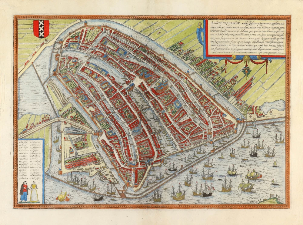
TRANSLATION OF CARTOUCHE TEXT: Amsterdam is a well-known city in Lower Germany that has recently arisen to accommodate merchants and is inhabited by people engaged in trade. It is almost impossible to think of a commercial activity not practised here. Hence, profit-seeking business people are drawn to this city from faraway lands and transship various goods, first and foremost grain, to Brabant and other parts of the world. Vast riches result from the trade of this kind.
COMMENTARY BY BRAUN: "Holland is the most fertile part of the Netherlands. It is crossed by many waterways full of fish, which ensure that in the whole world, there is no other landscape in which so many cities lie within such a confined area ... Amongst these, Amsterdam is the noblest ... It lies on the River Amstel, from which many canals lead into the city. About twice a year, many ships arrive here from all over Europe, some 200 or 300 from the Netherlands, France, England, Spain, Portugal, Germany, Poland, Lithuania, Norway, Sweden and the other countries of the North. ... There are also very good and experienced ship-builders here. ... This city is supported on large and sturdy wooden stilts that have been driven into the bed of the water. When you see the air, the sea, the dams and the many sluices, you can easily compare the city with Venice and consider it just as fortunate."
The plan presents Amsterdam in a bird's-eye view from a northeasterly direction. On the left-hand side, we can see how the mouth of the River Amstel has been dammed, and its waters channelled into canals and made to pass through the city before flowing out into the Zuiderzee (today the IJsselmeer). The canals, used to transport imported goods to the counting houses located all over the city, are lined with private homes, commercial buildings and warehouses. In the centre of the plan, the old town hall (Stadhuis, 21) and the neighbouring Nieuwe Kerk (23) are also clearly recognisable. With its depiction of the heavy shipping traffic inside the harbour and on the Zuiderzee, the engraving conveys an impression of the contemporary scale of trade conducted in the continually expanding metropolis. In the 13th century, Amsterdam was a small fishing port built on marshy ground. In 1300, it was granted its municipal charter, and in 1369, it became a member of the Hanseatic League. Not until the beginning of the 1600s did the city finally establish itself as the leading trade centre and the constantly expanding hub of a global financial and commercial empire. This Golden Age brought an economic boom and a flowering of the sciences and arts, which lasted until the end of the 17th century: Between 1570 and 1640, Amsterdam's population grew from around 30,000 to almost 140,000; today, it numbers about 750,000. (Taschen)
Braun G. & Hogenberg F. and the Civitates Orbis Terrarum.
The Civitates Orbis Terrarum, also known as the 'Braun & Hogenberg', is a six-volume town atlas and the most excellent book of town views and plans ever published: 363 engravings, sometimes beautifully coloured. It was one of the best-selling works in the last quarter of the 16th century. Georg Braun, a skilled writer, wrote the text accompanying the plans and views on the verso. Many plates were engraved after the original drawings of a professional artist, Joris Hoefnagel (1542-1600). The first volume was published in Latin in 1572 and the sixth in 1617. Frans Hogenberg, a talented engraver, created the tables for volumes I through IV, and Simon van den Neuwel made those for volumes V and VI. Other contributors were cartographers Daniel Freese and Heinrich Rantzau, who provided valuable geographical information. Works by Jacob van Deventer, Sebastian Münster, and Johannes Stumpf were also used as references. Translations appeared in German and French, making the atlas accessible to a broader audience.
Since its original publication of volume 1 in 1572, the Civitates Orbis Terrarum has left an indelible mark on the history of cartography. Seven more editions followed the first volume in 1575, 1577, 1582, 1588, 1593, 1599, and 1612. Vol.2, initially released in 1575, saw subsequent editions in 1597 and 1612. The subsequent volumes, each a treasure trove of historical insights, graced the world in 1581, 1588, 1593, 1599, and 1606. The German translation of the first volume, a testament to its widespread appeal, debuted in 1574, followed by the French edition in 1575.
Several printers were involved: Theodor Graminaeus, Heinrich von Aich, Gottfried von Kempen, Johannis Sinniger, Bertram Buchholtz, and Peter von Brachel, all of whom worked in Cologne.
Georg Braun (1541-1622)
Georg Braun, the author of the text accompanying the plans and views in the Civitates Orbis Terrarum, was born in Cologne in 1541. After his studies in Cologne, he entered the Jesuit Order as a novice, indicating his commitment to learning and intellectual pursuits. In 1561, he obtained his bachelor's degree; in 1562, he received his Magister Artium, further demonstrating his academic achievements. Although he left the Jesuit Order, he continued his studies in theology, gaining a licentiate in theology. His theological background likely influenced the content and tone of the text in the Civitates Orbis Terrarum, adding a unique perspective to the work.
Frans Hogenberg (1535-1590)
Frans Hogenberg was a Flemish and German painter, engraver, and mapmaker. He was born in Mechelen as the son of Nicolaas Hogenberg.
By the end of the 1560s, Frans Hogenberg was employed upon Abraham Ortelius's Theatrum Orbis Terrarum, published in 1570; he is named an engraver of numerous maps. In 1568, he was banned from Antwerp by the Duke of Alva and travelled to London, where he stayed a few years before emigrating to Cologne. He immediately embarked on his two most important works, the Civitates, published in 1572 and the Geschichtsblätter, which appeared in several series from 1569 until about 1587.
Thanks to large-scale projects like the Geschichtsblätter and the Civitates, Hogenberg's social circumstances improved with each passing year. He died as a wealthy man in Cologne in 1590.
Amstelredamum, Nobile Inferioris Germaniae Oppidum ...
Item Number: 31876 Authenticity Guarantee
Category: Antique maps > Europe > The Netherlands - Cities
Amsterdam, by Georg Braun & Frans Hogenberg.
Title: Amstelredamum, Nobile Inferioris Germaniae Oppidum ...
Cum privilegio.
Date of the first edition: 1572.
Date of this map: 1599.
Copper engraving, printed on paper.
Image size: 340 x 490mm (13½ x 19¼ inches).
Sheet size: 400 x 525mm (15¾ x 20¾ inches).
Verso: Latin text.
Condition: Hand-coloured, centrefold split and two tears at top centre reinforced.
Condition Rating: A
From: Civitates Orbis Terrarum, Liber Primus. Köln, Bertram Buchholtz, 1599. (Van der Krogt 4, 41:1.1)
TRANSLATION OF CARTOUCHE TEXT: Amsterdam is a well-known city in Lower Germany that has recently arisen to accommodate merchants and is inhabited by people engaged in trade. It is almost impossible to think of a commercial activity not practised here. Hence, profit-seeking business people are drawn to this city from faraway lands and transship various goods, first and foremost grain, to Brabant and other parts of the world. Vast riches result from the trade of this kind.
COMMENTARY BY BRAUN: "Holland is the most fertile part of the Netherlands. It is crossed by many waterways full of fish, which ensure that in the whole world, there is no other landscape in which so many cities lie within such a confined area ... Amongst these, Amsterdam is the noblest ... It lies on the River Amstel, from which many canals lead into the city. About twice a year, many ships arrive here from all over Europe, some 200 or 300 from the Netherlands, France, England, Spain, Portugal, Germany, Poland, Lithuania, Norway, Sweden and the other countries of the North. ... There are also very good and experienced ship-builders here. ... This city is supported on large and sturdy wooden stilts that have been driven into the bed of the water. When you see the air, the sea, the dams and the many sluices, you can easily compare the city with Venice and consider it just as fortunate."
The plan presents Amsterdam in a bird's-eye view from a northeasterly direction. On the left-hand side, we can see how the mouth of the River Amstel has been dammed, and its waters channelled into canals and made to pass through the city before flowing out into the Zuiderzee (today the IJsselmeer). The canals, used to transport imported goods to the counting houses located all over the city, are lined with private homes, commercial buildings and warehouses. In the centre of the plan, the old town hall (Stadhuis, 21) and the neighbouring Nieuwe Kerk (23) are also clearly recognisable. With its depiction of the heavy shipping traffic inside the harbour and on the Zuiderzee, the engraving conveys an impression of the contemporary scale of trade conducted in the continually expanding metropolis. In the 13th century, Amsterdam was a small fishing port built on marshy ground. In 1300, it was granted its municipal charter, and in 1369, it became a member of the Hanseatic League. Not until the beginning of the 1600s did the city finally establish itself as the leading trade centre and the constantly expanding hub of a global financial and commercial empire. This Golden Age brought an economic boom and a flowering of the sciences and arts, which lasted until the end of the 17th century: Between 1570 and 1640, Amsterdam's population grew from around 30,000 to almost 140,000; today, it numbers about 750,000. (Taschen)
Braun G. & Hogenberg F. and the Civitates Orbis Terrarum.
The Civitates Orbis Terrarum, also known as the 'Braun & Hogenberg', is a six-volume town atlas and the most excellent book of town views and plans ever published: 363 engravings, sometimes beautifully coloured. It was one of the best-selling works in the last quarter of the 16th century. Georg Braun, a skilled writer, wrote the text accompanying the plans and views on the verso. Many plates were engraved after the original drawings of a professional artist, Joris Hoefnagel (1542-1600). The first volume was published in Latin in 1572 and the sixth in 1617. Frans Hogenberg, a talented engraver, created the tables for volumes I through IV, and Simon van den Neuwel made those for volumes V and VI. Other contributors were cartographers Daniel Freese and Heinrich Rantzau, who provided valuable geographical information. Works by Jacob van Deventer, Sebastian Münster, and Johannes Stumpf were also used as references. Translations appeared in German and French, making the atlas accessible to a broader audience.
Since its original publication of volume 1 in 1572, the Civitates Orbis Terrarum has left an indelible mark on the history of cartography. Seven more editions followed the first volume in 1575, 1577, 1582, 1588, 1593, 1599, and 1612. Vol.2, initially released in 1575, saw subsequent editions in 1597 and 1612. The subsequent volumes, each a treasure trove of historical insights, graced the world in 1581, 1588, 1593, 1599, and 1606. The German translation of the first volume, a testament to its widespread appeal, debuted in 1574, followed by the French edition in 1575.
Several printers were involved: Theodor Graminaeus, Heinrich von Aich, Gottfried von Kempen, Johannis Sinniger, Bertram Buchholtz, and Peter von Brachel, all of whom worked in Cologne.
Georg Braun (1541-1622)
Georg Braun, the author of the text accompanying the plans and views in the Civitates Orbis Terrarum, was born in Cologne in 1541. After his studies in Cologne, he entered the Jesuit Order as a novice, indicating his commitment to learning and intellectual pursuits. In 1561, he obtained his bachelor's degree; in 1562, he received his Magister Artium, further demonstrating his academic achievements. Although he left the Jesuit Order, he continued his studies in theology, gaining a licentiate in theology. His theological background likely influenced the content and tone of the text in the Civitates Orbis Terrarum, adding a unique perspective to the work.
Frans Hogenberg (1535-1590)
Frans Hogenberg was a Flemish and German painter, engraver, and mapmaker. He was born in Mechelen as the son of Nicolaas Hogenberg.
By the end of the 1560s, Frans Hogenberg was employed upon Abraham Ortelius's Theatrum Orbis Terrarum, published in 1570; he is named an engraver of numerous maps. In 1568, he was banned from Antwerp by the Duke of Alva and travelled to London, where he stayed a few years before emigrating to Cologne. He immediately embarked on his two most important works, the Civitates, published in 1572 and the Geschichtsblätter, which appeared in several series from 1569 until about 1587.
Thanks to large-scale projects like the Geschichtsblätter and the Civitates, Hogenberg's social circumstances improved with each passing year. He died as a wealthy man in Cologne in 1590.
Related items

Amsterdam. 1638
Amsterdam, by M. Merian.
[Item number: 25887]
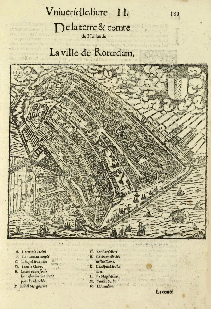
La Ville de Roterdam. [sic = Amsterdam] 1552
Amsterdam by Sebastian Münster.
[Item number: 28225]

Amsterdam Ville du Comté de Hollande et la plus considerable des Provinces Unies. c. 1780
Amsterdam by Pierre Aveline, published in Paris by Jean.
[Item number: 28778]

Scarce map
Afbeeldinge van zeker concept tot bedykinge van de Haarlemer, Leydse en andere byleggende Meeren. c. 1750
Polder map of Holland, by Nicolaas Visscher, published by Petrus Schenk Jr.
[Item number: 28918]
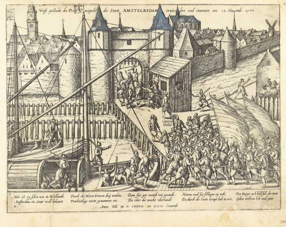
Attack on Amsterdam, 1577: the Haarlemmer gate occupied.
Waß gestalt die Prinsigsche die Statt Amstelredam erwischen und innemen am 23. Novemb: 1577. 1583-1612
Amsterdam Frans Hogenberg
[Item number: 30596]

Scarce
Amsterdam. 1686
Amsterdam by Christoph Riegel.
[Item number: 31501]

Amstelredam 1612
Amsterdam by Guicciardini Lodovico.
[Item number: 31798]

Fosse des Seigneurs de la rue de miroirs vers le fosse de Leyde, de Amsterdam. - Der Herren Graben von der Spiegel Straß sehent nach dem Leidischen Graben zu Amsterdam. c. 1750
Optical View of Amsterdam, by Martin Engelbrecht.
[Item number: 31895]
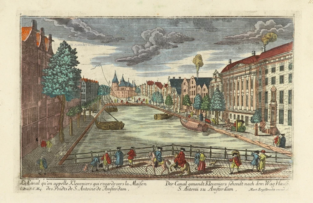
Le Canal qu'on appelle Kleveniers qui regarde vers la Maison des Poidts de S. Antoine de Amsterdam. - Der Canal genandt Kleveniers sehendt nach dem Wag Hauß S. Antonii zu Amsterdam. c. 1750
Optical View of Amsterdam, by Martin Engelbrecht.
[Item number: 31896]
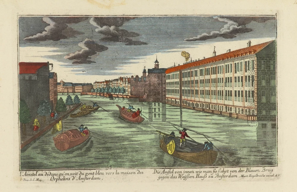
l'Amstel au dedans qu'on voit du pont bleu vers la maison des Orphelins d'Amsterdam. - Die Amstel von innen wie man sie siehet von der Blauen Brug gegen das Wayßen Hauß zu Amsterdam. c. 1750
Optical View of Amsterdam, by Martin Engelbrecht.
[Item number: 31898]

Le Binnekant de Lisle Neufie, et veue de la Tour de Mont Albaan d'Amsterdam. - Die Binnenkant der Neuen Insul, und Gesicht des Mont Alban Thurns zu Amsterdam. c. 1750
Optical View of Amsterdam, by Martin Engelbrecht.
[Item number: 31899]
Optical View
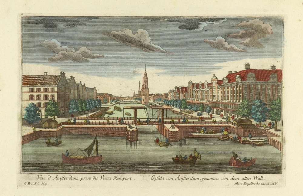
Vue d'Amsterdam prise du Vieux Rempart. - Gesicht von Amsterdam genomen von dem alten Wall. c. 1750
Amsterdam, by Martin Engelbrecht.
[Item number: 31900]

Optical View
L'Amstel par dedans regardant du pont-bleu l'Ecluse d'Amstel a Amsterdam. - Die Amstel von in[n]en nach der Blauen Bruck gegen der Waßer Schleuße zu Amsterdam. c. 1750
Amsterdam, by Martin Engelbrecht.
[Item number: 31902]

t'Stad Huys van Amsteldam. - La Casa Consigliaria d'Amsterdamo. c. 1750
Optical View of Amsterdam, by Martin Engelbrecht.
[Item number: 31903]

Amsterdam 1814
View of the Dam Square in Amsterdam
[Item number: 32455]

Spectacular and rare plan!
Amstelodami Veteris et Novissimi delineatio per Jacobum de la Feuille c. 1710
Amsterdam by Johannes de Ram, published by Jacob de la Feuille and Gerard van Keulen.
[Item number: 32702]

Scarce edition with index
Amstelredamum. 1581
Amsterdam, by Lodovico Guicciardini.
[Item number: 32713]