
Guinea by Blaeu J. 1649-55
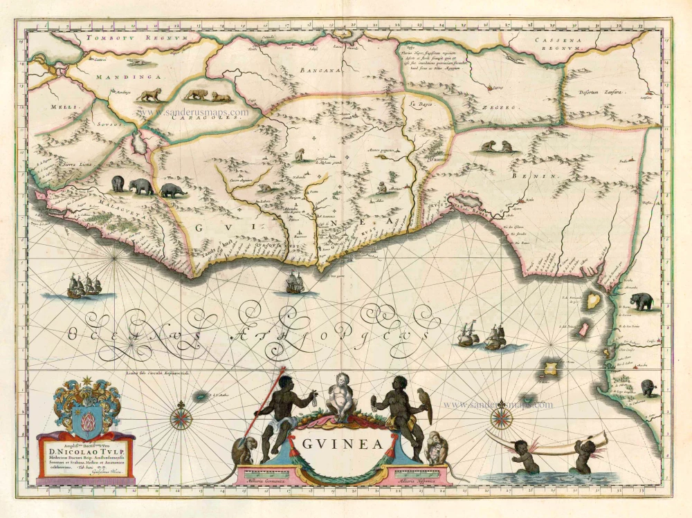
A magnificent and richly decorated map of the Guinea coast of West Africa, published by Joan Blaeu in Amsterdam between 1649 and 1655, with attractive early hand-colouring.
The map depicts an extensive stretch of the West African coastline, from Sierra Leone and Liberia in the west to the Gulf of Guinea and the coast of present-day Nigeria and Cameroon in the east. It encompasses the historical regions of Malagueta, Guinea, and Benin, along with numerous coastal settlements, rivers, trading stations, and inland territories.
The map provides a fascinating representation of European geographical knowledge of West Africa during the first half of the seventeenth century. The coastal regions are shown in considerable detail, reflecting their importance to Portuguese, Dutch and other European merchants, while the interior is represented through a combination of geographical information, indigenous place names, pictorial mountain ranges and decorative illustrations.
Particularly noteworthy are the numerous depictions of African wildlife. Elephants, lions and other animals appear throughout the interior, illustrating the European fascination with the natural history of the African continent. The representation of elephants also alludes to the importance of ivory in the region's international trade.
The Atlantic Ocean is embellished with several finely engraved sailing ships and an elaborate network of rhumb lines radiating from compass roses. The sea is identified by the large decorative inscription Oceanus Aethiopicus, reflecting the geographical terminology commonly employed by European cartographers of the period.
The most striking feature is the magnificent title cartouche occupying the lower centre of the map. Figures representing Africans surround it, along with monkeys, a parrot, and other exotic animals. The composition is richly coloured and reflects the Blaeu publishing house's elaborate decorative traditions.
In the lower right corner, two winged African putti carry a large elephant tusk, an explicit reference to the ivory trade. In the lower left, another ornamental cartouche contains a dedication to Nicolaes Tulp (1593–1674), the distinguished Amsterdam physician and civic official best known today as the subject of Rembrandt's celebrated painting The Anatomy Lesson of Dr Nicolaes Tulp (1632).
The map is also historically significant as a record of the growing Dutch commercial presence on the West African coast. During the seventeenth century, the Dutch West India Company established trading posts and fortifications along the coast, participating in the trade in gold, ivory and enslaved Africans. The region became an important centre of European maritime commerce and colonial competition.
A superb example of Dutch Golden Age cartography, distinguished by its magnificent decorative engraving, rich early colouring, numerous representations of African wildlife and important historical associations with Dutch maritime commerce and the exploration of West Africa.
Guinea
Item Number: 15770 new Authenticity Guarantee
Category: Antique maps > Africa
Guinea by Blaeu J.
Title: Guinea
Dedicated to Nicolaus Tulp by Willem Blaeu.
Date of the first edition: 1634.
Date of this map: 1649-55.
Copper engraving, printed on paper.
Size (not including margins): 385 x 525mm (15¼ x 20¾ inches).
Verso: Latin text.
Condition: Old coloured, excellent.
Condition Rating: .
From: Theatrum Orbis Terrarum.. J. Blaeu, 1649-55. (Van der Krogt 2, 2:202)
A magnificent and richly decorated map of the Guinea coast of West Africa, published by Joan Blaeu in Amsterdam between 1649 and 1655, with attractive early hand-colouring.
The map depicts an extensive stretch of the West African coastline, from Sierra Leone and Liberia in the west to the Gulf of Guinea and the coast of present-day Nigeria and Cameroon in the east. It encompasses the historical regions of Malagueta, Guinea, and Benin, along with numerous coastal settlements, rivers, trading stations, and inland territories.
The map provides a fascinating representation of European geographical knowledge of West Africa during the first half of the seventeenth century. The coastal regions are shown in considerable detail, reflecting their importance to Portuguese, Dutch and other European merchants, while the interior is represented through a combination of geographical information, indigenous place names, pictorial mountain ranges and decorative illustrations.
Particularly noteworthy are the numerous depictions of African wildlife. Elephants, lions and other animals appear throughout the interior, illustrating the European fascination with the natural history of the African continent. The representation of elephants also alludes to the importance of ivory in the region's international trade.
The Atlantic Ocean is embellished with several finely engraved sailing ships and an elaborate network of rhumb lines radiating from compass roses. The sea is identified by the large decorative inscription Oceanus Aethiopicus, reflecting the geographical terminology commonly employed by European cartographers of the period.
The most striking feature is the magnificent title cartouche occupying the lower centre of the map. Figures representing Africans surround it, along with monkeys, a parrot, and other exotic animals. The composition is richly coloured and reflects the Blaeu publishing house's elaborate decorative traditions.
In the lower right corner, two winged African putti carry a large elephant tusk, an explicit reference to the ivory trade. In the lower left, another ornamental cartouche contains a dedication to Nicolaes Tulp (1593–1674), the distinguished Amsterdam physician and civic official best known today as the subject of Rembrandt's celebrated painting The Anatomy Lesson of Dr Nicolaes Tulp (1632).
The map is also historically significant as a record of the growing Dutch commercial presence on the West African coast. During the seventeenth century, the Dutch West India Company established trading posts and fortifications along the coast, participating in the trade in gold, ivory and enslaved Africans. The region became an important centre of European maritime commerce and colonial competition.
A superb example of Dutch Golden Age cartography, distinguished by its magnificent decorative engraving, rich early colouring, numerous representations of African wildlife and important historical associations with Dutch maritime commerce and the exploration of West Africa.
Related items

Guinea c. 1680
Guinea by F. De Wit.
[Item number: 2646]

Pas-Caert vande Goud Cust in Guinea van C. Tres Puntas tot Acara ... 1683
Sea chart of Guinea, by Van Keulen Johannes.
[Item number: 4059]

Pas-Caart van Guinea en de Custen daer aen Gelegen van Cabo Verde tot Cabo de Bona Esperanca 1667
Sea chart of Guinea, by Pieter Goos.
[Item number: 19060]

Guinea c. 1658
Guinea, by Janssonius J.
[Item number: 19543]

Guineae Nova Descriptio. 1623
Guinea, by Jodocus Hondius.
[Item number: 21985]

Guinea 1721-41
Guinea, by F. De Wit after W. Blaeu.
[Item number: 23613]

Pascaerte van Guinea, tusschen C. Verde, tot Cabo de bona Esperanca. 1661
Sea chart of Guinea, by J. Van Loon.
[Item number: 24328]

Guinée, Grand Pays de L'Afrique, avec toutes ses Côtes, Havres et Rivieres. 1713
Guinea, by Pieter van der Aa.
[Item number: 26156]
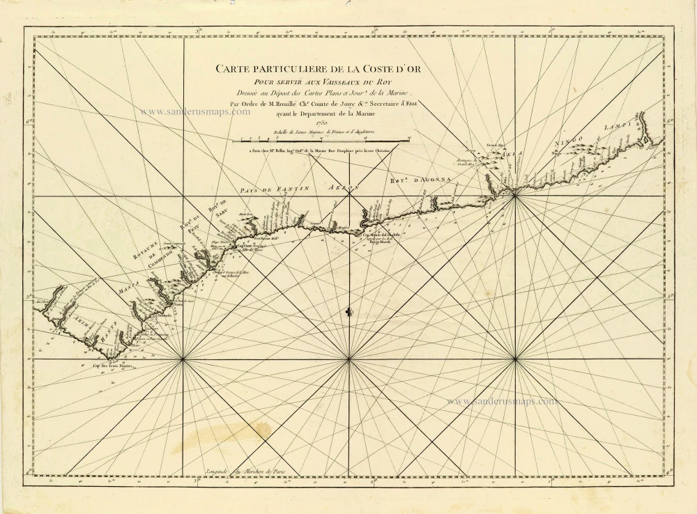
Carte Particulière de la Coste d'Or. 1756-1770
African Gold Coast (Guinea), by J.N. Bellin.
[Item number: 28125]
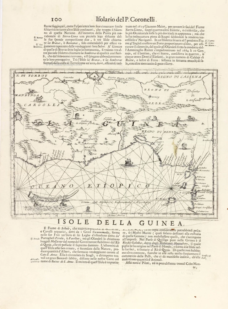
La Guinea. 1696
Guinea, by Vincenzo Coronelli.
[Item number: 29023]
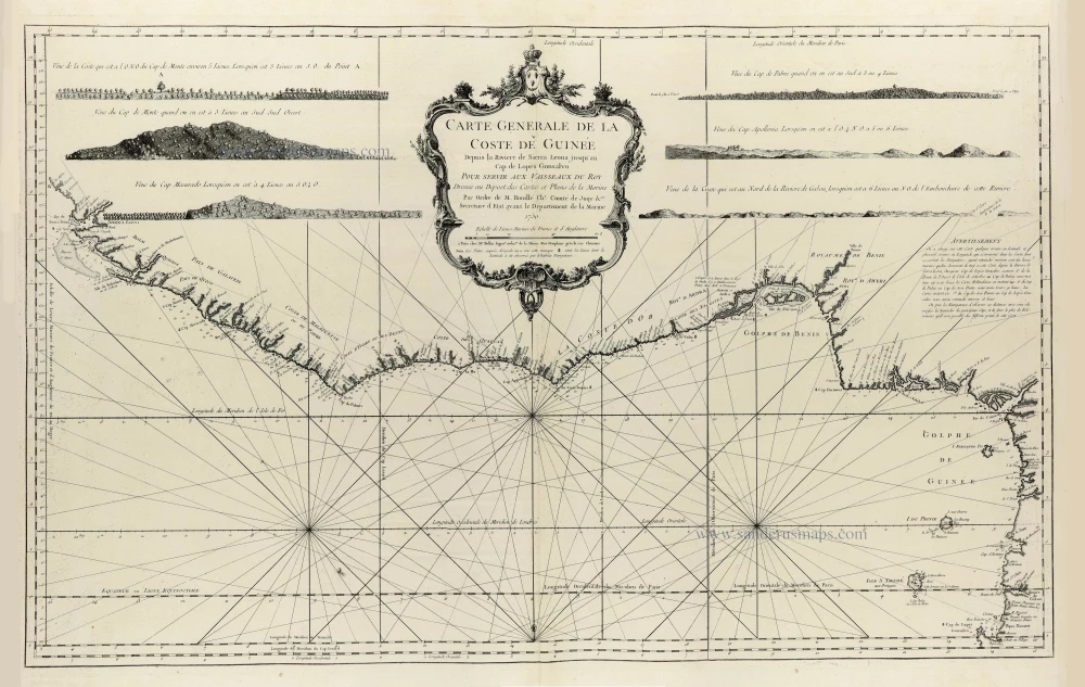
Carte Generale de la Coste de Guinée Depuis la Riviere de Sierra Leona jusqu'au Cap de Lopes Gonsalvo. 1756-1770
Coasts of Guinea, by J.N. Bellin.
[Item number: 33185]