
Africa by Petrus Bertius, published by Melchior Tavernier. c. 1630-1650

This rare map is one of the four known continents Melchior Tavernier had engraved, with or without Petrus Bertius' permission, which needs to be clarified. Tavernier was Paris's most important mapseller and publisher in the first half of the century. The Asia map bears the imprint of Cornelis Danckerts (the elder), a highly skilled engraver. It is safe to assume that the other are also by his hand. The original publication date is taken from Europe in the series, which bears 1627. Most probably sold separately at first, they did not appear in any atlas until Tavernier's Theatre Geographique du Royaume de France, first issued in 1632. Later editions appeared in 1634,1637,1638 and 1643. Although this was an atlas of France, the beginning contained maps of the world and the four continents. This map also appeared in a similar atlas by Christophe Tassin entitled Les Cartes Generale de toutes provinces de France, dated 1634 and later 1637 and c.1640 editions.
Petrus Bertius (1565-1629)
Petrus Bertius, born at Beveren, Flanders, in 1565, was related to Pieter van den Keere (Kaerius) and Jodocus Hondius. Both famous cartographers were brothers-in-law of Petrus Bertius. As a refugee, he settled in Amsterdam, and after finishing his studies, he became a professor of mathematics and librarian at the University of Leiden. In 1618, he became a cosmographer and historiographer for Louis XIII of France. He lived in Paris, where he died in 1629.
Petrus Bertius's remarkable work ethic is evident in the numerous geographical and theological works he produced. His contributions to the works of Clüver and Herrera further solidified his reputation in geography.
His fame among geographers was established by his text in the pocket atlas Tabularum Geographicarum and by his edition of Ptolemy’s Geographia.
The origin of the Tabularum Geographicum lies in the well-known miniature atlas Caert thresoor, published by Barent Langenes in 1598 in Middelburg. Bertius engraved 169 maps for this small but attractive atlas, sold for the first time in 1599 by Cornelis Claesz in Amsterdam. In 1600, Claesz published the pocket atlas with a Latin text composed by Petrus Bertius. From then on, new editions, often enlarged with new maps, regularly appeared, subsequently published by Cornelis Claesz, Jodocus Hondius, Johannes Janssonius and ultimately, in 1649, by Claes Jansz. Visscher.
Koeman divides this series of pocketbooks into two atlases: The Caert-thresoor, published by Langenes and Claesz., with five editions between 1598 and 1609, and the Tabularum Geographicarum Contractarum by Petrus Bertius with ten editions between 1600 and 1650.
Jean Baptiste Tavernier (1605-1789)
Brother of Melchior. Began as a bookseller 'sur le quai de l'Horloge aux Trois Estoiles' à Paris. Became later a merchant, diplomat and traveller in Turkey, Persia, central Asia and the East Indies.
The Danckerts Family.
The Danckerts family of Amsterdam was one of the best-known print and map sellers in 17th century Amsterdam. Their business activity covered a vast period, from ca. 1633. From 1669 until 1701, father Justus and his sons had their shop in the ‘Calverstraet in de Danckbaerheyt’.
Cornelis Danckerts (1561-1631) was a printseller born in Amsterdam and active in Antwerp.
Cornelis Danckerts, the elder (1603-1656) was an engraver and publisher in Amsterdam and Nieuwendijk. Son of Cornelis (above), whom he succeeded in 1631.
The house of Danckerts gained its greatest fame from Justus Danckerts (1635-1701 - son of Cornelis the elder) and his two sons, Theodorus and Cornelis. Dancker Danckerts (1634-1666), the elder brother of Justus, was known for his etchings of paintings, maps, and publications.
The grandfather, father, and sons were highly skilled and excellent artistic drafters and engravers. They are famous for the edition of their Atlas, which appeared from ca. 1686, and for several monumental and beautiful wall maps and views. However, compared with that published by the Blaeu's or Janssonius's, their cartographic work has attracted little attention and has never received proper recognition.
On 14 August 1684, Justus and his sons obtained the privilege from the States of Holland for their publications. In 1713, twelve years after Justus Danckerts, the heirs decided to sell part of the stock of maps and atlases and many copperplates. In 1727, after the death of the last surviving brother Theodorus, a final sale took place.
Carte de l'Afrique Corrigee et Augmentee, dessus Toutes les Aultres cy devant Faictes par P. Bertius.
Item Number: 30858 Authenticity Guarantee
Category: Antique maps > Africa
Africa by Petrus Bertius, published by Melchior Tavernier.
Title: Carte de l'Afrique Corrigee et Augmentee, dessus Toutes les Aultres cy devant Faictes par P. Bertius.
Engraver: Cornelis Danckerts.
Date of the first edition: 1627.
Date of this map: c. 1630-1650.
Copper engraving, printed on heavy paper.
Image size: 380 x 500mm (14.96 x 19.69 inches).
Sheet size: 505 x 695mm (19.88 x 27.36 inches).
Verso: Blank.
Condition: Original coloured, side margins extended; excellent.
Condition Rating: A+.
Separate publication - from a French Composite Atlas, c. 1630-1650.
This rare map is one of the four known continents Melchior Tavernier had engraved, with or without Petrus Bertius' permission, which needs to be clarified. Tavernier was Paris's most important mapseller and publisher in the first half of the century. The Asia map bears the imprint of Cornelis Danckerts (the elder), a highly skilled engraver. It is safe to assume that the other are also by his hand. The original publication date is taken from Europe in the series, which bears 1627. Most probably sold separately at first, they did not appear in any atlas until Tavernier's Theatre Geographique du Royaume de France, first issued in 1632. Later editions appeared in 1634,1637,1638 and 1643. Although this was an atlas of France, the beginning contained maps of the world and the four continents. This map also appeared in a similar atlas by Christophe Tassin entitled Les Cartes Generale de toutes provinces de France, dated 1634 and later 1637 and c.1640 editions.
Petrus Bertius (1565-1629)
Petrus Bertius, born at Beveren, Flanders, in 1565, was related to Pieter van den Keere (Kaerius) and Jodocus Hondius. Both famous cartographers were brothers-in-law of Petrus Bertius. As a refugee, he settled in Amsterdam, and after finishing his studies, he became a professor of mathematics and librarian at the University of Leiden. In 1618, he became a cosmographer and historiographer for Louis XIII of France. He lived in Paris, where he died in 1629.
Petrus Bertius's remarkable work ethic is evident in the numerous geographical and theological works he produced. His contributions to the works of Clüver and Herrera further solidified his reputation in geography.
His fame among geographers was established by his text in the pocket atlas Tabularum Geographicarum and by his edition of Ptolemy’s Geographia.
The origin of the Tabularum Geographicum lies in the well-known miniature atlas Caert thresoor, published by Barent Langenes in 1598 in Middelburg. Bertius engraved 169 maps for this small but attractive atlas, sold for the first time in 1599 by Cornelis Claesz in Amsterdam. In 1600, Claesz published the pocket atlas with a Latin text composed by Petrus Bertius. From then on, new editions, often enlarged with new maps, regularly appeared, subsequently published by Cornelis Claesz, Jodocus Hondius, Johannes Janssonius and ultimately, in 1649, by Claes Jansz. Visscher.
Koeman divides this series of pocketbooks into two atlases: The Caert-thresoor, published by Langenes and Claesz., with five editions between 1598 and 1609, and the Tabularum Geographicarum Contractarum by Petrus Bertius with ten editions between 1600 and 1650.
Jean Baptiste Tavernier (1605-1789)
Brother of Melchior. Began as a bookseller 'sur le quai de l'Horloge aux Trois Estoiles' à Paris. Became later a merchant, diplomat and traveller in Turkey, Persia, central Asia and the East Indies.
The Danckerts Family.
The Danckerts family of Amsterdam was one of the best-known print and map sellers in 17th century Amsterdam. Their business activity covered a vast period, from ca. 1633. From 1669 until 1701, father Justus and his sons had their shop in the ‘Calverstraet in de Danckbaerheyt’.
Cornelis Danckerts (1561-1631) was a printseller born in Amsterdam and active in Antwerp.
Cornelis Danckerts, the elder (1603-1656) was an engraver and publisher in Amsterdam and Nieuwendijk. Son of Cornelis (above), whom he succeeded in 1631.
The house of Danckerts gained its greatest fame from Justus Danckerts (1635-1701 - son of Cornelis the elder) and his two sons, Theodorus and Cornelis. Dancker Danckerts (1634-1666), the elder brother of Justus, was known for his etchings of paintings, maps, and publications.
The grandfather, father, and sons were highly skilled and excellent artistic drafters and engravers. They are famous for the edition of their Atlas, which appeared from ca. 1686, and for several monumental and beautiful wall maps and views. However, compared with that published by the Blaeu's or Janssonius's, their cartographic work has attracted little attention and has never received proper recognition.
On 14 August 1684, Justus and his sons obtained the privilege from the States of Holland for their publications. In 1713, twelve years after Justus Danckerts, the heirs decided to sell part of the stock of maps and atlases and many copperplates. In 1727, after the death of the last surviving brother Theodorus, a final sale took place.
Related items

L'Afrique divisée suivant l'estendue de ses principales parties ou sont distingués les uns des autres, Les Empires, Monarchies, Royaumes, Estats et Peuples qui partagent aujourd'huy l'Afrique sur les Relations les plus Nouvelles. 1692
Africa, by N. Sanson, so-called published by Hubert Jaillot. (Pirated edition by Pierre Mortier).
[Item number: 31141]

Africae nova descriptio. 1640
Africa by Willem Blaeu.
[Item number: 31334]

Totius Africae Accuratissima Tabula Authore I. Danckerts Amstelodami 1683-1690
Africa by Justus Danckerts.
[Item number: 31787]

Africa. 1618
Africa by Petrus Bertius, published by Jodocus Hondius II.
[Item number: 32060]

Totius Africae Nova Repraesentatio qua Practer Diversos in ea Status et Regiones, etiam Origo Nili c. 1720
Africa by Homann J.B.
[Item number: 32097]

Novissima et Perfectissima Africae 1696-1713
Africa by Danckerts J.
[Item number: 32459]
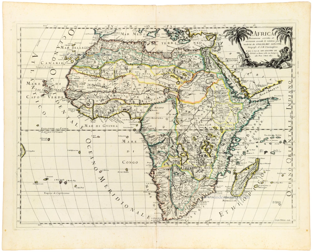
L' Africa. 1677
Africa by Giovanni De Rossi, after Nicolas Sanson.
[Item number: 32888]

L'Afrique divisée en ses principaux Etats. 1762
Africa by Jean Denis Janvier, published by Jean Lattré.
[Item number: 33071]