
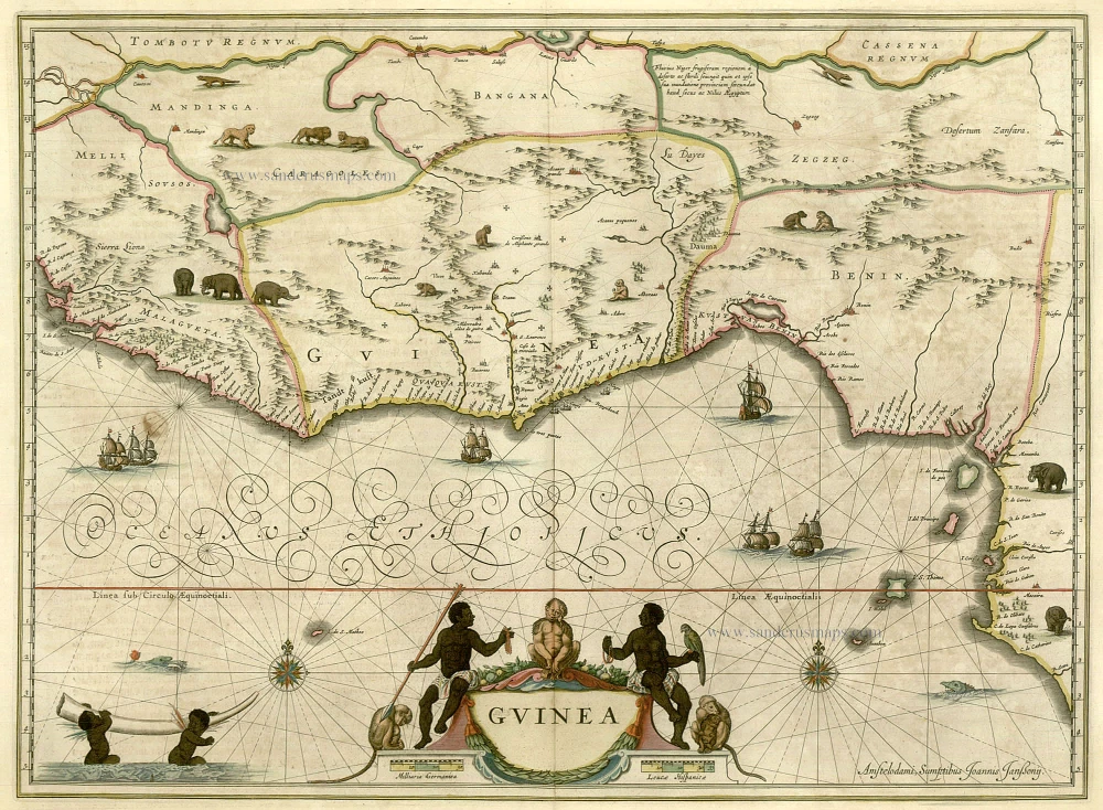
Western Africa, by Janssonius Heirs. 1675.
The Janssonius Family
Joannes Janssonius (Arnhem, 1588-1664), son of the Arnhem publisher Jan Janssen, married Elisabeth Hondius, daughter of Jodocus Hondius, in Amsterdam in 1612. After his marriage, he settled down in this town as a bookseller and publisher of cartographic material. In 1618, he established himself in Amsterdam next door to Blaeu’s bookshop. He entered into serious competition with Willem Jansz. Blaeu when copying Blaeu’s Licht der Zeevaert after the expiration of the privilege in 1620. His activities concerned the publication of atlases, books, single maps, and an extensive book trade with branches in Frankfurt, Danzig, Stockholm, Copenhagen, Berlin, Koningsbergen, Geneva, and Lyon. In 1631, he began publishing atlases together with Henricus Hondius.
In the early 1640s, Henricus Hondius left the atlas publishing business to Janssonius. Competition with Joan Blaeu, Willem’s son and successor, in atlas production, prompted Janssonius to enlarge his Atlas Novus finally into a work of six volumes, into which a sea atlas and an atlas of the Old World were inserted. Other atlases published by Janssonius are Mercator’s Atlas Minor, Hornius’s historical atlas (1652), the townbooks in eight volumes (1657), Cellarius’s Atlas Coelestis and several sea atlases and pilot guides.
After the death of Joannes Janssonius, the shop and publishing firm were continued by the heirs under the direction of Johannes van Waesbergen (c. 1616-1681), son-in-law of Joannes Janssonius. Van Waesbergen added Janssonius's name to his own.
In 1676, Joannes Janssonius’s heirs sold by auction “all the remaining Atlases in Latin, French, High and Low German, as well as the Stedeboecken in Latin, in 8 volumes, bound and unbound, maps, plates belonging to the Atlas and Stedeboecken.” The copperplates from Janssonius’s atlases were afterwards sold to Schenk and Valck.
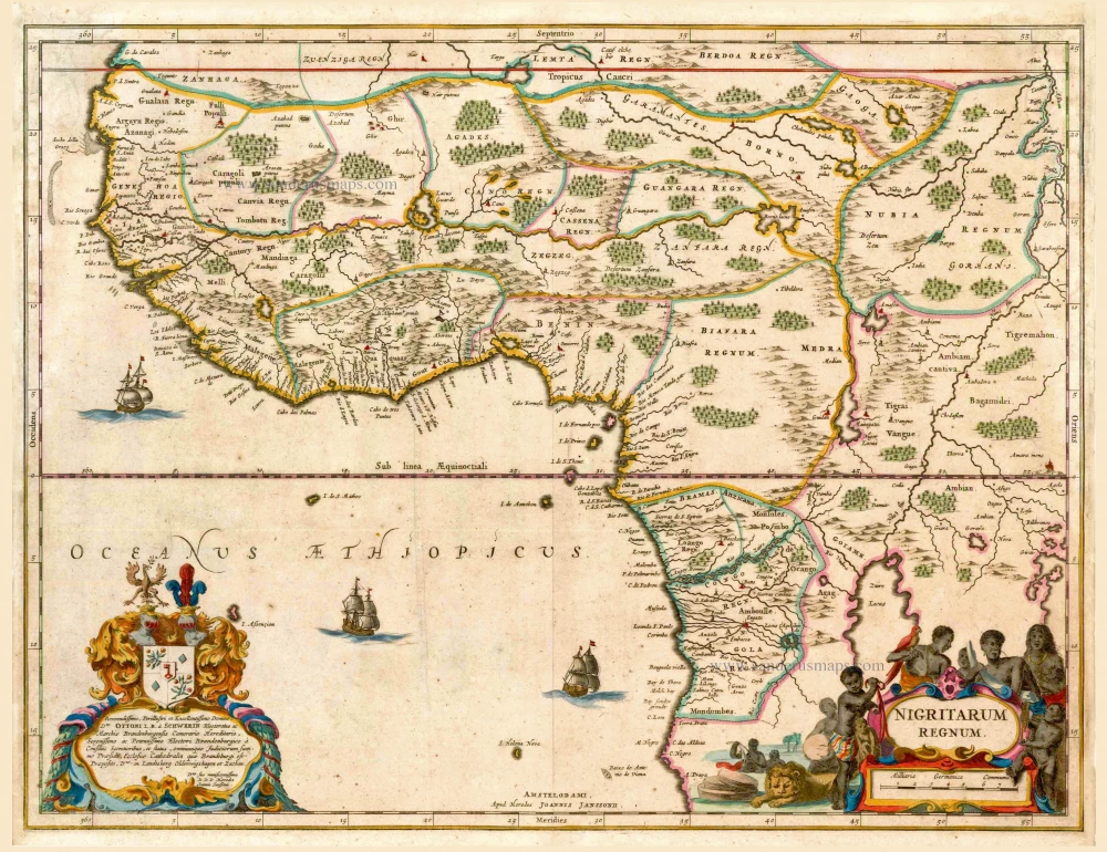
Nigritarum Regnum
Item Number: 12289 Authenticity Guarantee
Category: Antique maps > Africa
Western Africa, by Janssonius Heirs.
Title: Nigritarum Regnum.
Date of the first edition: 1675.
Date of this map: 1675..
Copper engraving, printed on paper.
Image size: 435 x 575mm (17.13 x 22.64 inches).
Sheet size: 500 x 585mm (19.69 x 23.03 inches).
Verso: Blank.
Condition: Original coloured, minor repairs.
Condition Rating: A.
From: Joannis Janssonii Atlantis Majoris, sive Cosmographiae Universalis. Tomus Octavus Quo continentur Huspania, ut & Asia, Africa & America. Amsterdam, Janssonius Heirs, 1675. (Van der Krogt 1, 1:406)
The Janssonius Family
Joannes Janssonius (Arnhem, 1588-1664), son of the Arnhem publisher Jan Janssen, married Elisabeth Hondius, daughter of Jodocus Hondius, in Amsterdam in 1612. After his marriage, he settled down in this town as a bookseller and publisher of cartographic material. In 1618, he established himself in Amsterdam next door to Blaeu’s bookshop. He entered into serious competition with Willem Jansz. Blaeu when copying Blaeu’s Licht der Zeevaert after the expiration of the privilege in 1620. His activities concerned the publication of atlases, books, single maps, and an extensive book trade with branches in Frankfurt, Danzig, Stockholm, Copenhagen, Berlin, Koningsbergen, Geneva, and Lyon. In 1631, he began publishing atlases together with Henricus Hondius.
In the early 1640s, Henricus Hondius left the atlas publishing business to Janssonius. Competition with Joan Blaeu, Willem’s son and successor, in atlas production, prompted Janssonius to enlarge his Atlas Novus finally into a work of six volumes, into which a sea atlas and an atlas of the Old World were inserted. Other atlases published by Janssonius are Mercator’s Atlas Minor, Hornius’s historical atlas (1652), the townbooks in eight volumes (1657), Cellarius’s Atlas Coelestis and several sea atlases and pilot guides.
After the death of Joannes Janssonius, the shop and publishing firm were continued by the heirs under the direction of Johannes van Waesbergen (c. 1616-1681), son-in-law of Joannes Janssonius. Van Waesbergen added Janssonius's name to his own.
In 1676, Joannes Janssonius’s heirs sold by auction “all the remaining Atlases in Latin, French, High and Low German, as well as the Stedeboecken in Latin, in 8 volumes, bound and unbound, maps, plates belonging to the Atlas and Stedeboecken.” The copperplates from Janssonius’s atlases were afterwards sold to Schenk and Valck.
Related items
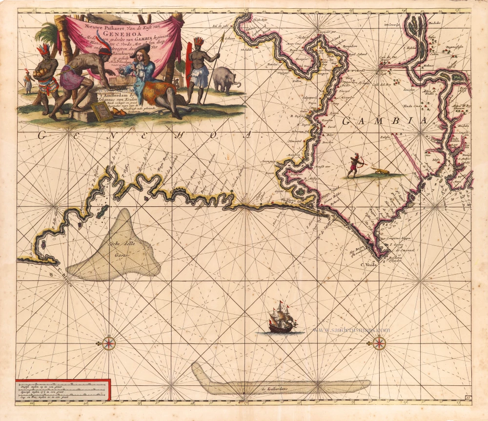
Nieuwe Paskaert, van de Kust van Genehoa als mede een Gedeelte van Gambia, beginnende an C. Blanco tot C. Verde, Met al syn diep ten end droogten, dus Ver Naeukeurig op gestelt. 1697-1709
The coasts of Senegal - Gambia by Johannes Van Keulen.
[Item number: 2016]
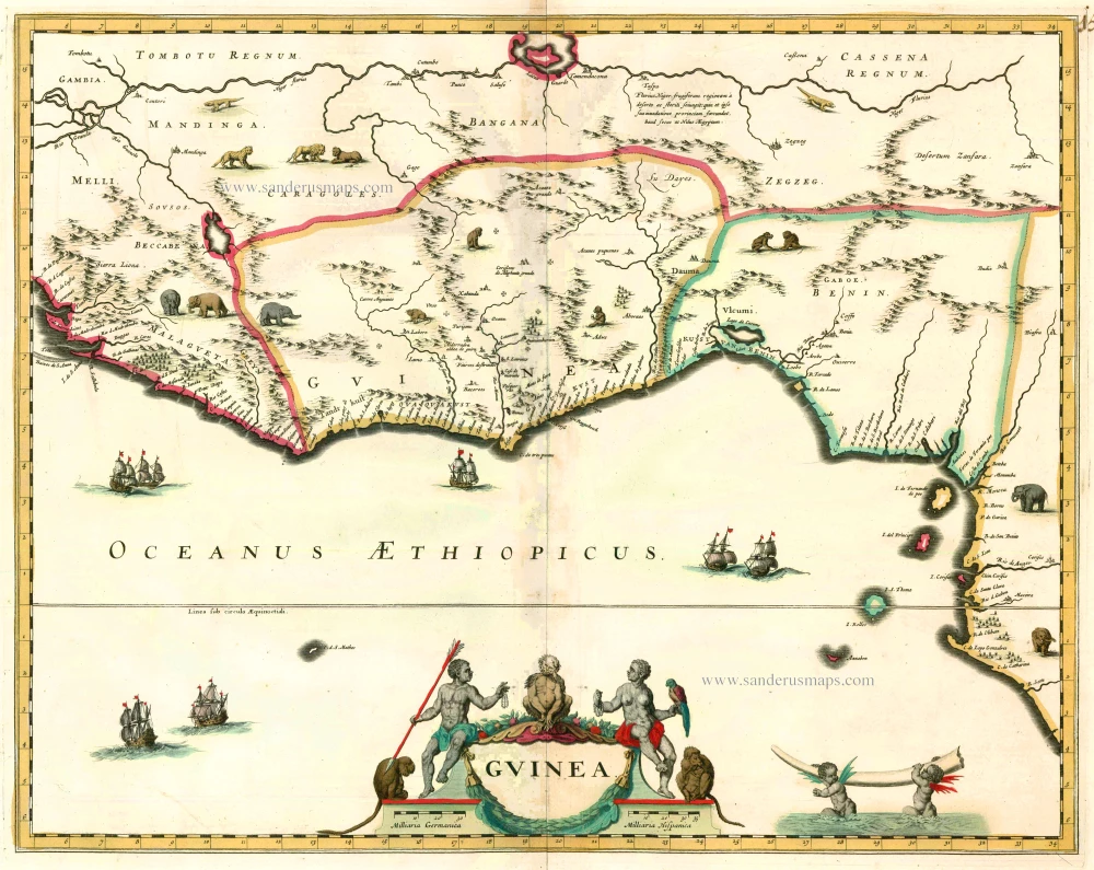
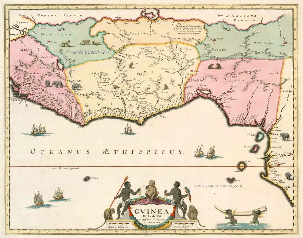
Guinea c. 1680
Guinea by F. De Wit.
[Item number: 2646]
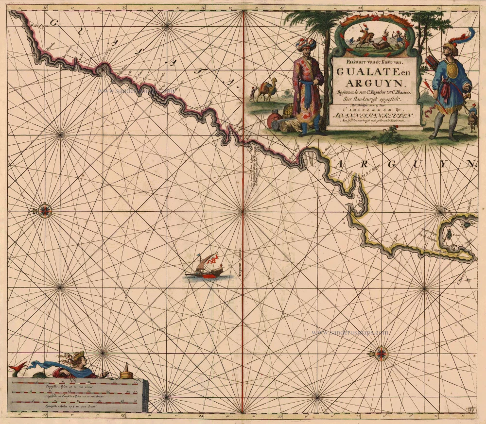
Paskaart van de Kuste van Gualate en Arguyn ... 1681
The coast of the Western Sahara, by J. Van Keulen.
[Item number: 5402]

Pascaert vande Bocht van Benin, Tary Ardra en Rio de Lagos, van Acra tot C. Formosa 1683
The Gulf of Benin (West Africa), by Van Keulen Johannes.
[Item number: 9587]
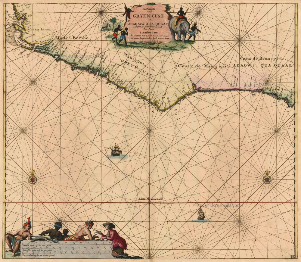
Pas Caarte vande Gryen-Cust en Adaows qua Quaas tuhessen de Serraliones en C. de Tres Puntas. 1683
Grain Coast - West Africa, by Johannes van Keulen.
[Item number: 10776]
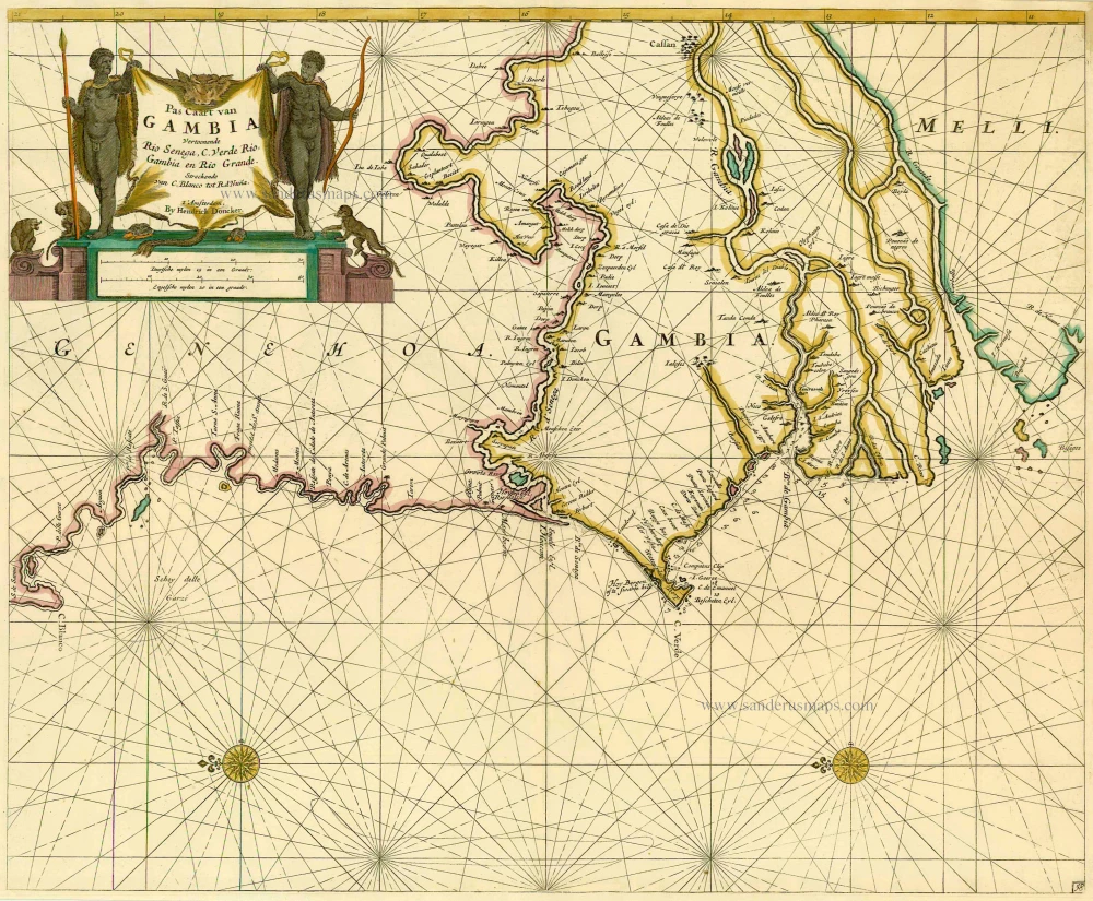
Pas Caart van GAMBIA Vertoonende Rio Senega, C. Verde, Rio Gambia en Rio Grande. Streckende van C. Blanco tot R. d'Nuna. 1686
Sea chart of the coasts of Senegal - Gambia, by Doncker H.
[Item number: 13653]
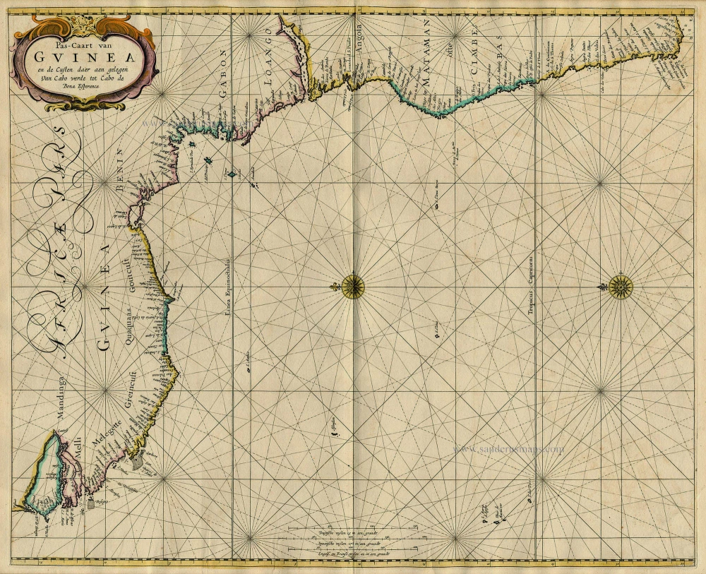
Pas-Caart van Guinea en de Custen daer aen Gelegen van Cabo Verde tot Cabo de Bona Esperanca 1667
Sea chart of Guinea, by Pieter Goos.
[Item number: 19060]
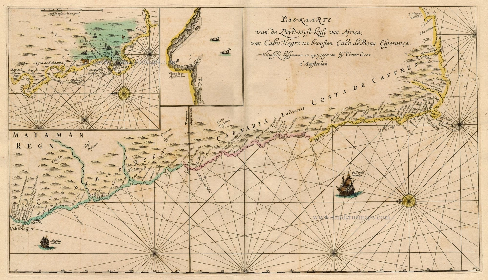
Pas-Kaarte van de Zuyd-West-Kust van Afrika; van Cabo Negro tot Beoosten Cabo de Bona Esperanca 1667
Sea chart of South African Coast, by Pieter Goos.
[Item number: 19073]
Guinea c. 1658
Guinea, by Janssonius J.
[Item number: 19543]
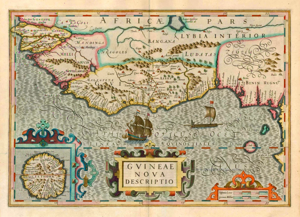
Guineae Nova Descriptio. 1623
Guinea, by Jodocus Hondius.
[Item number: 21985]
Guinea 1721-41
Guinea, by F. De Wit after W. Blaeu.
[Item number: 23613]
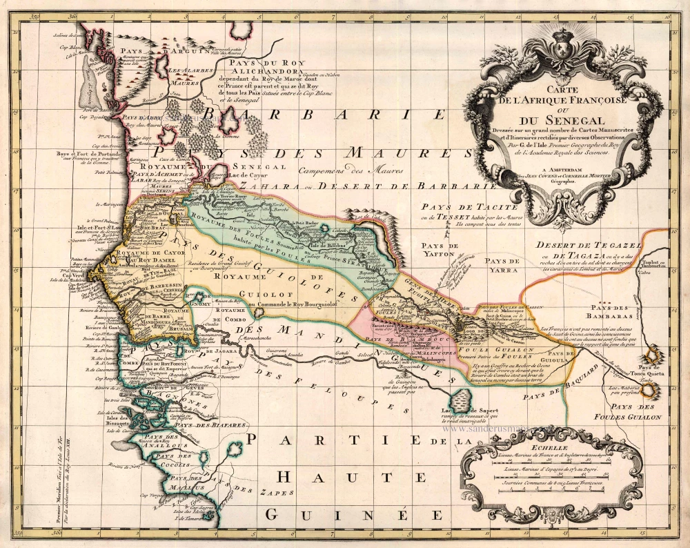
Carte de l'Afrique Françoise ou du Senegal ... 1721-41
Senegal by Guillaume Delisle, published by Covens & Mortier.
[Item number: 23614]

Pascaerte van Guinea, tusschen C. Verde, tot Cabo de bona Esperanca. 1661
Sea chart of Guinea, by J. Van Loon.
[Item number: 24328]
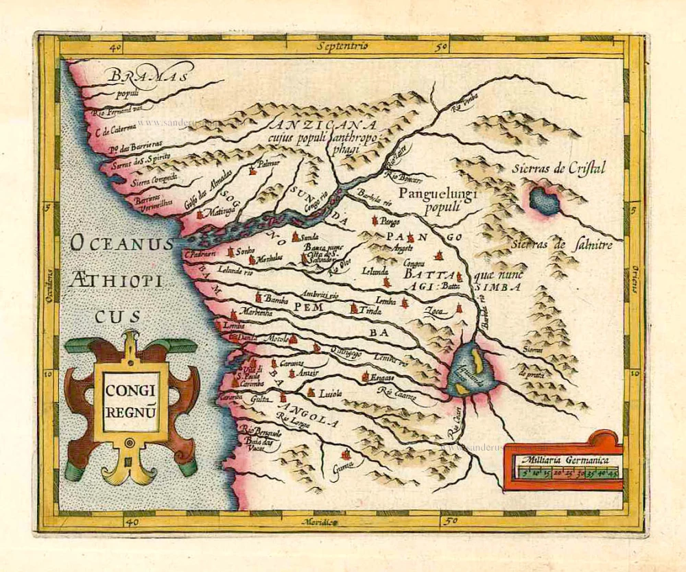
Congi Regnu. 1607
Congo, by G. Mercator - J. Hondius.
[Item number: 25292]