
Antique map of New England by Smith J. - Hulsius L. 1617
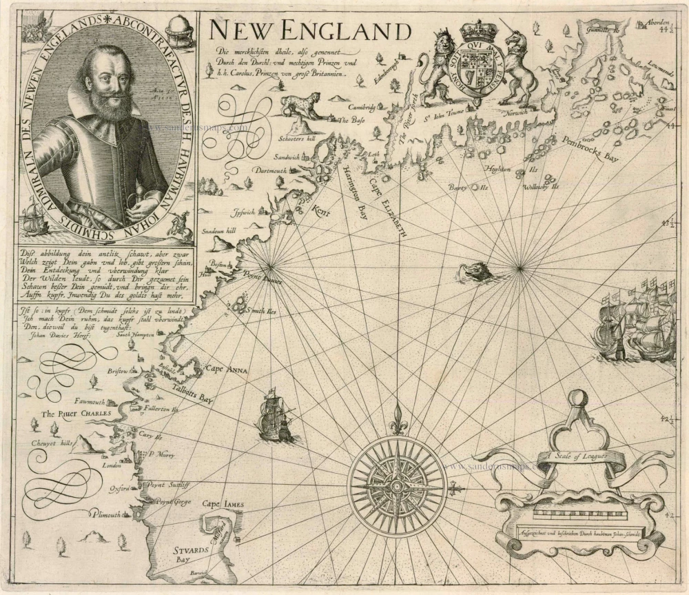


New England. Die mercklichsten dheile, also genennet Durch den Durchl: und mechtigen Prinzen und h.h. Carolus, Prinzen von gross Britannien
Item Number: 5304 Authenticity Guarantee
Category: Antique maps > America > North America
"In this work Levinus Hulsius translates John Smith's A Description of New England into German for the thirteenth part of his Sammlung von Sechs und Zwanzig Schiffarten. This extremely rare series competed with Theodore de Bry's collection of voyages. It is known for its accuracy and quality of illustration. For this map he utilised the first state of Smith's New England published the previous year in London." (Burden)
Copper engraving
Size: 29.5 x 34.5cm (11.4 x 13.4 inches)
Verso: Blank
Condition: Mint.
Condition Rating: A+
References: Burden, 190; McCorkle, 617.1.
From: Dreyzehente Schiffart, oder Grundliche und Warhaffte Beschreibung desz Neuwen Engellandts. Frankfurt, 1617.