
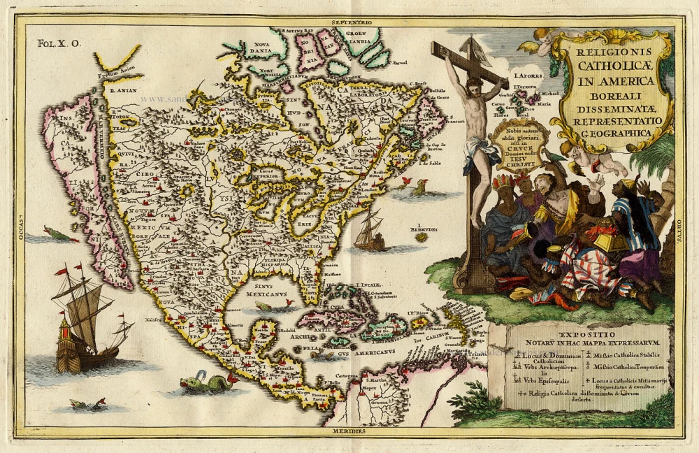
Antique map of North America by Scherer Heinrich c. 1700
Heinrich Scherer (1628 - 1704)
Geographer and engraver, professor of mathematics at the University of Munich.
Published the Atlas Novus (8 volumes, 187 plates), 1698-1710.
Religionis Catholicae in Americae Boreali Disseminatae Repraesentatio Geographica
Item Number: 19348 Authenticity Guarantee
Category: Antique maps > America > North America
Copper engraving
Size: 22 x 34cm (9 x 13 inches)
Verso: Blank
Condition: Coloured, excellent.
References: Tooley (America), p.132 87.
From: Atlas Novus ... Munich, c. 1700.
California as an island. The large titlepiece shows representative figures of the four continents bowing before the crucifix.
Heinrich Scherer (1628 - 1704)
Geographer and engraver, professor of mathematics at the University of Munich.
Published the Atlas Novus (8 volumes, 187 plates), 1698-1710.