
Antique map of U.S., Central America, West Indies by Châtelain 1713-1719
The item displayed on this page has been sold. However, we have a similar map in stock:
United States, Central America, and the West Indies, by Zacharias Châtelain. 1719
Carte Contenant le Royaume du Mexique et la ...
[Item number: 29409]

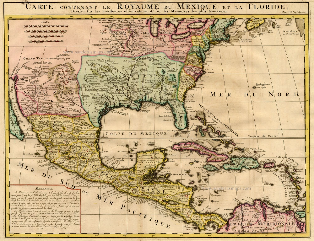
Carte Contenant le Royaume du Mexique et la Floride ...
Item Number: 19125 Authenticity Guarantee
Category: Antique maps > America > North America
Antique map of the U.S., Central America, and West Indies by Châtelain.
Title: Carte Contenant le Royaume du Mexique et la Floride ...
Date: 1713-1719.
Copper engraving, printed on paper.
Size (not including margins): 405 x 518mm (15.94 x 20.39 inches).
Verso: Blank.
Condition: Hand coloured.
Condition Rating: A.
From: Atlas Historique. Amsterdam, Châtelain, 1713-1719.