
Antique map of Virginia by Blaeu 1649-55
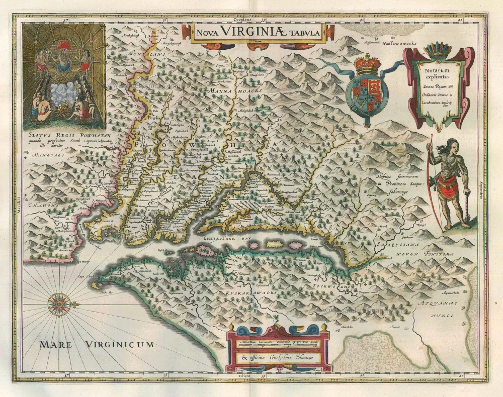


Nova Virginiae Tabula
Item Number: 3044 Authenticity Guarantee
Category: Antique maps > America > North America
Antique map of Virginia by Blaeu, oriented to the West
This is Henricus Hondius' derivative of John Smith's highly important map of Virginia, 1612. It is, however, drawn from his deceased brother Jodocus' version of 1618. The two had led separate careers for at least ten years and in 1629, upon the death of Jodocus, Willem Blaeu acquired a number of plates from the estate. About thirty of these formed the nucleus of Blaeu's Atlantis Appendix of 1630. This challenge to the atlas of Henricus Hondius, which was now quite dated, stimulated fierce competition between the two houses.
Taken from the first state of the Smith, it continues the coastlines where the former had left them vague. The royal arms at the top lack the motto and a third cartouche is introduced to contain the Notarum explicatio.
Date of the first edition: 1630
Date of this map: 1649-55
Copper engraving
Size: 37.5 x 48cm (14.6 x 18.7 inches)
Verso text: Latin
Condition: Contemporary coloured, excellent.
Condition Rating: A
References: Van der Krogt 2, 9410:2.2; Burden, 193, State 2.
From: Theatrum Orbis Terrarum.. J. Blaeu, 1649-55. (Van der Krogt 2, 2:202)