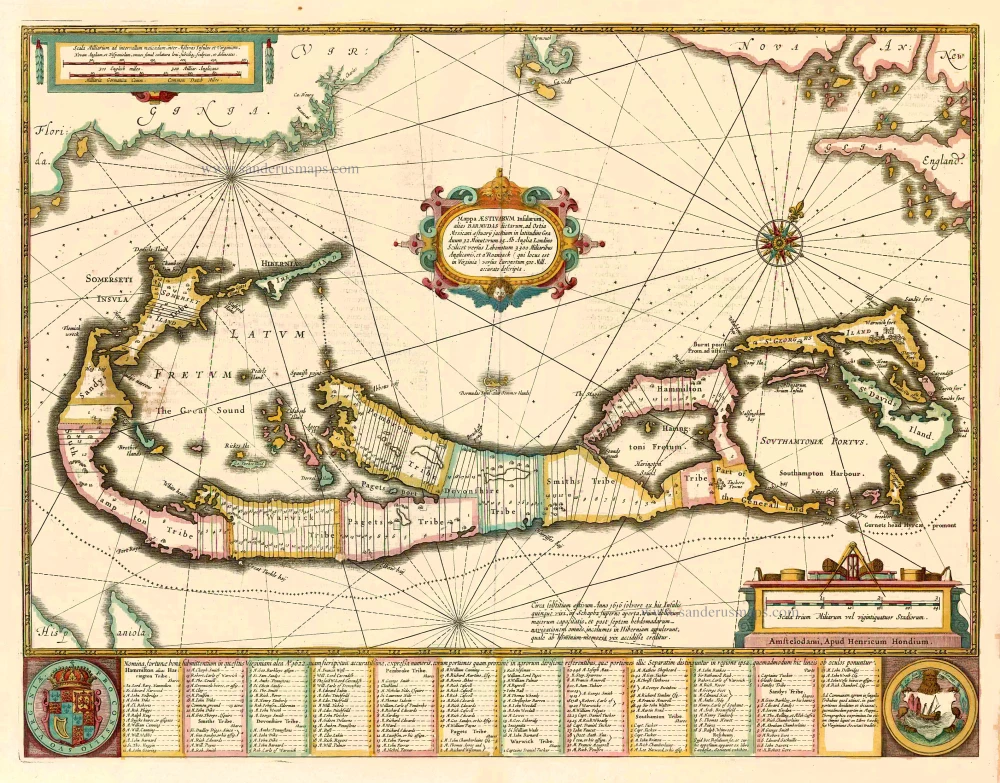
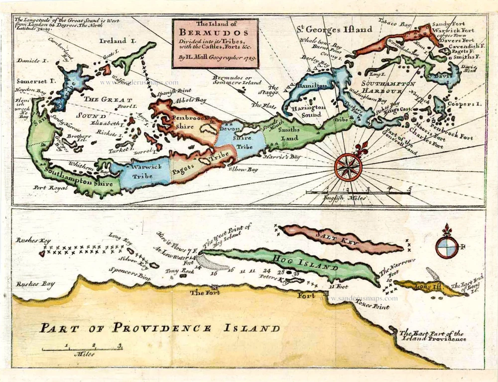
Bermuda and New Providence Island (Bahamas), by Herman Moll. 1729
Herman Moll (1654? – 1732)
Herman Moll, a geographer and cartographer, was born in Bremen and went to London about 1675, possibly as a refugee from the turmoil of the Scanian Wars of 1674 to 1679.
At first, he practised as an engraver and then, starting in 1694, moved into atlas production. His range of atlases and maps produced for other publishers is extensive.
Around 1715 Moll issued The World Described, a collection of thirty large, double-sided maps which saw numerous editions. In these maps, Moll's skill as an engraver is evident.
A characteristic of Moll is his tendency to engrave indignant notes on many of his maps, especially those larger maps printed on two sheets, complaining of plagiarism and deriding his competitors. Nevertheless, it would not be unfair to rank him as England's first geographer, a style he adopted from the early 1700s.
Two of the most famous Moll maps are known respectively as the Beaver Map and the Codfish Map. They were distinctive for their elaborate cartouches and images.
"Moll's maps were in his lifetime and after very influential, and are still among the most sought-after aesthetic engravings in the history of cartography."
The Island of Bermudos Divided into its Tribes, with the Castles, Forts &c.
Item Number: 27842 Authenticity Guarantee
Category: Antique maps > America > North America
Old, antique map of Bermuda and New Providence Island (Bahamas), by Herman Moll.
Title: The Island of Bermudos Divided into its Tribes, with the Castles, Forts &c.
By H. Moll Geographer 1729.
Oriented to the northwest.
Date of the first edition: 1729.
Date of this map: 1729.
Date on map: 1729.
Copper engraving, printed on paper.
Size (not including margins): 200 x 265mm (7.87 x 10.43 inches).
Verso: Blank.
Condition: Coloured, excellent.
Condition Rating: A+.
From: Atlas Minor: or, a Set of Sixty-two New and Correct Maps. London: H. Moll, 1729.
Herman Moll (1654? – 1732)
Herman Moll, a geographer and cartographer, was born in Bremen and went to London about 1675, possibly as a refugee from the turmoil of the Scanian Wars of 1674 to 1679.
At first, he practised as an engraver and then, starting in 1694, moved into atlas production. His range of atlases and maps produced for other publishers is extensive.
Around 1715 Moll issued The World Described, a collection of thirty large, double-sided maps which saw numerous editions. In these maps, Moll's skill as an engraver is evident.
A characteristic of Moll is his tendency to engrave indignant notes on many of his maps, especially those larger maps printed on two sheets, complaining of plagiarism and deriding his competitors. Nevertheless, it would not be unfair to rank him as England's first geographer, a style he adopted from the early 1700s.
Two of the most famous Moll maps are known respectively as the Beaver Map and the Codfish Map. They were distinctive for their elaborate cartouches and images.
"Moll's maps were in his lifetime and after very influential, and are still among the most sought-after aesthetic engravings in the history of cartography."