
New York & New Jersey by Samuel Holland, published by Thomas Jefferys. 1775
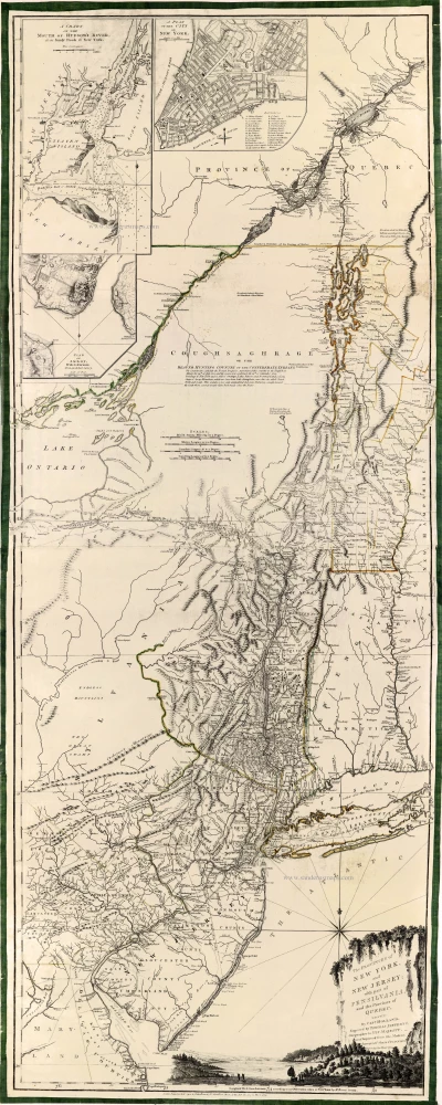
One of the most influential and comprehensive maps of the region published during the American Revolution.
The first state of Holland's large, important map was a separate publication, c. 1768. In 1775, the title was changed, three insets were added and the imprint was dated 20 Dec 1775.
Thomas Jefferys (c. 1719-1771)
Thomas Jefferys was an outstanding English cartographer who was the leading map supplier of his day. He engraved and printed maps for government and other official bodies and produced a wide range of commercial maps and atlases. He made some of the finest maps of the time of North America and the West Indies.
He was appointed Geographer to the Prince of Wales and George II. However, in 1766, he became bankrupt and subsequently, the publication of his maps was managed by Robert Sayer, who in 1774 was joined in partnership by John Bennett and William Faden.
The Provinces of New York and New Jersey; with Part of Pensilvania, and the Province of Quebec.
Item Number: 28237 Authenticity Guarantee
Category: Antique maps > America > North America
Old, antique map of New York & New Jersey by Samuel Holland, published by Jefferys Thomas.
Title: The Provinces of New York and New Jersey; with Part of Pensilvania, and the Province of Quebec.
By Capt. Holland.
Engraved by Thomas Jefferys, Geographer to His Majesty.
and improved from the Modern Surveys of those Colonies
Down to the Year 1775.
London. Printed for Robt. Sayer & John Bennett, N° 53, in Fleet Street, as he Act directs. 20 Dec. 1775.
Cartographer: Samuel Holland.
Engraver: Thomas Jefferys.
Date of the first edition: 1768.
Date of this map: 1775.
Date on map: 1775.
Copper engraving, printed on paper.
Size (not including margins): 1360 x 530mm (53.54 x 20.87 inches).
Verso: Blank.
Condition: Original coloured in outline. Printed on two sheets of paper, joined, edges reinforced with green silk.
Condition Rating: A+.
References: Tooley (America), p. 77-78 #44 c; McCorkle, p. 170 #768.3; Shirley (Brit.Lib.), T.Jef-2b (17)
From: Jefferys Thomas, The American Atlas. London, 1775. (Tooley (Brit.Lib.), T.JEF-2b).
One of the most influential and comprehensive maps of the region published during the American Revolution.
The first state of Holland's large, important map was a separate publication, c. 1768. In 1775, the title was changed, three insets were added and the imprint was dated 20 Dec 1775.
Thomas Jefferys (c. 1719-1771)
Thomas Jefferys was an outstanding English cartographer who was the leading map supplier of his day. He engraved and printed maps for government and other official bodies and produced a wide range of commercial maps and atlases. He made some of the finest maps of the time of North America and the West Indies.
He was appointed Geographer to the Prince of Wales and George II. However, in 1766, he became bankrupt and subsequently, the publication of his maps was managed by Robert Sayer, who in 1774 was joined in partnership by John Bennett and William Faden.
Related items
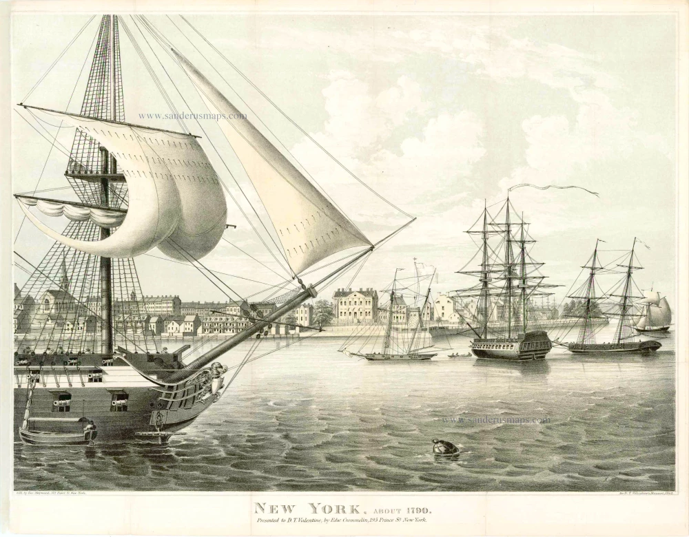
New York, about 1790. Presented to D.T. Valentine, by Edw. Crommelin, 195 Prince St. New York. 19e eeuw
New York, by G. Hayward for D.T. Valentine's Manuel, 1862.
[Item number: 4174]
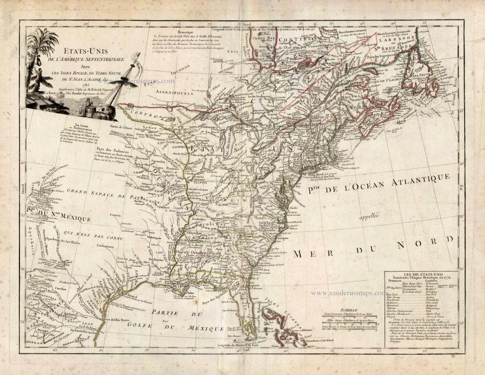
Etats-Unis de l'Amerique Septentrionale avec les Isles Royale, de Terre Neuve de St. Jean, l'Acadie &c. 1786
United States (East) by Boudet A. - de Vaugondy R.
[Item number: 25265]
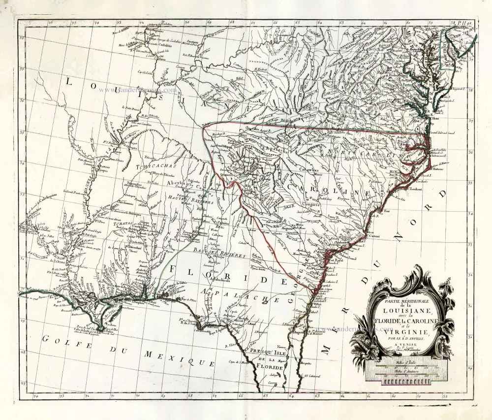
Partie Méridionale de la Louisiane, avec la Floride, la Caroline et la Virginie. 1776-79
The United States (Southeast), by Francesco Santini.
[Item number: 26983]
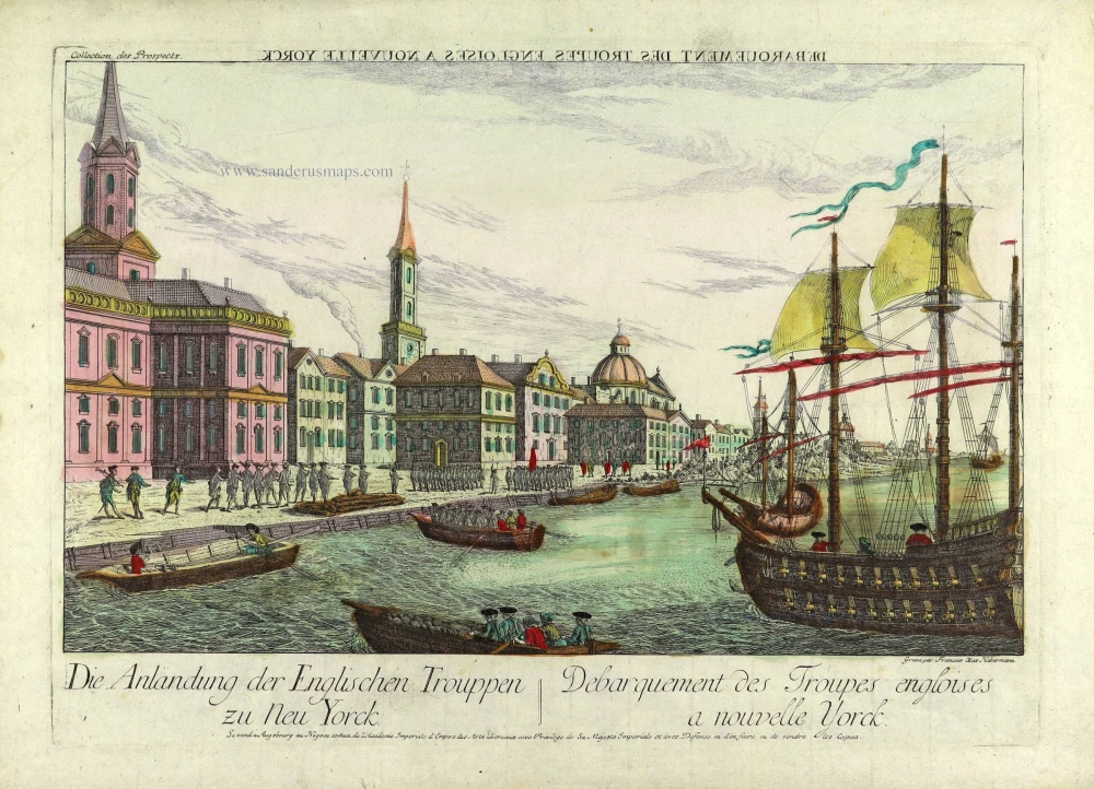
Débarquement des Troupes Engloises a Nouvelle Yorck. c. 1770
Perspective view of New York.
[Item number: 28217]