
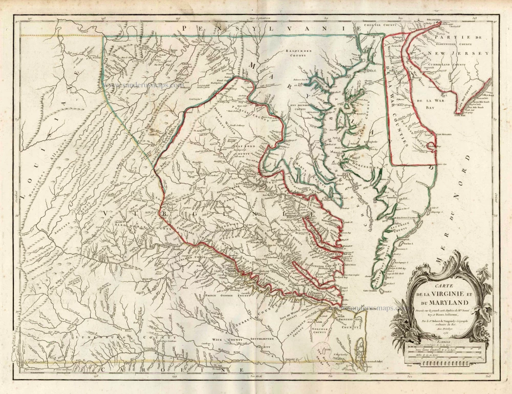
Old, antique map of Maryland & Virginia by Robert de Vaugondy. c. 1757
Gilles and Didier Robert de Vaugondy
Gilles Robert de Vaugondy (1688-1766) and his son Didier Robert de Vaugondy (1723-1786) were leading cartographers in France during the 18th century. They served both as geographer to the king of France. The father, Gilles is also known as ‘Le Sieur’ or ‘Monsieur Robert’. He descended from the Nicolas Sanson family through Sanson's grandson Pierre Moulard-Sanson, from whom he inherited Sanson's cartographic material. After Hubert Jaillot died in 1712, the de Vaugondy's acquired numerous copies of his maps and plates, which formed the basis of their beautiful Atlas Universel (1757).
Their business flourished from 1731 to 1778. They made a substantial contribution to the world of cartography.
Carte de la Virginie et du Maryland Dressee sur la Grande Carte Angloise de Mrs. Josue Fry et Pierre Jefferson.
Item Number: 4333 Authenticity Guarantee
Category: Antique maps > America > North America
Old, antique map of Maryland & Virginia by Robert de Vaugondy.
Date on map: 1755
Copper engraving
Size: 49 x 64cm (19.1 x 25 inches)
Verso: Blank
Condition: Original outline colour, excellent.
Condition Rating: A
References: Pedley, 470 State 1.
From: Atlas Universelle. Paris, c.1757.
Gilles and Didier Robert de Vaugondy
Gilles Robert de Vaugondy (1688-1766) and his son Didier Robert de Vaugondy (1723-1786) were leading cartographers in France during the 18th century. They served both as geographer to the king of France. The father, Gilles is also known as ‘Le Sieur’ or ‘Monsieur Robert’. He descended from the Nicolas Sanson family through Sanson's grandson Pierre Moulard-Sanson, from whom he inherited Sanson's cartographic material. After Hubert Jaillot died in 1712, the de Vaugondy's acquired numerous copies of his maps and plates, which formed the basis of their beautiful Atlas Universel (1757).
Their business flourished from 1731 to 1778. They made a substantial contribution to the world of cartography.