
Old antique map of Southern North America - Central America by J.B. Homann 1716-37

The Homann Family
Johann Baptist Homann (1664-1724) was born in Oberkammlach in Southern Germany. Around 1693 Homann moved to Vienna, where he lived and studied printing and copper plate engraving until 1695. In 1702 he founded a map publishing company in Nuremberg, which is recognized as one of the most important German map publishers of the eighteenth century. In the next five years, Homann produced hundreds of maps and developed a distinctive style characterized by heavy detailed engraving, elaborate allegorical cartouche work, and vivid hand colour. He published his first atlas in 1707. Homann's company successfully competed with leading European mapmakers. By 1715 Homann's rising star caught the attention of the Holy Roman Emperor Charles the VI, who appointed him Imperial Cartographer. In the same year, he was also appointed a member of the Royal Academy of Sciences in Berlin. Homann's prestigious title came with several significant advantages, including access to the most up to date cartographic information as well as the "Privilege". In 1716 Homann published his masterpiece Grosser Atlas über die ganze Welt (Grand Atlas of all the World).
After Johann Baptist Homann's death in 1724, Johan Christoph Homann (1703-1730) and other heirs continued the company under the name Homann's Erben (Homann's Heirs) until 1852.
Regni Mexicani seu Novae Hispaniae Floridae, Novae Angliae, Carolinae, Virginiae, et Pensylvaniae nec non Insularum Archipelagi Mexicani in America Septentrionali Accurata Tabula ...
Item Number: 25289 Authenticity Guarantee
Category: Antique maps > America > North America
Old, antique map of Southern North America - Central America by Homann J.B.
First (and only?) state.
Copper engraving
Size: 47.5 x 57cm (18.5 x 22.2 inches)
Verso: Blank
Condition: Some discolouration at centrefold, lower centrefold reinforced.
Condition Rating: A
References: Portinaro - Knirsch, Pl. CXV.
From: Grosser Atlas Uber die Gantze Welt ... Von Joann Baptist Homann ... Nürnberg, 1716 [- 37]. [Shirley (Brit.Lib.), T.HOM-1c]
This map, based on the map of de L'Isle of 1703, extends from the northern coast of South America to the Great Lakes and from New England to, and including, New Mexico.
Dense with place names, Homann's map shows the de facto and de jure political division of North America after the treaty of Utrecht of 1713 and the French expansion into Louisiana in the following 10 years. The contested southern border of Carolina is drawn to England's advantage, since it pushes deep into Spanish-claimed territory, almost to St Augustine.
The Homann Family
Johann Baptist Homann (1664-1724) was born in Oberkammlach in Southern Germany. Around 1693 Homann moved to Vienna, where he lived and studied printing and copper plate engraving until 1695. In 1702 he founded a map publishing company in Nuremberg, which is recognized as one of the most important German map publishers of the eighteenth century. In the next five years, Homann produced hundreds of maps and developed a distinctive style characterized by heavy detailed engraving, elaborate allegorical cartouche work, and vivid hand colour. He published his first atlas in 1707. Homann's company successfully competed with leading European mapmakers. By 1715 Homann's rising star caught the attention of the Holy Roman Emperor Charles the VI, who appointed him Imperial Cartographer. In the same year, he was also appointed a member of the Royal Academy of Sciences in Berlin. Homann's prestigious title came with several significant advantages, including access to the most up to date cartographic information as well as the "Privilege". In 1716 Homann published his masterpiece Grosser Atlas über die ganze Welt (Grand Atlas of all the World).
After Johann Baptist Homann's death in 1724, Johan Christoph Homann (1703-1730) and other heirs continued the company under the name Homann's Erben (Homann's Heirs) until 1852.
Related items
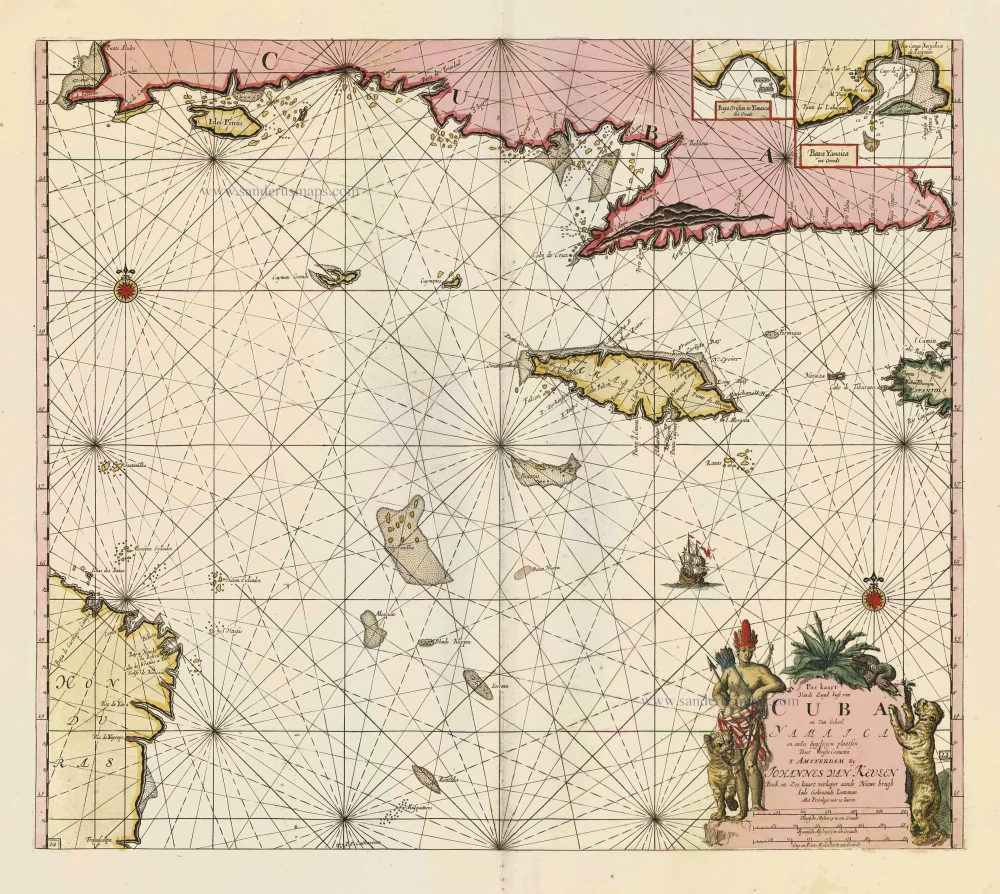
Pas Kaart vande Zuyd Kust van Cuba en van Geheel Yamaica en and're Bygeleegen Plaatsen ... 1697-1709
Cuba - Jamaica by Johannes van Keulen
[Item number: 11219]
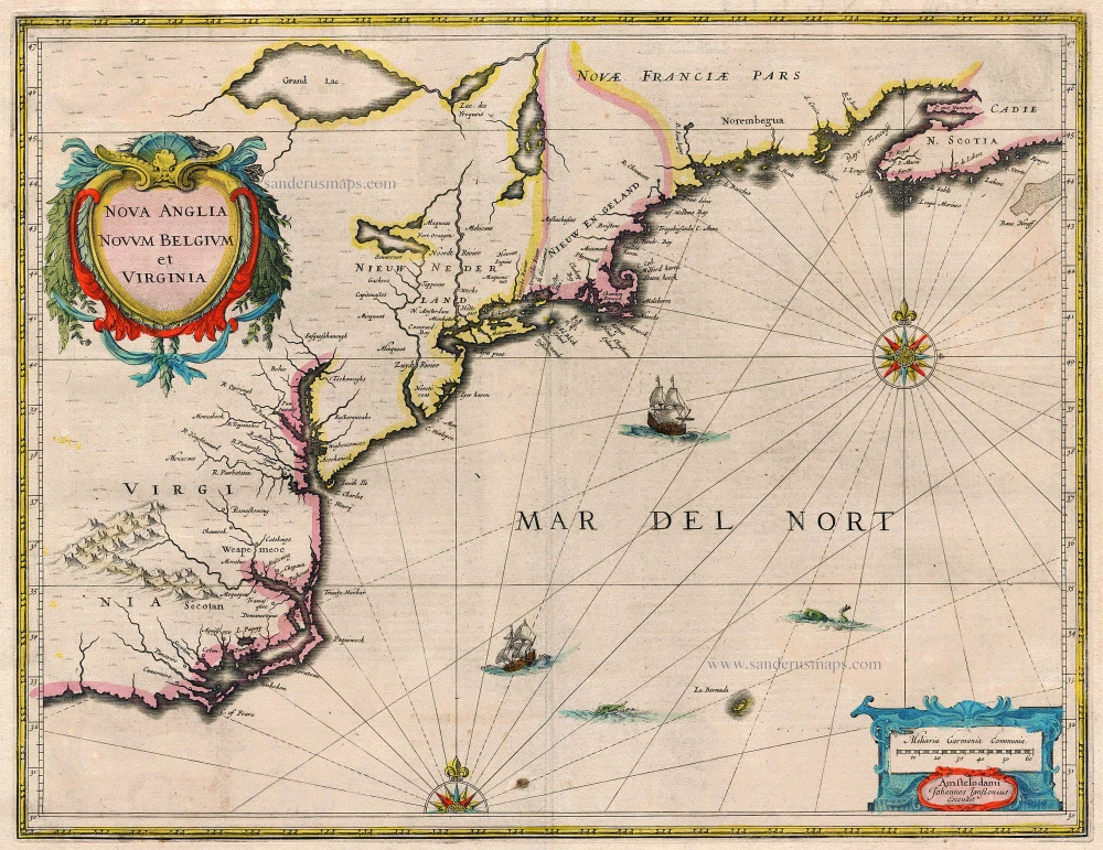
Nova Anglia Novum Belgium et Virginia 1638
United States (Northeast) by Janssonius J.
[Item number: 19011]
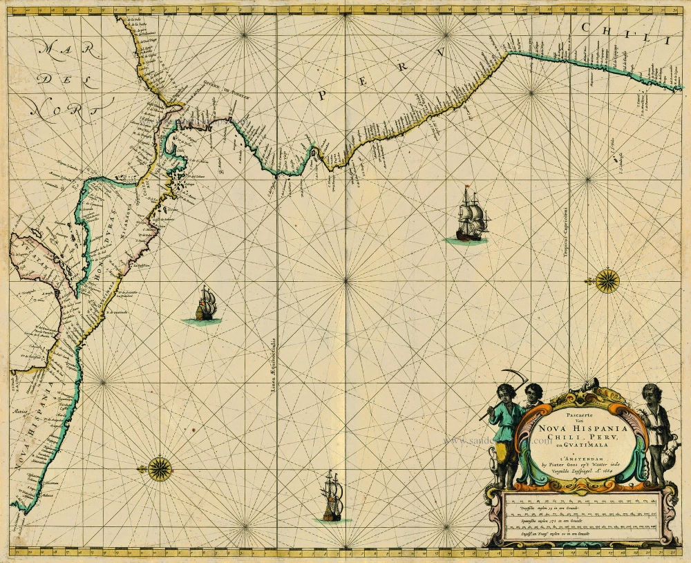
Pascaerte van Nova Hispania Chili, Peru, en Guatimala 1667
Central America, by Pieter Goos.
[Item number: 19031]
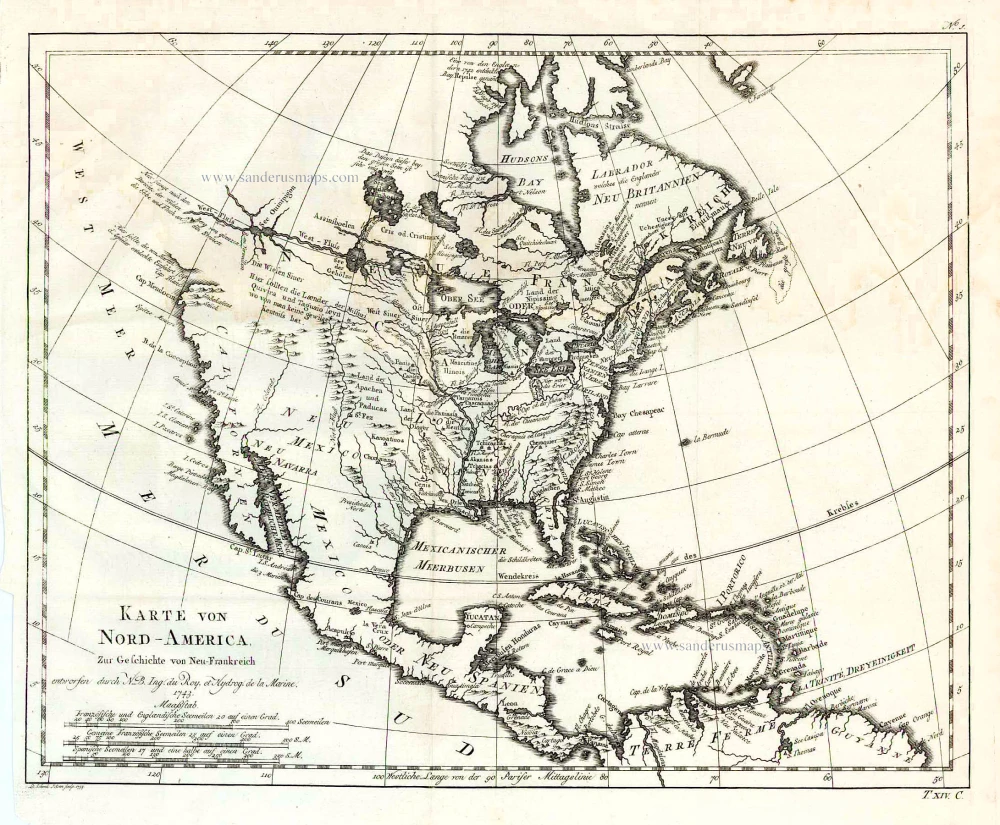
Karte von Nord-America, zur Geschichte von Neu-Frankreich. 1747-74
North America, by Jacques Nicolas Bellin.
[Item number: 26799]