Old antique map of United States (Midwest) by Jonathan Carver. 1784
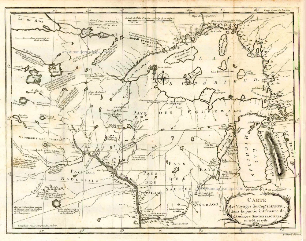
This map shows the area of the headwaters of the Mississippi.
The longest journey during the period following the French and Indian War was taken by Jonathan Carver between 1766 and 1768. He left Boston and, taking Mackinac Island as a jumping-off point, explored the Wisconsin and upper Mississippi rivers as far north as the St. Francis River. Carver was the first person to refer in print to a large mountain range that was a barrier to explorers seeking the Pacific Ocean from the east, probably a reference to the Rocky Mountain system.
Carte des Voyages du Cap. Carver, dans la partie intérieure de L'Amérique Septentrionale, en 1766 et 1767.
Item Number: 26007 Authenticity Guarantee
Category: Antique maps > America > North America
Old, antique map of the United States (Midwest) by Jonathan Carver.
Date of the first edition: 1784
Date of this map: 1784
Copper engraving, printed on paper.
Size (not including margins): 26.5 x 34cm (10.3 x 13.3 inches)
Verso: Blank
Condition: Folds as ususal.
Condition Rating: A
References: See Schwartz-Ehrenberg, p.173.
From: Carver J. Voyage dans les parties intérieures de l'Amérique Septentrionale, pendant les années 1766, 1767 & 1768. Paris, Pissot, 1784.
This map shows the area of the headwaters of the Mississippi.
The longest journey during the period following the French and Indian War was taken by Jonathan Carver between 1766 and 1768. He left Boston and, taking Mackinac Island as a jumping-off point, explored the Wisconsin and upper Mississippi rivers as far north as the St. Francis River. Carver was the first person to refer in print to a large mountain range that was a barrier to explorers seeking the Pacific Ocean from the east, probably a reference to the Rocky Mountain system.


