
Texas by Ferdinand Roemer 1849
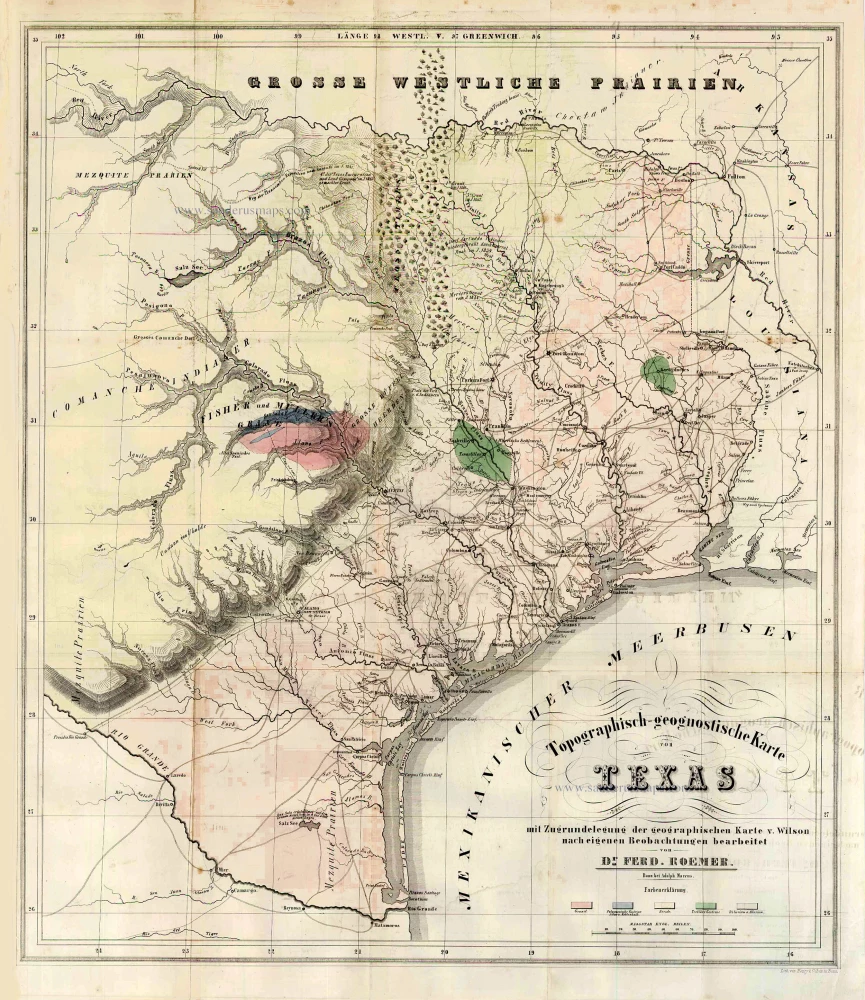
The first geological map of Texas. Shows mid-nineteenth century Cross Timbers, land grants, and Native American settlements, geography, and cities in Texas. Includes legend color keyed to geological formations and historical notes.
Topographisch-geognostische Karte von Texas, mit Zugrandelegung der geographischen Karte v. Wilson nach eigenen Beobachtungen bearbeitet.
Item Number: 27302 Authenticity Guarantee
Category: Antique maps > America > North America
Old, antique map of Texas by Ferdinand Roemer.
Title: Topographisch-geognostische Karte von Texas, mit Zugrandelegung der geographischen Karte v. Wilson nach eigenen Beobachtungen bearbeitet.
Date of the first edition: 1849.
Date of this map: 1849.
Lithograph, printed on paper.
Size (not including margins): 560 x 480mm (22.05 x 18.9 inches).
Verso: Blank.
Condition: Hand coloured, folds as issued, mint.
Condition Rating: A+.
From: Texas. Mit besonderer Rücksicht auf deutsche Auswanderung und die physischen Verhältnisse des Landes.Bonn, A. Marcus, 1849.
The first geological map of Texas. Shows mid-nineteenth century Cross Timbers, land grants, and Native American settlements, geography, and cities in Texas. Includes legend color keyed to geological formations and historical notes.