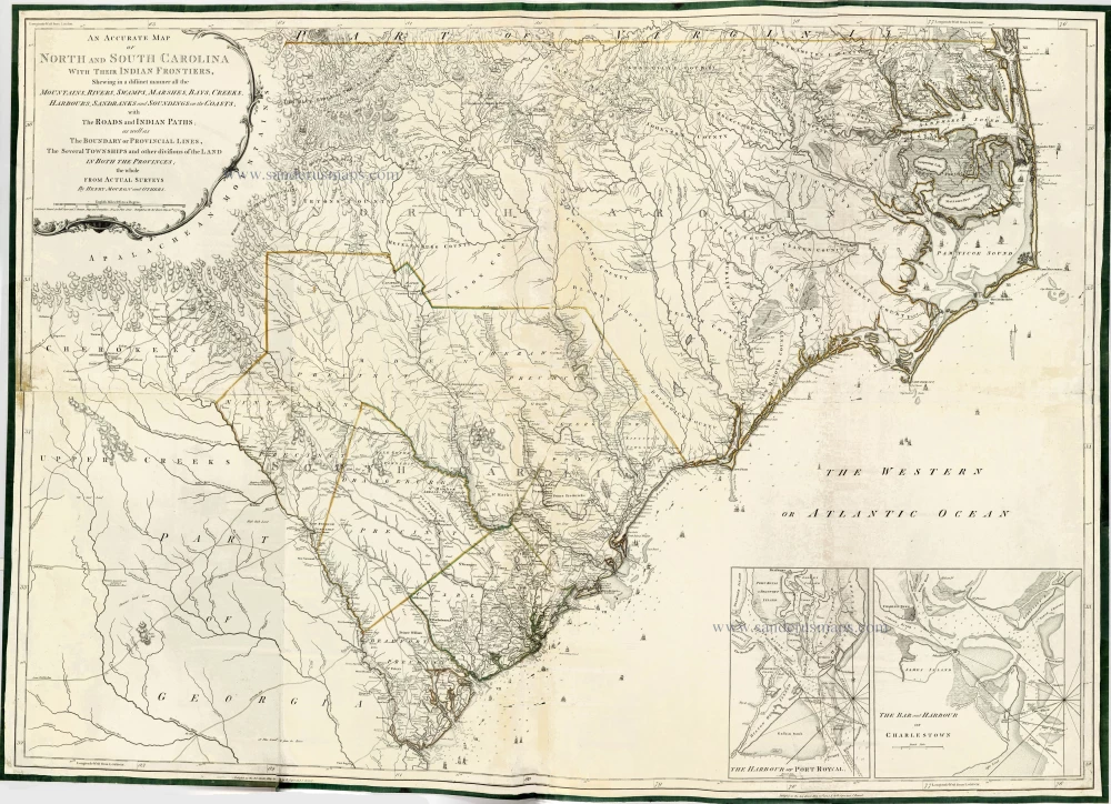
The Carolinas by Henry Mouzon. 1775
This map, which extends from the coastal area of the two Carolinas westward to the Appalachian mountains in the Cherokee country, was the chief type map for the region during the fifty years following its publication.
Both British and American forces used it during the Revolutionary War. The copy of the Mouzon map carried by George Washington is preserved at the American Geographical Society Library in Milwaukee. The copy of the Mouzon map carried by Sir Henry Clinton, the British Commander, is held at the William L. Clements Library at the University of Michigan in Ann Arbor.
Henry Mouzon Jr. (1741-1807)
An Accurate Map of North and South Carolina with their Indian Frontiers,
Item Number: 28152 Authenticity Guarantee
Category: Antique maps > America > North America
Old, antique map of teh Carolinas, by Henry Mouzon.
Title: An Accurate Map of North and South Carolina with their Indian Frontiers,
Shewing in a distinct manner all the Mountains, Rivers, Swamps, Marshes, Bays, Creeks, Harbours, Sandbanks and Soundings on the Coasts;
with The Roads and Indian Paths; as well as The Boundary or Provincial Lines,
The Several Townships and other divisions of the Land in Both the Provinces;
the whole from Actual Surveys By Henry Mouzon and Others.
London Printed for Rob. Sayer and J. Bennett, Map and Print-sellers, N° 53 in Fleet Street. Publish'd as the Act directs May 30th 1775.
Sparrow Sc.
Engraver: Sparrow S.
Date of the first edition: 1775.
Date of this map: 1775.
Date on map: 1775.
Copper engraving, printed on paper.
Size (not including margins): 1045 x 1455mm (41.14 x 57.28 inches).
Verso: Blank.
Condition: Coloured in outline, with a few small reinforcements at the back. Printed on four sheets, joined, edges reinforced with green silk. Good.
Condition Rating: A.
References: Cumming, #450;
Two insets at the bottom right: The Harbour of Port Royal and The Bar and Harbour of Charlestown.
This map appeared in: Jefferys T. The American Atlas. London, 1775.
Because the map was too large for the atlas, most copies are damaged on the left margin.
This map, which extends from the coastal area of the two Carolinas westward to the Appalachian mountains in the Cherokee country, was the chief type map for the region during the fifty years following its publication.
Both British and American forces used it during the Revolutionary War. The copy of the Mouzon map carried by George Washington is preserved at the American Geographical Society Library in Milwaukee. The copy of the Mouzon map carried by Sir Henry Clinton, the British Commander, is held at the William L. Clements Library at the University of Michigan in Ann Arbor.
Henry Mouzon Jr. (1741-1807)

