
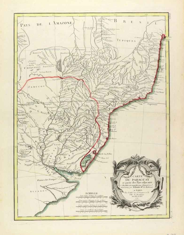
Paraguay par R. Bonne, published by J. Lattré. 1771
Jean Lattré (???? - 1782)
'Graveur Ordinaire du Roi' (engraver to the King). A Paris-based engraver, bookseller, and map publisher. He worked with his father, Jean I, and specialised in town plans. Engraved maps for Robert de Vaugondy and for Rigobert Bonne. In 1771 he published Atlas moderne ou collection de cartes sur toutes les parties du Globe terrestre par plusieurs Auteurs.
Rigobert Bonne (1729-1795)
Rigobert Bonne was a French cartographer considered one of the most important cartographers of the late 18th century.
He applied himself to physics, mathematics, geography, and for fifteen years, he was one of the most sought-after masters in Paris. Finally, in 1775, he succeeded Giovanni Rizzi-Zannoni as cartographer to the King of France in the Hydrographic Service of the Navy.
He produced maps for Father Raynal's works and the Methodical Encyclopedia of Nicolas Desmarest.
The work of Bonne is highly regarded for its detail, historical importance, and overall aesthetic appeal.
Carte du Paraguay et partie des Pays adjacants.
Item Number: 30408 Authenticity Guarantee
Category: Antique maps > America > South America
Paraguay par R. Bonne, published by J. Lattré.
Title: Carte du Paraguay et partie des Pays adjacants.
Projettée et assujettie aux Observations Astronomiq. par M. Bonne M.tre de Mathemat.
A Paris Chez Lattré rue St. Jacques a la Ville de Bordeaux.
Avec Priv. du Roi 1771.
Cartographer: Rigobert Bonne.
Date of the first edition: 1771.
Date of this map: 1771.
Date on map: 1771.
Copper engraving, printed on paper.
Image size: 420 x 315mm (16.54 x 12.4 inches).
Sheet size: 500 x 395mm (19.69 x 15.55 inches).
Verso: Blank.
Condition: Original coloured in outline, excellent.
Condition Rating: A+.
From: Lattré J. & Bonne R., Atlas moderne ou collection de cartes sur toutes les parties du globe terrestre ar plusieurs auteurs. A Paris, Chez Lattre Graveur Ordinaire du Roy, ... 1771. Maps by Bonne, Janvier, & Rizzi Zannoni.
Jean Lattré (???? - 1782)
'Graveur Ordinaire du Roi' (engraver to the King). A Paris-based engraver, bookseller, and map publisher. He worked with his father, Jean I, and specialised in town plans. Engraved maps for Robert de Vaugondy and for Rigobert Bonne. In 1771 he published Atlas moderne ou collection de cartes sur toutes les parties du Globe terrestre par plusieurs Auteurs.
Rigobert Bonne (1729-1795)
Rigobert Bonne was a French cartographer considered one of the most important cartographers of the late 18th century.
He applied himself to physics, mathematics, geography, and for fifteen years, he was one of the most sought-after masters in Paris. Finally, in 1775, he succeeded Giovanni Rizzi-Zannoni as cartographer to the King of France in the Hydrographic Service of the Navy.
He produced maps for Father Raynal's works and the Methodical Encyclopedia of Nicolas Desmarest.
The work of Bonne is highly regarded for its detail, historical importance, and overall aesthetic appeal.
Related items
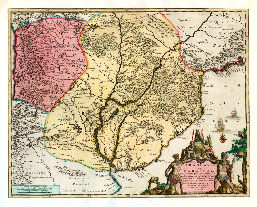
Paraguaria ou Paraguay, Avec les Pays qui l'environnent, dans l'Amerique Meridionale. 1713
Paraguay, by Pieter van der Aa.
[Item number: 26152]
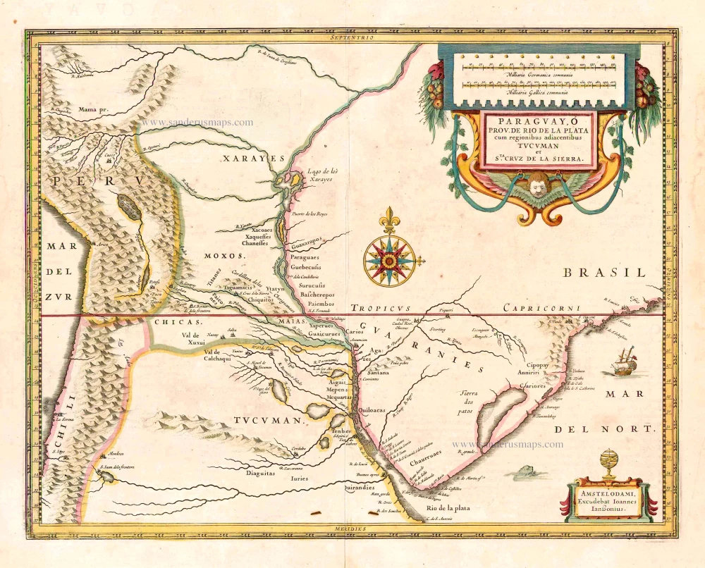
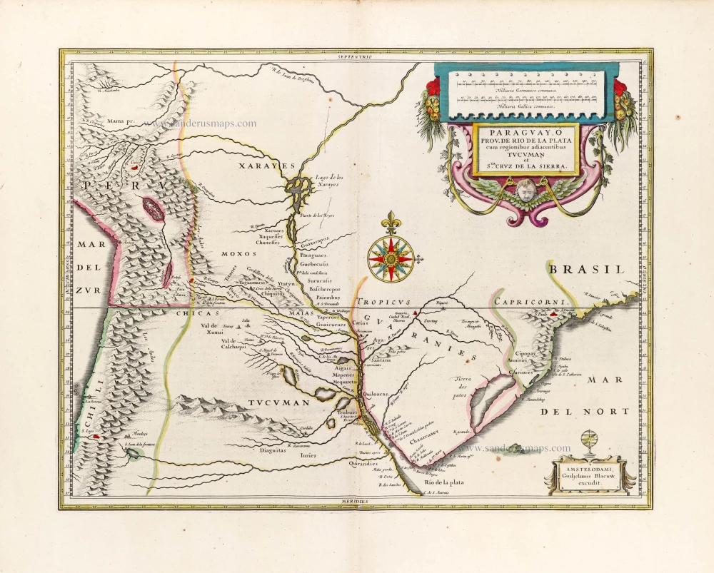
Paraguay, O Prov. de Rio de la Plata cum regionibus adiacentibus Tucuman et Sta. Cruz de la Sierra. 1641
Paraguay, by Johannes Janssonius.
[Item number: 26569]
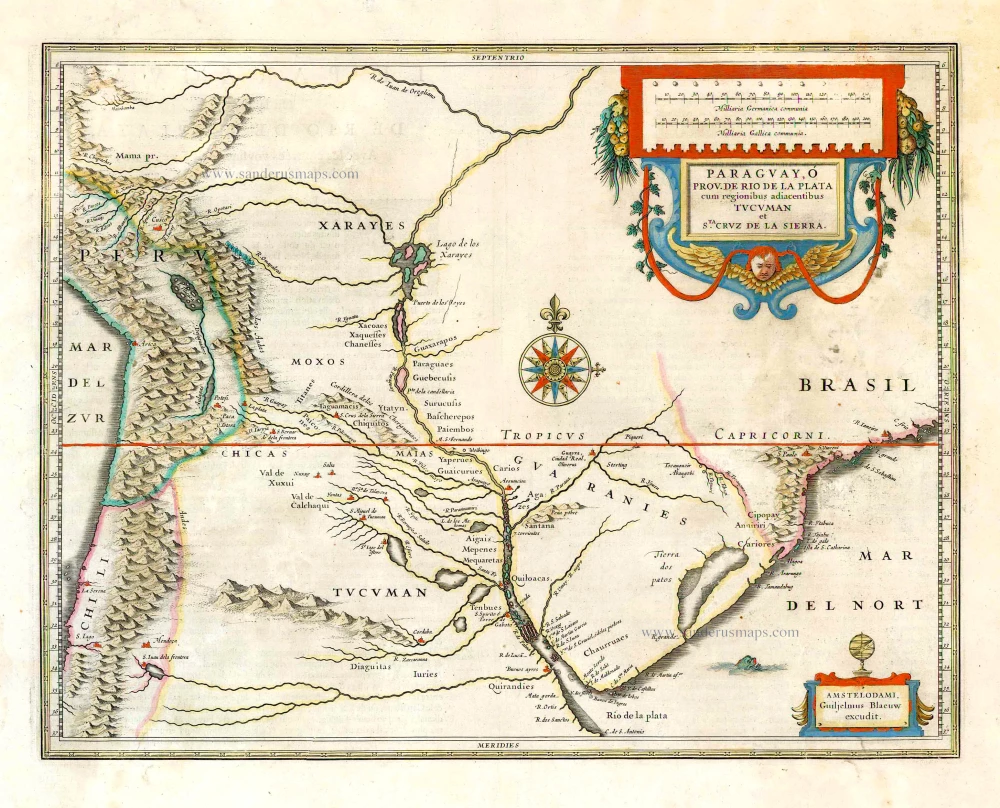
Paraguay, o Prov. de Rio de la Plata cum regionibus adiacentibus Tucuman et Sta Cruz de la Sierra. 1643-50
Paraguay, by Willem & Joan Blaeu.
[Item number: 26749]
Paraguay, o Prov. de Rio de la Plata cum regionibus adiacentibus Tucuman et Sta Cruz de la Sierra. 1643
Paraguay, by Willem & Joan Blaeu.
[Item number: 30008]