
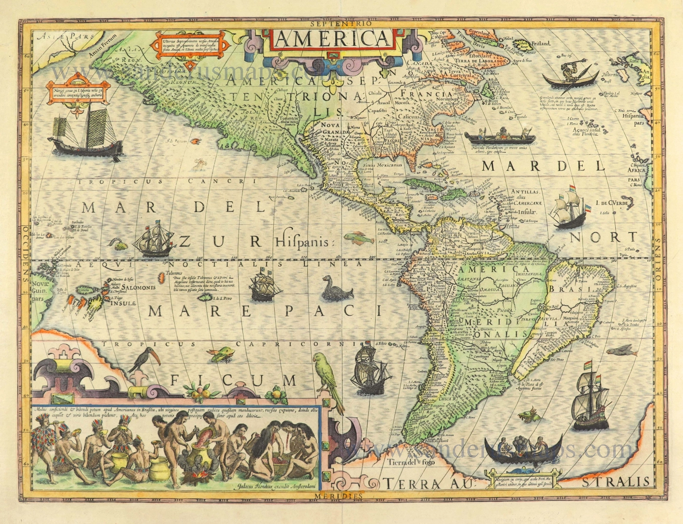
America, by Matheus Merian 1631
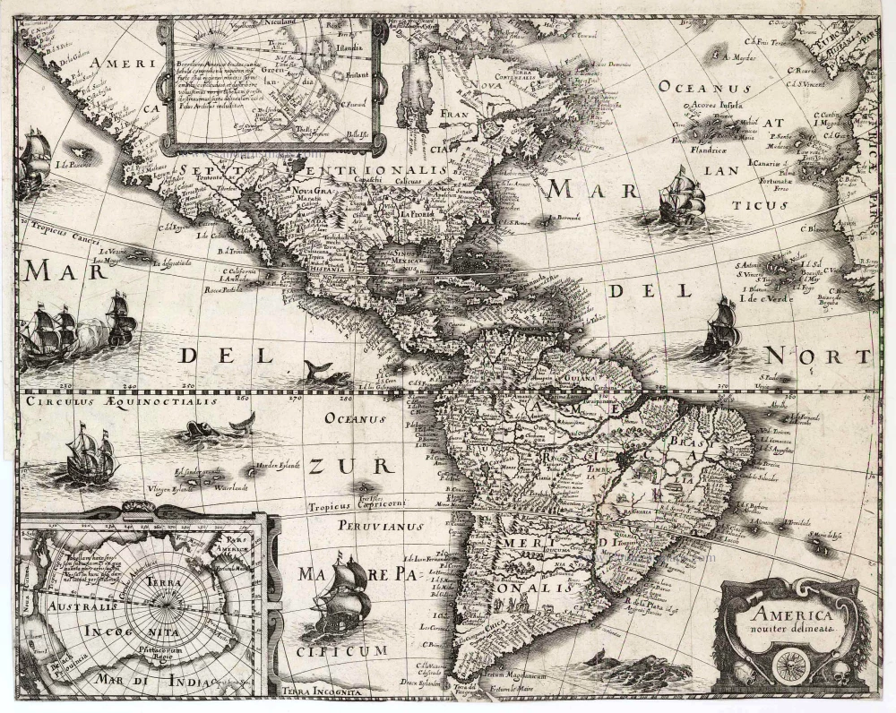
The Newe Welt ... by Johann Ludwig Gottfried was a compilation of the various voyages published by Theodore de Bry. The printer, Matheus Merian, was the latter's son-in-law, and able to contribute a number of the old de Bry Plates. Accompanying it was this map of America derived from that by Jodocus Hondius, 1618, but lacking the decorative borders.
Matthäus Merian the Elder (1593-1650)
Matthäus Merian, the leading German illustrator of the 17th century, was born in Basel in 1593. He learned the art of copperplate engraving in Zurich and subsequently worked and studied in Strasbourg, Nancy, Paris, and the Low Countries. In 1618 he went to Frankfurt, wherein in 1618, he married the eldest daughter of J.T. de Bry, publisher and engraver. After de Bry died in 1623, he took over his business. De Bry’s business remained in Merian’s family until 1726, when a fire destroyed it. In 1635 he began the series Theatrum Europaeum. Between 1642 and 1688, he published Martin Zeiller’s Topographia Germaniae, with more than 2,000 plates etched and engraved by himself and his sons Matthäus and Caspar. He also took over and completed the later parts and editions of the Grand Voyages and Petits Voyages, initially started by de Bry in 1590. Matthäus Merian died after in 1650 in Bad Schwalbach near Wiesbaden.
America noviter delineata.
Item Number: 2515 Authenticity Guarantee
Category: Antique maps > America > The Americas
Old, antique map of America with polar region insets, by Matheus Merian.
Title: America noviter delineata.
Date of the first edition: 1631.
Date of this map: 1631.
Copper engraving, printed on paper.
Size (not including margins): 355 x 450mm (13.98 x 17.72 inches).
Verso: Blank.
Condition: Folded as issued, right and lower margins trimmed.
Condition Rating: A
From: J.L. Gottfried. Newe Welt und Americanische Historien. Frankfurt, 1631.
The Newe Welt ... by Johann Ludwig Gottfried was a compilation of the various voyages published by Theodore de Bry. The printer, Matheus Merian, was the latter's son-in-law, and able to contribute a number of the old de Bry Plates. Accompanying it was this map of America derived from that by Jodocus Hondius, 1618, but lacking the decorative borders.
Matthäus Merian the Elder (1593-1650)
Matthäus Merian, the leading German illustrator of the 17th century, was born in Basel in 1593. He learned the art of copperplate engraving in Zurich and subsequently worked and studied in Strasbourg, Nancy, Paris, and the Low Countries. In 1618 he went to Frankfurt, wherein in 1618, he married the eldest daughter of J.T. de Bry, publisher and engraver. After de Bry died in 1623, he took over his business. De Bry’s business remained in Merian’s family until 1726, when a fire destroyed it. In 1635 he began the series Theatrum Europaeum. Between 1642 and 1688, he published Martin Zeiller’s Topographia Germaniae, with more than 2,000 plates etched and engraved by himself and his sons Matthäus and Caspar. He also took over and completed the later parts and editions of the Grand Voyages and Petits Voyages, initially started by de Bry in 1590. Matthäus Merian died after in 1650 in Bad Schwalbach near Wiesbaden.
Related items
America sive India Nova ad magnae Gerardi Mercatoris avi Universalis imitationem in compendium redacta. 1623
America, by Gerard Mercator
[Item number: 131]
Americae nova Tabula. 1647-49
America, by Willem Blaeu.
[Item number: 6717]
Nieuwe Kaart van America c. 1770
Antique map of America by Tirion I.
[Item number: 19194]

America. 1597
AMERICA by Giovanni Magini
[Item number: 22492]
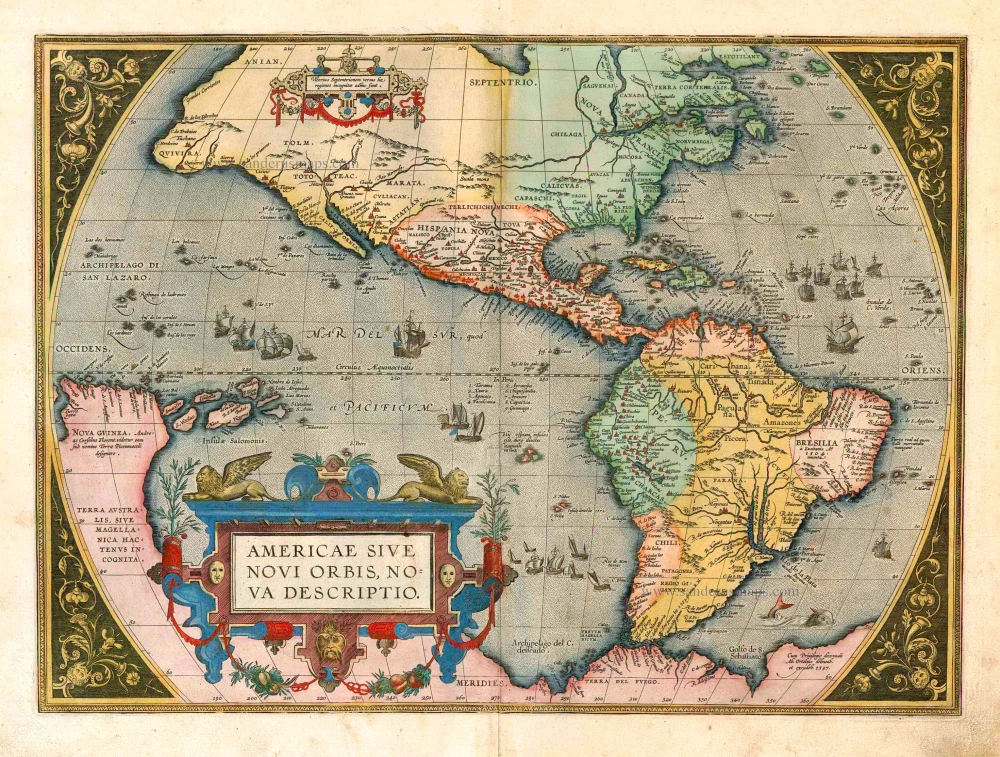
Americae Sive Novi Orbis, Nova Descriptio. 1598
America, by Abraham Ortelius.
[Item number: 25618]
Americae tam Septentrionalis quam Meridionalis in Mappa Geographica Delineatio. c. 1700
America by A.F. Zürner, published by Petrus Schenk.
[Item number: 25715]
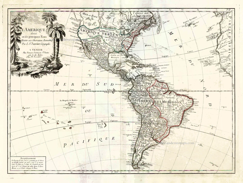
L'Amerique Divisée en ses Principaux Etats Assujettie aux Observations Astronomiq. 1776-79
America, by Francesco Santini.
[Item number: 26978]
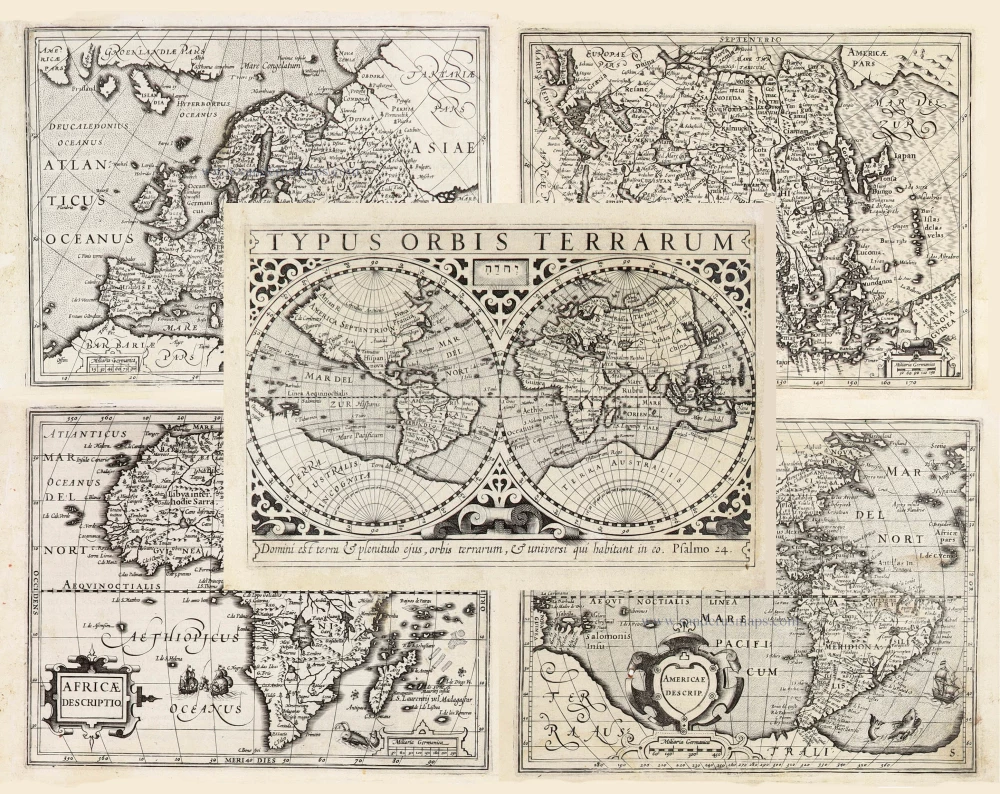
Typus Orbis Terrarum, [in set with:] Europa, [and] Asia, [and] Americae Descrip., [and] Africae Descriptio. 1607
World + Continents, by Jodocus Hondius.
[Item number: 27088]
Original Halma edition.
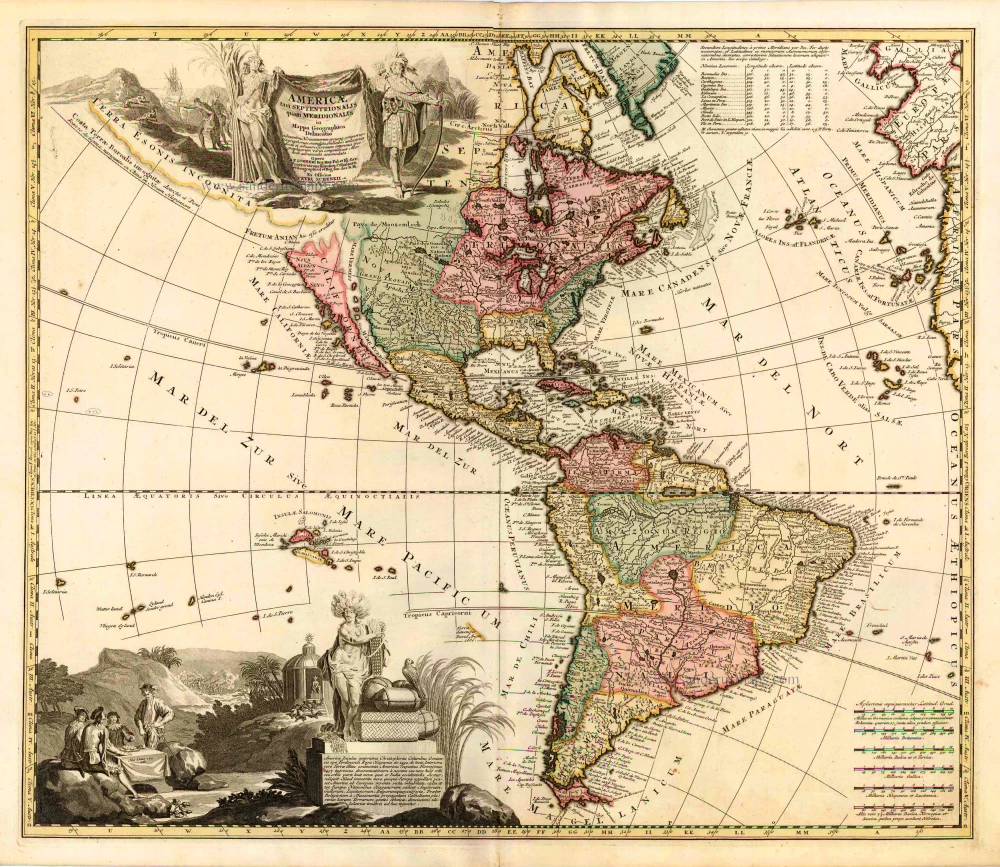
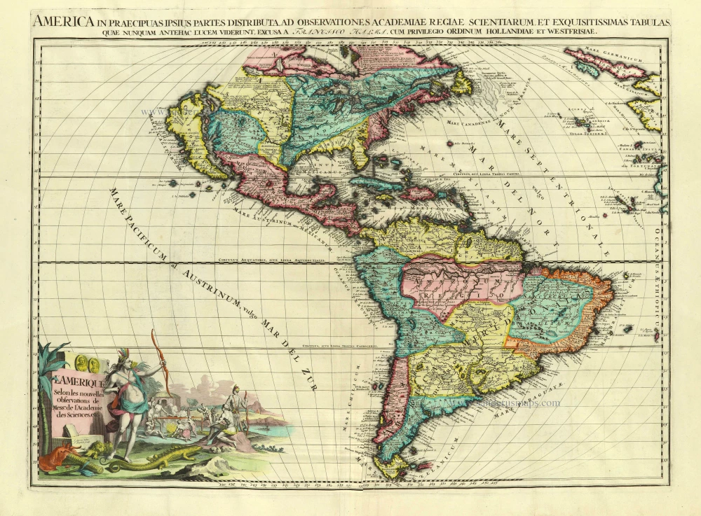
L'Amerique selon les Nouvelles Observations de Messrs. de l'Academie des Sciences, etc. Before 1713
America, by François Halma.
[Item number: 28017]
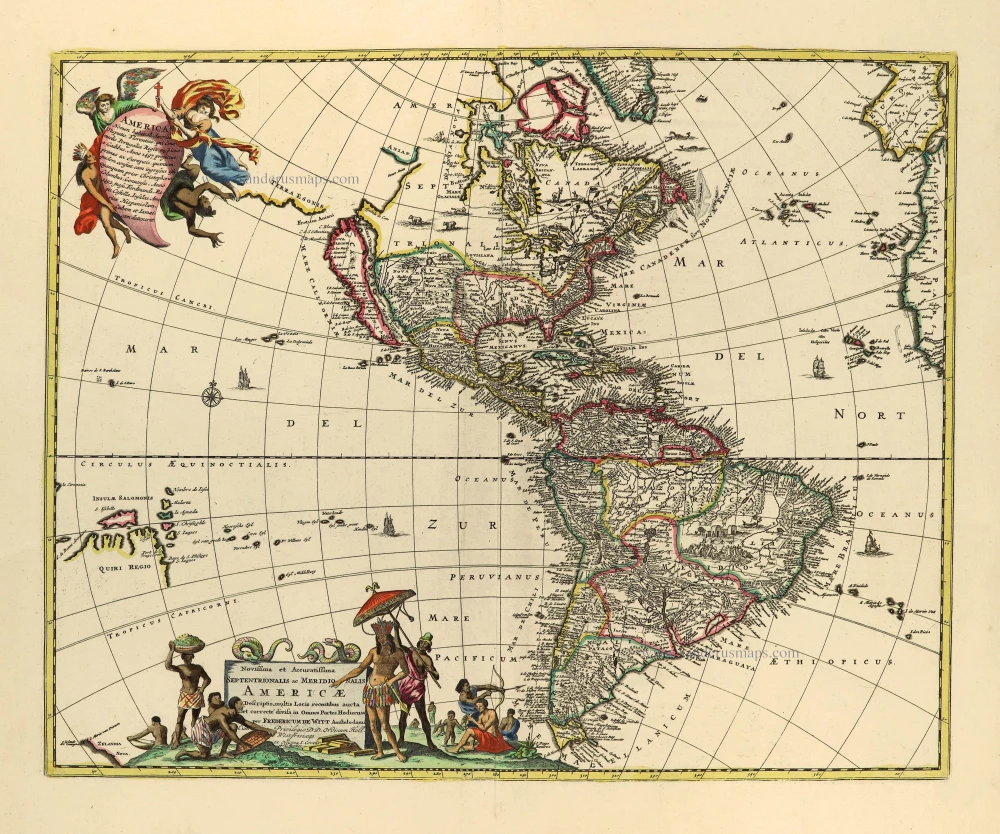
Novissima et Accuratissima Septentrionalis ac Meridionalis Americae. c. 1715
America by Frederick de Wit, published by Covens & Mortier.
[Item number: 28295]
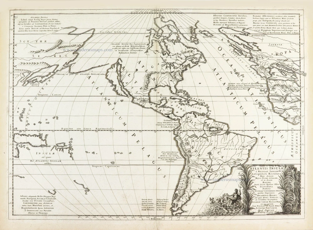
California as an island
Atlantis Insula. 1692
The Americas by Guillaume Sanson.
[Item number: 28376]
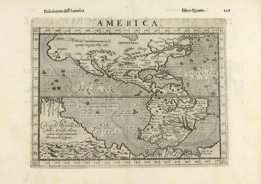
America. 1598
America, by Giovanni Lorenzo d'Anania, published by Girolamo Ruscelli.
[Item number: 28432]
America. 1613
America by Jodocus Hondius.
[Item number: 28530]
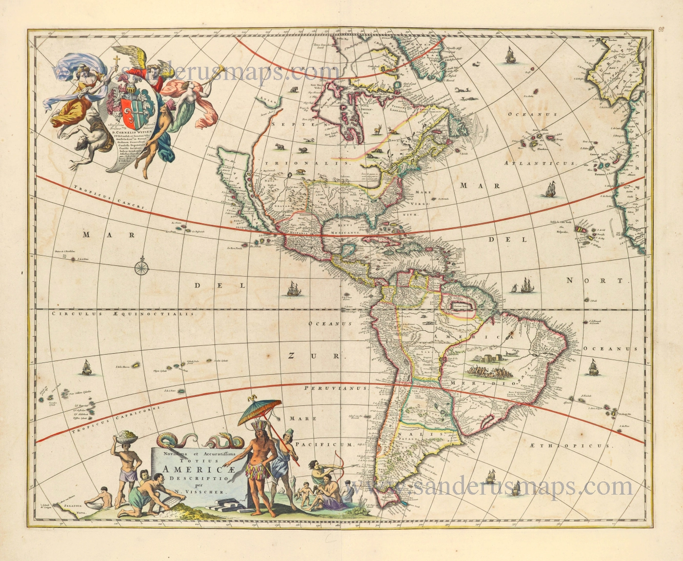
Novissima et Accuratissima Totius Americae Descriptio. 1656-77
America by Nicolaes Visscher I.
[Item number: 28554]
First plate
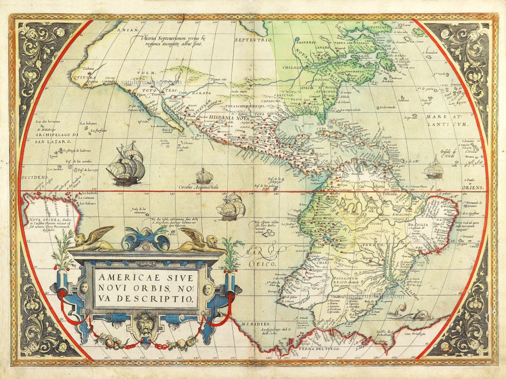
Americae Sive Novi Orbis, Nova Descriptio. 1572
America by Abraham Ortelius.
[Item number: 29237]
One of the most elaborately engraved maps ever published.
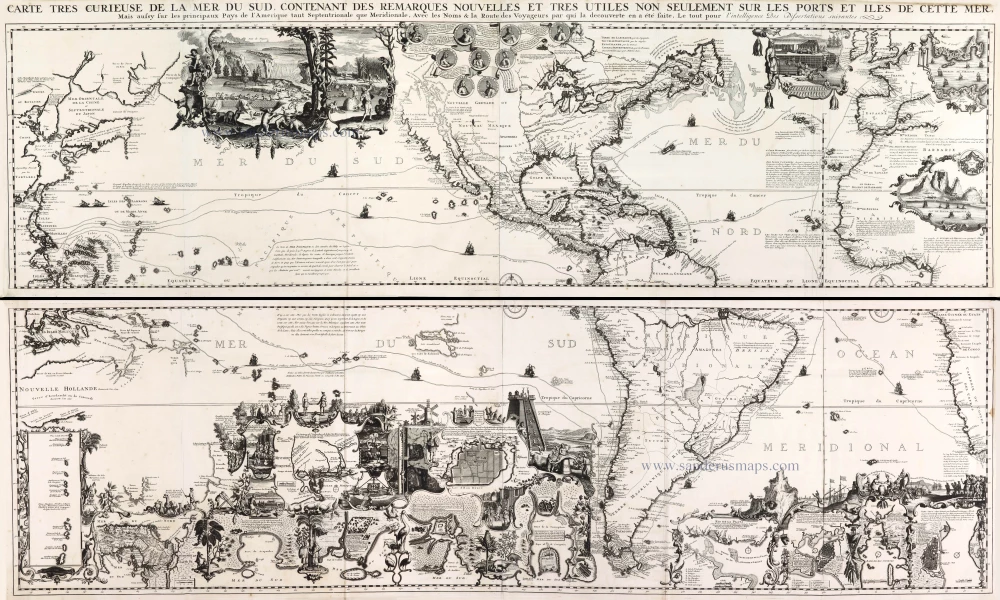
Carte tres Curieuse de la Mer du Sud, Contenant des Remarques Nouvelles et tres Utiles non Seulement sur les Ports et Iles de cette Mer, 1719
Pacific by Zacharias Châtelain after Nicolas de Fer.
[Item number: 29466]