
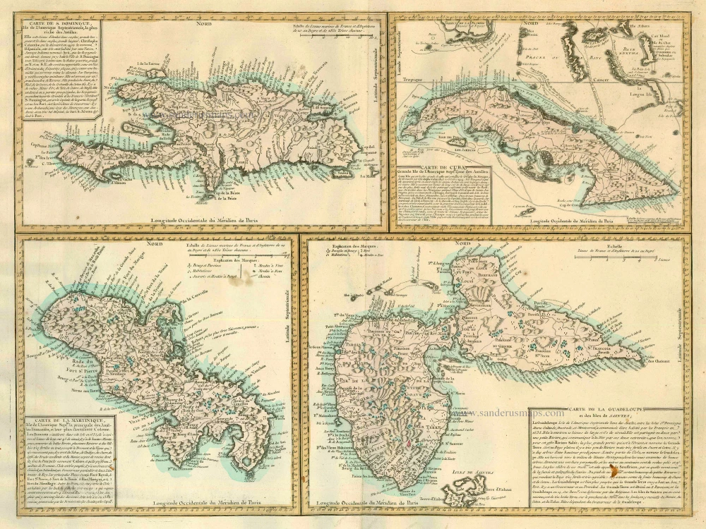
Antique map of Cuba - Dominican Republic - Martinique - Guadeloup by J. Lattré. 1779
Jean Lattré (???? - 1782)
'Graveur Ordinaire du Roi' (engraver to the King). A Paris-based engraver, bookseller, and map publisher. He worked with his father, Jean I, and specialised in town plans. Engraved maps for Robert de Vaugondy and for Rigobert Bonne. In 1771 he published Atlas moderne ou collection de cartes sur toutes les parties du Globe terrestre par plusieurs Auteurs.
Carte de S. Domingue [on sheet with:] Carte de Cuba [and] Carte de la Martinique [and] Carte de la Guadeloupe et des Isles de Saintes.
Item Number: 23491 Authenticity Guarantee
Category: Antique maps > America > West Indies
Four maps on one sheet by J. Lattré: Dominican Republic - Cuba - Martinique - Guadeloup, oriented to the North
Date: c.1779.
Copper engraving
Size: 37 x 49.5cm (14.4 x 19.3 inches)
Verso: Blank
Condition: Old coloured, rust spot.
Condition Rating: A
Jean Lattré (???? - 1782)
'Graveur Ordinaire du Roi' (engraver to the King). A Paris-based engraver, bookseller, and map publisher. He worked with his father, Jean I, and specialised in town plans. Engraved maps for Robert de Vaugondy and for Rigobert Bonne. In 1771 he published Atlas moderne ou collection de cartes sur toutes les parties du Globe terrestre par plusieurs Auteurs.
Related items
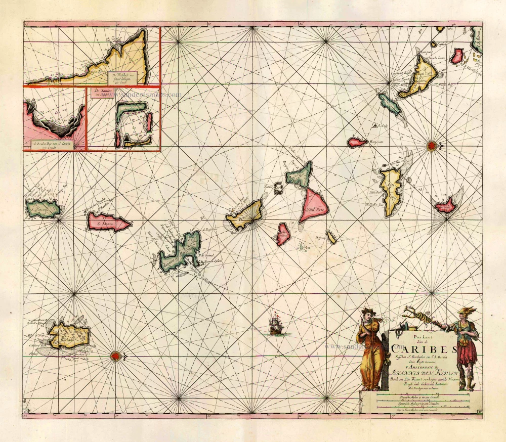
Pas Kaart van de Caribes tusschen I. Barbados en I.S. Martin. 1684
The Lesser Antilles, by J. Van Keulen.
[Item number: 2377]
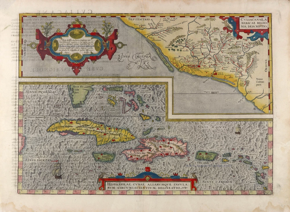
Culiacanae Americae Regionis Descriptio. - Hispaniolae, Cubae, Aliarumquae Insularum Circumiacentium, delineatio. 1581
Antilles - Mexico by Ortelius A.
[Item number: 6245]
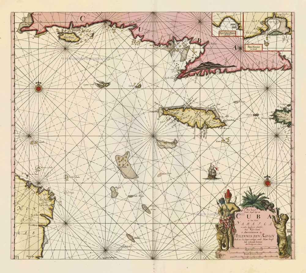
Pas Kaart vande Zuyd Kust van Cuba en van Geheel Yamaica en and're Bygeleegen Plaatsen ... 1697-1709
Cuba - Jamaica by Johannes van Keulen
[Item number: 11219]

Pas Kaart van de Boght van Florida met de Canaal tusschen Florida en Cuba ... 1680-1694
Sea chart of the Gulf of Mexico, Yucatan Channel, by J. Van Keulen.
[Item number: 16285]
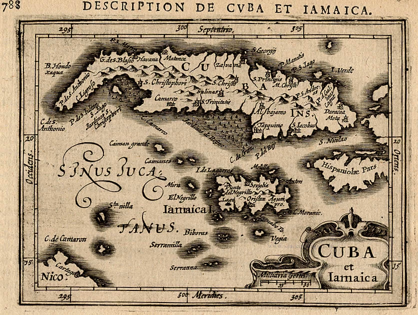
Cuba et Iamaica. 1618
Cuba and Jamaica,by Bertius P.
[Item number: 18315]

Heightened in gold
Pascaert vande Caribes Eylanden. 1667
Sea chart of the Lesser Antilles, by Pieter Goos.
[Item number: 25708]

Cuba Insula et Iamaica. 1607
Antilles: Cuba - Jamaica, by Cornelis van Wytfliet.
[Item number: 26502]
In excellent condition
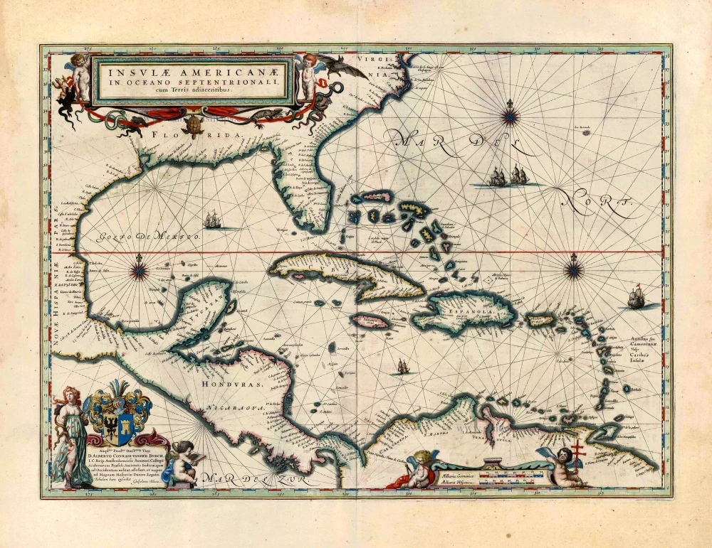
Insulae Americanae in Oceano Septentrionali, cum Terris Adiacentibus. 1643-50
West Indies by Willem Blaeu.
[Item number: 26985]
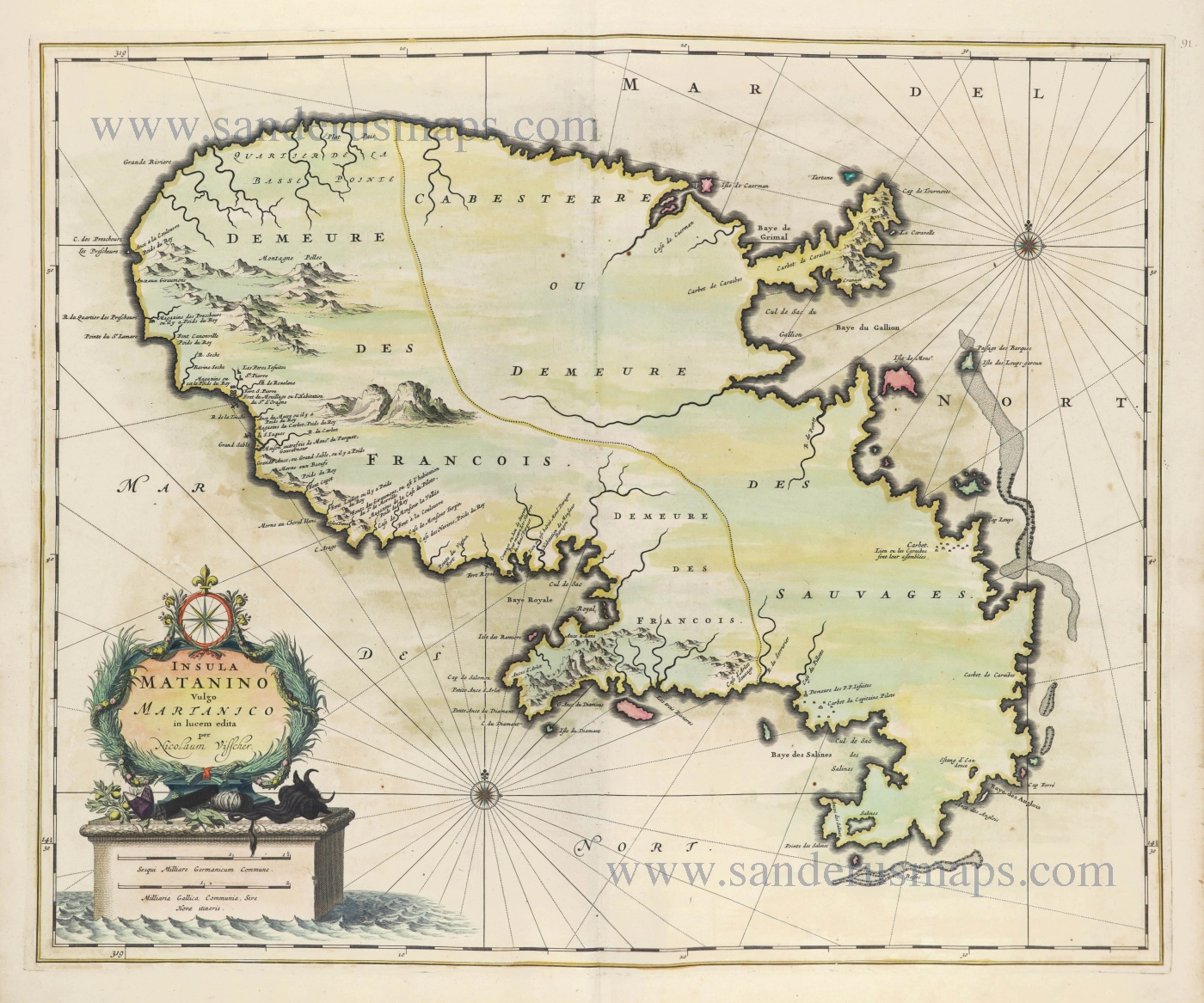
Insula Matanino Vulgo Matanico. 1656-77
Martinique by Nicolaes Visscher I.
[Item number: 28550]