
Antilles: Cuba - Jamaica, by Cornelis van Wytfliet. 1607

In 1597 Cornelis van Wytfliet published his Augmentum to Ptolemy's Geography. This is true as much as it covers all the Americas, a part of the world unknown to the latter; however, no other connection exists. Dedicated to Philip III of Spain, it is a history of the New World, recording its discovery, natural history etc. For the book, Wytfliet had engraved nineteen maps, by whom we do not know, one of the world and eighteen regional maps of the Americas. This book can be indeed called the first atlas of America. It was an immediate success and ran to several editions. (Burden)
Cornelius Wytfliet (? – 1597)
Cornelius Wytfliet was a geographer from Leuven. After graduating with a Licentiate in Laws from the University of Leuven, Wytfliet moved to Brussels and became secretary to the Council of Brabant.
In 1597, he published the first atlas of America: the Descriptionis Ptolemaicae Augmentum (Augmentation to Ptolemy’s description). He named his work an augmentation of Ptolemy’s Geography because it covers the Americas, a part of the world unknown to Ptolemy. However, there is no other connection between the works of Ptolemy and Van Wytfliet. Dedicated to Philip III of Spain, it is a history of the New World to date, recording its discovery, natural history, etc. It provides a history of exploration and the voyages of Christopher Columbus (1492-1502), John Cabot (1497-98), Sebastian Cabot (1526-28), Francisco Pizarro (1527-35), Giovanni de Verazzano (1524), Jacques Cartier (1540-42), and Martin Frobisher (1576-78). Most of Van Wytfliet’s maps are the first or among the earliest of specific regions of North and South America.
For the book, Wytfliet had engraved nineteen maps, one of the world and eighteen regional maps of the Americas. The book was an immediate success and ran to several editions.
Two editions of the Descriptionis Ptolemaicae were published at Leuven in 1597 and 1598, and in 1603, the first Douai edition appeared, with later editions with French text. The last edition was published in Arnhem in 1615.
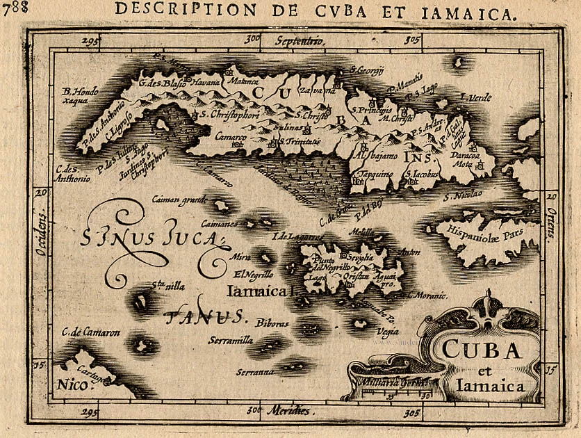
Cuba Insula et Iamaica.
Item Number: 26502 Authenticity Guarantee
Category: Antique maps > America > West Indies
Antilles: Cuba - Jamaica, by Cornelis van Wytfliet.
Title: Cuba Insula et Iamaica.
Date of the first edition: 1597.
Date of this map: 1607.
Copper engraving, printed on paper.
Size (not including margins): 230 x 290mm (9 x 11½ inches).
Verso: Blank.
Condition: A few brown stains, else good.
Condition Rating: A.
From: Histoire Universelle des Indes Occidentales. Douai, Françoes Fabri, 1607. (Van der Krogt 3, 371:12)
In 1597 Cornelis van Wytfliet published his Augmentum to Ptolemy's Geography. This is true as much as it covers all the Americas, a part of the world unknown to the latter; however, no other connection exists. Dedicated to Philip III of Spain, it is a history of the New World, recording its discovery, natural history etc. For the book, Wytfliet had engraved nineteen maps, by whom we do not know, one of the world and eighteen regional maps of the Americas. This book can be indeed called the first atlas of America. It was an immediate success and ran to several editions. (Burden)
Cornelius Wytfliet (? – 1597)
Cornelius Wytfliet was a geographer from Leuven. After graduating with a Licentiate in Laws from the University of Leuven, Wytfliet moved to Brussels and became secretary to the Council of Brabant.
In 1597, he published the first atlas of America: the Descriptionis Ptolemaicae Augmentum (Augmentation to Ptolemy’s description). He named his work an augmentation of Ptolemy’s Geography because it covers the Americas, a part of the world unknown to Ptolemy. However, there is no other connection between the works of Ptolemy and Van Wytfliet. Dedicated to Philip III of Spain, it is a history of the New World to date, recording its discovery, natural history, etc. It provides a history of exploration and the voyages of Christopher Columbus (1492-1502), John Cabot (1497-98), Sebastian Cabot (1526-28), Francisco Pizarro (1527-35), Giovanni de Verazzano (1524), Jacques Cartier (1540-42), and Martin Frobisher (1576-78). Most of Van Wytfliet’s maps are the first or among the earliest of specific regions of North and South America.
For the book, Wytfliet had engraved nineteen maps, one of the world and eighteen regional maps of the Americas. The book was an immediate success and ran to several editions.
Two editions of the Descriptionis Ptolemaicae were published at Leuven in 1597 and 1598, and in 1603, the first Douai edition appeared, with later editions with French text. The last edition was published in Arnhem in 1615.
Related items

Pas Kaart vande Zuyd Kust van Cuba en van Geheel Yamaica en and're Bygeleegen Plaatsen ... 1697-1709
Cuba - Jamaica by Johannes van Keulen
[Item number: 11219]
Cuba et Iamaica. 1618
Cuba and Jamaica,by Bertius P.
[Item number: 18315]

Iamaica. - [Above map :] Descrittione del l'Isola Iamaica hora detta di S. Iacopo. 1590
Jamaica by Tommaso Porcacchi.
[Item number: 29823]
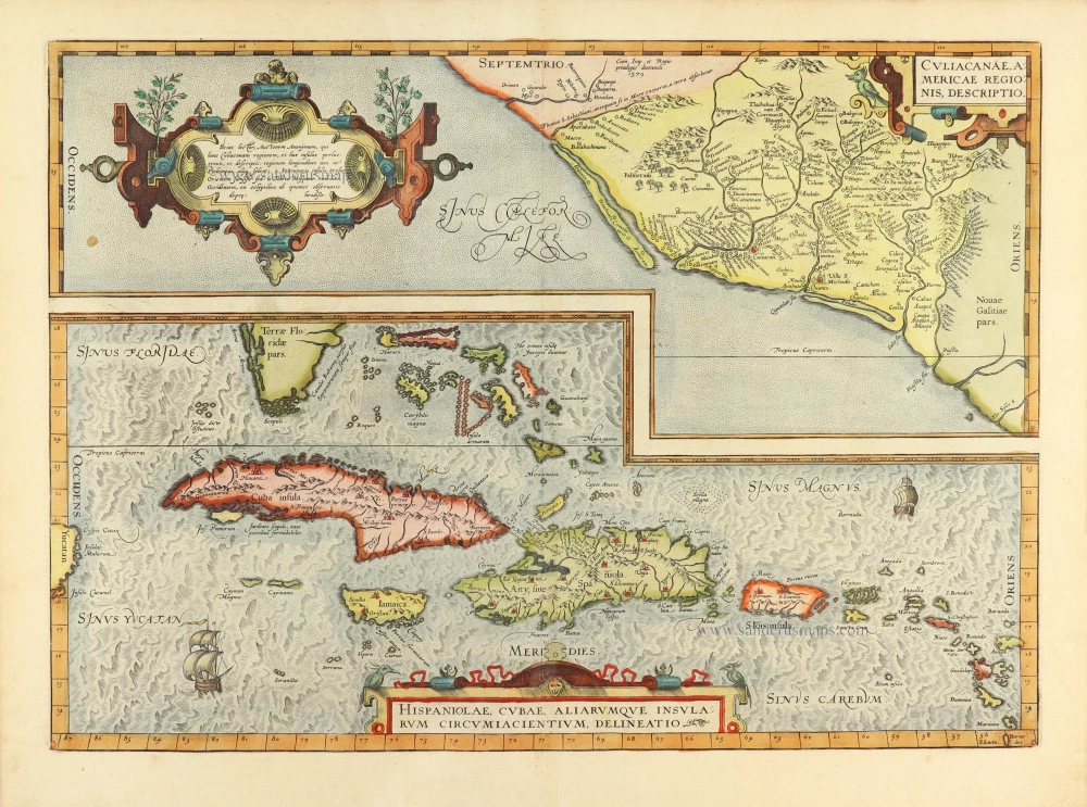
Culiacanae Americae Regionis Descriptio. - Hispaniolae, Cubae, Aliarumquae Insularum Circumiacentium, delineatio. 1584
Antilles by Abraham Ortelius.
[Item number: 30904]

First edition of the capture of the Spanish silver fleet by Admiral Piet Heyn, Cuba 1628.
Abbildung Welcher Gestalt die Spanische Silberflotta von dem Hollandischen General Peter Peters Hann an der Insul Cuba... 1631
Gottfried, the Battle for Havana (1628) when the Dutch Piet Hein captured the Spanish silver fleet,
[Item number: 31561]

Cuba Insula. c. 1600
Cuba & Jamaica by Barent Langenes.
[Item number: 32297]

From the first Dutch folio printed sea atlas
Insularum Hispaniolae et Cubae, Cum Insulis circumjacentibus. 1650
The Antilles by Joannes Janssonius.
[Item number: 32621]