
West Indies, Bermuda, New England, Virginia by Châtelain. 1713-1719
The Châtelain Family
Zacharias Châtelain (1684-1743) was a bookseller and publisher of Amsterdam. He was succeeded by his sons Zacharias jr and Henry Abraham. The Châtelain family was best known for the historical atlas Atlas Historique, ou nouvelle introduction à l’histoire…, a major work of its time. It was an encyclopaedia in seven volumes, including geography as one of its main subjects. The atlas was published in Amsterdam in seven volumes in various editions with different imprints from 1705 to 1739. An anonym person (Mr. C***) compiled the work with compositions of text, maps, plates and chronological and genealogical tables by Gueudeville, except volume 7, where H.P. Limiers took over this task. The maps were made mainly after the work of Guillaume de l'Isle.
The 1705 edition was published with the imprint “L’Honoré & Châtelain”. Later editions had the imprint: “les Frères Châtelain Libraires” or “L’Honoré & Châtelain Libraires”.
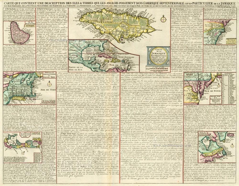
Carte qui Contient une Description des Iles & Terres que les Anglois Possèdent dans l'Amerique Septentrionale, et en Particulier de la Jamaique, ..
Item Number: 16834 Authenticity Guarantee
Category: Antique maps > America > West Indies
Antique map of West Indies by Châtelain.
Title: Carte qui Contient une Description des Iles & Terres que les Anglois Possèdent dans l'Amerique Septentrionale, et en Particulier de la Jamaique, ..
Date: 1713-1719.
Copper engraving, printed on paper.
Size (not including margins): 410 x 520mm (16.14 x 20.47 inches).
Verso: Blank.
Condition: Hand coloured.
Condition Rating: A.
From: Atlas Historique. Amsterdam, Châtelain, 1713-1719.
The Châtelain Family
Zacharias Châtelain (1684-1743) was a bookseller and publisher of Amsterdam. He was succeeded by his sons Zacharias jr and Henry Abraham. The Châtelain family was best known for the historical atlas Atlas Historique, ou nouvelle introduction à l’histoire…, a major work of its time. It was an encyclopaedia in seven volumes, including geography as one of its main subjects. The atlas was published in Amsterdam in seven volumes in various editions with different imprints from 1705 to 1739. An anonym person (Mr. C***) compiled the work with compositions of text, maps, plates and chronological and genealogical tables by Gueudeville, except volume 7, where H.P. Limiers took over this task. The maps were made mainly after the work of Guillaume de l'Isle.
The 1705 edition was published with the imprint “L’Honoré & Châtelain”. Later editions had the imprint: “les Frères Châtelain Libraires” or “L’Honoré & Châtelain Libraires”.
Related items
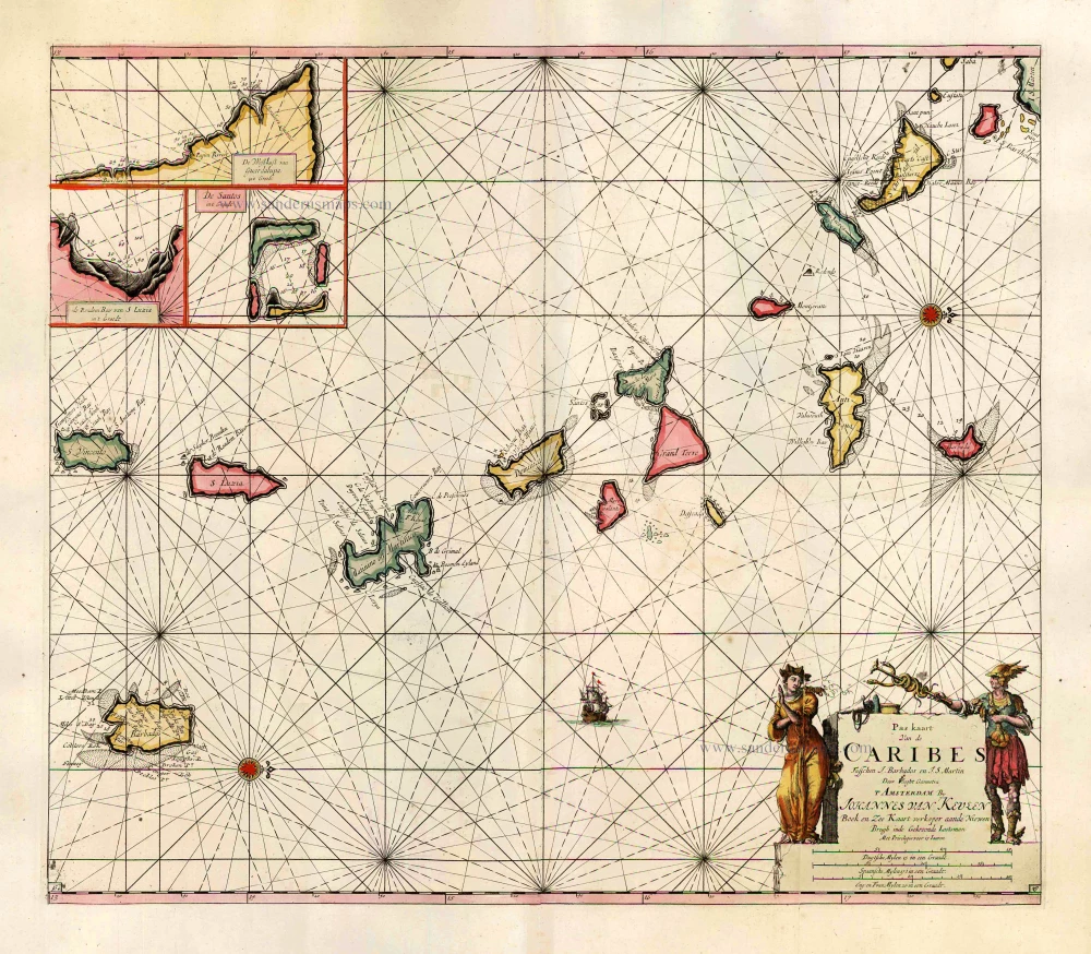
Pas Kaart van de Caribes tusschen I. Barbados en I.S. Martin. 1684
The Lesser Antilles, by J. Van Keulen.
[Item number: 2377]
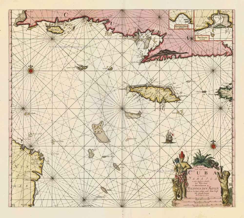
Pas Kaart vande Zuyd Kust van Cuba en van Geheel Yamaica en and're Bygeleegen Plaatsen ... 1697-1709
Cuba - Jamaica by Johannes van Keulen
[Item number: 11219]

Pas Kaart van de Boght van Florida met de Canaal tusschen Florida en Cuba ... 1680-1694
Sea chart of the Gulf of Mexico, Yucatan Channel, by J. Van Keulen.
[Item number: 16285]

Heightened in gold
Pascaert vande Caribes Eylanden. 1667
Sea chart of the Lesser Antilles, by Pieter Goos.
[Item number: 25708]
In excellent condition
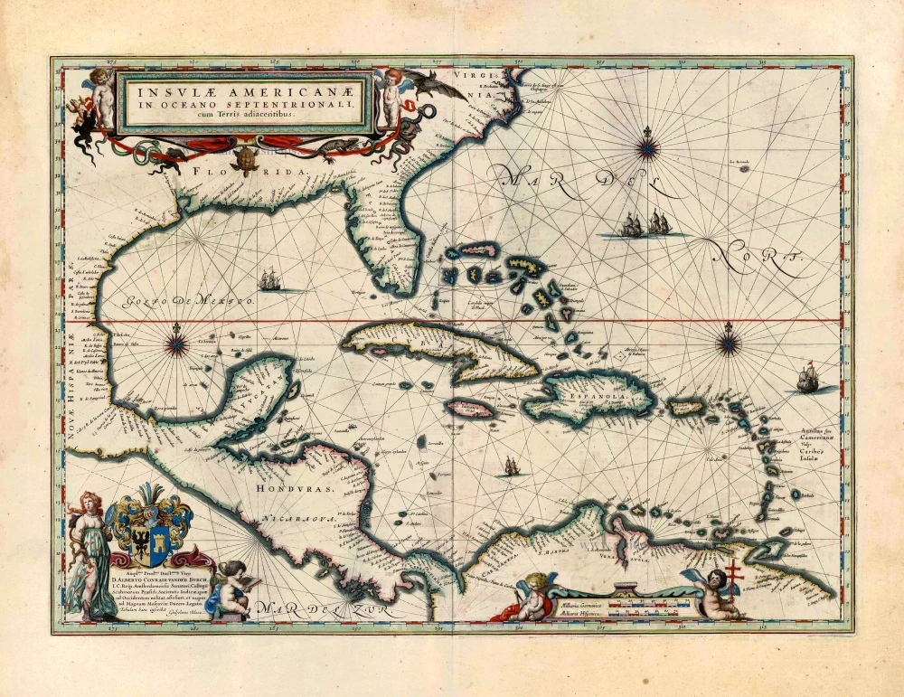
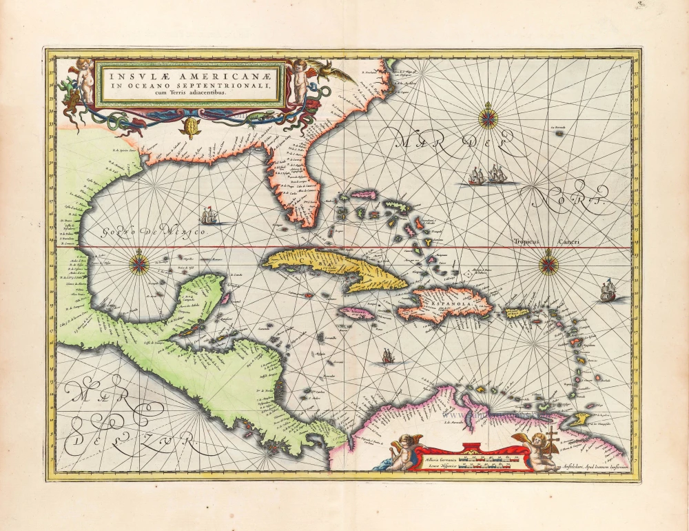
Insulae Americanae in Oceano Septentrionali, cum Terris Adiacentibus. 1643-50
West Indies by Willem Blaeu.
[Item number: 26985]
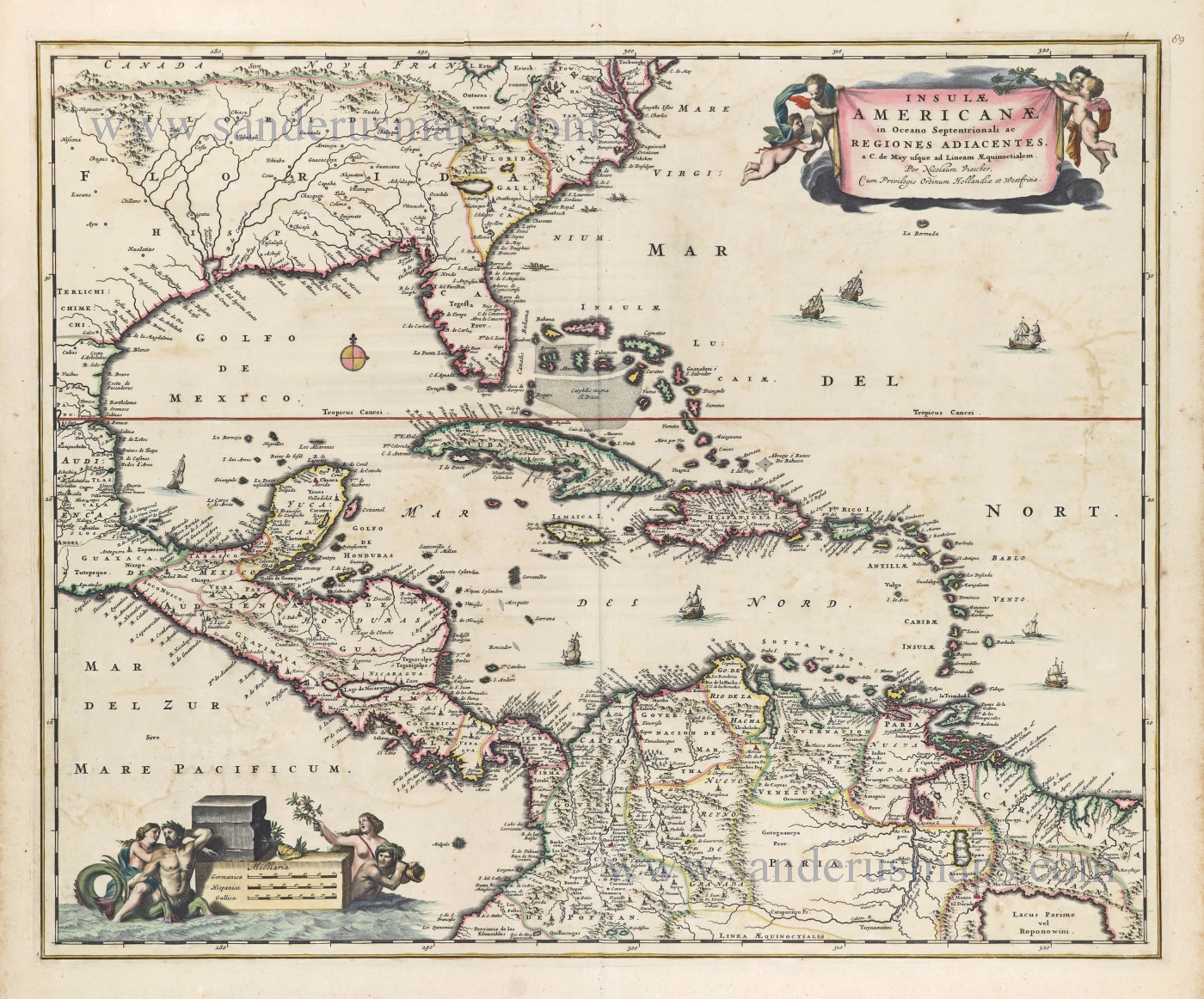
Insulae Americanae in Oceano Septentrionali ac Regiones Adiacentes, a. C. de May usque ad Lineam AEquinoctialem. c. 1682
The Antilles by Nicolaes Visscher II.
[Item number: 28553]
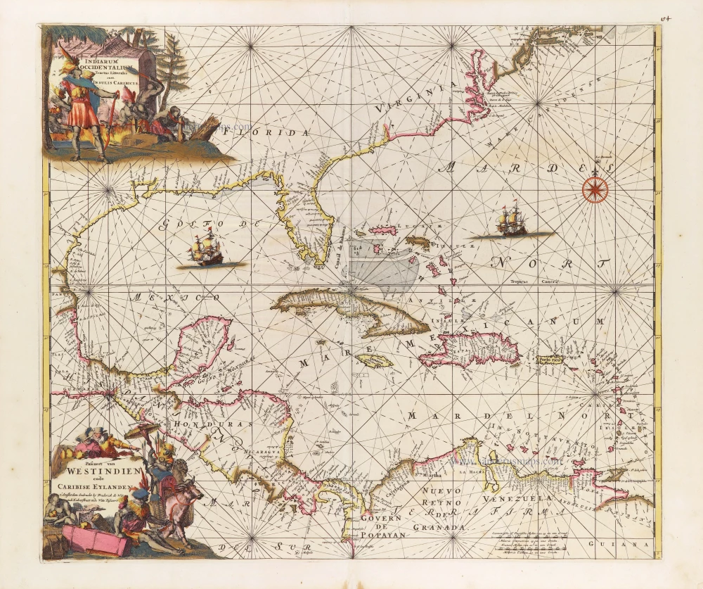
Indiarum Occidentalium Tractus Littoralis cum Insulis Caribicis. - Pascaert van Westindien ende Caribise Eylanden. c. 1680
West Indies, by Frederick de Wit.
[Item number: 29176]
With luxury colour
Insulae Americanae in Oceano Septentrionali, cum Terris adiacentibus. 1666
West Indies, by Johannes Janssonius.
[Item number: 29806]
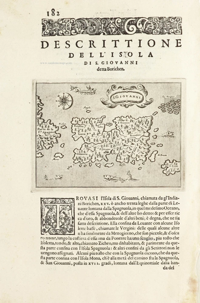
S.Giovanni. - [Above map :] Descrittione del l'Isola di S. Giovanni detta Borichen. 1590
Puerto Rico by Tommaso Porcacchi.
[Item number: 29810]