
The Antilles by Nicolaes Visscher II. c. 1682
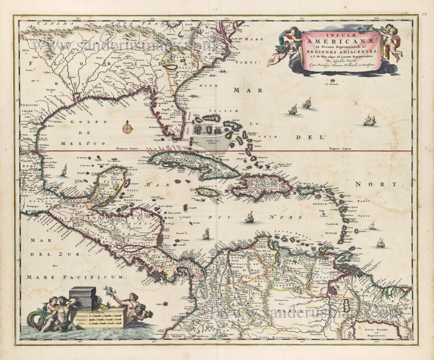
This map is derived from the long lineage of maps that began with the Hessel Gerritsz sea chart of c.1631. Of all those before, no other embraced interior detail. Cartographically it is not so innovative, utilising older Dutch geography. No mention is made, for instance, of the English presence in Carolina. Two baroque cartouches adorn opposite corners enclosing the title and the scale of miles. The map appeared in Visscher atlases entitled Atlas Minor. Those called the Atlas Contractus are generally accepted by Nicolaas Visscher I. Both Visscher atlases are largely composite; their contents vary, the Atlas Minor averaging around 100 maps; Visscher's privilege was renewed in 1697. In 1702 he died, and the business was continued with considerable vigour by his widow Elizabeth, who maintained the Atlas Minor. One atlas survives with the title of Atlas Major. With her dead in 1726, the famous firm began by Claes Jansz. Visscher, sometime before 1608, passed out of the family and into the hands of Andries de Leth. Many plates were disposed of to Petrus Schenk II at an unknown date, possibly before the death of Elizabeth but after the death of Schenk's father c. 1718/19. The map appears in examples of his Atlas Contractus, which is similarly undated and composite in nature until c.1740. (Burden)
The Visscher Family
For nearly a century, the members of the Visscher family were essential art dealers and map publishers in Amsterdam.
Claes Jansz. Visscher, or N.J. Piscator (1587-1652)
Claes Jansz. Vischer bought a house in Amsterdam, 'de gulden Bors', on the crucial Kalverstraat and changed the name into "In de Visscher"; under this title, the shop was to flourish for many years.
He was famous for his engravings and etchings of Dutch landscapes and 'historical scenes', such as sieges, battles, etc. These 'historical scenes' were considered contemporary illustrated news items, especially e.g. that of 'the Eighty Years' War'.
For the publication of his first atlas, he bought copperplates of the atlas Germania Inferior by Pieter van den Keere (1623).
In 1649, he published an atlas entitled Tabularum Geographicarum Contractarum, containing the same maps as Langenes' Caert Thresoor, for which Visscher had only new title pages engraved.
Claes Jansz. Visscher died in 1652. His wife, Neeltjen Florisdr., had already died in 1640. They had seven children, four of whom were still alive at Claes Jansz.'s death. One was Nicolaes Visscher I, who was to continue his father's business.
Nicolaes Visscher I (1618-1679)
Nicolaes Visscher I partnered with his father, continued the business, and stayed on the Kalverstraat 'in de Visscher' till his death.
In about 1657, the first edition of his Atlas Contractus Orbis Terrarum appeared.
Between 1664 and 1677, several editions of his Atlas Contractus appeared without a printed index, for these atlases had no fixed contents but were composed according to the buyer's financial leaping pole.
In May 1664, Nicolaes Visscher was admitted as a member of the Booksellers' Guild of his town. In July 1677, he was granted a patent of the States of Holland and West-Friesland for printing and publishing maps and atlases for 15 years.
After this, he again published an Atlas Contractus with a printed index. At about the same time, he also brought out an Atlas Minor.
Nicolaes Visscher II (1649-1702)
Nicolaes Visscher II inherited the 'shop' from his father. To obtain a new privilege, he applied to the States of Holland and West-Friesland in 1682 for a patent for printing and publishing maps. This patent was granted to him the same year. He moved the firm to the Dam, but it kept the same signboard: "In de Visscher".
Around 1683, he published his first Atlas Minor with a printed index of 91 maps. In 1684, an atlas Germania Inferior appeared. Till 1697, he published another number of atlases. He used his grandfather's (Claes Jansz.) maps less often now and relied more and more on his own.
The wars waged at this time initiated the compilation of maps of the countries where the armies operated. Many war maps were included in the various editions of his Atlas Minor.
After Nicolaes's death, his wife, Elizabeth Verseyl, published all the war maps as an atlas under the title De Stoel des Oorlogs in de Wereld (The seat of war in the world).
The widow of Nicolaes Visscher II (?-1726)
His widow continued the business energetically, and by her hand, under the name of her deceased husband, numerous atlases appeared, e.g., several editions of the Atlas Minor, an Atlas Maior and De Stoel des Oorlogs. The shop enjoyed a high reputation due to the assortment's incredible variety. Not only 'Visscher' maps but also maps of other publishers were obtainable. With the death of Elizabeth Verseyl in 1726, the last descendant died of a great map- and atlas-publishing firm in Amsterdam.
Insulae Americanae in Oceano Septentrionali ac Regiones Adiacentes, a. C. de May usque ad Lineam AEquinoctialem.
Item Number: 28553 Authenticity Guarantee
Category: Antique maps > America > West Indies
Old, antique map of Antilles, by Nicolaes Visscher II.
Title: Insulae Americanae in Oceano Septentrionali ac Regiones Adiacentes, a. C. de May usque ad Lineam AEquinoctialem.
Per Nicolaum Visscher.
Cum Privilegio Ordinum Hollandiae et Westfrisiae.
Date of the first edition: c. 1680.
Date of this map: c. 1682.
Copper engraving, printed on paper.
Map size: 465 x 570mm (18.31 x 22.44 inches).
Sheet size: 540 x 615mm (21.26 x 24.21 inches).
Verso: Blank.
Condition: Original coloured, minor offsetting.
Condition Rating: A.
References: Portinaro & Knirsch #82; Burden, #531, State 2
From: Atlas Contractus Orbis Terrarum Praecipuas ac Novissimas Complectens Tabulas. Amsterdam, N. Visscher, c. 1682. (Koeman III, Vis5-8)
This map is derived from the long lineage of maps that began with the Hessel Gerritsz sea chart of c.1631. Of all those before, no other embraced interior detail. Cartographically it is not so innovative, utilising older Dutch geography. No mention is made, for instance, of the English presence in Carolina. Two baroque cartouches adorn opposite corners enclosing the title and the scale of miles. The map appeared in Visscher atlases entitled Atlas Minor. Those called the Atlas Contractus are generally accepted by Nicolaas Visscher I. Both Visscher atlases are largely composite; their contents vary, the Atlas Minor averaging around 100 maps; Visscher's privilege was renewed in 1697. In 1702 he died, and the business was continued with considerable vigour by his widow Elizabeth, who maintained the Atlas Minor. One atlas survives with the title of Atlas Major. With her dead in 1726, the famous firm began by Claes Jansz. Visscher, sometime before 1608, passed out of the family and into the hands of Andries de Leth. Many plates were disposed of to Petrus Schenk II at an unknown date, possibly before the death of Elizabeth but after the death of Schenk's father c. 1718/19. The map appears in examples of his Atlas Contractus, which is similarly undated and composite in nature until c.1740. (Burden)
The Visscher Family
For nearly a century, the members of the Visscher family were essential art dealers and map publishers in Amsterdam.
Claes Jansz. Visscher, or N.J. Piscator (1587-1652)
Claes Jansz. Vischer bought a house in Amsterdam, 'de gulden Bors', on the crucial Kalverstraat and changed the name into "In de Visscher"; under this title, the shop was to flourish for many years.
He was famous for his engravings and etchings of Dutch landscapes and 'historical scenes', such as sieges, battles, etc. These 'historical scenes' were considered contemporary illustrated news items, especially e.g. that of 'the Eighty Years' War'.
For the publication of his first atlas, he bought copperplates of the atlas Germania Inferior by Pieter van den Keere (1623).
In 1649, he published an atlas entitled Tabularum Geographicarum Contractarum, containing the same maps as Langenes' Caert Thresoor, for which Visscher had only new title pages engraved.
Claes Jansz. Visscher died in 1652. His wife, Neeltjen Florisdr., had already died in 1640. They had seven children, four of whom were still alive at Claes Jansz.'s death. One was Nicolaes Visscher I, who was to continue his father's business.
Nicolaes Visscher I (1618-1679)
Nicolaes Visscher I partnered with his father, continued the business, and stayed on the Kalverstraat 'in de Visscher' till his death.
In about 1657, the first edition of his Atlas Contractus Orbis Terrarum appeared.
Between 1664 and 1677, several editions of his Atlas Contractus appeared without a printed index, for these atlases had no fixed contents but were composed according to the buyer's financial leaping pole.
In May 1664, Nicolaes Visscher was admitted as a member of the Booksellers' Guild of his town. In July 1677, he was granted a patent of the States of Holland and West-Friesland for printing and publishing maps and atlases for 15 years.
After this, he again published an Atlas Contractus with a printed index. At about the same time, he also brought out an Atlas Minor.
Nicolaes Visscher II (1649-1702)
Nicolaes Visscher II inherited the 'shop' from his father. To obtain a new privilege, he applied to the States of Holland and West-Friesland in 1682 for a patent for printing and publishing maps. This patent was granted to him the same year. He moved the firm to the Dam, but it kept the same signboard: "In de Visscher".
Around 1683, he published his first Atlas Minor with a printed index of 91 maps. In 1684, an atlas Germania Inferior appeared. Till 1697, he published another number of atlases. He used his grandfather's (Claes Jansz.) maps less often now and relied more and more on his own.
The wars waged at this time initiated the compilation of maps of the countries where the armies operated. Many war maps were included in the various editions of his Atlas Minor.
After Nicolaes's death, his wife, Elizabeth Verseyl, published all the war maps as an atlas under the title De Stoel des Oorlogs in de Wereld (The seat of war in the world).
The widow of Nicolaes Visscher II (?-1726)
His widow continued the business energetically, and by her hand, under the name of her deceased husband, numerous atlases appeared, e.g., several editions of the Atlas Minor, an Atlas Maior and De Stoel des Oorlogs. The shop enjoyed a high reputation due to the assortment's incredible variety. Not only 'Visscher' maps but also maps of other publishers were obtainable. With the death of Elizabeth Verseyl in 1726, the last descendant died of a great map- and atlas-publishing firm in Amsterdam.
Related items
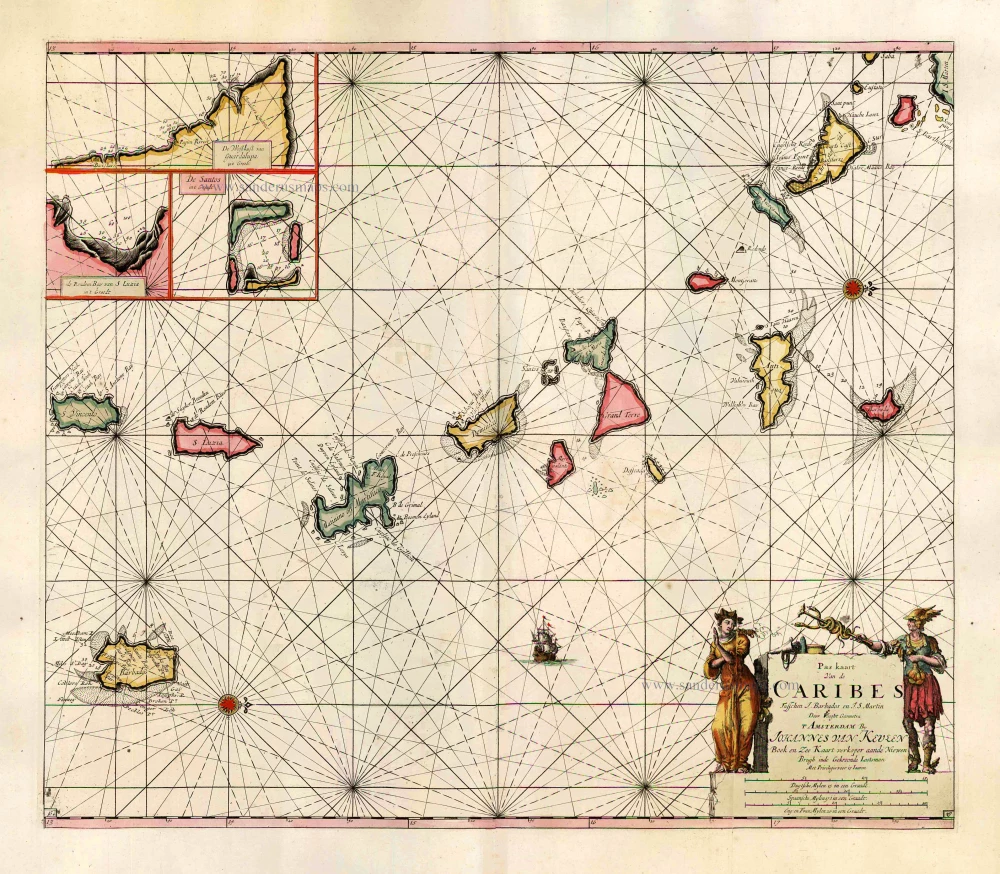
Pas Kaart van de Caribes tusschen I. Barbados en I.S. Martin. 1684
The Lesser Antilles, by J. Van Keulen.
[Item number: 2377]
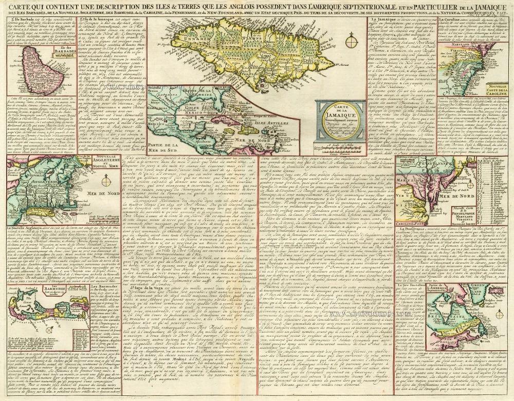
Carte qui Contient une Description des Iles & Terres que les Anglois Possèdent dans l'Amerique Septentrionale, et en Particulier de la Jamaique, .. 1713-1719
West Indies, Bermuda, New England, Virginia by Châtelain.
[Item number: 16834]

Cuba Insula et Iamaica. 1607
Antilles: Cuba - Jamaica, by Cornelis van Wytfliet.
[Item number: 26502]
In excellent condition
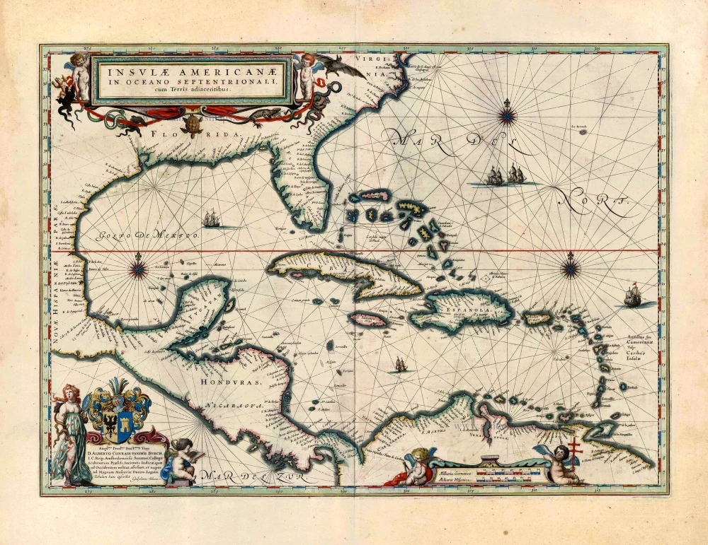
Insulae Americanae in Oceano Septentrionali, cum Terris Adiacentibus. 1643-50
West Indies by Willem Blaeu.
[Item number: 26985]
Big and spectacular map in excellent condition
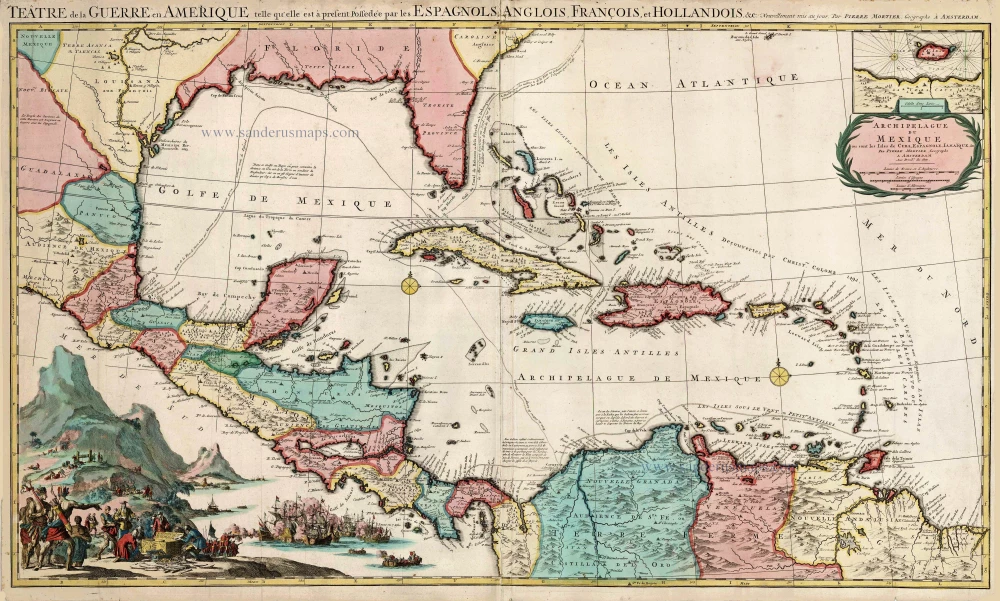
Teatre de la Guerre en Amerique, telle qu'elle est a Present Possedee par les Espagnols, Anglois, Francois, et Hollandois &c. c. 1705
Central America by Pieter Mortier (Pierre).
[Item number: 27766]
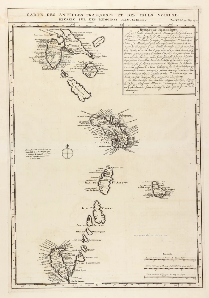
Carte des Antilles françoises et des Isles voisines dressée sur ledes memoires manuscrits. 1719
French Antilles and Lesser Antilles islands, by Z. Châtelain.
[Item number: 29359]
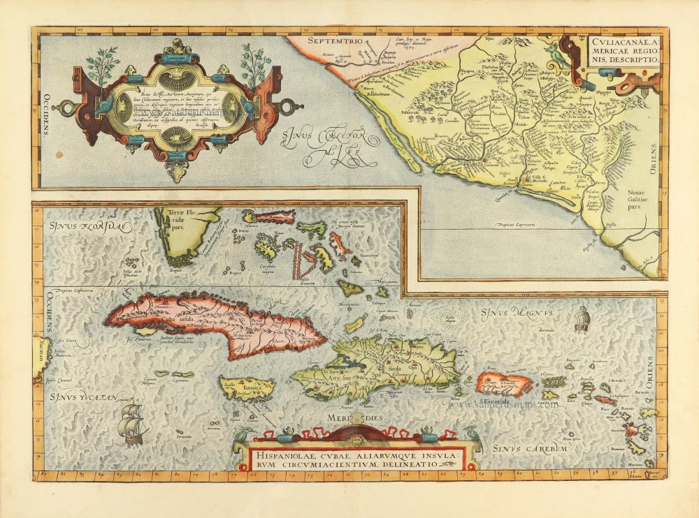
Culiacanae Americae Regionis Descriptio. - Hispaniolae, Cubae, Aliarumquae Insularum Circumiacentium, delineatio. 1584
Antilles by Abraham Ortelius.
[Item number: 30904]