
Tartary, by Pieter van der Aa. 1713
Pieter van der Aa (Leiden, 1659-1733)
Pieter van der Aa was already in 1682 owner of a bookshop and auction house. During his life, he has published an enormous amount of printed material.
After 1700, van der Aa increasingly specialised in books on geography and travel.
He published composite atlases, a series of geographical descriptions of European countries, and some very spectacular works. Between 1706 and 1708 he published the Naauweurige versameling der gedenkwaardigste zee- en land-reysen, in 28 volumes.
Many of Van der Aa’s publications are richly illustrated with maps and plates. He took over many copperplates and prints from other publishers such as Carel Allard and Frederik De Wit. The composite atlases that appeared from his workshop contain a curious mixture of his own material, copies of maps from other publishers, and reprints made from old copper plates, now with his own imprint.
The Galérie agréable du monde, was completed in 1729, and comprised 66 parts, bound in 27 volumes. Van der Aa presented it as a good investment; after publication, the antiquarian value of the work would double, the more so since it was printed in a limited edition of only one hundred copies.
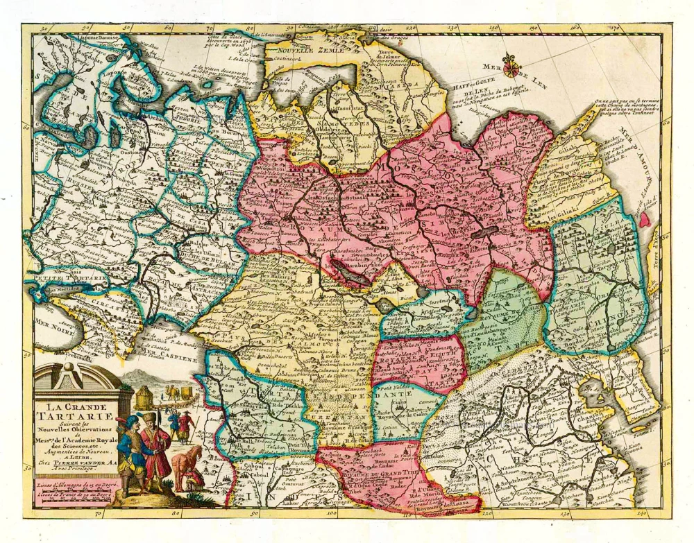
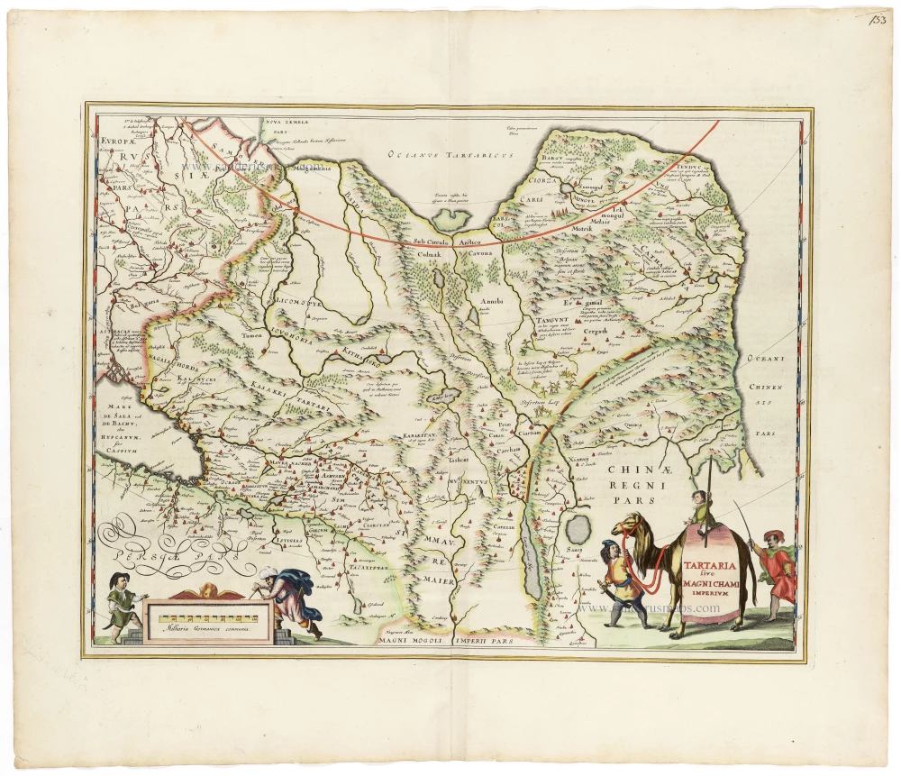
La Grande Tartarie.
Item Number: 26112 Authenticity Guarantee
Category: Antique maps > Asia > Central Asia
Tartary, by Pieter van der Aa.
Title: La Grande Tartarie.
Date of the first edition: 1713.
Date of this map: 1713.
Copper engraving, printed on paper.
Size (not including margins): 220 x 290mm (8.66 x 11.42 inches).
Verso: Blank.
Condition: Original coloured, trimmed to neatline and mounted on heavy paper at an early time.
Condition Rating: A.
From: Nouvel Atlas, très exact et fort commode pour toutes sortes de personnes, Contenant Les Principales cartes géographiques. Leiden, P. Van der Aa, n.d. (1713) (Koeman, Aa7).
Van der Aa maps are rarely found in original colouring.
Pieter van der Aa (Leiden, 1659-1733)
Pieter van der Aa was already in 1682 owner of a bookshop and auction house. During his life, he has published an enormous amount of printed material.
After 1700, van der Aa increasingly specialised in books on geography and travel.
He published composite atlases, a series of geographical descriptions of European countries, and some very spectacular works. Between 1706 and 1708 he published the Naauweurige versameling der gedenkwaardigste zee- en land-reysen, in 28 volumes.
Many of Van der Aa’s publications are richly illustrated with maps and plates. He took over many copperplates and prints from other publishers such as Carel Allard and Frederik De Wit. The composite atlases that appeared from his workshop contain a curious mixture of his own material, copies of maps from other publishers, and reprints made from old copper plates, now with his own imprint.
The Galérie agréable du monde, was completed in 1729, and comprised 66 parts, bound in 27 volumes. Van der Aa presented it as a good investment; after publication, the antiquarian value of the work would double, the more so since it was printed in a limited edition of only one hundred copies.
Related items

Royaume du Grand Mogol, avec tous les Pays qui en dépendent, suivant les Relations des fideles Voyageurs. 1713
India by Pieter van de Aa
[Item number: 26117]
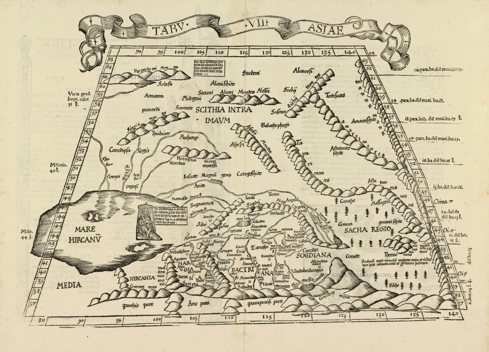
Tabu. .VII. Asiae. 1525
Central Asia, by Lorenz Fries.
[Item number: 27997]
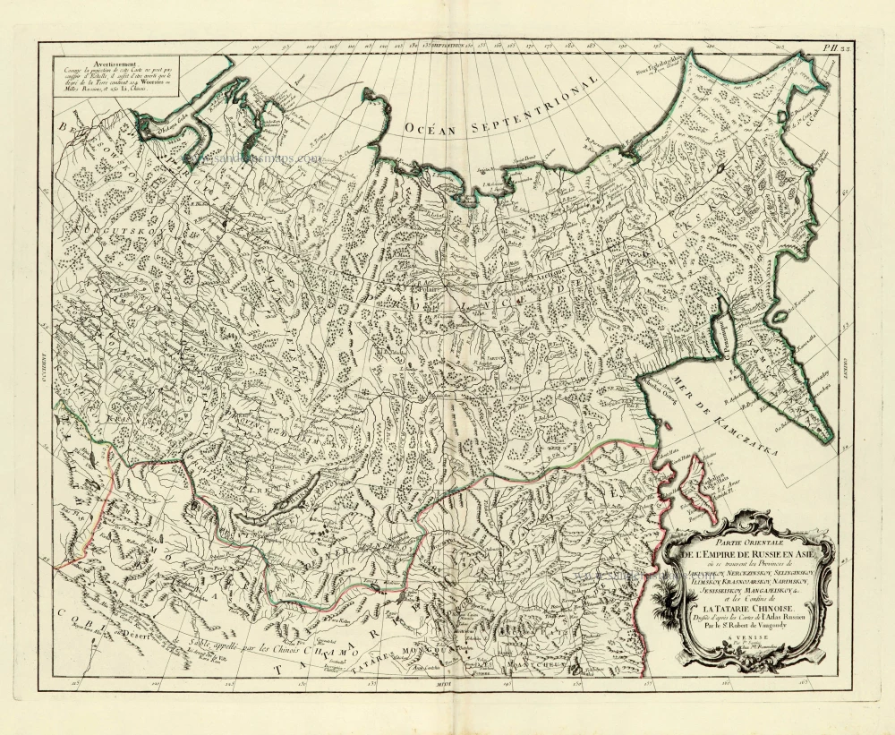
Partie orientale de l'Empire de Russie en Asie. 1776-79
Asiatic Russia, by Paolo Santini.
[Item number: 28095]

Tartariae Sive Magni Chami Regni Typus. 1584
Tartary, by Abraham Ortelius.
[Item number: 29224]

Tartaria sive Magni Chami Imperium. 1643
Tartary, by Willem & Joan Blaeu.
[Item number: 30142]
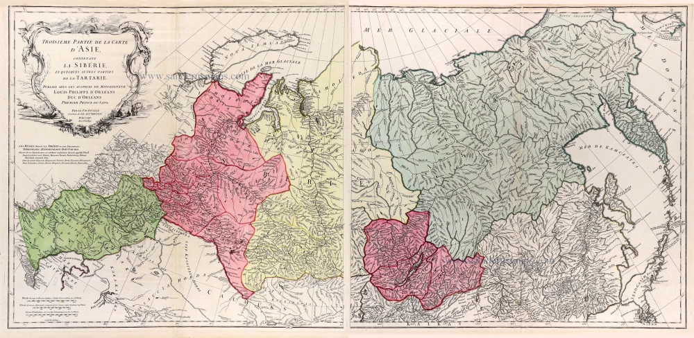
Troisieme partie de la carte d'Asie, contenant la Siberie, et quelques autres parties de la Tartarie. 1753
Siberia & Tartary by J.B. d'Anville, published by N. de Fer.
[Item number: 31077]

Tartaria. 1618
Tartary by Petrus Bertius, published by Jodocus Hondius II
[Item number: 32138]
Tartaria Sive Magnichami Imperium 1666
Tartary, by Johannes Janssonius.
[Item number: 33095]
new