
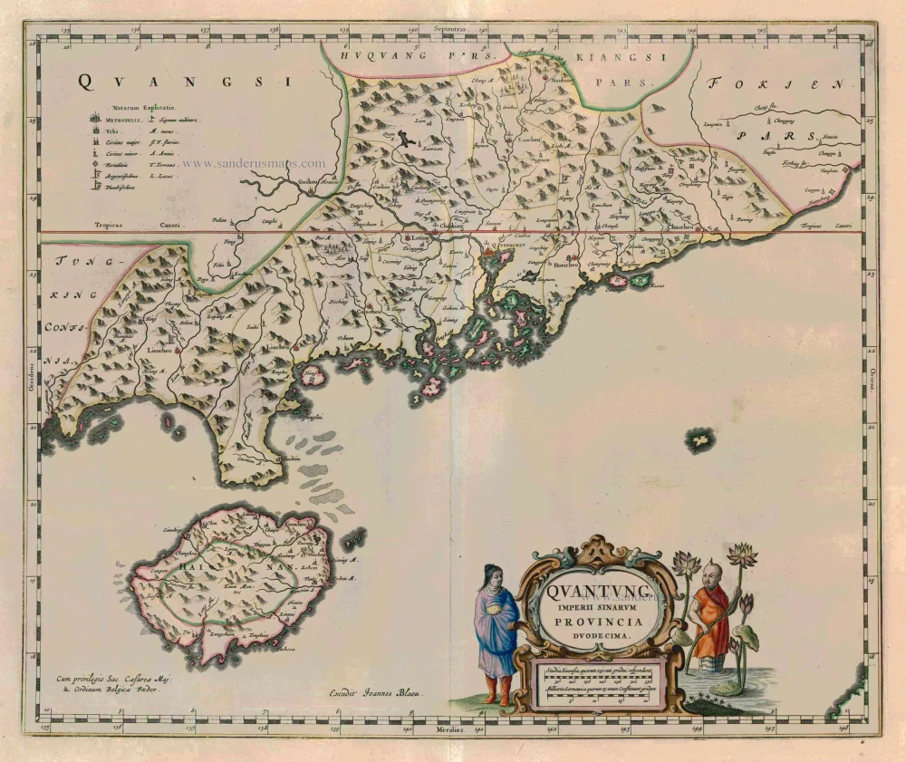
Antique map of the Province of Canton with the Pearl River delta and the Island of Hainan, by J. Blaeu. 1655-1659
back
References: Van der Krogt 2 - 8432:2.
Quantung, Imperii Sinarum Provincia Duodecima
SOLD
Item Number: 8149 Authenticity Guarantee
Category: Antique maps > Asia > China
Antique map of the Province of Canton with the Pearl River delta and the Island of Hainan, by J. Blaeu.
Based on the cartographic compilations of the Jesuit missionary Martino Martini
Date of the first edition: 1655
Date of this map: 1655-1659
Copper engraving
Size: 41 x 49.5cm (16 x 19.3 inches)
Verso: Blank
Condition: Old coloured, excellent.
Condition Rating: A
References: Van der Krogt 2, 8432:2..
From: Novus Atlas Sinensis a Martino Martinio Soc. Iesu Descriptus ..., Amsterdam, 1655.