
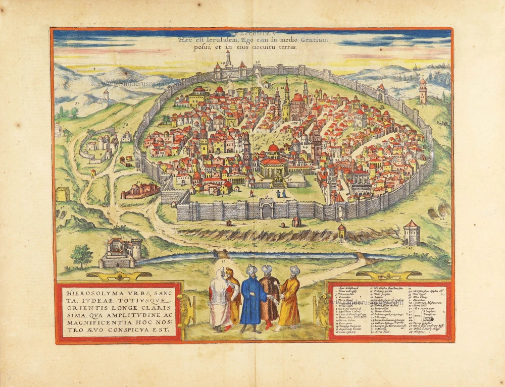
Jerusalem by Braun Georg & Hogenberg Frans 1582
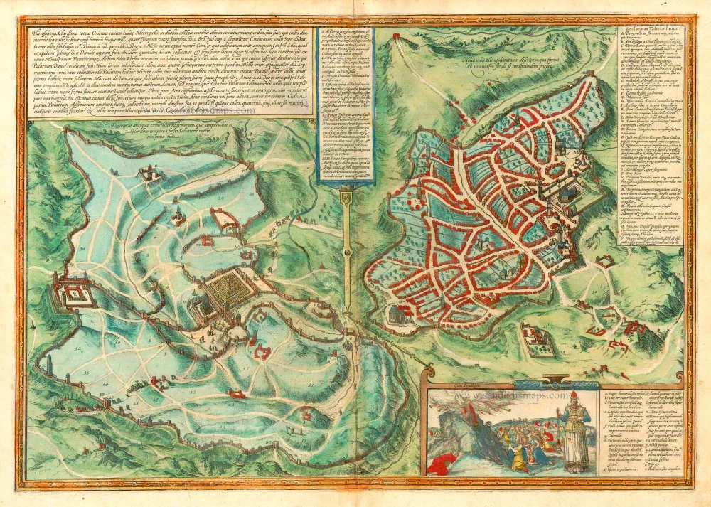


With a vignette of Moses receiving the Commandments. Key to locations.
TRANSLATION OF CARTOUCHE TEXT: Jerusalem, most famous city in the whole Orient and capital of Judaea, lay on two hills that rise above all the other surrounding elevations. These two hills were separated by a densely populated valley. (Josephus calls it Tyropoeon in Book 6 of his Jewish War. ) The higher of the two hills is called Sion and is itself subdivided into three lesser elevations. In Chapter 5 of the Second Book of Kings, the first of these is called Mello, beside Mount Gion; here was built the ancient stronghold of Siloe that was occupied by the Jebusites and conquered by David, who also brought the Ark of the Covenant here and chose this site as his burial place. The Franciscan monastery, called Sion, was constructed on this very spot. Another elevation on the east side of Sion is called the Lower Town, where David's palace lay. He also resided here in person before he had conquered the Jebusite camp on the Mello. On another hill to the north lay Herod's palace. These three hills were surrounded by a common wall and are called the city of David. The other main hill has two parts, the first of which is called Solomon's palace, on the south side of the same mountain. Because the Temple stood on this hill, it was also surrounded by a wall and thereby connected to the city of David. The other part of this second main hill, opposite Mount Moriah and lying to its east, was called Acra. Its middle part was called Bezetha, which means "New Town". It, too, was surrounded by walls. Another middle part of Acra, opposite the Cedron Stream, includes the palace of the Assyrians; this was a suburb enclosed by walls. Thus the five hills of Jerusalem described here were surrounded by altogether four different circumference walls. Jerusalem is at the present time called Cuzumoharech by the Turks.
COMMENTARY BY BRAUN (on verso): "That Jerusalem is the centre of the whole world and lies on high mountains in the middle of the land of the Jews is attested not just by geographers but by all historians and the Holy Bible. Thus saith the Lord God: This is Jerusalem: I have set it in the midst of the nations and countries that are round about her (Ezek.5). [...] It is divided by many valleys, possesses a fertile soil and also many cisterns with clear water; it is surrounded by a triple wall [...]."
This plate presents two bird's-eye plans of Jerusalem, on the left as it was in biblical times and on the right as it appeared in the 16th century. The information provided in the cartouches makes it possible to compare the city of the past with that of Braun's day. Inset within the lower right-hand corner is an illustration of Moses receiving the Tablets of the Law, together with the figure of a high priest; the priest's vestments are described in detail in the accompanying cartouche. According to the Bible, at the time of the conquest of Canaan by the tribes of Israel the city was ruled by the Jebusites; they were driven out by King David in 997 BC. The First Temple was built under Solomon in the middle of the 10th century, and Jerusalem subsequently became the centre of Judaism. Solomon's temple was destroyed in 586 BC by the Neo-Babylonian king Nebuchadnezzar II. The Second Temple was built after the end of Babylonian rule in 537 BC. The Romans conquered Jerusalem in 37 BC and installed Herod the Great as a client king. In the course of the Jewish War in AD 66-70, the Second Temple was destroyed by the Romans and the city was razed to the ground. After the Bar-Kokhba Revolt in AD 132-135, Jerusalem was renamed Aelia Capitilina, a temple to Jupiter was erected on the Temple Mount, and Jews were forbidden to enter the city on penalty of death. The Church of the Holy Sepulchre was built under Emperor Constantine and consecrated in AD 335. In 638 the Byzantine city was conquered by the Arabs, who erected the Dome of the Rock on the Temple Mount. During the time of the Crusades, Jerusalem was subject alternately to Christian and Muslim rulers. In the High Middle Ages, the city represented the centre of the world for Christianity. Up to this day Jerusalem is of great symbolic importance to Jews, Christians and Muslims. (Taschen)
Braun G. & Hogenberg F. and the Civitates Orbis Terrarum.
The Civitates Orbis Terrarum, also known as the 'Braun & Hogenberg', is a six-volume town atlas and the most excellent book of town views and plans ever published: 363 engravings, sometimes beautifully coloured. It was one of the best-selling works in the last quarter of the 16th century. Georg Braun, a skilled writer, wrote the text accompanying the plans and views on the verso. Many plates were engraved after the original drawings of a professional artist, Joris Hoefnagel (1542-1600). The first volume was published in Latin in 1572 and the sixth in 1617. Frans Hogenberg, a talented engraver, created the tables for volumes I through IV, and Simon van den Neuwel made those for volumes V and VI. Other contributors were cartographers Daniel Freese and Heinrich Rantzau, who provided valuable geographical information. Works by Jacob van Deventer, Sebastian Münster, and Johannes Stumpf were also used as references. Translations appeared in German and French, making the atlas accessible to a wider audience.
Since its original publication of volume 1 in 1572, the Civitates Orbis Terrarum has left an indelible mark on the history of cartography. The first volume was followed by seven more editions in 1575, 1577, 1582, 1588, 1593, 1599, and 1612. Vol.2, initially released in 1575, saw subsequent editions in 1597 and 1612. The subsequent volumes, each a treasure trove of historical insights, graced the world in 1581, 1588, 1593, 1599, and 1606. The German translation of the first volume, a testament to its widespread appeal, debuted in 1574, followed by the French edition in 1575.
Several printers were involved: Theodor Graminaeus, Heinrich von Aich, Gottfried von Kempen, Johannis Sinniger, Bertram Buchholtz, and Peter von Brachel, all of whom worked in Cologne.
Georg Braun (1541-1622)
Georg Braun, the author of the text accompanying the plans and views in the Civitates Orbis Terrarum, was born in Cologne in 1541. After his studies in Cologne, he entered the Jesuit Order as a novice, indicating his commitment to learning and intellectual pursuits. In 1561, he obtained his bachelor's degree; in 1562, he received his Magister Artium, further demonstrating his academic achievements. Although he left the Jesuit Order, he continued his studies in theology, gaining a licentiate in theology. His theological background likely influenced the content and tone of the text in the Civitates Orbis Terrarum, adding a unique perspective to the work.
Frans Hogenberg (1535-1590)
Frans Hogenberg was a Flemish and German painter, engraver, and mapmaker. He was born in Mechelen as the son of Nicolaas Hogenberg.
By the end of the 1560s, Frans Hogenberg was employed upon Abraham Ortelius's Theatrum Orbis Terrarum, published in 1570; he is named an engraver of numerous maps. In 1568, he was banned from Antwerp by the Duke of Alva and travelled to London, where he stayed a few years before emigrating to Cologne. He immediately embarked on his two most important works, the Civitates, published in 1572 and the Geschichtsblätter, which appeared in several series from 1569 until about 1587.
Thanks to large-scale projects like the Geschichtsblätter and the Civitates, Hogenberg's social circumstances improved with each passing year. He died as a wealthy man in Cologne in 1590.
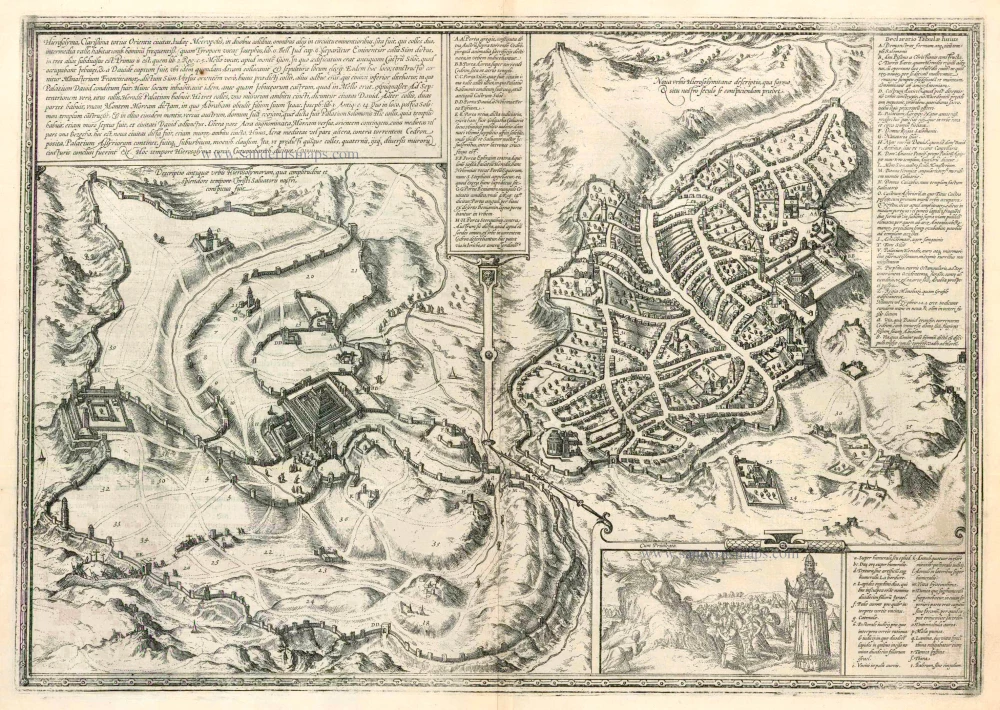
Hierosolyma, Clarissima Totius Orientis Civitas Iudaee Metropolis ...
Item Number: 25330 Authenticity Guarantee
Category: Antique maps > Asia > Holy Land
Old, antique map with two bird's-eye view plans of Jerusalem by Georg Braun and Frans Hogenberg: Old and modern Jerusalem.
Date of the first edition: 1572
Date of this map: 1582
Copper engraving
Size (not including margins): 34 x 49cm (13.3 x 19.1 inches)
Verso text: Latin
Condition: Contemporary old coloured, lower centrefold split reinforced.
Condition Rating: A
References: Van der Krogt 4, #1961, State 2 (with privilege); Fauser, #6101; Taschen, Braun and Hogenberg, p.128.
From: Civitates Orbis Terrarum, Liber Primus. Köln, Gottfried von Kempen, 1582. (Van der Krogt 4, 41:1.1(1582))
With a vignette of Moses receiving the Commandments. Key to locations.
TRANSLATION OF CARTOUCHE TEXT: Jerusalem, most famous city in the whole Orient and capital of Judaea, lay on two hills that rise above all the other surrounding elevations. These two hills were separated by a densely populated valley. (Josephus calls it Tyropoeon in Book 6 of his Jewish War. ) The higher of the two hills is called Sion and is itself subdivided into three lesser elevations. In Chapter 5 of the Second Book of Kings, the first of these is called Mello, beside Mount Gion; here was built the ancient stronghold of Siloe that was occupied by the Jebusites and conquered by David, who also brought the Ark of the Covenant here and chose this site as his burial place. The Franciscan monastery, called Sion, was constructed on this very spot. Another elevation on the east side of Sion is called the Lower Town, where David's palace lay. He also resided here in person before he had conquered the Jebusite camp on the Mello. On another hill to the north lay Herod's palace. These three hills were surrounded by a common wall and are called the city of David. The other main hill has two parts, the first of which is called Solomon's palace, on the south side of the same mountain. Because the Temple stood on this hill, it was also surrounded by a wall and thereby connected to the city of David. The other part of this second main hill, opposite Mount Moriah and lying to its east, was called Acra. Its middle part was called Bezetha, which means "New Town". It, too, was surrounded by walls. Another middle part of Acra, opposite the Cedron Stream, includes the palace of the Assyrians; this was a suburb enclosed by walls. Thus the five hills of Jerusalem described here were surrounded by altogether four different circumference walls. Jerusalem is at the present time called Cuzumoharech by the Turks.
COMMENTARY BY BRAUN (on verso): "That Jerusalem is the centre of the whole world and lies on high mountains in the middle of the land of the Jews is attested not just by geographers but by all historians and the Holy Bible. Thus saith the Lord God: This is Jerusalem: I have set it in the midst of the nations and countries that are round about her (Ezek.5). [...] It is divided by many valleys, possesses a fertile soil and also many cisterns with clear water; it is surrounded by a triple wall [...]."
This plate presents two bird's-eye plans of Jerusalem, on the left as it was in biblical times and on the right as it appeared in the 16th century. The information provided in the cartouches makes it possible to compare the city of the past with that of Braun's day. Inset within the lower right-hand corner is an illustration of Moses receiving the Tablets of the Law, together with the figure of a high priest; the priest's vestments are described in detail in the accompanying cartouche. According to the Bible, at the time of the conquest of Canaan by the tribes of Israel the city was ruled by the Jebusites; they were driven out by King David in 997 BC. The First Temple was built under Solomon in the middle of the 10th century, and Jerusalem subsequently became the centre of Judaism. Solomon's temple was destroyed in 586 BC by the Neo-Babylonian king Nebuchadnezzar II. The Second Temple was built after the end of Babylonian rule in 537 BC. The Romans conquered Jerusalem in 37 BC and installed Herod the Great as a client king. In the course of the Jewish War in AD 66-70, the Second Temple was destroyed by the Romans and the city was razed to the ground. After the Bar-Kokhba Revolt in AD 132-135, Jerusalem was renamed Aelia Capitilina, a temple to Jupiter was erected on the Temple Mount, and Jews were forbidden to enter the city on penalty of death. The Church of the Holy Sepulchre was built under Emperor Constantine and consecrated in AD 335. In 638 the Byzantine city was conquered by the Arabs, who erected the Dome of the Rock on the Temple Mount. During the time of the Crusades, Jerusalem was subject alternately to Christian and Muslim rulers. In the High Middle Ages, the city represented the centre of the world for Christianity. Up to this day Jerusalem is of great symbolic importance to Jews, Christians and Muslims. (Taschen)
Braun G. & Hogenberg F. and the Civitates Orbis Terrarum.
The Civitates Orbis Terrarum, also known as the 'Braun & Hogenberg', is a six-volume town atlas and the most excellent book of town views and plans ever published: 363 engravings, sometimes beautifully coloured. It was one of the best-selling works in the last quarter of the 16th century. Georg Braun, a skilled writer, wrote the text accompanying the plans and views on the verso. Many plates were engraved after the original drawings of a professional artist, Joris Hoefnagel (1542-1600). The first volume was published in Latin in 1572 and the sixth in 1617. Frans Hogenberg, a talented engraver, created the tables for volumes I through IV, and Simon van den Neuwel made those for volumes V and VI. Other contributors were cartographers Daniel Freese and Heinrich Rantzau, who provided valuable geographical information. Works by Jacob van Deventer, Sebastian Münster, and Johannes Stumpf were also used as references. Translations appeared in German and French, making the atlas accessible to a wider audience.
Since its original publication of volume 1 in 1572, the Civitates Orbis Terrarum has left an indelible mark on the history of cartography. The first volume was followed by seven more editions in 1575, 1577, 1582, 1588, 1593, 1599, and 1612. Vol.2, initially released in 1575, saw subsequent editions in 1597 and 1612. The subsequent volumes, each a treasure trove of historical insights, graced the world in 1581, 1588, 1593, 1599, and 1606. The German translation of the first volume, a testament to its widespread appeal, debuted in 1574, followed by the French edition in 1575.
Several printers were involved: Theodor Graminaeus, Heinrich von Aich, Gottfried von Kempen, Johannis Sinniger, Bertram Buchholtz, and Peter von Brachel, all of whom worked in Cologne.
Georg Braun (1541-1622)
Georg Braun, the author of the text accompanying the plans and views in the Civitates Orbis Terrarum, was born in Cologne in 1541. After his studies in Cologne, he entered the Jesuit Order as a novice, indicating his commitment to learning and intellectual pursuits. In 1561, he obtained his bachelor's degree; in 1562, he received his Magister Artium, further demonstrating his academic achievements. Although he left the Jesuit Order, he continued his studies in theology, gaining a licentiate in theology. His theological background likely influenced the content and tone of the text in the Civitates Orbis Terrarum, adding a unique perspective to the work.
Frans Hogenberg (1535-1590)
Frans Hogenberg was a Flemish and German painter, engraver, and mapmaker. He was born in Mechelen as the son of Nicolaas Hogenberg.
By the end of the 1560s, Frans Hogenberg was employed upon Abraham Ortelius's Theatrum Orbis Terrarum, published in 1570; he is named an engraver of numerous maps. In 1568, he was banned from Antwerp by the Duke of Alva and travelled to London, where he stayed a few years before emigrating to Cologne. He immediately embarked on his two most important works, the Civitates, published in 1572 and the Geschichtsblätter, which appeared in several series from 1569 until about 1587.
Thanks to large-scale projects like the Geschichtsblätter and the Civitates, Hogenberg's social circumstances improved with each passing year. He died as a wealthy man in Cologne in 1590.
Related items
Hierosolyma, Clarissima Totius Orientis Civitas Iudaee Metropolis ... 1599
Jerusalem, by Georg Braun and Frans Hogenberg.
[Item number: 23948]
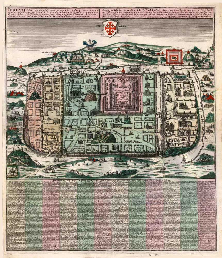
Ierusalem, cum Suburbiis, Prout Tempore Christi Floruit ... 1740
Jerusalem, by M. Seutter.
[Item number: 25345]
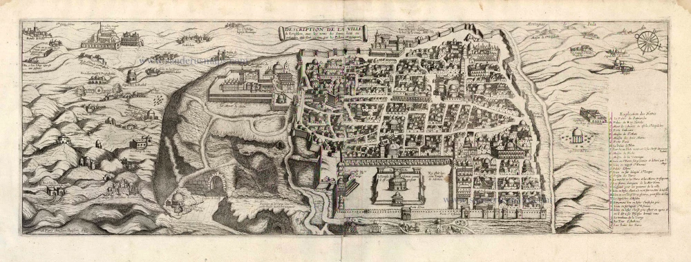
Description de la Ville de Jerusalem avec les Noms des Saints Lieux ou Antiquitez qui sont Visitez par les Pellerins et Voiageurs. 1648
Jerusalem by J. Boisseau.
[Item number: 25598]
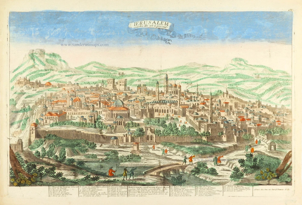
Ierusalem comme elle est a present. c. 1780
Jerusalem by Pierre Aveline.
[Item number: 28752]
Hierosolyma Urbs Sancta, Iudeae, Totiusque Orientis Longe Clarissima ... 1623
Jerusalem, by Georg Braun & Frans Hogenberg
[Item number: 29229]
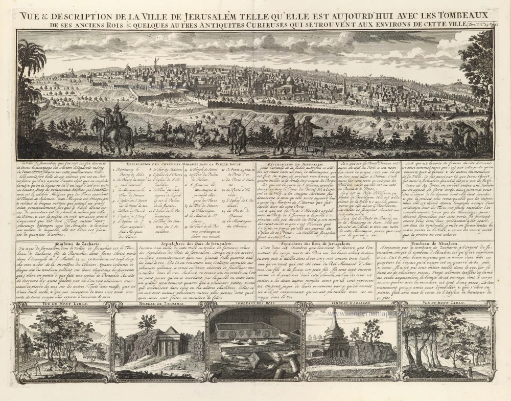
Vue & Description de la ville de Jerusalem telle qu'elle est aujourd'hui avec les tombeaux de ses anciens rois, & quelques autres antiquités curieuses qui se trouvent aux environs de cette ville. 1719
Jerusalem, by Z. Châtelain
[Item number: 29374]
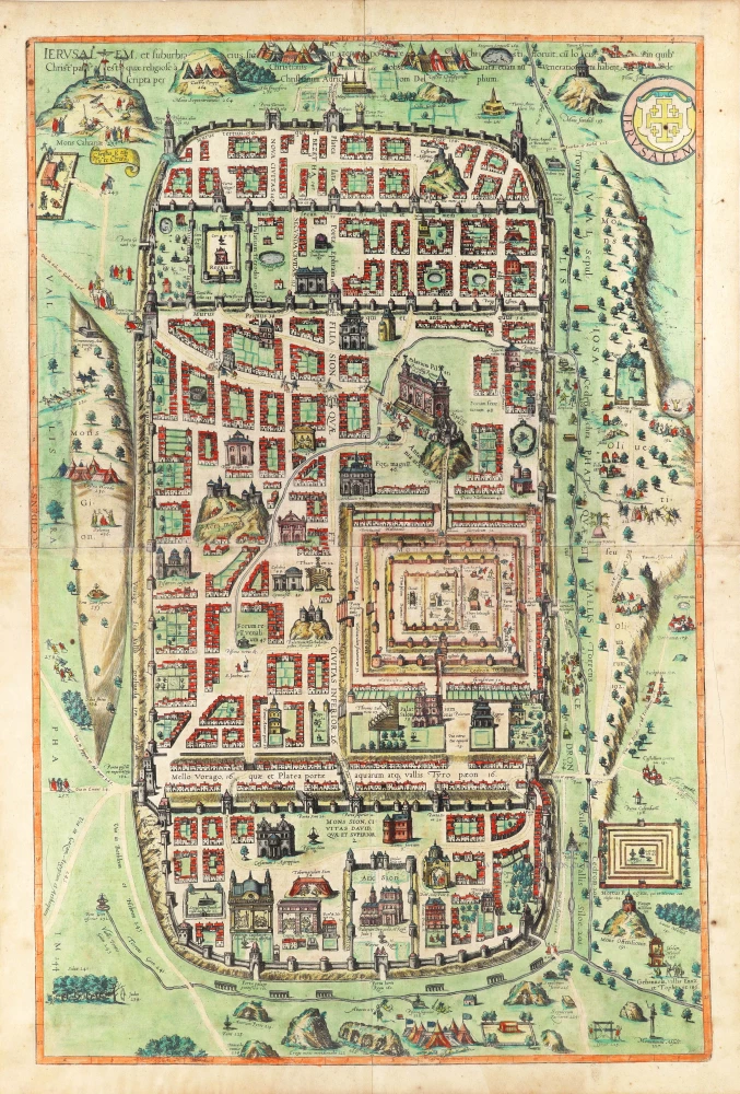
Ierusalem, et Suburbia eius, sicut Tempore Christi Floruit, cum Locis in quibus Christ Pass. est quae religiose à Christianis observata etiam num Veneratio ni habent descripta per Christianum Adrichom Delphum Delphum. 1617
Jerusalem by Georg Braun and Frans Hogenberg.
[Item number: 29850]
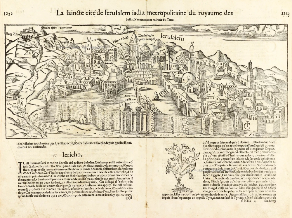
La saincte cité de Ierusalem iadiz metropolitaine du royaume des Iuifz, & maintenant colonie du Turc. 1568
Jerusalem, by Sebastian Munster.
[Item number: 30601]