
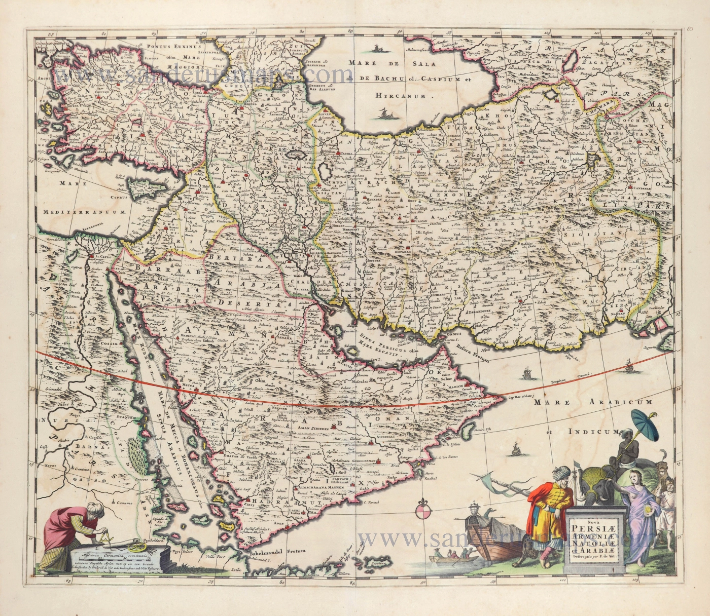
Middle East with Arabia and Persia by Frederick de Wit. 1666-77


Frederick de Wit (1630-1706)
The engraver and map-seller, Frederick de Wit, was born in Gouda (Netherlands) in 1630 as a son of Hendrick Fredericksz de Wit. Through his marriage with Maria van der Waag of Amsterdam in 1661, he obtained citizenship of the city where he had been working since 1648 and where he became one of the most famous engravers of maps of the second half of the 17th century. Although De Wit was a Catholic, which meant that he was not favoured at the time by the city council, he was awarded the honour of being listed as one of the "excellent citizens" on the roll of the city council in the years 1694-1704. However, his name was not written in the Guild of St. Luke book before 1664. At that time, he lived on the Kalverstraat "in de Witte Pascaert", where he stayed until his death in 1706. His earliest dates on maps engraved are 1659 (Regni Daniae) and 1660 (World map).
Frederick de Wit published several world atlases, a sea atlas, and an atlas of the Netherlands.
The dating of the maps is difficult. However, as a privilege was granted in 1689, the annotation 'cum privilegio' marks an edition after 1688.
Around 1700, Frederick de Wit entered the market with a town atlas. He produced two volumes with a total of 260 plans and views. Most were printed from plates used for Janssonius and Blaeu town atlases.
After he died in 1706, his widow continued the shop until 1709. The plates and stock of De Wit's atlas were sold to Covens & Mortier in 1710, who sold the atlas for an extended period.
Nova Persiae Armeniae Natoliae et Arabiae.
Item Number: 28571 Authenticity Guarantee
Category: Antique maps > Asia > Middle East
Old, antique map of Arabia - Persia, by Frederick de Wit.
Title: Nova Persiae Armeniae Natoliae et Arabiae.
Descriptio per F. de Wit.
t'Amsterdam by Frederick de Wit inde Kalverstraet inde Witte Pascaert.
Date of the first edition: 1666.
Date of this map: 1666-77.
Copper engraving, printed on paper.
Size (not including margins): 474 x 554mm (18.66 x 21.81 inches).
Verso: Blank.
Condition: Original coloured, some offsetting.
Condition Rating: A
References: Tibbetts, p. 89 #121; Alai (Persia), p. 84 E. 88 Pl. 55; Khaled Al Ankary, p. 221 #77
From: Atlas Contractus Orbis Terrarum Praecipuas ac Novissimas Complectens Tabulas. Amsterdam, N. Visscher, 1656-77. (Koeman III, Vis5-8)
Frederick de Wit (1630-1706)
The engraver and map-seller, Frederick de Wit, was born in Gouda (Netherlands) in 1630 as a son of Hendrick Fredericksz de Wit. Through his marriage with Maria van der Waag of Amsterdam in 1661, he obtained citizenship of the city where he had been working since 1648 and where he became one of the most famous engravers of maps of the second half of the 17th century. Although De Wit was a Catholic, which meant that he was not favoured at the time by the city council, he was awarded the honour of being listed as one of the "excellent citizens" on the roll of the city council in the years 1694-1704. However, his name was not written in the Guild of St. Luke book before 1664. At that time, he lived on the Kalverstraat "in de Witte Pascaert", where he stayed until his death in 1706. His earliest dates on maps engraved are 1659 (Regni Daniae) and 1660 (World map).
Frederick de Wit published several world atlases, a sea atlas, and an atlas of the Netherlands.
The dating of the maps is difficult. However, as a privilege was granted in 1689, the annotation 'cum privilegio' marks an edition after 1688.
Around 1700, Frederick de Wit entered the market with a town atlas. He produced two volumes with a total of 260 plans and views. Most were printed from plates used for Janssonius and Blaeu town atlases.
After he died in 1706, his widow continued the shop until 1709. The plates and stock of De Wit's atlas were sold to Covens & Mortier in 1710, who sold the atlas for an extended period.
Related items
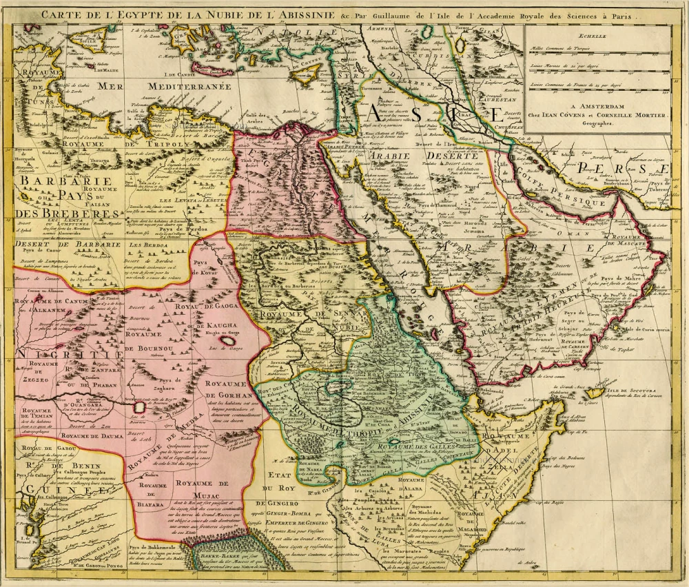
Carte de l'Egypte de la Nubie de l'Abissinie &c. ca. 1730.
Northeast Africa & Arabia by Guillaume Delisle, published by Covens & Mortier
[Item number: 12721]
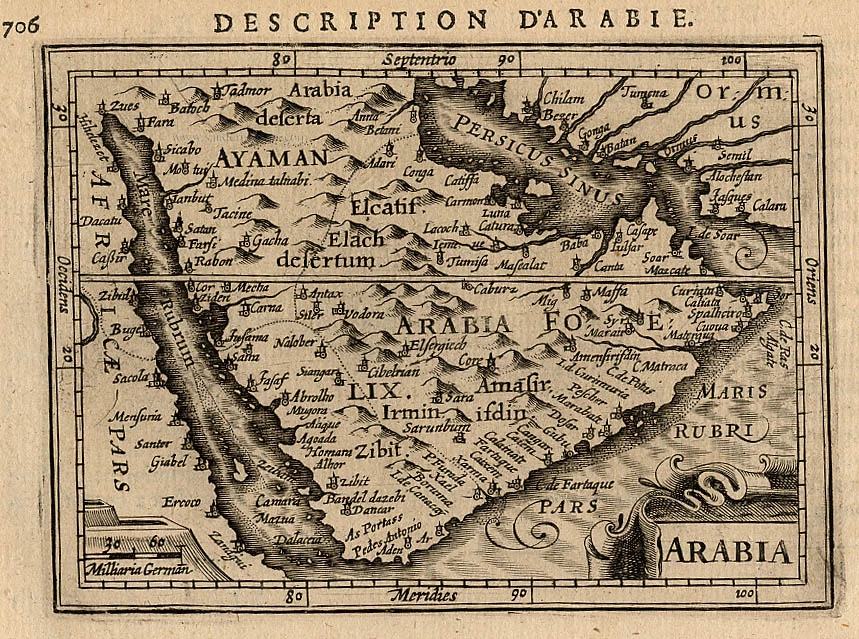
Arabia 1618
Arabia, by Bertius P.
[Item number: 18293]
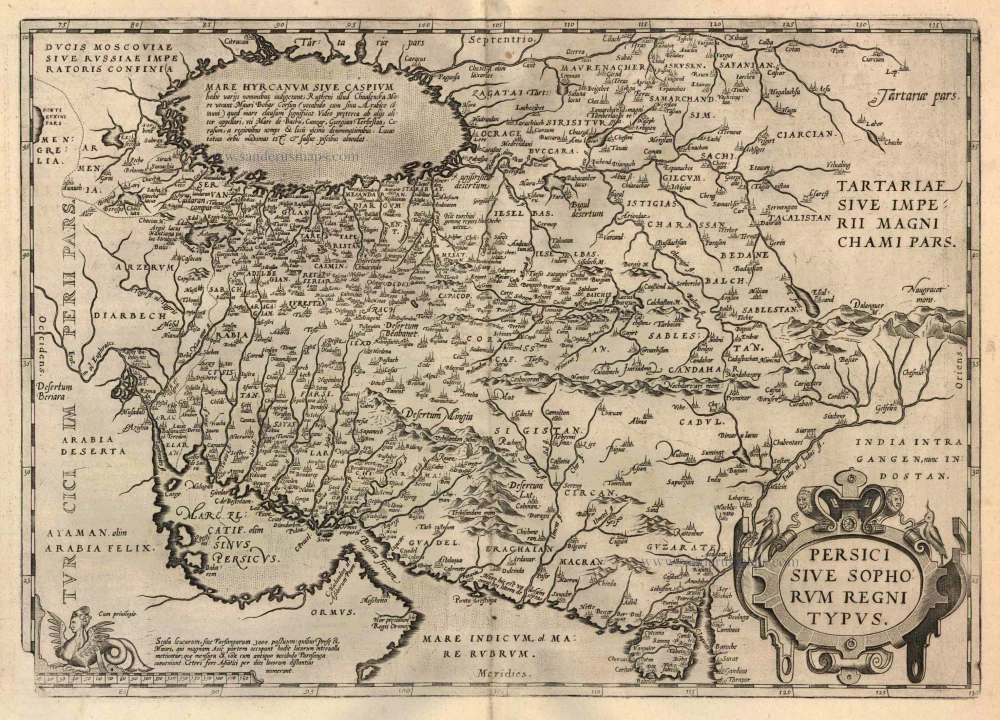
Persici sive Sophorum Regni Typus 1612
Persia, by Abraham Ortelius.
[Item number: 22957]
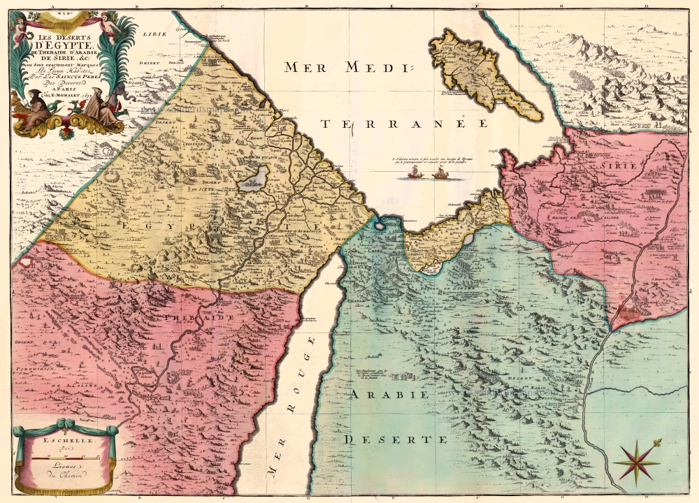
Les Deserts d'Egypte, de Thebaide d'Arabie, de Sirie, &c., ou sont Exactement Marques les Lieux Habitez par les Saincts Peres des Deserts 1710
Egypt and the Middle East by Jaillot - Covens & Mortier.
[Item number: 23617]
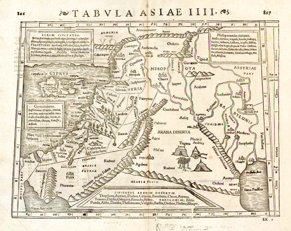
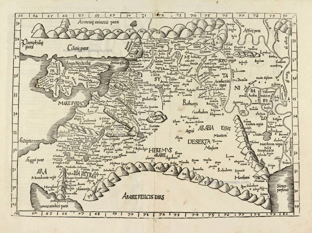
Tabula Asiae IIII. 1571
Middle East - Cyprus - Holy Land by Strabo - Sebastian Münster
[Item number: 25653]
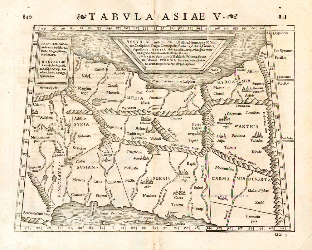
Tabula Asiae V. 1571
Persia, by Strabo - S. Munster.
[Item number: 25654]
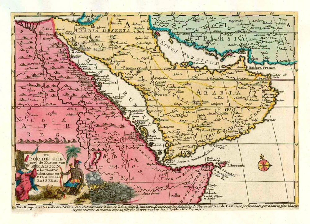
De Roode Zee met de Kusten van Arabien; en het Naauw tussen Aden en Zeila tot aan Bassora. 1714
Arabia, by Pieter van der Aa.
[Item number: 26103]
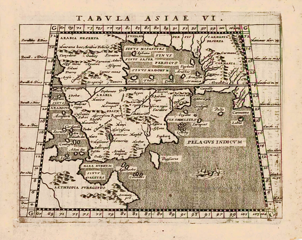
Tabula Asiae VI. 1597
Arabia, by Giovanni Magini.
[Item number: 26519]
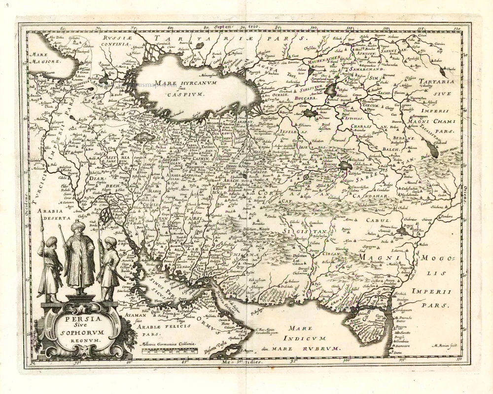
Persia Sive Spohorum Regnum. 1638
Persia, by Matthäus Merian.
[Item number: 26598]
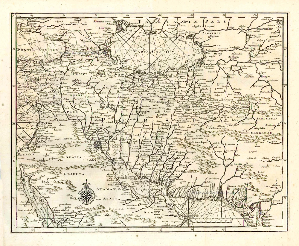
[Persia]. 1724-26
Persia by François Valentyn (Valentijn)
[Item number: 26899]
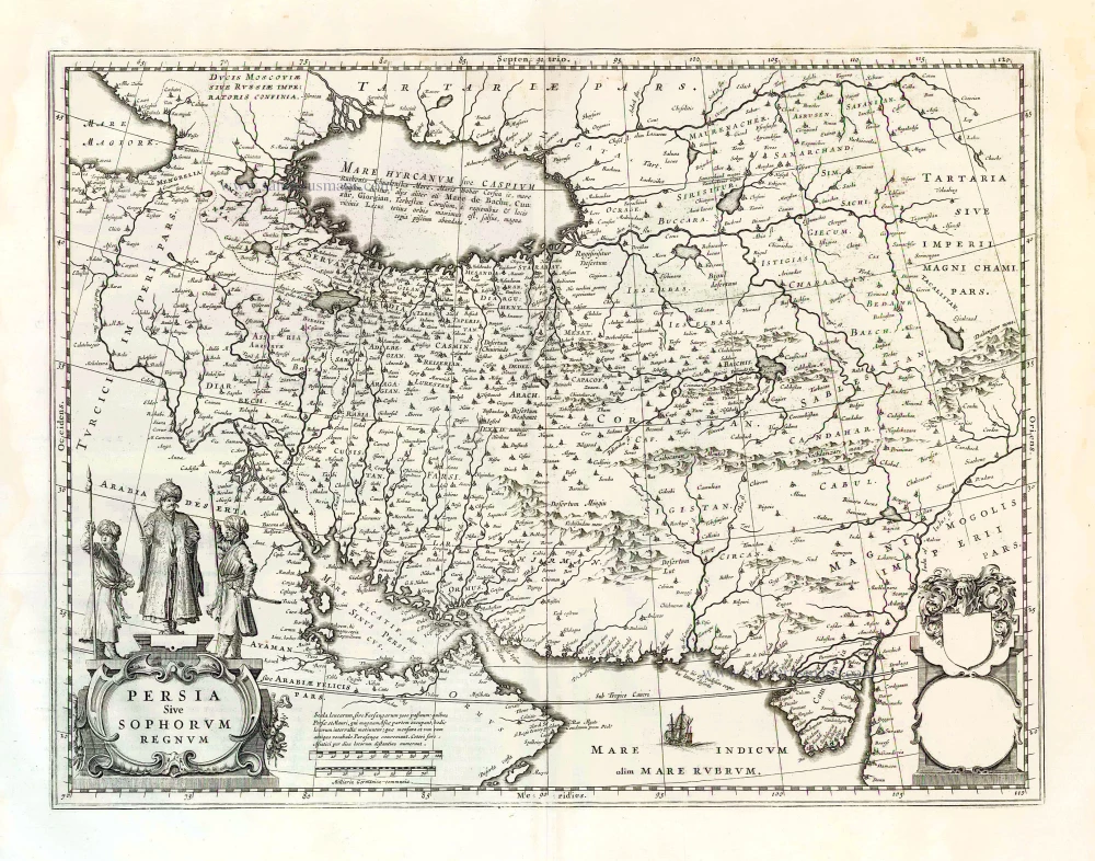
Persia Sive Sophorum Regnum. 1664-65
Persia, by Willem Blaeu.
[Item number: 27084]

Persici vel Sophorum Regni Typus. 1619
Persia by Gerard Mercator - Jodocus Hondius
[Item number: 27195]
Tabula .IIII. Asiae. 1525
Middle East, by Lorenz Fries.
[Item number: 27995]
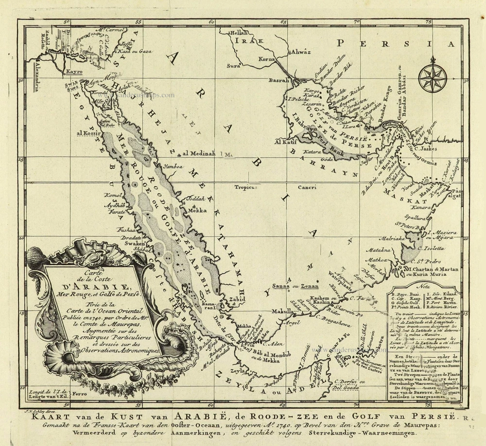
Carte de la coste d'Arabie, Mer Rouge, et Golfe du Perse. 1750
Arabia by Jacques Nicolas Bellin.
[Item number: 28188]
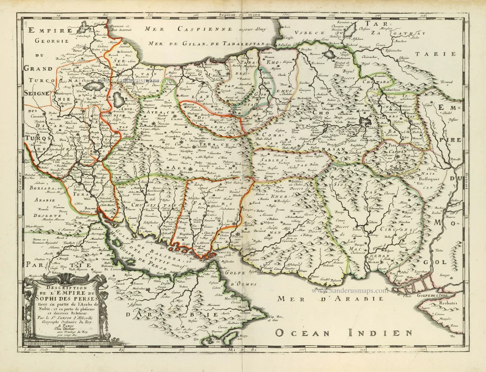
Description de l'Empire du Sophi des Perses 1658
Persia by Nicolas Sanson.
[Item number: 28477]