
Rare
Spice Islands by Hulsius Levinus. 1608
Levinus Hulsius (c. 1550–1606) Cartographer, Publisher, and Disseminator of Geographic Knowledge
Levinus Hulsius was a significant figure in the intellectual and commercial culture of early modern Europe, not only as a publisher and maker of scientific instruments, but as a cartographer and promoter of geographic knowledge at a time of rapid exploration and shifting worldviews.
Born around 1550 in the Southern Netherlands (likely in Flanders), Hulsius fled the religious conflicts of the Spanish-occupied Low Countries, eventually settling in the imperial city of Frankfurt am Main. Frankfurt, a hub for printing and book fairs, became the ideal environment for Hulsius to establish his multilingual publishing and cartographic enterprise. His work coincided with the late Renaissance surge, driven by voyages to the Americas, Africa, and Asia.
Hulsius both created and commissioned maps that reflected the most current geographic knowledge available to him at the time. Many of these maps were featured as fold-out plates in his printed books, particularly in works that dealt with navigation and exploration. His maps, while sometimes derivative of those of other contemporary cartographers like Gerardus Mercator and Abraham Ortelius, were notable for their precision and the clarity of their engraved details. One of his essential projects involved issuing updated maritime maps and charts, designed for use by merchants and navigators operating from German and Dutch ports. These often included coastal profiles and route diagrams, which were essential for navigation.
Hulsius is perhaps best known for publishing the "Collection of Voyages" (Sammlung von Schiffahrten), a major German-language compendium of exploration accounts. Although begun during his lifetime, this series extended well beyond his death. This collection included translations and summaries of travel narratives from explorers such as Sir Francis Drake, Thomas Cavendish, and Willem Barentsz, many of which were accompanied by maps and illustrations. These were among the earliest German editions of such materials, expanding access to new geographic knowledge for German-speaking audiences. The maps in these works ranged from regional charts to broader world maps, often integrating the latest discoveries and speculative geographies of the day.
After Hulsius died in 1606, his publishing house continued operation under his name, managed by family members and associates, notably his son-in-law. The firm carried forward the Voyages collection, with new volumes appearing up until 1650. Many of these later volumes included updated maps reflecting new discoveries, particularly in North America, the East Indies, and along the African coasts. They also featured reprints and revisions of earlier maps with corrected geographic information, as well as continuations of travel accounts with appended charts and coastal views.
These posthumous publications ensured that Hulsius’s name remained associated with one of the most significant early modern German contributions to geographic and exploratory literature.
[No title]
Item Number: 32054 Authenticity Guarantee
Category: Antique maps > Asia > Southeast Asia
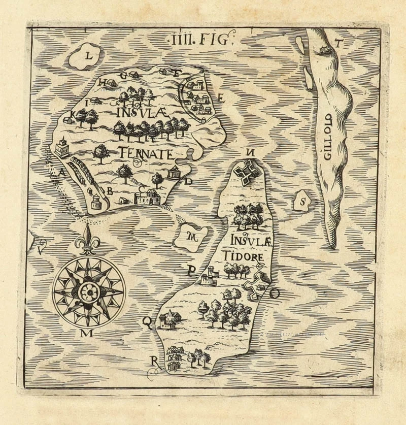
Indonesia - The isles of Ternate, Tidore, and Gillolo (Halmahera).
[No title]
Date of the first edition: 1608.
Date of this map: 1608.
Copper engraving, printed on paper.
Image size: 115 x 115mm (4½ x 4½ inches).
Sheet size: 150 x 145mm (6 x 5¾ inches).
Verso: Blank.
Condition: Excellent.
Condition Rating: A+.
From: Sammlung von sechs und zwanzig Schiffahrten in verschiedene fremde Länder. Achte Schiffahrt oder Kurtze Beschreibung etlicher Reysen … der Holländer und Seeländer in die Ost Indien von Anno 1599 bis Anno 1604. Frankfurt am Main, L. Hulsius, 1608.
This eight volume covers voyages by Dutch captains such as Jacob Cornelisz. van Neck and Wijbrand van Warwijck, spanning years 1599–1604.
Although Hulsius died in 1606, this volume was published under his imprint, compiled from Dutch originals, and illustrated with eight plates.
Levinus Hulsius (c. 1550–1606) Cartographer, Publisher, and Disseminator of Geographic Knowledge
Levinus Hulsius was a significant figure in the intellectual and commercial culture of early modern Europe, not only as a publisher and maker of scientific instruments, but as a cartographer and promoter of geographic knowledge at a time of rapid exploration and shifting worldviews.
Born around 1550 in the Southern Netherlands (likely in Flanders), Hulsius fled the religious conflicts of the Spanish-occupied Low Countries, eventually settling in the imperial city of Frankfurt am Main. Frankfurt, a hub for printing and book fairs, became the ideal environment for Hulsius to establish his multilingual publishing and cartographic enterprise. His work coincided with the late Renaissance surge, driven by voyages to the Americas, Africa, and Asia.
Hulsius both created and commissioned maps that reflected the most current geographic knowledge available to him at the time. Many of these maps were featured as fold-out plates in his printed books, particularly in works that dealt with navigation and exploration. His maps, while sometimes derivative of those of other contemporary cartographers like Gerardus Mercator and Abraham Ortelius, were notable for their precision and the clarity of their engraved details. One of his essential projects involved issuing updated maritime maps and charts, designed for use by merchants and navigators operating from German and Dutch ports. These often included coastal profiles and route diagrams, which were essential for navigation.
Hulsius is perhaps best known for publishing the "Collection of Voyages" (Sammlung von Schiffahrten), a major German-language compendium of exploration accounts. Although begun during his lifetime, this series extended well beyond his death. This collection included translations and summaries of travel narratives from explorers such as Sir Francis Drake, Thomas Cavendish, and Willem Barentsz, many of which were accompanied by maps and illustrations. These were among the earliest German editions of such materials, expanding access to new geographic knowledge for German-speaking audiences. The maps in these works ranged from regional charts to broader world maps, often integrating the latest discoveries and speculative geographies of the day.
After Hulsius died in 1606, his publishing house continued operation under his name, managed by family members and associates, notably his son-in-law. The firm carried forward the Voyages collection, with new volumes appearing up until 1650. Many of these later volumes included updated maps reflecting new discoveries, particularly in North America, the East Indies, and along the African coasts. They also featured reprints and revisions of earlier maps with corrected geographic information, as well as continuations of travel accounts with appended charts and coastal views.
These posthumous publications ensured that Hulsius’s name remained associated with one of the most significant early modern German contributions to geographic and exploratory literature.
Related items
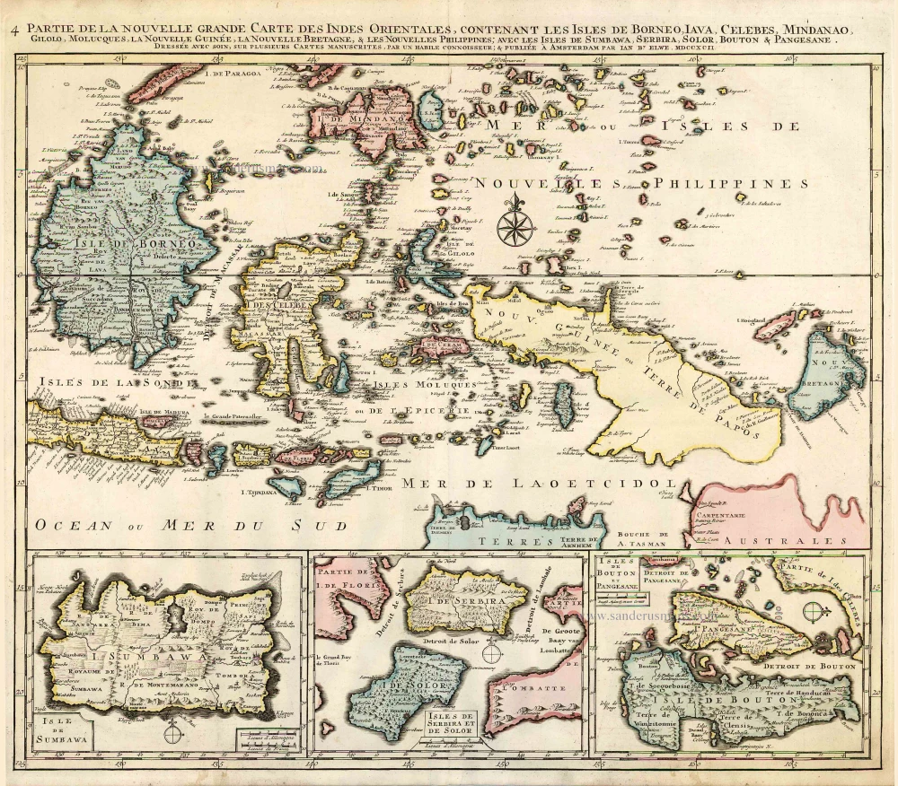
Partie de la Nouvelle Grande Carte des Indes Orientales, Contenant les Isles de Borneo, Iava, Celebes, Mindanao ... 1792
Indonesia - New Guinea - Australia by J.B. Elwe.
[Item number: 2293]
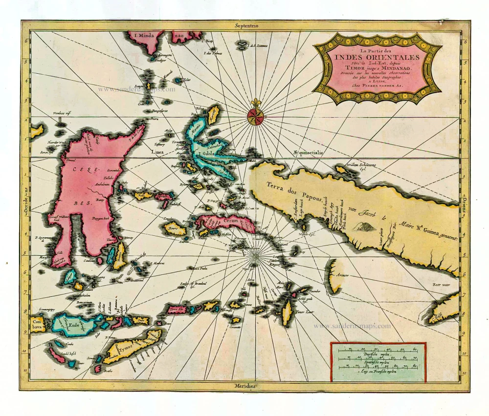
La Partie des Indes Orientales vers le Zud-Est, depuis Timor jusqu'a Mindanao. 1713
Indonesia by P. Van der Aa
[Item number: 26101]
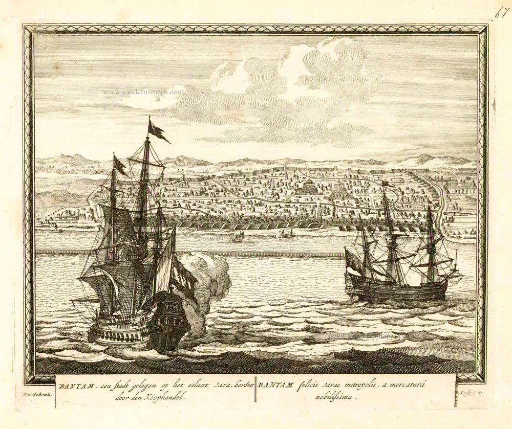
Bantam, een stadt gelegen op het eilant Java, beroemt door den Koophandel. = Bantam felicis Javae metropolis, a mercaturi nobilissima. 1702
Banten (Bantam - Indonesia), by Petrus Schenk.
[Item number: 26661]
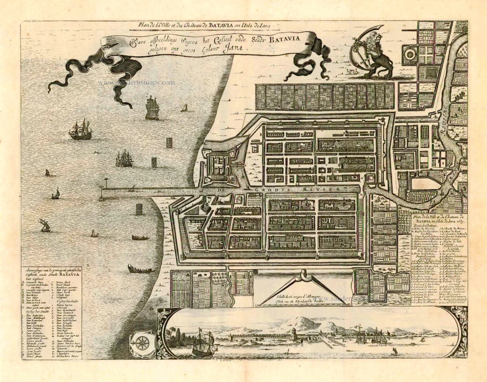
Plan de la Ville er du Château de Batavia en l'Isle de Iava. | Ware afbeeldinge Wegens het Casteel ende Stadt Batavia gelegen opt groot Eylant Java. 1728
Batavia (Jakarta - Indonesia), by Pieter Van der Aa.
[Item number: 27887]

SCARCE !
Bantam. 1685/90
View of Banten (Indonesia), by Carel Allard.
[Item number: 30580]