
Old antique chart of Southeast Asia, by L. Renard. 1715
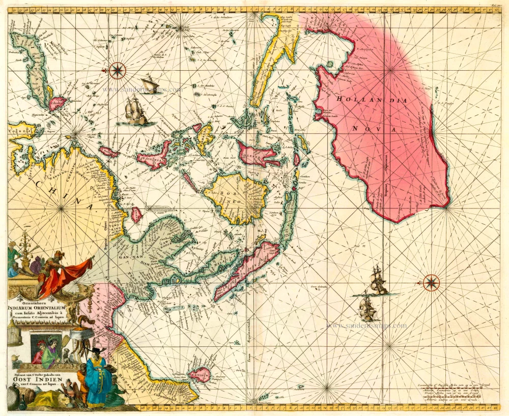
Orientaliora Indiarum Orientalium cum Insulis Adjacentibus à Promontorio C. Comorin ad Iapan. - Pascaert van t' Ooster gedeelte van Oost Indien van C. Comorin tot Iapan.
Item Number: 26325 Authenticity Guarantee
Category: Antique maps > Asia > Southeast Asia
Old, antique sea chart of Southeast Asia with Australia, by L. Renard after F. de Wit.
Oriented to the east.
Date of the first edition: 1680 (= de Wit)
Date of this map: 1715
Copper engraving, printed on paper.
Size (not including margins): 44.5 x 54.5cm (17.4 x 21.3 inches)
Verso: Blank
Condition: Original coloured, cartouche later coloured. Excellent.
Condition Rating: A
References: Parry, Plate 6.22; Clancy, Map 6.13; Tooley (Australia), p.206 #41.
From: Renard L. Atlas de la Navigation et du Commerce. Amsterdam, 1715.
This chart is a direct copy of Pieter Goos' chart 'Orientaliora Indiarum Orientalium ...' of 1666.
Related items
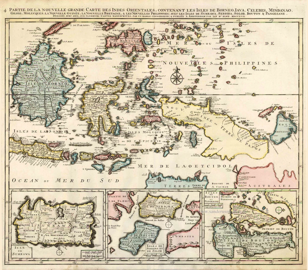
Partie de la Nouvelle Grande Carte des Indes Orientales, Contenant les Isles de Borneo, Iava, Celebes, Mindanao ... 1792
Indonesia - New Guinea - Australia by J.B. Elwe.
[Item number: 2293]
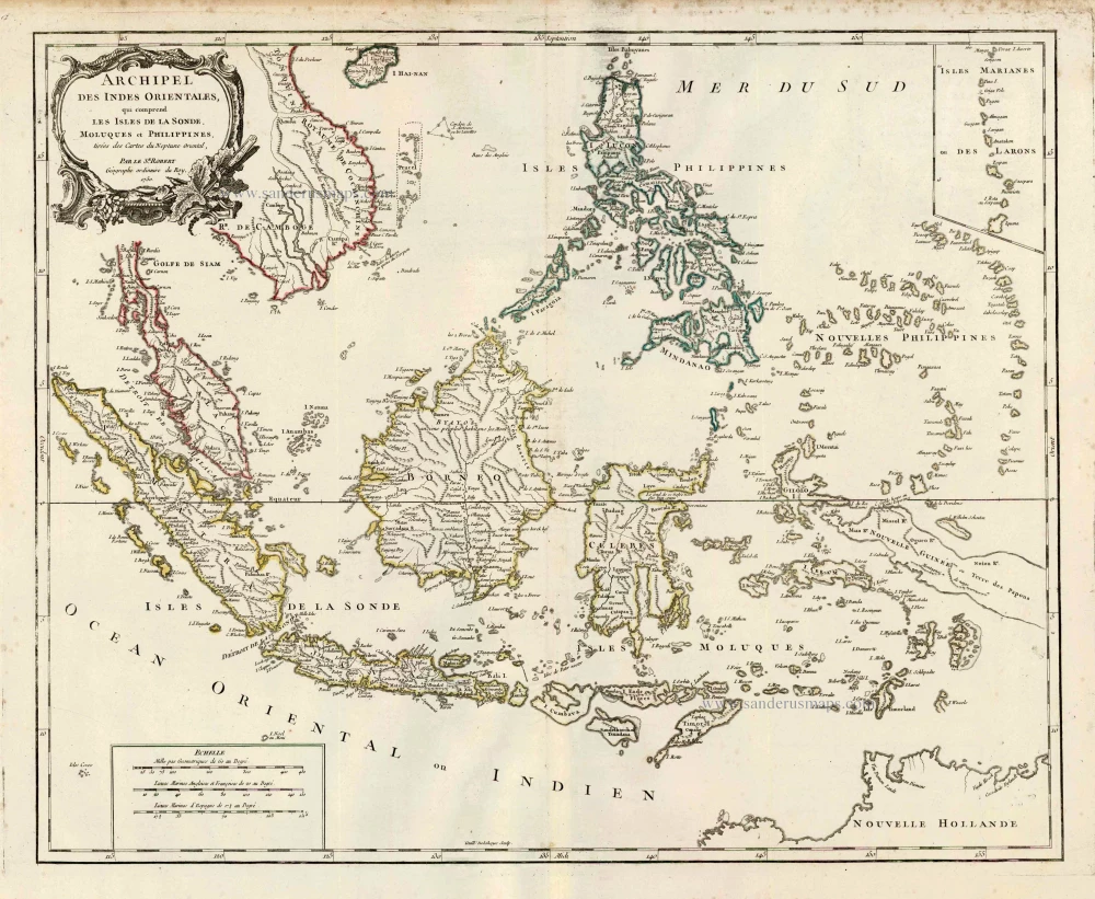
Archipel des Indes Orientales qui Comprend les Isles de la Sonde, Moluques et Philippines. c. 1757
Southeast Asia, par Robert de Vaugondy.
[Item number: 4751]
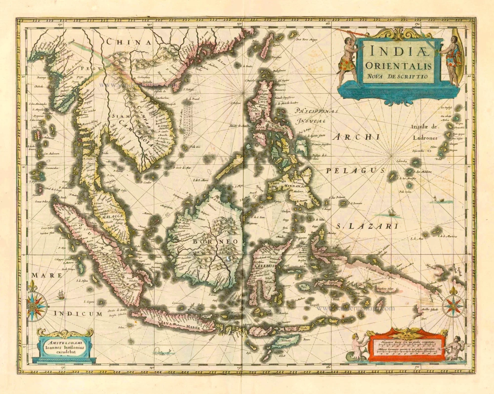
The most accurate and one of the most elegant 17th c. maps of the East Indies
Indiae Orientalis Nova Descriptio. 1644-58
Southeast Asia by Janssonius, Johannes
[Item number: 10013]
From the Cloppenburg edition
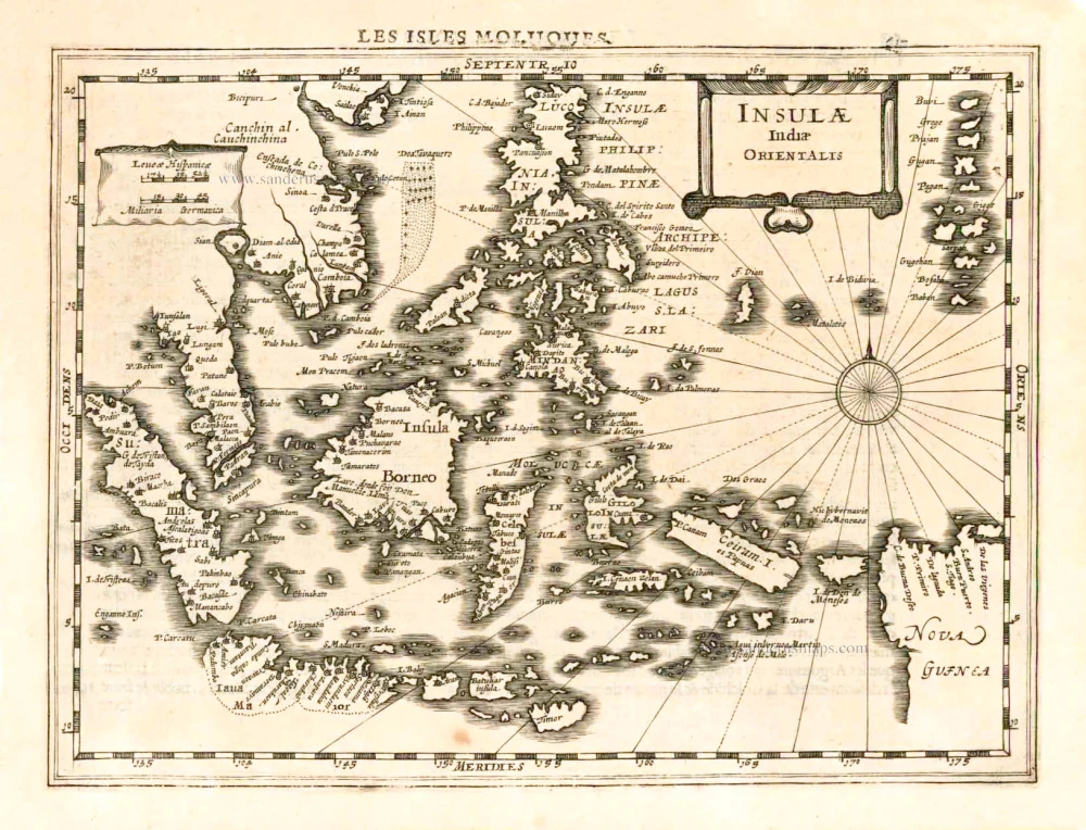
Insulae Indiae Orientalis. 1630
Southeast Asia, by G. Mercator - J. Hondius.
[Item number: 25234]
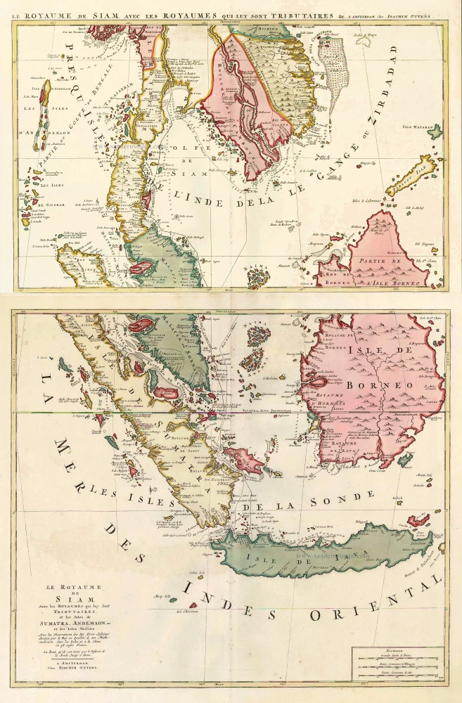
Le Royaume de Siam avec les Royaumes qui luy sont Tributaires, et les Isles de Sumatra, Andemaon, etc. et les Isles Voisine. c. 1700
Southeast Asia, by J. Ottens.
[Item number: 25716]
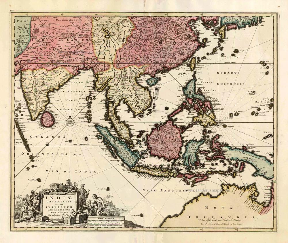
Indiae Orientalis nec non Insularum Adiacentium Nova Descriptio. c. 1740
Southeast Asia by Nicolaes Visscher, published by Petrus Schenk.
[Item number: 25718]
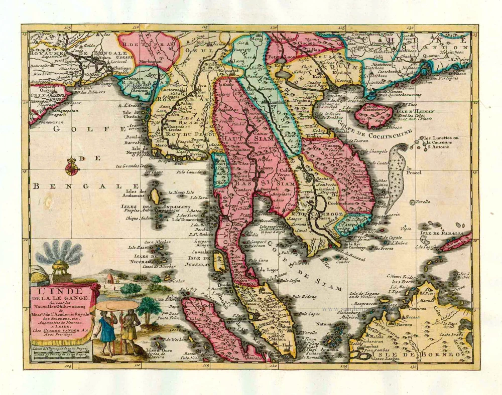
L'Inde de la le Gange, 1713
Southeast Asia, by Pieter van der Aa.
[Item number: 26097]