
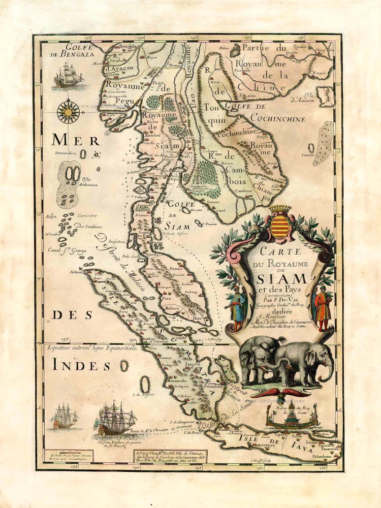
Thailand by Placide de Sainte-Hélène 1686
Pierre Duval (Abbeville, 1618 - 1683)
French geographer, nephew and pupil of Nicolas Sanson. He was encouraged by Louis XIV to move to Paris. In 1650 he became Géographe Ordinaire du Roy.
Carte du Royaume de Siam et des Pays Circonvoisins.
Item Number: 27106 Authenticity Guarantee
Category: Antique maps > Asia > Southeast Asia
Old, antique map of the Kingdom of Siam and its neighbouring countries, by Placide de Sainte-Hélène.
Date of the first edition: 1686
Date of this map: 1686
Copper engraving, printed on paper.
Size (not including margins): 48 x 33.5cm (18.7 x 13.1 inches)
Verso: Blank
Condition: Original coloured, excellent.
Condition Rating: A+
References: Pastoureau, Placide #1: Suarez (SE Asia), p.213, fig.125; Not in Durant-Curtis.
From: Père Placide, Cartes de geographie. Paris, Augustin Dechaussé, beginning 18th cent. (Pastoureau, p.367 Placide)
Pierre Duval (Abbeville, 1618 - 1683)
French geographer, nephew and pupil of Nicolas Sanson. He was encouraged by Louis XIV to move to Paris. In 1650 he became Géographe Ordinaire du Roy.
Related items
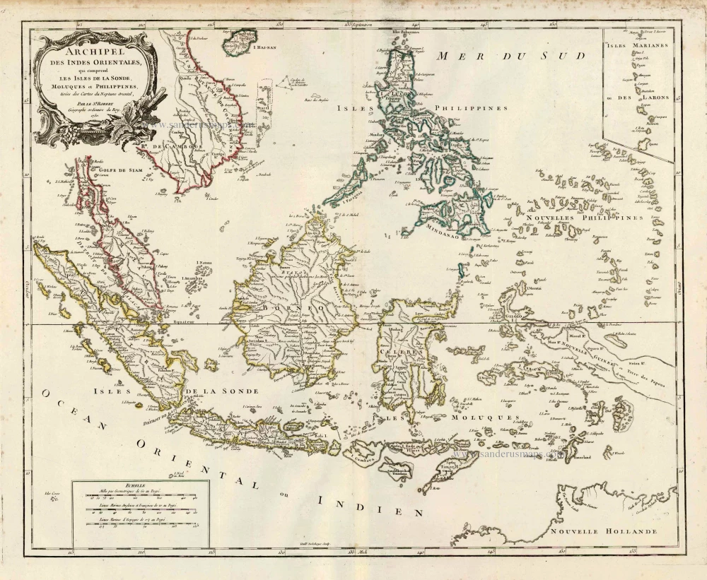
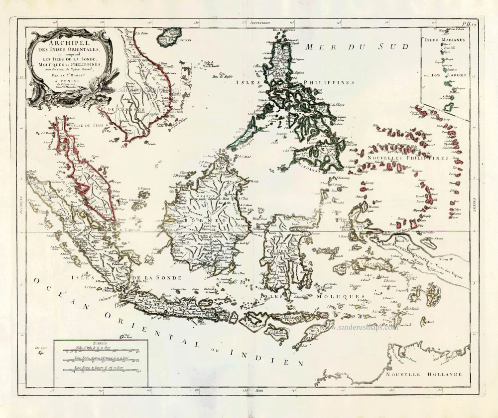
Archipel des Indes Orientales qui Comprend les Isles de la Sonde, Moluques et Philippines. c. 1757
Southeast Asia, par Robert de Vaugondy.
[Item number: 4751]
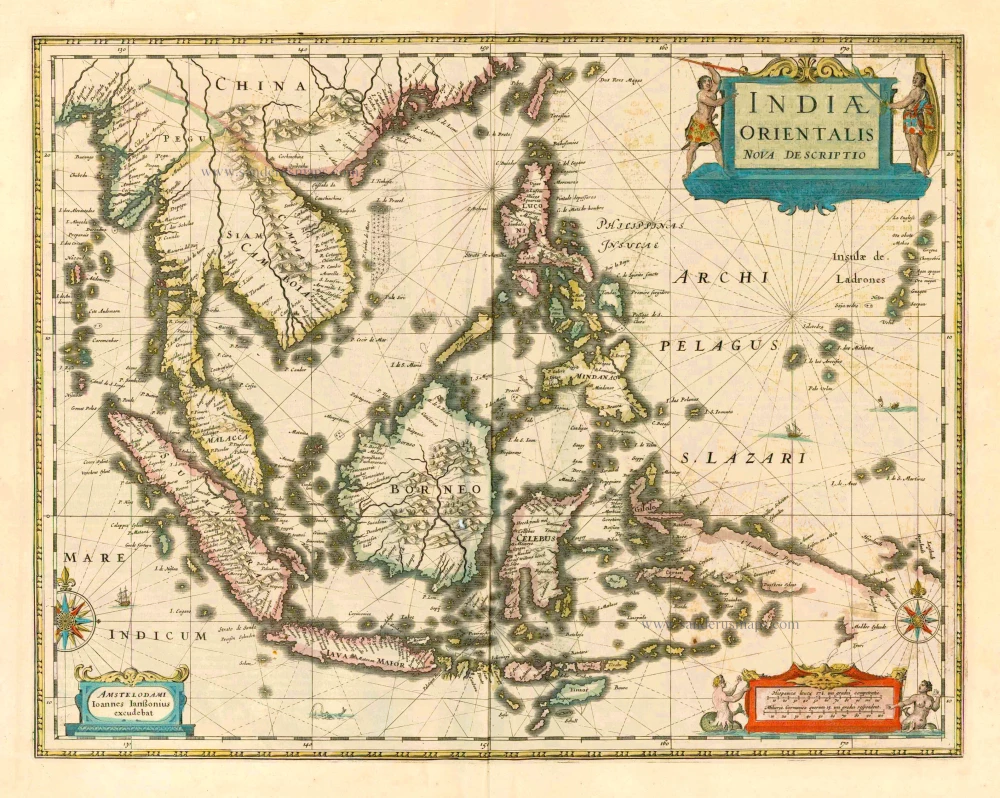
The most accurate and one of the most elegant seventeenth-century maps of the East Indies
Indiae Orientalis Nova Descriptio. 1644-58
Southeast Asia by Janssonius, Johannes
[Item number: 10013]
From the Cloppenburg edition
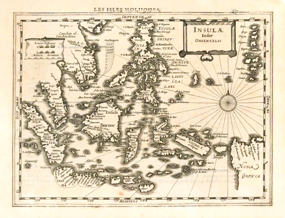
Insulae Indiae Orientalis. 1630
Southeast Asia, by G. Mercator - J. Hondius.
[Item number: 25234]
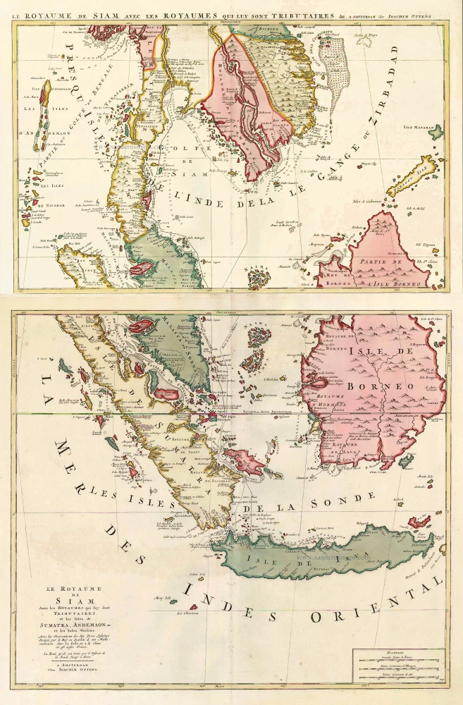
Le Royaume de Siam avec les Royaumes qui luy sont Tributaires, et les Isles de Sumatra, Andemaon, etc. et les Isles Voisine. c. 1700
Southeast Asia, by J. Ottens.
[Item number: 25716]
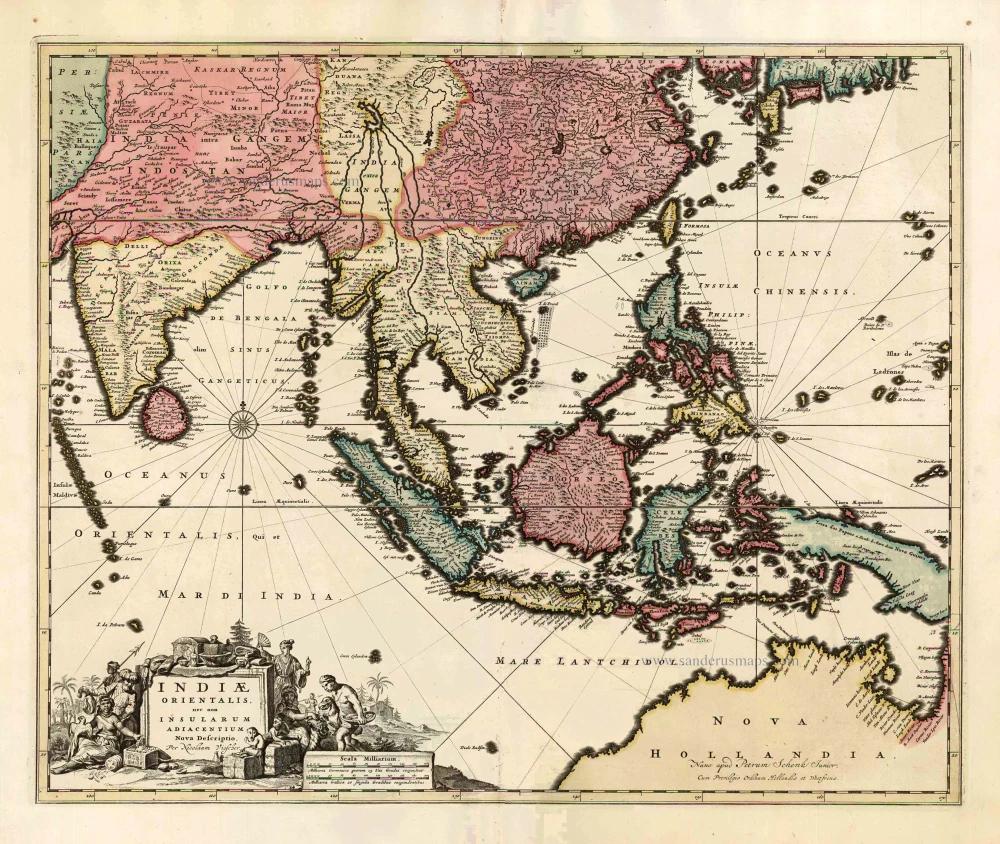
Indiae Orientalis nec non Insularum Adiacentium Nova Descriptio. c. 1740
Southeast Asia by Nicolaes Visscher, published by Petrus Schenk.
[Item number: 25718]
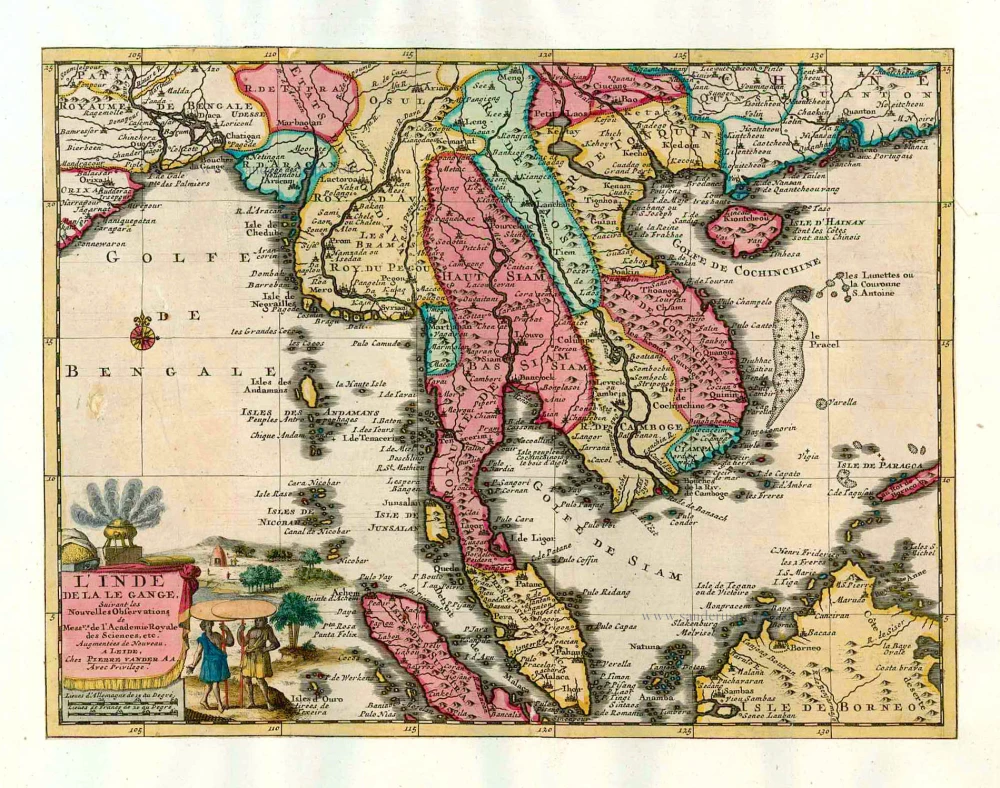
L'Inde de la le Gange, 1713
Southeast Asia, by Pieter van der Aa.
[Item number: 26097]
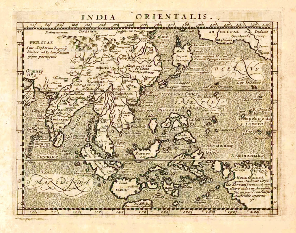
India Orientalis. 1597
Southeast Asia, by Giovanni Magini.
[Item number: 26521]

This map has the first accurate depiction of the Philippines
India quae Orientalis dicitur et Insulae Adiacentes. 1640-43
Southeast Asia by Willem & Joan Blaeu
[Item number: 26566]
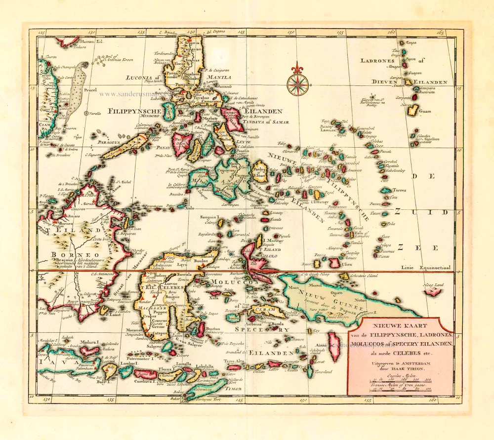
Nieuwe Kaart van de Filippynsche, Ladrones, Moluccos of Specery Eilanden als mede Celebes, etc. 1744
Philippines - Indonesia by Tirion I.
[Item number: 26584]
Archipel des Indes Orientales qui comprend les Isles de la Sonde, Moluques et Philippines. 1776-79
Southeast Asia, by Francesco Santini.
[Item number: 26977]