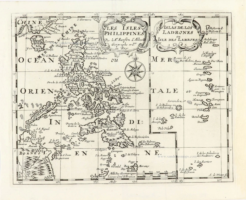
First map of the Philippines. With rare original colouring.
Philippines by Langenes Barent 1600


Petrus Bertius (1565-1629)
Petrus Bertius, born at Beveren, Flanders, in 1565, was related to Pieter van den Keere (Kaerius) and Jodocus Hondius. Both famous cartographers were brothers-in-law of Petrus Bertius. As a refugee, he settled in Amsterdam, and after finishing his studies, he became a professor of mathematics and librarian at the University of Leiden. In 1618, he became a cosmographer and historiographer for Louis XIII of France. He lived in Paris, where he died in 1629.
Petrus Bertius's remarkable work ethic is evident in the numerous geographical and theological works he produced. His contributions to the works of Clüver and Herrera further solidified his reputation in geography.
His fame among geographers was established by his text in the pocket atlas Tabularum Geographicarum and by his edition of Ptolemy’s Geographia.
The origin of the Tabularum Geographicum lies in the well-known miniature atlas Caert thresoor, published by Barent Langenes in 1598 in Middelburg. Bertius engraved 169 maps for this small but attractive atlas, sold for the first time in 1599 by Cornelis Claesz in Amsterdam. In 1600, Claesz published the pocket atlas with a Latin text composed by Petrus Bertius. From then on, new editions, often enlarged with new maps, regularly appeared, subsequently published by Cornelis Claesz, Jodocus Hondius, Johannes Janssonius and ultimately, in 1649, by Claes Jansz. Visscher.
Koeman divides this series of pocketbooks into two atlases: The Caert-thresoor, published by Langenes and Claesz., with five editions between 1598 and 1609, and the Tabularum Geographicarum Contractarum by Petrus Bertius with ten editions between 1600 and 1650.
The Caert-Thresoor.
The Caert-Thresoor of 1598 set a new standard for minor atlases. Scholars like Petrus Bertius and Jacobus Viverius edited the text. The small maps are exceptionally well engraved, neat, clear, and elegantly composed. They served many purposes in other books published in Amsterdam. Their contents reflect the level of cartography in Amsterdam at the turn of the century, where up-to-date information on newly discovered regions was readily available. The Caert-Thresoor is a collection of maps to which the text was adapted and not the other way around, as is the case with many geographical studies.
The first edition was published in 1598 by Barent Langenes, a bookseller and publisher in Middelburg.
The book was reissued under the title P. Bertii Tabularum Geographicarum Libri quatuor, in 1600. Bertius recomposed the contents, following Ptolemy's arrangement. Secondly, in 1609, Jacobus Viverius wrote an entirely revised Dutch text, published under the title Handboeck of Cort Begrijp des Caerten. In or after 1609, the year of Cornelis Claesz.'s death, a French edition appeared, printed by Matthaeus Becker for Hendrik Laurensz., the successor of Cornelis Claesz. Finally, an entirely new small atlas was created in 1616 by Jodocus Hondius Jr. All the maps were re-made, and the text by Bertius was revised.
The original maps from the Caert-Thresoor were used to illustrate many of the books on voyages and geography published in Amsterdam in 1596-1600. (Van der Krogt)
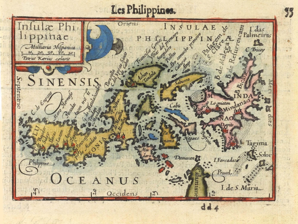
Insulae Philippinae.
Item Number: 29516 Authenticity Guarantee
Category: Antique maps > Asia > Southeast Asia
Old antique map of the Philippines, by Bertius Petrus.
Title: Insulae Philippinae.
Oriented to the east.
Date of the first edition: 1598.
Date of this map: 1600.
Copper engraving, printed on paper.
Map size: 90 x 125mm (3.54 x 4.92 inches).
Sheet size: 120 x 160mm (4.72 x 6.3 inches).
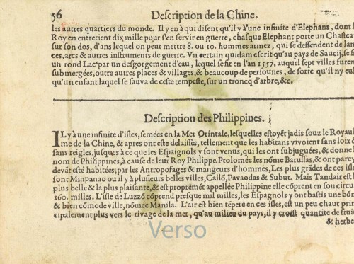
Verso: French text.
Condition: Original coloured, excellent.
Condition Rating: A+.
From: Barent Langenes. Thrésor de Chartes. Den Haag, Albert Henry for Cornelis Claesz., c. 1600. (Van der Krogt 3, 341:11)
Petrus Bertius (1565-1629)
Petrus Bertius, born at Beveren, Flanders, in 1565, was related to Pieter van den Keere (Kaerius) and Jodocus Hondius. Both famous cartographers were brothers-in-law of Petrus Bertius. As a refugee, he settled in Amsterdam, and after finishing his studies, he became a professor of mathematics and librarian at the University of Leiden. In 1618, he became a cosmographer and historiographer for Louis XIII of France. He lived in Paris, where he died in 1629.
Petrus Bertius's remarkable work ethic is evident in the numerous geographical and theological works he produced. His contributions to the works of Clüver and Herrera further solidified his reputation in geography.
His fame among geographers was established by his text in the pocket atlas Tabularum Geographicarum and by his edition of Ptolemy’s Geographia.
The origin of the Tabularum Geographicum lies in the well-known miniature atlas Caert thresoor, published by Barent Langenes in 1598 in Middelburg. Bertius engraved 169 maps for this small but attractive atlas, sold for the first time in 1599 by Cornelis Claesz in Amsterdam. In 1600, Claesz published the pocket atlas with a Latin text composed by Petrus Bertius. From then on, new editions, often enlarged with new maps, regularly appeared, subsequently published by Cornelis Claesz, Jodocus Hondius, Johannes Janssonius and ultimately, in 1649, by Claes Jansz. Visscher.
Koeman divides this series of pocketbooks into two atlases: The Caert-thresoor, published by Langenes and Claesz., with five editions between 1598 and 1609, and the Tabularum Geographicarum Contractarum by Petrus Bertius with ten editions between 1600 and 1650.
The Caert-Thresoor.
The Caert-Thresoor of 1598 set a new standard for minor atlases. Scholars like Petrus Bertius and Jacobus Viverius edited the text. The small maps are exceptionally well engraved, neat, clear, and elegantly composed. They served many purposes in other books published in Amsterdam. Their contents reflect the level of cartography in Amsterdam at the turn of the century, where up-to-date information on newly discovered regions was readily available. The Caert-Thresoor is a collection of maps to which the text was adapted and not the other way around, as is the case with many geographical studies.
The first edition was published in 1598 by Barent Langenes, a bookseller and publisher in Middelburg.
The book was reissued under the title P. Bertii Tabularum Geographicarum Libri quatuor, in 1600. Bertius recomposed the contents, following Ptolemy's arrangement. Secondly, in 1609, Jacobus Viverius wrote an entirely revised Dutch text, published under the title Handboeck of Cort Begrijp des Caerten. In or after 1609, the year of Cornelis Claesz.'s death, a French edition appeared, printed by Matthaeus Becker for Hendrik Laurensz., the successor of Cornelis Claesz. Finally, an entirely new small atlas was created in 1616 by Jodocus Hondius Jr. All the maps were re-made, and the text by Bertius was revised.
The original maps from the Caert-Thresoor were used to illustrate many of the books on voyages and geography published in Amsterdam in 1596-1600. (Van der Krogt)