
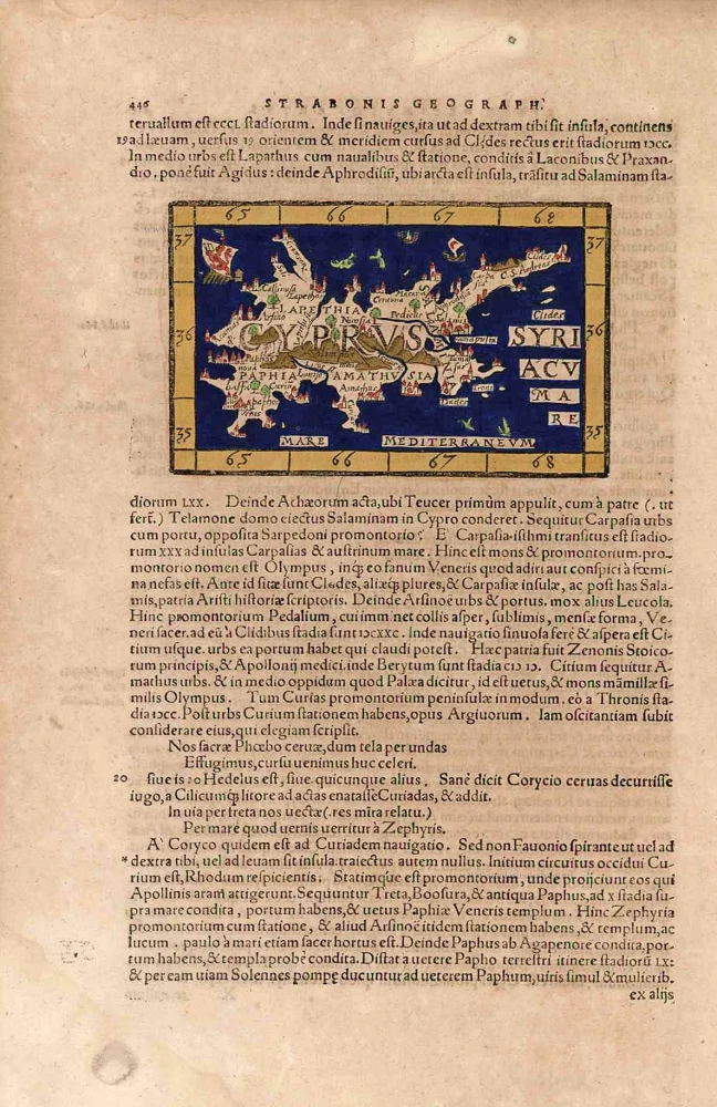
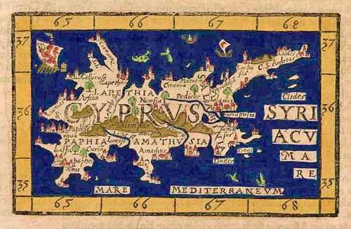
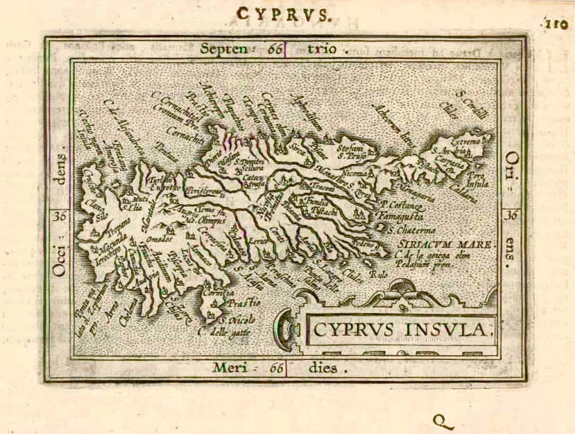
Cyprus by Johannes Honter. 1571
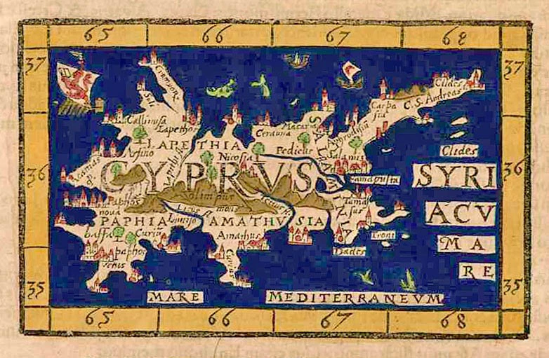

Johannes Honter (1498-1549)
Johannes Honter Coronensis was a Transylvanian Saxon, renaissance humanist, protestant reformer, and theologian. He studied at the University of Vienna between 1520 and 1525, graduating with a magister artium title. In 1530 he registered at the Krakow University, and there he published his first books.
Between 1530 and 1532 he lived in Basel and practised wood engraving. He produced several important maps and star charts, but he is best known for his pocket geography, the Rudimentorum cosmographiae, (1530). It was the first modern geography schoolbook. The work was reprinted widely under variant titles, and some editions were illustrated with maps.
The maps were also used to illustrate two Basel editions of Strabo's geographical text, issued in 1571.
Cyprus.
Item Number: 27856 Authenticity Guarantee
Category: Antique maps > Asia > Turkey - Cyprus
Old, antique map of Cyprus, by Johannes Honter.
Title: Cyprus.
Date of the first edition: 1561.
Date of this map: 1571.
Woodcut, printed on paper.
Size (not including margins and text): 78 x 125mm (3.07 x 4.92 inches).
Verso: Latin.
Condition: Hand coloured, excellent.
Condition Rating: A+.
References: Baynton-Williams Cyprus, #6; Stylianou, p.68 #74 fig.77
From: Strabonis nobilissimi et doctissimi philosophi ac geogaphi Rerum geographicarum commentarij libris XVII continnti, latini facti ... Basel, Officina Henricpetrina, 1571.
Johannes Honter (1498-1549)
Johannes Honter Coronensis was a Transylvanian Saxon, renaissance humanist, protestant reformer, and theologian. He studied at the University of Vienna between 1520 and 1525, graduating with a magister artium title. In 1530 he registered at the Krakow University, and there he published his first books.
Between 1530 and 1532 he lived in Basel and practised wood engraving. He produced several important maps and star charts, but he is best known for his pocket geography, the Rudimentorum cosmographiae, (1530). It was the first modern geography schoolbook. The work was reprinted widely under variant titles, and some editions were illustrated with maps.
The maps were also used to illustrate two Basel editions of Strabo's geographical text, issued in 1571.
Related items

Cyprus Insula - Candia, olim Creta. 1572
Cyprus - Crete, by A. Ortelius.
[Item number: 16585]
Cypri Insulae Nova Descript. 1573 1592
Cyprus, by Ortelius A.
[Item number: 22955]
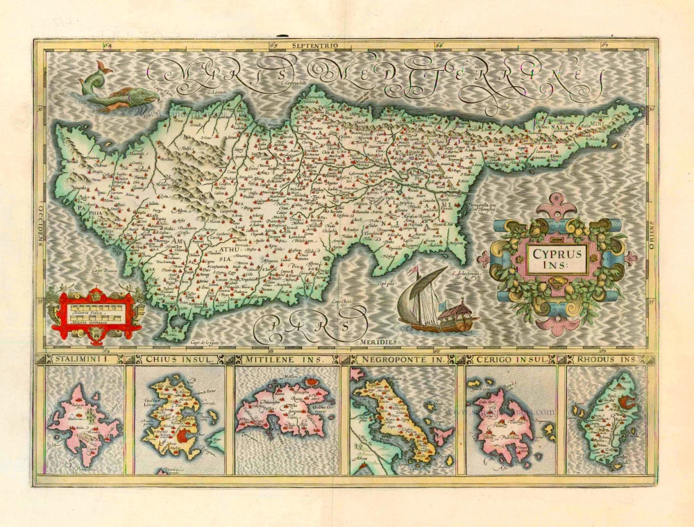
Cyprus Ins: 1633
Cyprus, by Jodocus Hondius.
[Item number: 24436]
Cyprus Insula. 1552
Cyprus, by S. Münster.
[Item number: 25723]

Cyprus Ins: 1641
Cyprus, by Henricus Hondius.
[Item number: 26436]
Cyprus. 1602
Cyprus, by Barent Langenes, published by P. Bertius.
[Item number: 26542]
Cyprus Insula. 1640-43
Cyprus, by W. & J. Blaeu.
[Item number: 26641]
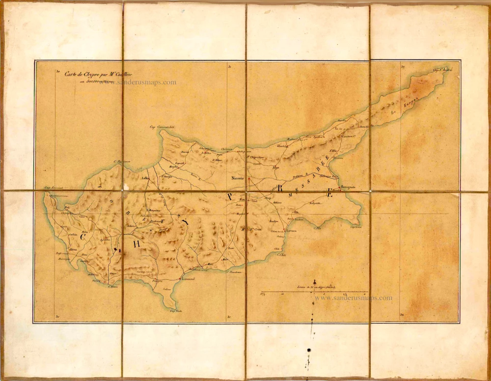
Carte de Chypre par Mr Caillier. c. 1850
Manuscript map of Cyprus, by Caillier.
[Item number: 26720]
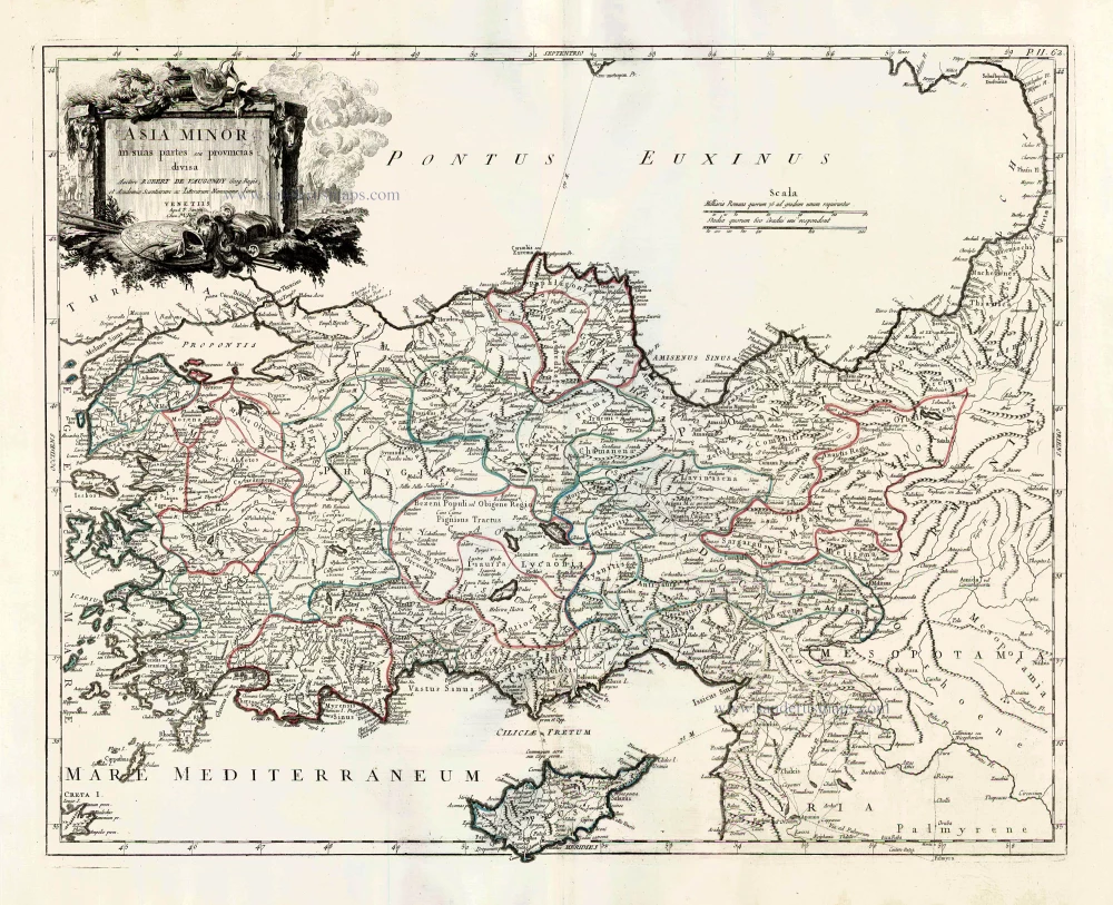
Asia Minor in suas partes seu provincias divisa. 1776-79
Turkey and Cyprus, by Paolo Santini.
[Item number: 27014]
Scarce
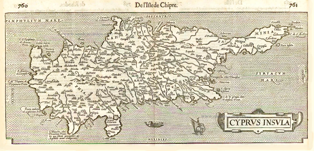
Cyprus Insula. - De L'Isle de Chipre. 1575
Cyprus, by François Belleforest.
[Item number: 27300]
Cyprus Insula. 1609
Cyprus by Abraham Ortelius.
[Item number: 27509]
Very rare.
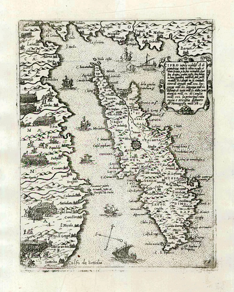
Cipro insula nobiliss. ... c. 1575
Cyprus by Giovanni Francesco Camocio
[Item number: 27577]
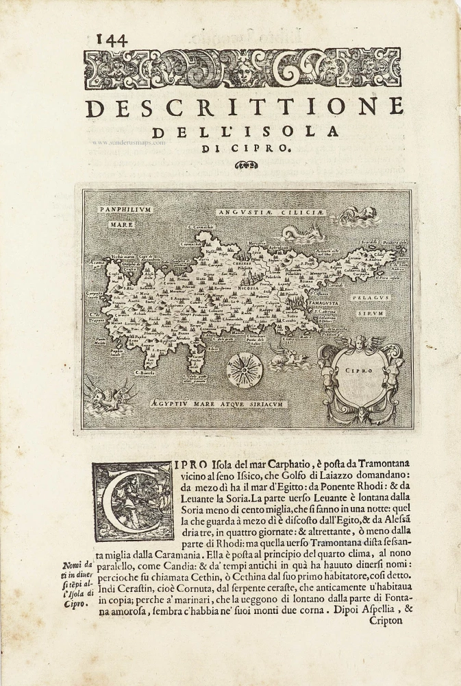
Cipro. - [Above map :] Descrittione dell'Isola di Cipro. 1590
Cyprus by Thomasso Porcacchi.
[Item number: 29827]
Rare.
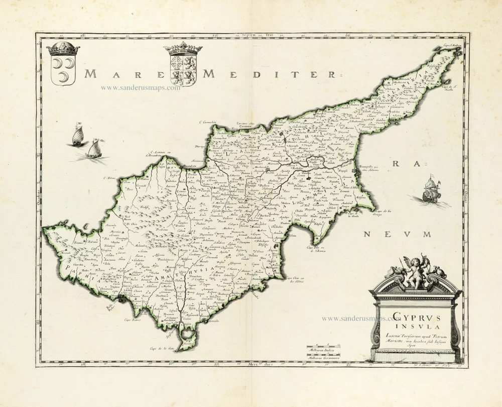
Cyprus Insula. ca. 1658-1663
Cyprus by Nicolas Sanson, published by Pierre Mariette.
[Item number: 30045]
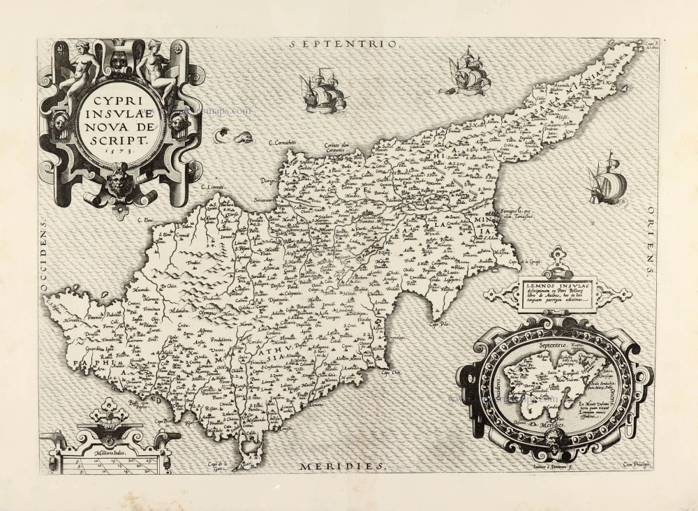
Cypri Insulae Nova Descript. 1573 1575
Cyprus by Abraham Ortelius.
[Item number: 30103]