
Rare map showing the peregrinations of St. Paul.
The peregrinations of St. Paul in the Eastern Mediterranean, by Jacques Honervogt after Abraham Ortelius. c. 1630-1650
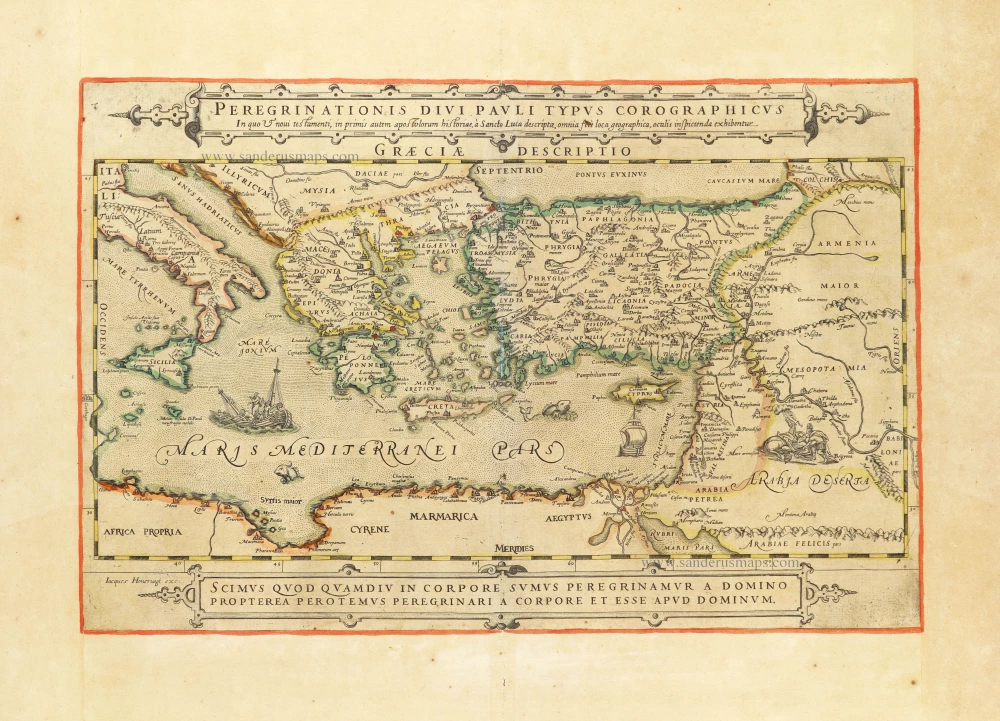
This very rare map, published in Paris by Jacques Honervogt, illustrates the travels of the Apostle Paul. The map is based on Ortelius's Paulus Travels map.
Pastoureau does not mention this map. Zacharakis is the only cartographer who knows her.
Jacques Honervogt (c. 1590 - c. 1663)
Native of Cologne, worked as an engraver and publisher in Paris from 1608 'Chez Iac Honervogt rue St. Iacques a lanseigne de la Ville de Cologne'. After 1654, he worked with Gérard Jollain, who took over after his death.
Peregrinationis Divi Pauli Typus Corographicus In quo & novi testamenti, in primis autem apostulorum historiae, à Sancto Luca descriptae, omnia fere loca geographica, oculis inspicienda exhibentur.
Item Number: 30854 new Authenticity Guarantee
Category: Antique maps > Asia > Turkey - Cyprus
The peregrinations of St. Paul in the Eastern Mediterranean, by Jacques Honervogt after Abraham Ortelius.
Title: Peregrinationis Divi Pauli Typus Corographicus In quo & novi testamenti, in primis autem apostulorum historiae, à Sancto Luca descriptae, omnia fere loca geographica, oculis inspicienda exhibentur.
Iacques Honervogt exc.
Engraver: J. Honervogt.
Date: c. 1630-1650.
Copper engraving, printed on heavy paper.
Image size: 320 x 490mm (12.6 x 19.29 inches).
Sheet size: 505 x 690mm (19.88 x 27.17 inches).
Verso: Blank.
Condition: Original coloured in outline, age-toned.
Condition Rating: A
Separate publication - from a French Composite Atlas, c. 1630-1650.
This very rare map, published in Paris by Jacques Honervogt, illustrates the travels of the Apostle Paul. The map is based on Ortelius's Paulus Travels map.
Pastoureau does not mention this map. Zacharakis is the only cartographer who knows her.
Jacques Honervogt (c. 1590 - c. 1663)
Native of Cologne, worked as an engraver and publisher in Paris from 1608 'Chez Iac Honervogt rue St. Iacques a lanseigne de la Ville de Cologne'. After 1654, he worked with Gérard Jollain, who took over after his death.
Related items
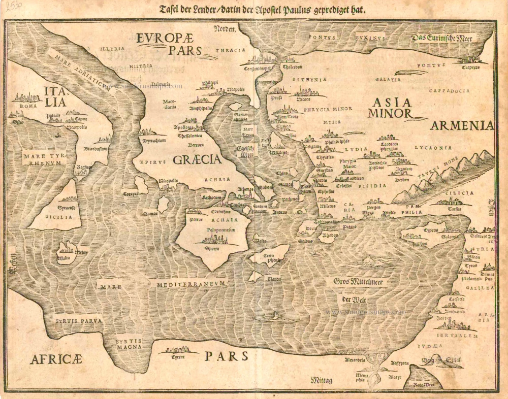
Tafel der Lender darin der Apostel Paulus geprediget hat. 1581
Eastern part of the Mediterranean Sea, by Heinrich Bünting.
[Item number: 2530]
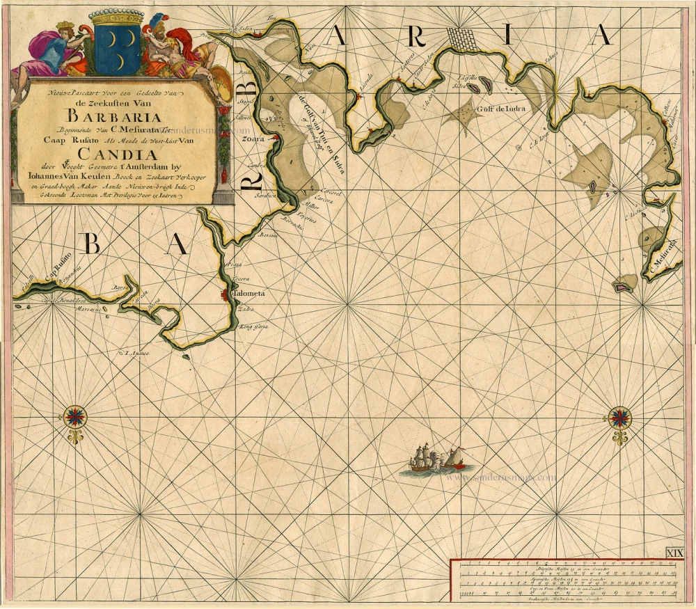
Nieuwe Pascaart voor een Gedeelte van de Zeekusten van Barbaria Beginnende van C. Mesurata tot Caap Rusato Als mede de West-kust van Candia. 1697-1709
Sea chart of the coasts of Morocco, by Johannes Van Keulen.
[Item number: 6506]
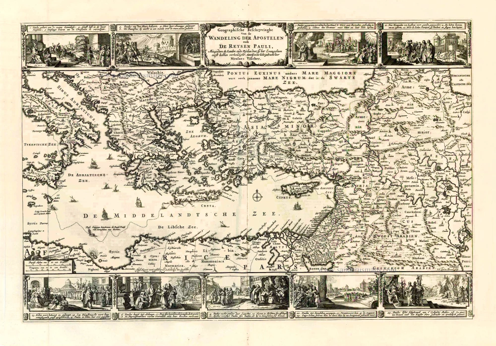
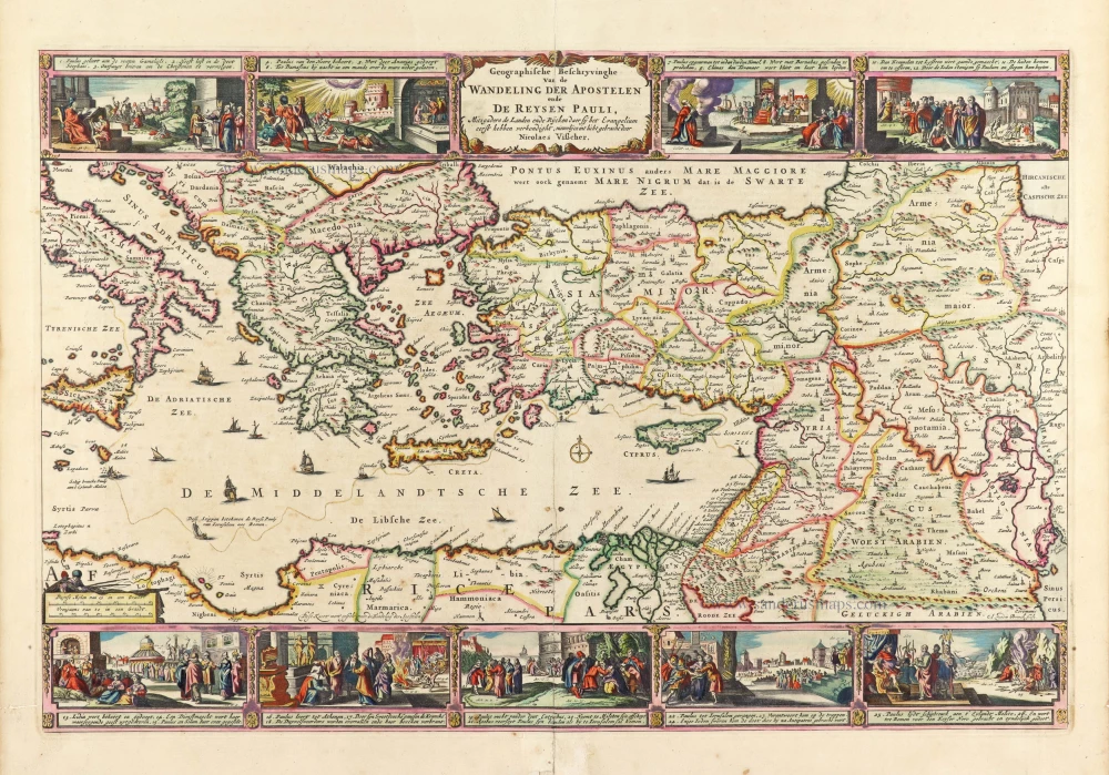
Geografische Beschryvinghe van de Wandeling der Apostelen ende De Reysen Pauli, Mitsgaders de Landen ende Rijcken daer sij het Evangelium eerst hebben verkondight. ... c. 1664
Eastern Mediterranean Sea, by Nicolaes Visscher I.
[Item number: 27590]
La Mer Mediterranee Divisee en ses Principales Parties ou Mers. c. 1705
Mediterranean Sea by Pieter (Pierre) Mortier
[Item number: 27767]
Mediteraneo e Colfo de Setelia. c. 1604
Eastern Mediterranean Sea by Jean Zuallart.
[Item number: 28484]
Iesu Christi salvatoris nostri apostolorum Petri, et Pauli mansiones, itinera, peregrinationes &c. per Galilaeam, Samariam, Iudaeam, et per Aegyptum, Asiam, Europam. 1665
Eastern Mediterranean by Nicolas Sanson.
[Item number: 30044]
Geographia Patriarchalis Tabula Geographica in Epitomen Contracta; in quo Patriarchatus Antiqui Romanus, Constantinopolitanus, Alexandrinus Antiochenus, et Ierosolymitanus; ... 1669
Europe & Mediterranean Sea by Nicolas & Guillaume Sanson.
[Item number: 30049]
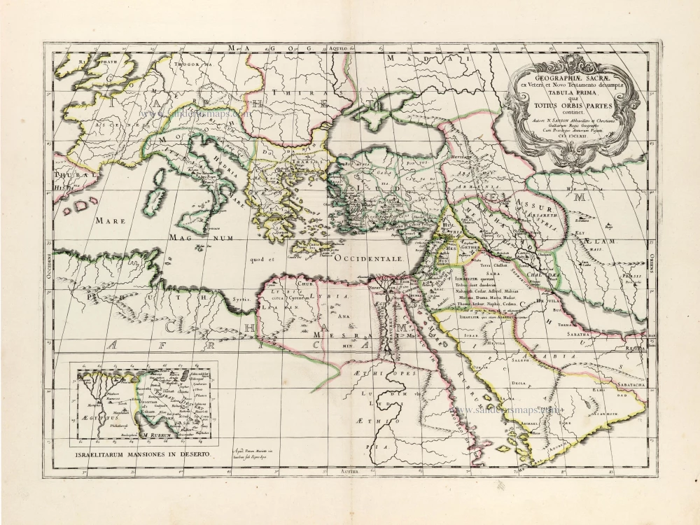
Geographiae Sacrae ex Veteri et Novo Testamento desumptae Tabula Prima, quae Totius Orbis Partet continet. 1665
Eastern Mediterranean by Nicolas Sanson, published by Pierre Mariette.
[Item number: 30075]
Parergon map
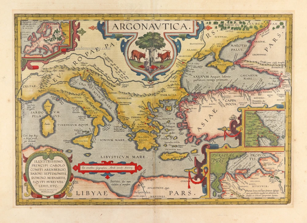
Argonautica. 1603
The roaming of Jason and his Argonauts in the Mediterranean Sea, by Abraham Ortelius.
[Item number: 30179]
Superb old colouring, heightened with gold.
Geografische Beschryvinghe van de Wandeling der Apostelen ende De Reysen Pauli, Mitsgaders de Landen ende Rijcken daer sij het Evangelium eerst hebben verkondight. ... 1663
Eastern Mediterranean Sea, by Nicolaes Visscher I.
[Item number: 30537]