
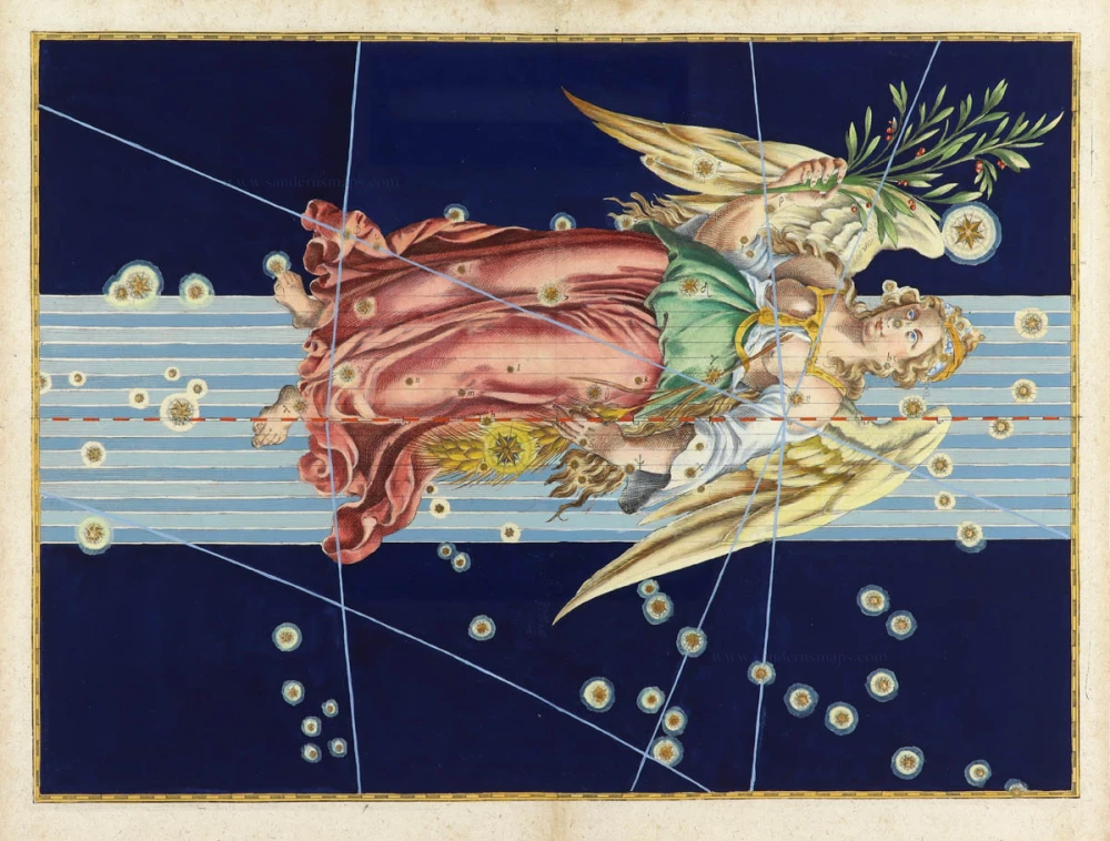
Zodiac sign of the ARIES, by John Flamsteed. 1776

John Flamsteed (1646–1719)
John Flamsteed was an English astronomer and the first Astronomer Royal of England. Appointed in 1675 by King Charles II, Flamsteed played a crucial role in improving the accuracy of celestial observations, which directly influenced the development of more precise navigation and cartography.
At the time, accurate mapping of the seas and lands was heavily dependent on the ability to determine longitude, which required precise knowledge of the positions of stars. To aid maritime navigation and improve maps, Charles II founded the Royal Greenwich Observatory, with Flamsteed as its director.
Flamsteed devoted his career to creating the first comprehensive and accurate star catalogue. Over several decades, he recorded the positions of nearly 3,000 stars, correcting errors made by earlier astronomers like Tycho Brahe and Johannes Hevelius. His meticulous observations enabled the creation of improved celestial charts, which were crucial for navigational maps used by sailors and explorers.
His most significant work, the "Historia Coelestis Britannica" (published posthumously in 1725), provided exact star positions that became fundamental for both astronomical studies and practical applications in cartography. These celestial maps and tables were used to refine sea charts, helping navigators determine their positions at sea with greater accuracy.
The Atlas Coelestis, a star atlas, was published in 1729, based on observations made by John Flamsteed. Finally, the changes in the positions of stars (the original observations were made in the 1690s) led to an update made in 1776 by the French engineer Jean Nicolas Fortin.
In summary, John Flamsteed's pioneering astronomical work significantly advanced the precision of celestial cartography and, by extension, global navigation and mapping in the late 17th and early 18th centuries.
Le Belier.
Item Number: 31835 Authenticity Guarantee
Category: Antique maps > Celestial Maps
Zodiac sign of the ARIES, by John Flamsteed.
Title: Le Belier.
Date: 1776.
Copper engraving, printed on paper.
Image size: 180 x 230mm (7 x 9 inches).
Sheet size: 220 x 255mm (8¾ x 10 inches).
Verso: blank text.
Condition: Hand coloured, excellent.
Condition Rating: A+.
From: Atlas Celeste de Flamsteed. Paris, M.J. Fortin / F.G. Deschamps, 1776.
John Flamsteed (1646–1719)
John Flamsteed was an English astronomer and the first Astronomer Royal of England. Appointed in 1675 by King Charles II, Flamsteed played a crucial role in improving the accuracy of celestial observations, which directly influenced the development of more precise navigation and cartography.
At the time, accurate mapping of the seas and lands was heavily dependent on the ability to determine longitude, which required precise knowledge of the positions of stars. To aid maritime navigation and improve maps, Charles II founded the Royal Greenwich Observatory, with Flamsteed as its director.
Flamsteed devoted his career to creating the first comprehensive and accurate star catalogue. Over several decades, he recorded the positions of nearly 3,000 stars, correcting errors made by earlier astronomers like Tycho Brahe and Johannes Hevelius. His meticulous observations enabled the creation of improved celestial charts, which were crucial for navigational maps used by sailors and explorers.
His most significant work, the "Historia Coelestis Britannica" (published posthumously in 1725), provided exact star positions that became fundamental for both astronomical studies and practical applications in cartography. These celestial maps and tables were used to refine sea charts, helping navigators determine their positions at sea with greater accuracy.
The Atlas Coelestis, a star atlas, was published in 1729, based on observations made by John Flamsteed. Finally, the changes in the positions of stars (the original observations were made in the 1690s) led to an update made in 1776 by the French engineer Jean Nicolas Fortin.
In summary, John Flamsteed's pioneering astronomical work significantly advanced the precision of celestial cartography and, by extension, global navigation and mapping in the late 17th and early 18th centuries.
Related items

[ Zodiac sign ] 1624
CAPRICORN, by Johann Bayer.
[Item number: 31723]

[ Zodiac sign ] 1624
ARIES, by Johann Bayer.
[Item number: 31724]

[ Zodiac sign ] 1624
SAGITARIUS, by Johann Bayer.
[Item number: 31725]

[ Zodiac sign ] 1624
LIBRA, by Johann Bayer.
[Item number: 31726]

[ Zodiac sign ] 1624
CANCER, by Johann Bayer.
[Item number: 31727]

[ Zodiac sign ] 1624
TAURUS, by Johann Bayer.
[Item number: 31728]

[ Zodiac sign ] 1624
AQUARIUS, by Johann Bayer.
[Item number: 31729]

[ Zodiac sign ] 1624
LEO, by Johann Bayer.
[Item number: 31730]

[ Zodiac sign ] 1624
GEMINI, by Johann Bayer.
[Item number: 31731]
[ Zodiac sign ] 1624
VIRGO, by Johann Bayer.
[Item number: 31732]

[ Zodiac sign ] 1624
SCORPIO, by Johann Bayer.
[Item number: 31733]

La Vierge 1776
Zodiac sign of the VIRGO, by John Flamsteed.
[Item number: 31831]

Les Gemeaux. 1776
Zodiac sign of the GEMINI, by John Flamsteed.
[Item number: 31833]

Les Poissons. 1776
Zodiac sign of the PISCES, by John Flamsteed.
[Item number: 31834]

Le Cancer. 1776
Zodiac sign of the CANCER, by John Flamsteed.
[Item number: 31836]

Le Capricorne, et le Verseau. 1776
Zodiac sign of the CAPRICORN and AQUARIUS, by John Flamsteed.
[Item number: 31837]

La Balance, et le Scorpion. 1776
Zodiac sign of the LIBRA and SCORPIO, by John Flamsteed.
[Item number: 31838]

Le Sagittaire. 1776
Zodiac sign of the SAGITARIUS, by John Flamsteed.
[Item number: 31839]