
Atlas Title Page, by Abraham Ortelius. 1603
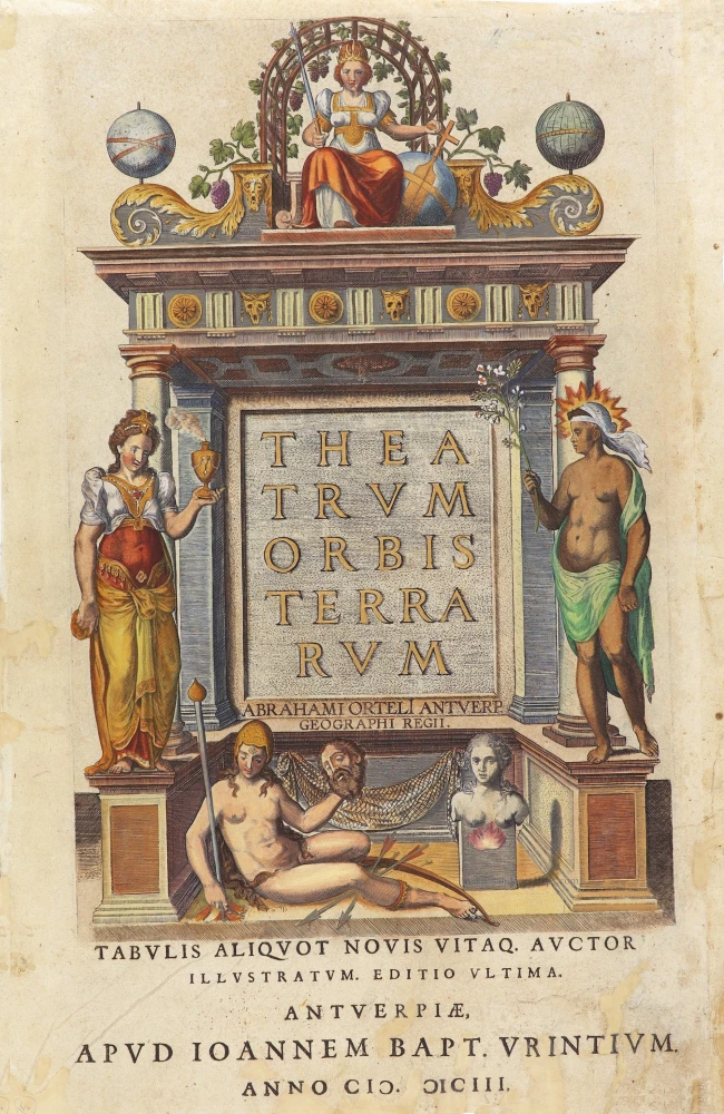
At the top is Catholic Europe, crowned and enthroned. She holds a sceptre and an orb, the latter with a cross signifying her Christian religion and a rudder intimating her control over the affairs of the world. The arch or arbour in which she is seated is decked with vine leaves and clusters of grapes, further symbols of the Christian Eucharist.
To her right (on the left of the title) is the figure of Asia holding a thurible. The aromatic fumes from it suggest an oriental mystery. Opposite her is a black figure, who represents Africa, burnt black by the sun. Her head glows with the heat, and in her right hand is a sprig of balsam whose unique provenance was considered Egypt. At the foot of the frontispiece is a naked South American woman with a hammock with arms and hunting equipment appropriate to her status as an Amazonian warrior. The severed head suggests cannibalistic practices, elaborated in more detail in the accompanying poem based on Hans Staden's 1557 description of the Tupinamba Indians in Brazil, where he was held captive for nine months. Finally, there is a puzzling truncated bust. This is Magellanica, the terra incognita or unexplored virgin land on either side of Magellan's Strait. The fire beneath the bust corresponds to the fire sighted by Magellan and the lands named Tierra del Fuego or Magellanica. (Shirley)
Abraham Ortelius (1527-1598)
The maker of the 'first atlas', the Theatrum Orbis Terrarum (1570), was born on 4 April 1527 into an old Antwerp family. He learned Latin and studied Greek and mathematics.
Abraham and his sisters Anne and Elizabeth took up map colouring. He was admitted to the Guild of St. Luke as an "illuminator of maps." Besides colouring maps, Ortelius was a dealer in antiques, coins, maps, and books, with the book and map trade gradually becoming his primary occupation.
Business went well because his means permitted him to start an extensive collection of medals, coins, antiques, and a library of many volumes. In addition, he travelled a lot and visited Italy and France, made contacts everywhere with scholars and editors, and maintained extensive correspondence with them.
In 1564 he published his first map, a large and ambitious world wall map. The inspiration for this map may well have been Gastaldi's large world map. In 1565 he published a map of Egypt and a map of the Holy Land, a large map of Asia followed.
In 1568 the production of individual maps for his atlas Theatrum Orbis Terrarum was already in full swing. He completed the atlas in 1569, and in May of 1570, the Theatrum was available for sale. It was one of the most expensive books ever published.
This first edition contained seventy maps on fifty-three sheets. Franciscus Hogenberg engraved the maps.
Later editions included Additamenta (additions), resulting in Ortelius' historical atlas, the Parergon, mostly bound together with the atlas. The Parergon can be called a truly original work of Ortelius, who drew the maps based on his research.
The importance of the Theatrum Orbis Terrarum for geographical knowledge in the last quarter of the sixteenth century is difficult to overemphasize. Nothing was like it until Mercator's atlas appeared twenty-five years later. Demand for the Theatrum was remarkable. Some 24 editions appeared during Ortelius's lifetime and another ten after his death in 1598. Editions were published in Dutch, German, French, Spanish, English, and Italian. The number of map sheets grew from 53 in 1570 to 167 in 1612 in the last edition.
In 1577, engraver Philip Galle and poet-translator Pieter Heyns published the first pocket-sized edition of the Theatrum, the Epitome. The work was trendy. Over thirty editions of this Epitome were published in different languages.
Theatrum Orbis Terrarum.
Item Number: 29285 Authenticity Guarantee
Category: Antique maps > Curiosities
Atlas Title Page, by Abraham Ortelius.
Title: Theatrum Orbis Terrarum.
Abraham Orteli Antwerp. Geographi Regii.
Date of the first edition: 1570.
Date of this map: 1603.
Date on map: 1603.
Copper engraving, printed on paper.
Map size: 355 x 230mm (13.98 x 9.06 inches).
Sheet size: 435 x 285mm (17.13 x 11.22 inches).
Verso: Latin text.
Condition: Hand coloured, restored.
Condition Rating: C.
From: Theatrum Orbis Terrarum Abrahami Ortelii Antverp. Geographi Regii. Antwerpen, J.B. Vrients, 1603. (Van der Krogt 3, 1:053)
At the top is Catholic Europe, crowned and enthroned. She holds a sceptre and an orb, the latter with a cross signifying her Christian religion and a rudder intimating her control over the affairs of the world. The arch or arbour in which she is seated is decked with vine leaves and clusters of grapes, further symbols of the Christian Eucharist.
To her right (on the left of the title) is the figure of Asia holding a thurible. The aromatic fumes from it suggest an oriental mystery. Opposite her is a black figure, who represents Africa, burnt black by the sun. Her head glows with the heat, and in her right hand is a sprig of balsam whose unique provenance was considered Egypt. At the foot of the frontispiece is a naked South American woman with a hammock with arms and hunting equipment appropriate to her status as an Amazonian warrior. The severed head suggests cannibalistic practices, elaborated in more detail in the accompanying poem based on Hans Staden's 1557 description of the Tupinamba Indians in Brazil, where he was held captive for nine months. Finally, there is a puzzling truncated bust. This is Magellanica, the terra incognita or unexplored virgin land on either side of Magellan's Strait. The fire beneath the bust corresponds to the fire sighted by Magellan and the lands named Tierra del Fuego or Magellanica. (Shirley)
Abraham Ortelius (1527-1598)
The maker of the 'first atlas', the Theatrum Orbis Terrarum (1570), was born on 4 April 1527 into an old Antwerp family. He learned Latin and studied Greek and mathematics.
Abraham and his sisters Anne and Elizabeth took up map colouring. He was admitted to the Guild of St. Luke as an "illuminator of maps." Besides colouring maps, Ortelius was a dealer in antiques, coins, maps, and books, with the book and map trade gradually becoming his primary occupation.
Business went well because his means permitted him to start an extensive collection of medals, coins, antiques, and a library of many volumes. In addition, he travelled a lot and visited Italy and France, made contacts everywhere with scholars and editors, and maintained extensive correspondence with them.
In 1564 he published his first map, a large and ambitious world wall map. The inspiration for this map may well have been Gastaldi's large world map. In 1565 he published a map of Egypt and a map of the Holy Land, a large map of Asia followed.
In 1568 the production of individual maps for his atlas Theatrum Orbis Terrarum was already in full swing. He completed the atlas in 1569, and in May of 1570, the Theatrum was available for sale. It was one of the most expensive books ever published.
This first edition contained seventy maps on fifty-three sheets. Franciscus Hogenberg engraved the maps.
Later editions included Additamenta (additions), resulting in Ortelius' historical atlas, the Parergon, mostly bound together with the atlas. The Parergon can be called a truly original work of Ortelius, who drew the maps based on his research.
The importance of the Theatrum Orbis Terrarum for geographical knowledge in the last quarter of the sixteenth century is difficult to overemphasize. Nothing was like it until Mercator's atlas appeared twenty-five years later. Demand for the Theatrum was remarkable. Some 24 editions appeared during Ortelius's lifetime and another ten after his death in 1598. Editions were published in Dutch, German, French, Spanish, English, and Italian. The number of map sheets grew from 53 in 1570 to 167 in 1612 in the last edition.
In 1577, engraver Philip Galle and poet-translator Pieter Heyns published the first pocket-sized edition of the Theatrum, the Epitome. The work was trendy. Over thirty editions of this Epitome were published in different languages.
Related items
Exceptional nice old colour. Heightened in gold.
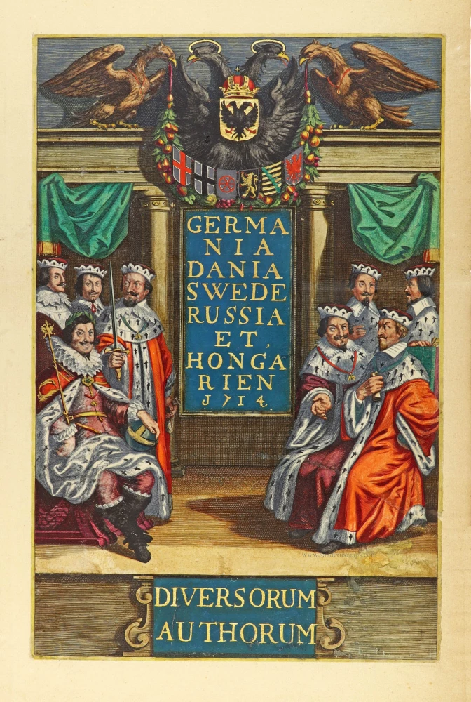
Germania Dania Swede Russia et Hongarien 1714. - Diversorum Authorum. 1714
Joannes Janssonius, title page
[Item number: 30095]

De Praecipuis, Totius Universi Urbibus Liber Secundus. 1575-1612
Georg Braun & Frans Hogenberg, allegorical atlas title page of the second part.
[Item number: 30096]