
Adriatic Sea by Münster S. 1571

Strabo (c. 63 BC - c. 21 AD)
Strabo was a Greek geographer and historian who travelled in Europe, Africa and Asia and influenced later geographers. He compiled the Geographia, a world geography presenting a descriptive history of people and places from different regions of the world known during his lifetime.
His work was first published in 1469, and many later editions followed in the 15th and 16th centuries, some of them illustrated with Ptolemy maps.
Claudius Ptolemy (c.100 – c.170 AD)
Sebastian Münster (1488-1552)
Sebastian Münster, a German geographer, cartographer, Hebraist, and theologian, was born in Ingelheim, near Mainz In 1505, he went to Heidelberg to enter the Franciscan order. In 1507 he went to Louvain, where he studied mathematics, geography, and astronomy. In 1509 Münster became a student of Konrad Pelikan, who taught Hebrew and Greek as well as mathematics and cosmography. In 1518 he completed his studies at the University of Tübingen. He was the favorite of the famous mathematician and astronomer Johann Stöffler.
In 1524 Münster was appointed professor of Hebrew at Heidelberg University. In 1525 he published his first map as part of a broadside: The Instrument of the Suns combined a map, calendar, astrological almanac, sundial, and nocturnal on one attractive sheet, suitable for wall mounting.
In 1540 he published a Latin edition of Ptolemy's Geographia with illustrations. He based this edition on the Latin translation by Willibald Pirkheimer and produced new maps to supplement the Ptolemaic maps. The twenty-seven maps of the Ptolemaic canon are supplemented by twenty-one new maps. Further editions appeared in 1541 and 1542.
In 1544 he published the Cosmographia, a bulky book with 659 pages and some 520 woodcuts. Maps in this edition included three maps from the Ptolemaic canon and fourteen modern maps (from previous editions of the Geographia), as well as nine new maps. Later editions (1545, 1546, 1548) enlarged the Cosmographia. The 1550 edition contains cities, portraits, and costumes. These editions in both Latin and German constitute the full fruition of Münster's dream of a comprehensive geography.
The Cosmographia was one of the most successful works of the 16th century. It passed through 24 editions in 100 years, in different languages, including Latin, French, Italian, English, and even Czech. The last German edition was published in 1628.
He died at Basel of the plague in 1552.
As a cartographer, Münster deserves special recognition for formulating a plan for a comprehensive and uniform map of a country. As a geographer, his greatest achievement was the Cosmographia. (Karrow).
Tabula Rhaetiae et Vindeliciae.
Item Number: 29054 Authenticity Guarantee
Category: Antique maps > Europe > Austria
Old antique map of Switzerland and the northern coast of the Adriatic Sea, by Strabo - S. Munster.
Title: Tabula Rhaetiae et Vindeliciae.
Cartographer: Claudius Ptolemy.
Date of the first edition: 1540.
Date of this map: 1571.
Woodcut, printed on paper.
Map size: 275 x 345mm (10.83 x 13.58 inches).
Sheet size: 325 x 405mm (12.8 x 15.94 inches).
Verso: Latin text.
Condition: Excellent.
Condition Rating: A+.
From: Strabo, Rerum Geographicum Libri Septemdecim. Basel, Heinrich Petri, 1571.
Strabo (c. 63 BC - c. 21 AD)
Strabo was a Greek geographer and historian who travelled in Europe, Africa and Asia and influenced later geographers. He compiled the Geographia, a world geography presenting a descriptive history of people and places from different regions of the world known during his lifetime.
His work was first published in 1469, and many later editions followed in the 15th and 16th centuries, some of them illustrated with Ptolemy maps.
Claudius Ptolemy (c.100 – c.170 AD)
Sebastian Münster (1488-1552)
Sebastian Münster, a German geographer, cartographer, Hebraist, and theologian, was born in Ingelheim, near Mainz In 1505, he went to Heidelberg to enter the Franciscan order. In 1507 he went to Louvain, where he studied mathematics, geography, and astronomy. In 1509 Münster became a student of Konrad Pelikan, who taught Hebrew and Greek as well as mathematics and cosmography. In 1518 he completed his studies at the University of Tübingen. He was the favorite of the famous mathematician and astronomer Johann Stöffler.
In 1524 Münster was appointed professor of Hebrew at Heidelberg University. In 1525 he published his first map as part of a broadside: The Instrument of the Suns combined a map, calendar, astrological almanac, sundial, and nocturnal on one attractive sheet, suitable for wall mounting.
In 1540 he published a Latin edition of Ptolemy's Geographia with illustrations. He based this edition on the Latin translation by Willibald Pirkheimer and produced new maps to supplement the Ptolemaic maps. The twenty-seven maps of the Ptolemaic canon are supplemented by twenty-one new maps. Further editions appeared in 1541 and 1542.
In 1544 he published the Cosmographia, a bulky book with 659 pages and some 520 woodcuts. Maps in this edition included three maps from the Ptolemaic canon and fourteen modern maps (from previous editions of the Geographia), as well as nine new maps. Later editions (1545, 1546, 1548) enlarged the Cosmographia. The 1550 edition contains cities, portraits, and costumes. These editions in both Latin and German constitute the full fruition of Münster's dream of a comprehensive geography.
The Cosmographia was one of the most successful works of the 16th century. It passed through 24 editions in 100 years, in different languages, including Latin, French, Italian, English, and even Czech. The last German edition was published in 1628.
He died at Basel of the plague in 1552.
As a cartographer, Münster deserves special recognition for formulating a plan for a comprehensive and uniform map of a country. As a geographer, his greatest achievement was the Cosmographia. (Karrow).
Related items

Very rare.
Raetiae veteris et exterae pars Orientalis, qua Comitatus Tyrolis cum Regionibus finitimis, continetur. 1616
Switzerland - Eastern Rhaetia by Matthias Hirtzgarter.
[Item number: 31190]
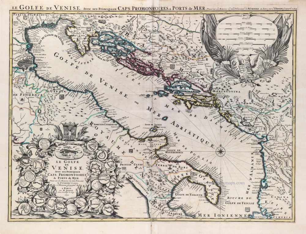
Le Golfe de Venise, avec les Principaux Caps, Promontoires, & Ports de Mer. 1692
Adriatic Sea, cartouche with a bird's-eye view of Venice and 22 plans of fortified cities, by N. Sanson after Vincenzo Coronelli. So-called published by Hubert Jaillot. (Pirated edition by Pierre Mortier).
[Item number: 31203]

L'Elvezia divisa ne suoi tredici cantoni e suoi Alleati 1779-1785
Switzerland, by Antonio Zatta.
[Item number: 31893]

Parte Occidentale dell' Elvezia Divisa ne' suoi Cantoni [and] Parte Orientale dell' Elvezia 1779-1785
Switzerland in two maps, by Antonio Zatta.
[Item number: 31894]

La Suisse. 1633
Switzerland by Christophe Tassin.
[Item number: 32007]

Tabula Geographica qua pars Meridionalis sive Superior Rheni, Mosae, et Mosellae, ac minores influentes Fluvii nec non mediae partes Archiepiscopatus et Electoratus Moguntini et Palatinatus Rheni, Lotharingia Helvetia Alsatia Suevia Ducatus et Comitatus Burgindiae, aliaque Galliae et Italiae c. 1695
Switzerland, Eastern France, and south-western Germany, by N. Visscher
[Item number: 32630]

L' Helvetia o Paese de Suizzeri con li Stati, che sono à medesimi collegati, e sogetti 1686
Switzerland by Giacomo Cantelli da Vignola, published by Giovanni de Rossi.
[Item number: 32901]