
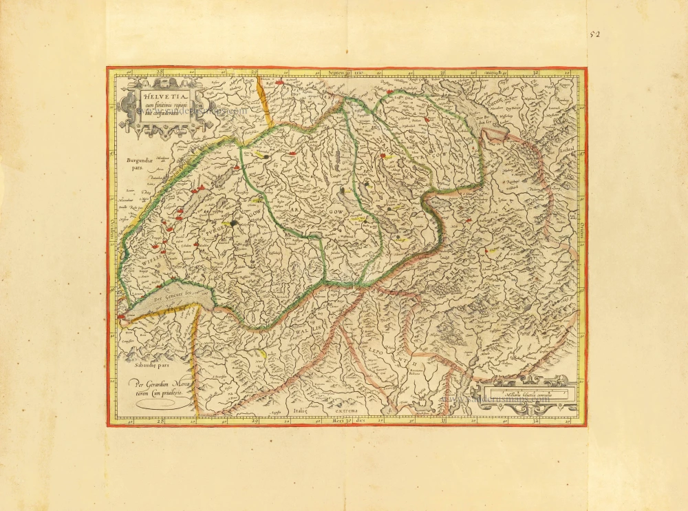
Early Tavernier with an exclusive text beneath. RARE!
Switzerland by Melchior Tavernier. c. 1630-1650
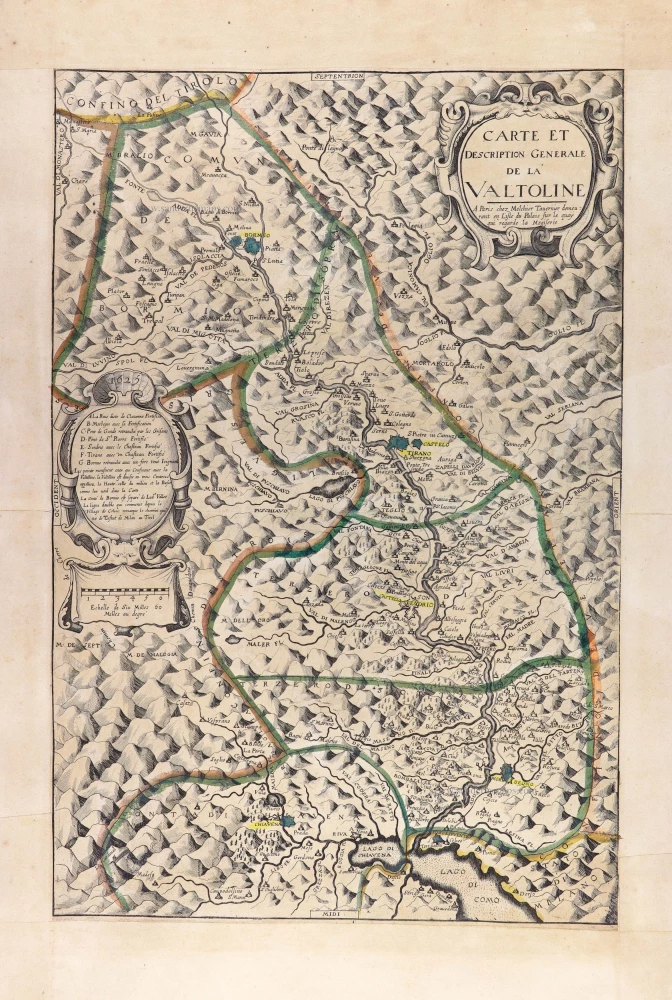
According to Fordham (in Phillips, IV, p. 463, 5222/88), this map is, along with the Carte et Description Générale de la Valtoline, Tavernier's two earliest printed maps.
Rare - Not recorded by Sceffer.
The Tavernier Family.
Engravers, booksellers and publishers in Paris.
There were two Melchiors; they flourished concurrently, making their contribution impossible to distinguish.
Melchior Tavernier I, the elder (1564-1641)
Gabriel Tavernier (1566-1610)
Flemish engraver.
Melchior Tavernier II, the younger (1594-1665)
Son of Gabriel Tavernier. Engraver, mapseller and publisher 'dans l'Isle du Palais à la Sphère Royale', Paris.
He sold the works of Hondius, Janssonius and Willem Blaeu as some of the earliest published works of Nicolas Sanson. He sold most of his plates and equipment to Pierre Mariette in 1644.
Jean Bapitiste Tavernier (1605-1689)
He was the brother of Melchior and later became a merchant, diplomat, and traveller in Turkey, Persia, Central Asia, and the East Indies.
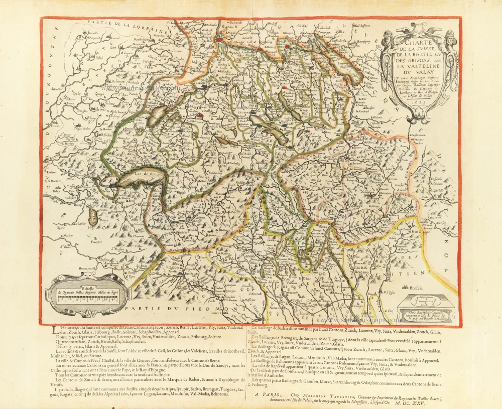
Charte de la Suisse, de la Rhetie, ou des Grisons, de la Valtelin, du Valay,
Item Number: 30851 Authenticity Guarantee
Category: Antique maps > Europe > Italy
Switzerland by Melchior Tavernier.
Title: Charte de la Suisse, de la Rhetie, ou des Grisons, de la Valtelin, du Valay,
In the lower margin, a printed text explaining Switzerland's composition is followed by M. Tavernier's imprint and the date M.DC.XXV [1625].
Cartographer: Gaspar Baudouin.
Engraver: Melchior Tavernier.
Date of the first edition: 1625.
Date of this map: c. 1625.
Date on map: 1625.
Copper engraving, printed on thick paper.
Image size: 380 x 515mm (14.96 x 20.28 inches).
Sheet size: 505 x 690mm (19.88 x 27.17 inches).
Verso: Blank.
Condition: Original coloured, side margins extended; excellent.
Condition Rating: A+.
From a French Composite Atlas, c. 1630-1650.
Appeared in: Theatre geographique du royaume de France. Paris, M. Tavernier, 1632. (Pastoureau, II A)
According to Fordham (in Phillips, IV, p. 463, 5222/88), this map is, along with the Carte et Description Générale de la Valtoline, Tavernier's two earliest printed maps.
Rare - Not recorded by Sceffer.
The Tavernier Family.
Engravers, booksellers and publishers in Paris.
There were two Melchiors; they flourished concurrently, making their contribution impossible to distinguish.
Melchior Tavernier I, the elder (1564-1641)
Gabriel Tavernier (1566-1610)
Flemish engraver.
Melchior Tavernier II, the younger (1594-1665)
Son of Gabriel Tavernier. Engraver, mapseller and publisher 'dans l'Isle du Palais à la Sphère Royale', Paris.
He sold the works of Hondius, Janssonius and Willem Blaeu as some of the earliest published works of Nicolas Sanson. He sold most of his plates and equipment to Pierre Mariette in 1644.
Jean Bapitiste Tavernier (1605-1689)
He was the brother of Melchior and later became a merchant, diplomat, and traveller in Turkey, Persia, Central Asia, and the East Indies.
Related items
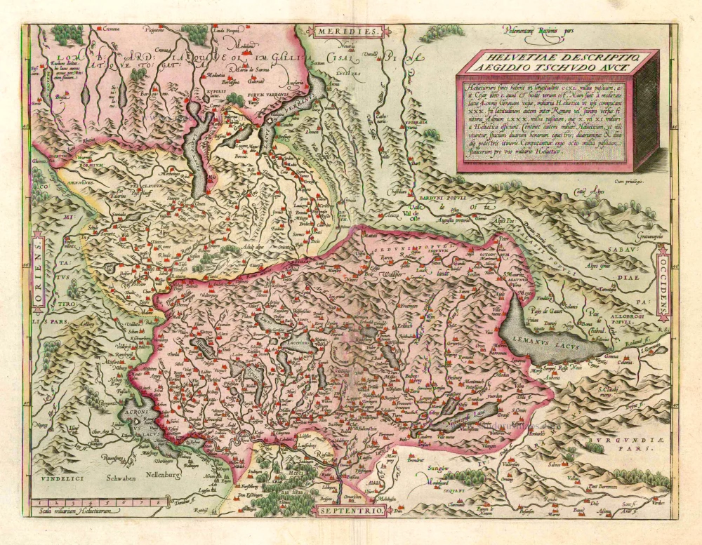
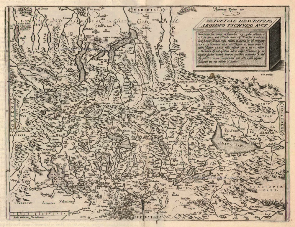
Helvetiae Descriptio Aegidio Tschudo Auct. 1598
Switzerland, by Abraham Ortelius.
[Item number: 3868]
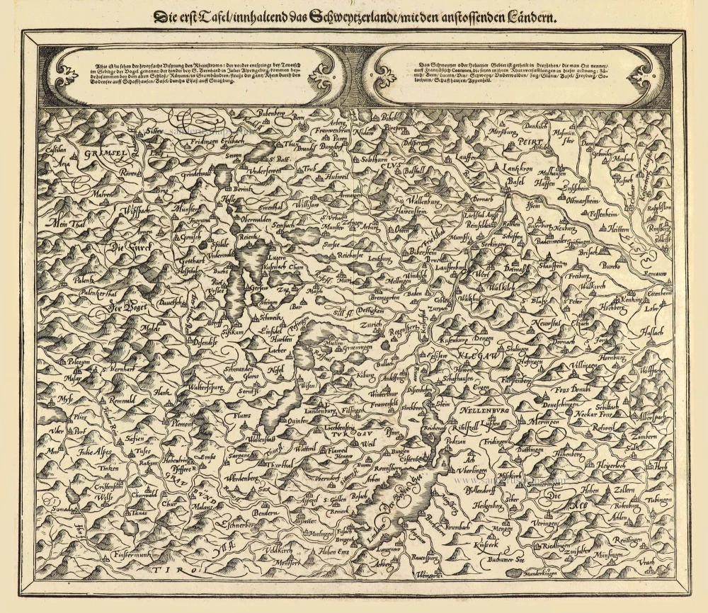
Die erst Tafel innhaltend das Schweytzerlandt mit den anstossenden Ländern. 1588
Switzerland by Sebastian Münster.
[Item number: 14631]
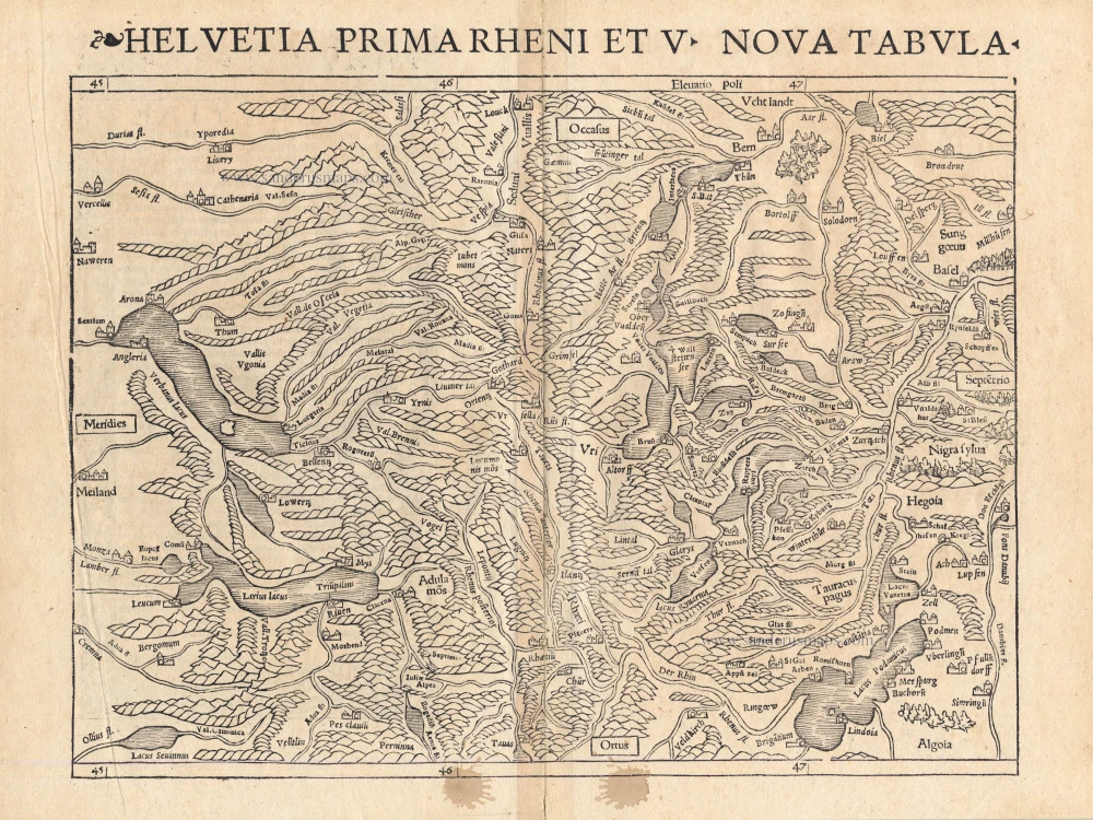
Helvetia Prima Rheni et V Nova Tabula. 1542
Switzerland by Sebastian Munster.
[Item number: 14925]
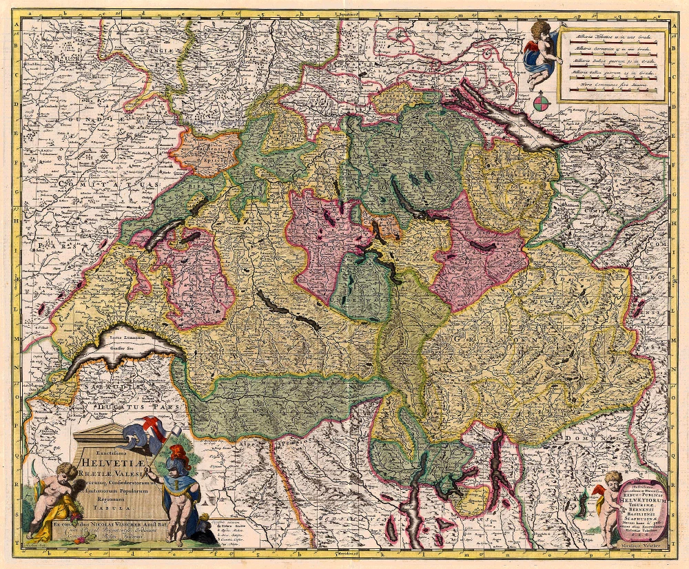
Exactissima Helvetiae Rhaetiae, Valesiae ... 1683-1696
Switzerland, by Visscher N.
[Item number: 18692]
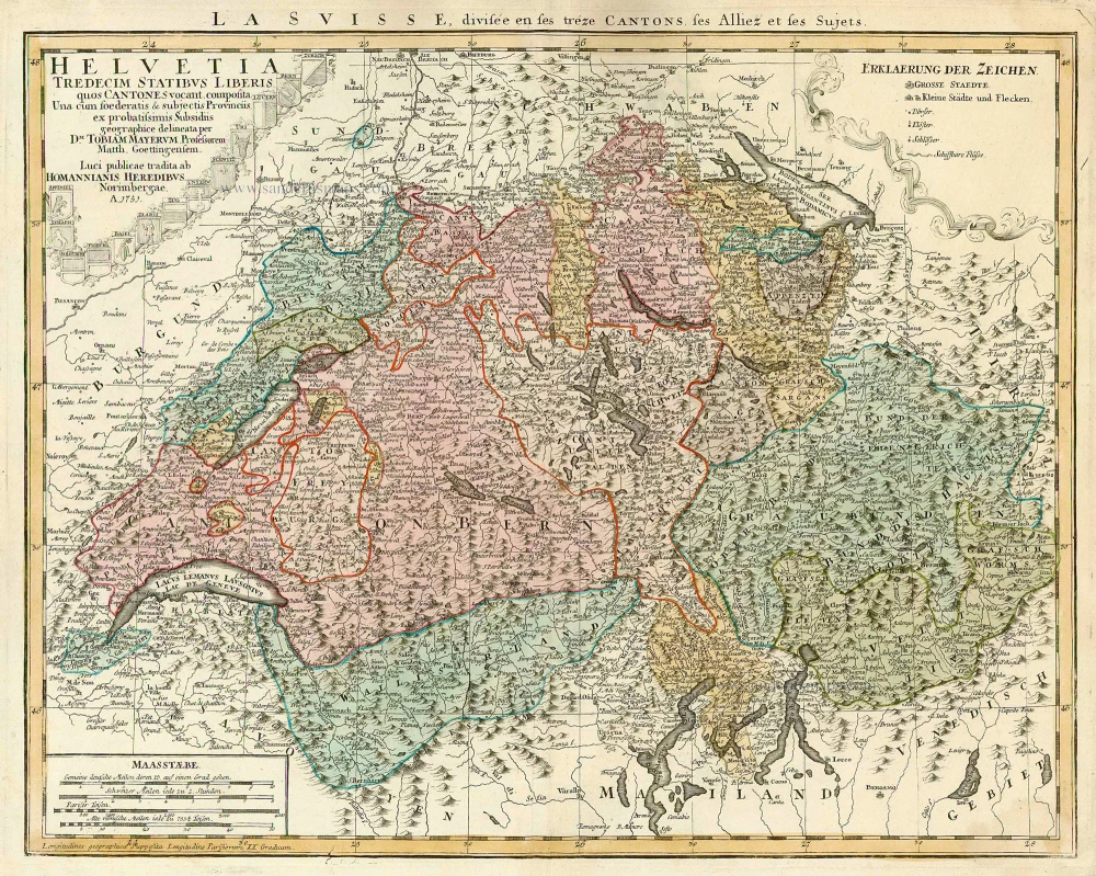
Helvetia Tredecim Statibus Liberis quos Cantones vocant Composita ... c. 1757.
Switzerland, by Homann Heirs.
[Item number: 22480]
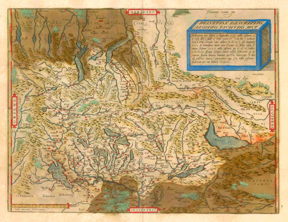
Helvetiae Descriptio Aegidio Tschudo Auct. 1612
Switzerland, by Ortelius A.
[Item number: 22945]
Helvetiae Descriptio Aegidio Tschudo Auct. 1579
SWITZERLAND by Abraham Ortelius
[Item number: 23164]
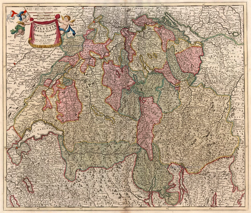
Novissima et Acuratissima Helvetiae, Rhaetiae, Valesiae et Partis Sabaudiae Tabula 1756
Antique map of Switzerland by Ottens R. & J.
[Item number: 23506]
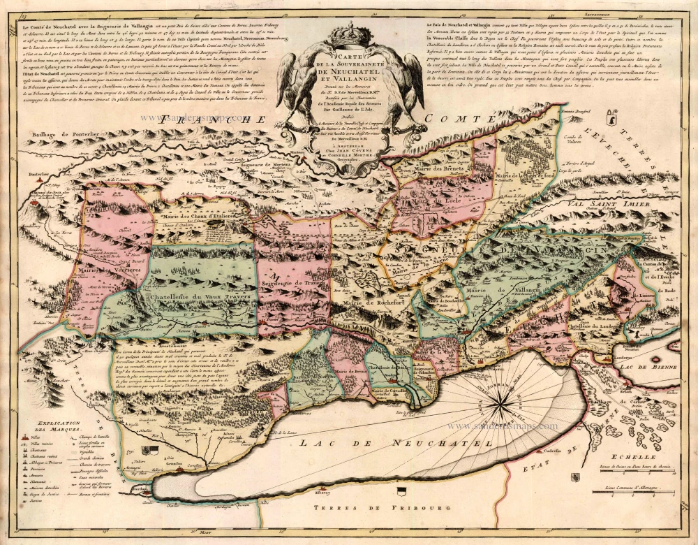
Carte de la Souverainete de Neuchatel et Vallangin ... 1721-41
Switzerland - Lake of Neuchâtel by Guillaume Delisle, published by Covens & Mortier.
[Item number: 23877]
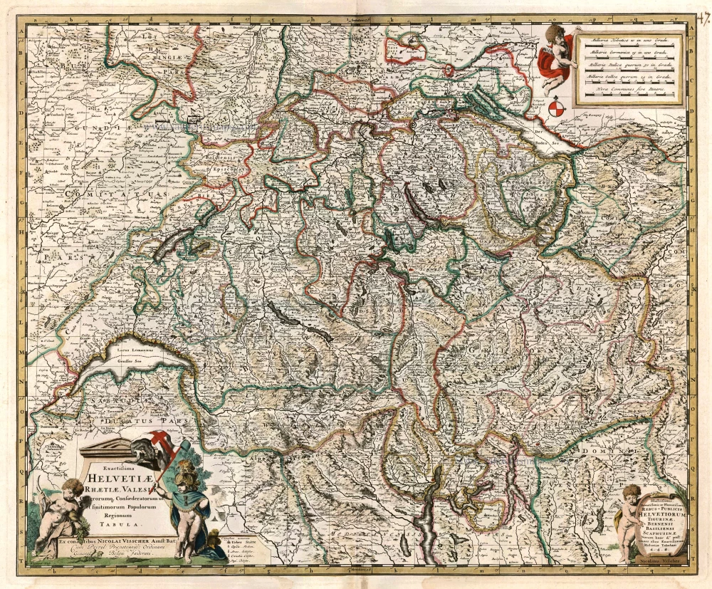
Exactissima Helvetiae Rhaetiae, Valesiae C. terorumq Confoederatorum ut et finitimorum Populorum Regionum Tabula. c. 1680
Switzerland by Nicolaas Visscher.
[Item number: 24384]
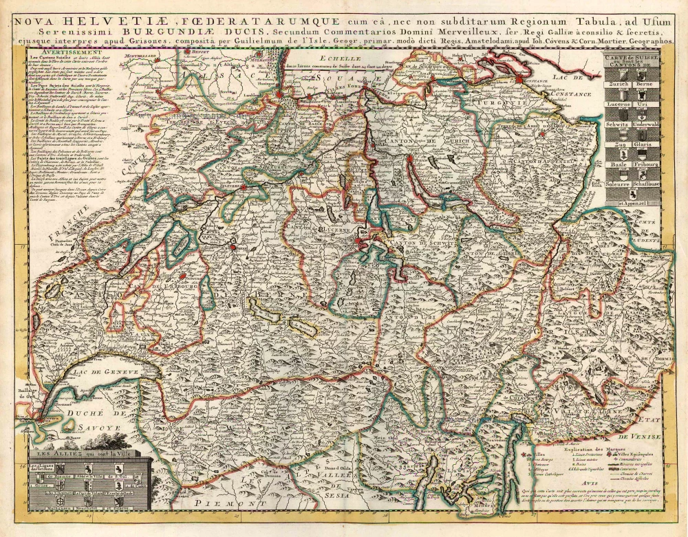
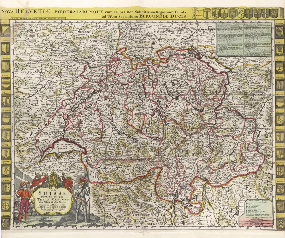
Nova Helvetiae, Foederatarumque cum ea, nec non Subditarum Regionum Tabula ... 1730
Switzerland by Guillaume Delisle, published by Covens & Mortier.
[Item number: 25699]
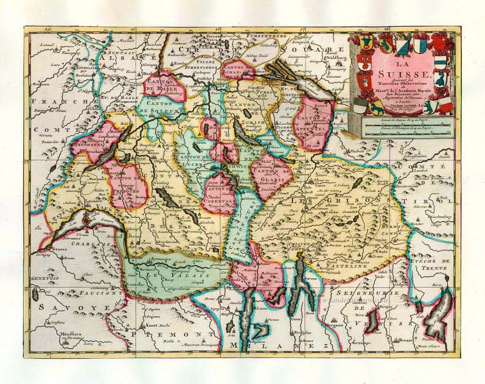
La Suisse. 1713
Switzerland, by Pieter Van der Aa.
[Item number: 26174]
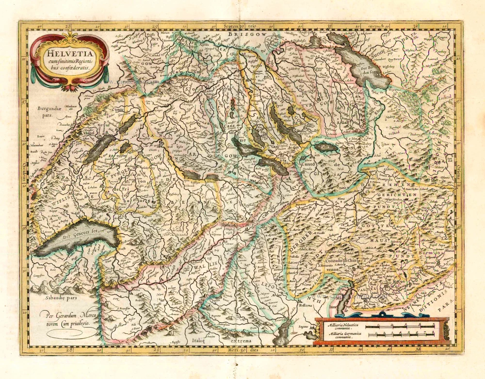
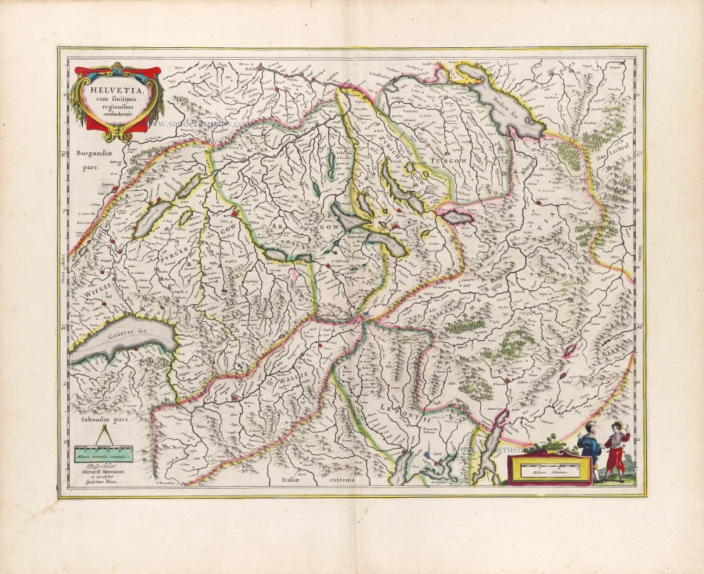
Helvetia cum finitimis regionibus confoederatis. 1641
Switzerland, by Henricus Hondius
[Item number: 26292]
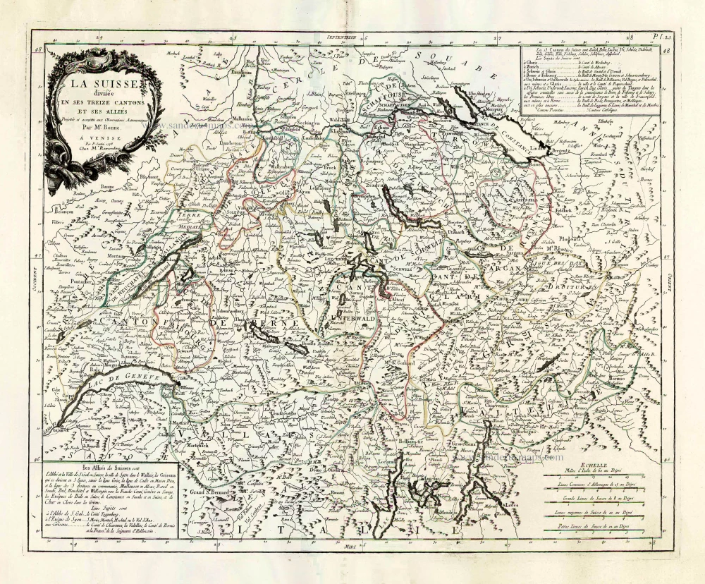
La Suisse Divisee en ses Treize Cantons et ses Allies. 1776-79
Switzerland, by Francesco Santini.
[Item number: 26957]

Zurichgow. [Lettering in lower right quadrant.] 1628.
Northern Switzerland, by Gerard Mercator.
[Item number: 27450]
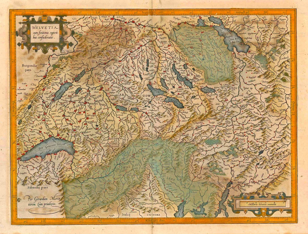
Helvetia cum finitimis regionibus confoederatis. 1623
Switzerland, by Gerard Mercator.
[Item number: 27884]
Nova Helvetiae Tabula. c. 1634
Switzerland, by Jodocus Hondius.
[Item number: 28003]
Ta . Here . Helve. [From verso] 1525
Switzerland by Lorenz Fries.
[Item number: 28199]
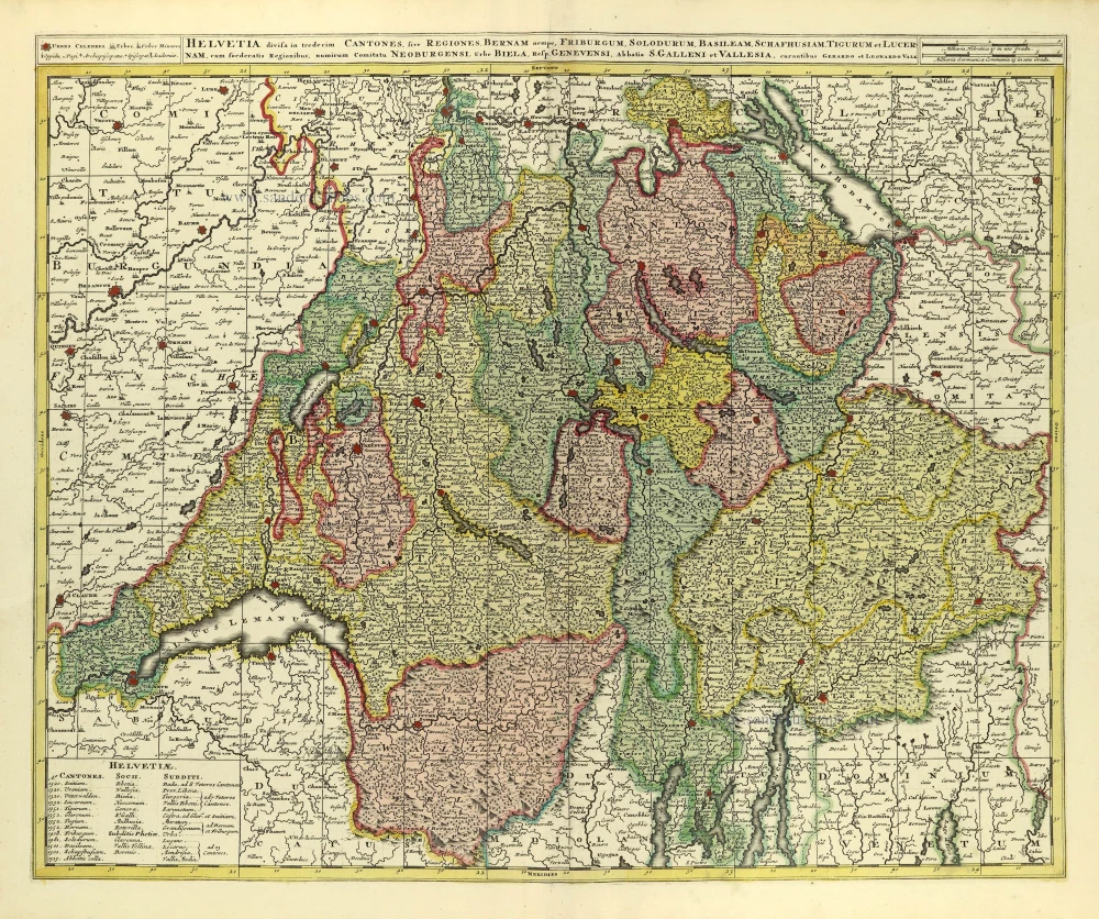
Helvetia Divisa in Tredicem Cantones sive Regiones, Bernam nempe Fruburgum, Solodurum, Basileam, Schafhusiam; Tigurum et Lucernam, cum foederatis Regionibus, numirum Comitatu Neoburgensi, urbe Biela, Resp. Genevensi Abbatia S. Galleni et Vallesia. c. 1702
Switzerland by Gerard & Leonard Valck.
[Item number: 28270]
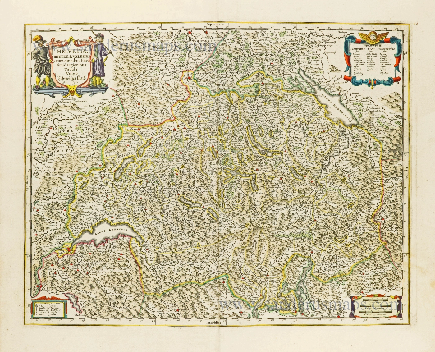
Helvetiae Rhetiae & Valesiae cum omnibus finitimis regionibus Tabula Vulgo Schweitzerland. c. 1678
Switzerland by Johannes Janssonius.
[Item number: 28538]
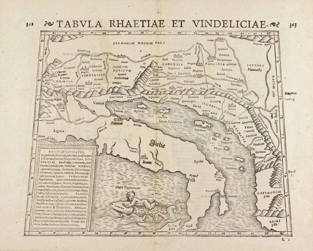
Tabula Rhaetiae et Vindeliciae. 1571
Adriatic Sea by Münster S.
[Item number: 29054]
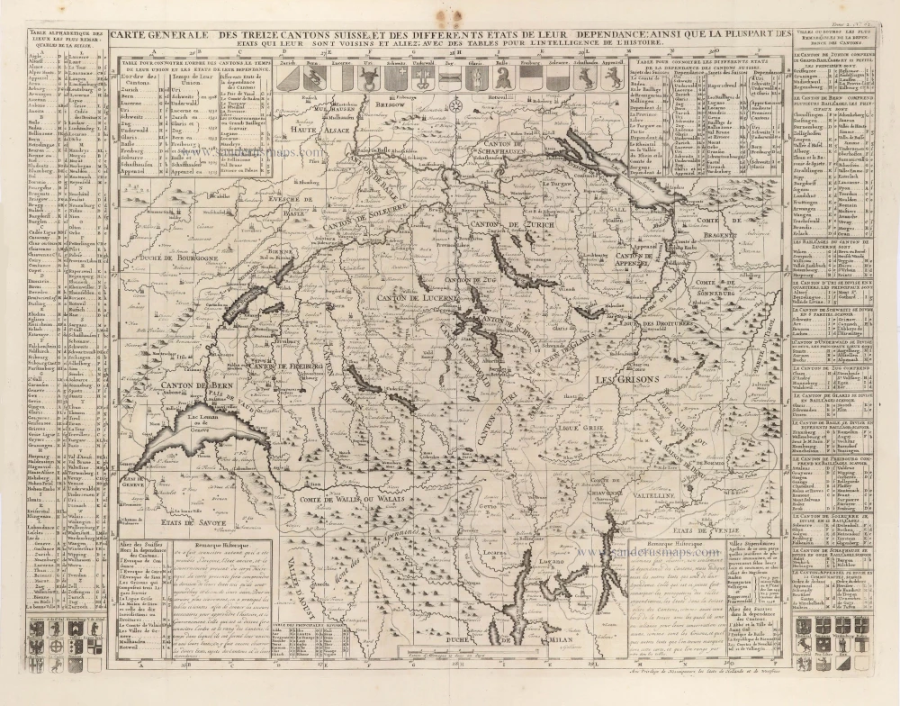
Carte Générale des treize Cantons Suisse, et des différents Etats de leur Dépendance; ainsi que la pluspart des Etats qui leur sont voisins et aliez; avec des tables pour l'intelligence de l'Histoire. 1708
Switzerlandx, by Zacharias Châtelain.
[Item number: 29444]
La Suisse divisée en ses Treze Cantons, Ses Alliez & Ses Sujets, c. 1709
Switzerland by Hubert Jaillot, published by Pierre Mortier.
[Item number: 29566]
Helvetia cum finitimis Regionibus confoederatis. 1643
Switzerland by Willem Blaeu.
[Item number: 29928]
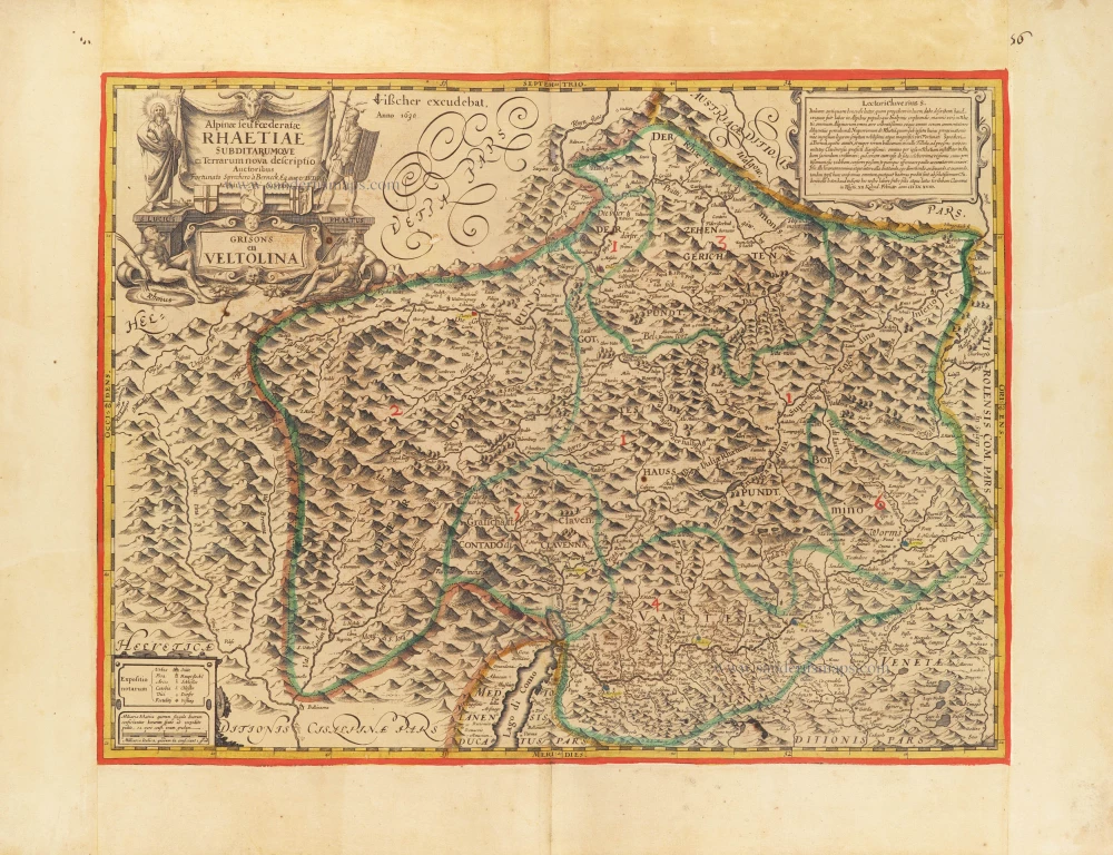
The first modern map of the Canton of Graubunden.
Alpinae seu foederatae Rhaetiae subdirarumque ei Terrarum nova descriptio. Grisons en Veltolina. 1630
Italian and Swiss Alps by C.J. Visscher, after Philipp Cluverius.
[Item number: 30936]
Very rare.
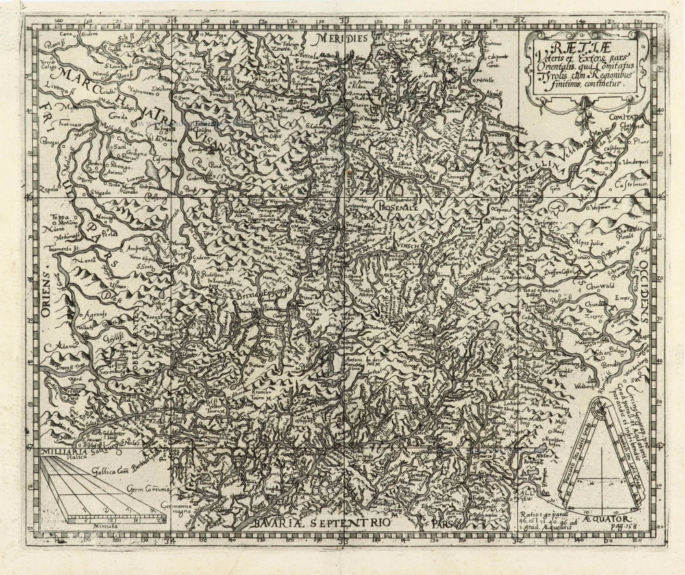
Raetiae veteris et exterae pars Orientalis, qua Comitatus Tyrolis cum Regionibus finitimis, continetur. 1616
Switzerland - Eastern Rhaetia by Matthias Hirtzgarter.
[Item number: 31190]
Important and rare map
Carte et description generale de la Valtoline. c. 1630-1650
Valtellina by Melchior Tavernier.
[Item number: 31209]
Helvetia cum finitimis regionibus confoederatis. c. 1610-1650
Switzerland, by Gerard Mercator.
[Item number: 31211]

Helvetia. 1618
Switzerland by Petrus Bertius, published by Jodocus Hondius II.
[Item number: 31585]
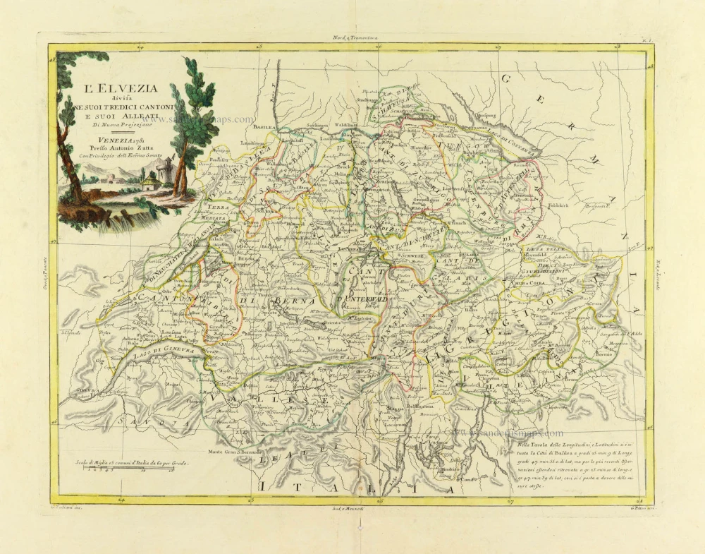
L'Elvezia divisa ne suoi tredici cantoni e suoi Alleati 1779-1785
Switzerland, by Antonio Zatta.
[Item number: 31893]

Parte Occidentale dell' Elvezia Divisa ne' suoi Cantoni [and] Parte Orientale dell' Elvezia 1779-1785
Switzerland in two maps, by Antonio Zatta.
[Item number: 31894]

La Suisse. 1633
Switzerland by Christophe Tassin.
[Item number: 32007]