
Switzerlandx, by Zacharias Châtelain. 1708

The Châtelain Family
Zacharias Châtelain (1684-1743) was a bookseller and publisher of Amsterdam. He was succeeded by his sons Zacharias jr and Henry Abraham. The Châtelain family was best known for the historical atlas Atlas Historique, ou nouvelle introduction à l’histoire…, a major work of its time. It was an encyclopaedia in seven volumes, including geography as one of its main subjects. The atlas was published in Amsterdam in seven volumes in various editions with different imprints from 1705 to 1739. An anonym person (Mr. C***) compiled the work with compositions of text, maps, plates and chronological and genealogical tables by Gueudeville, except volume 7, where H.P. Limiers took over this task. The maps were made mainly after the work of Guillaume de l'Isle.
The 1705 edition was published with the imprint “L’Honoré & Châtelain”. Later editions had the imprint: “les Frères Châtelain Libraires” or “L’Honoré & Châtelain Libraires”.
Carte Générale des treize Cantons Suisse, et des différents Etats de leur Dépendance; ainsi que la pluspart des Etats qui leur sont voisins et aliez; avec des tables pour l'intelligence de l'Histoire.
Item Number: 29444 Authenticity Guarantee
Category: Antique maps > Europe > Switzerland
Old, antique map of Switzerland, by Zacharias Châtelain.
Title: Carte Générale des treize Cantons Suisse, et des différents Etats de leur Dépendance; ainsi que la pluspart des Etats qui leur sont voisins et aliez; avec des tables pour l'intelligence de l'Histoire.
Tome 2. N° 62.
Avec Privilege de Nosseigneurs les Etats de Hollande et de Westfrise.
Date of the first edition: 1708.
Date of this map: 1708.
Copper engraving, printed on paper.
Map size: 465 x 615mm (18.31 x 24.21 inches).
Sheet size: 530 x 650mm (20.87 x 25.59 inches).
Verso: Blank.
Condition: Folds as issued, excellent.
Condition Rating: A+.
From: Châtelain Z. Atlas Historique, ou Nouvelle Introduction A l'Histoire, à la Chronologie & à la Geographie Ancienne & Moderne; ... Tome III. Qui comprend la Grande Bretagne, l'Irlande, la Suisse, la Savoye, La Loraine & la Republique de Venise. A Amsterdam, Chez L'Honoré & Châtelain Libraires, M.DCC.VIII. (1708). (Koeman II, p. 36, Cha4)
Joint: Carte ancienne de la Suisse abregées sur les divers evenements et revolutions qui y sont arrivées, ...
The Châtelain Family
Zacharias Châtelain (1684-1743) was a bookseller and publisher of Amsterdam. He was succeeded by his sons Zacharias jr and Henry Abraham. The Châtelain family was best known for the historical atlas Atlas Historique, ou nouvelle introduction à l’histoire…, a major work of its time. It was an encyclopaedia in seven volumes, including geography as one of its main subjects. The atlas was published in Amsterdam in seven volumes in various editions with different imprints from 1705 to 1739. An anonym person (Mr. C***) compiled the work with compositions of text, maps, plates and chronological and genealogical tables by Gueudeville, except volume 7, where H.P. Limiers took over this task. The maps were made mainly after the work of Guillaume de l'Isle.
The 1705 edition was published with the imprint “L’Honoré & Châtelain”. Later editions had the imprint: “les Frères Châtelain Libraires” or “L’Honoré & Châtelain Libraires”.
Related items

Helvetiae Descriptio Aegidio Tschudo Auct. 1598
Switzerland, by Abraham Ortelius.
[Item number: 3868]
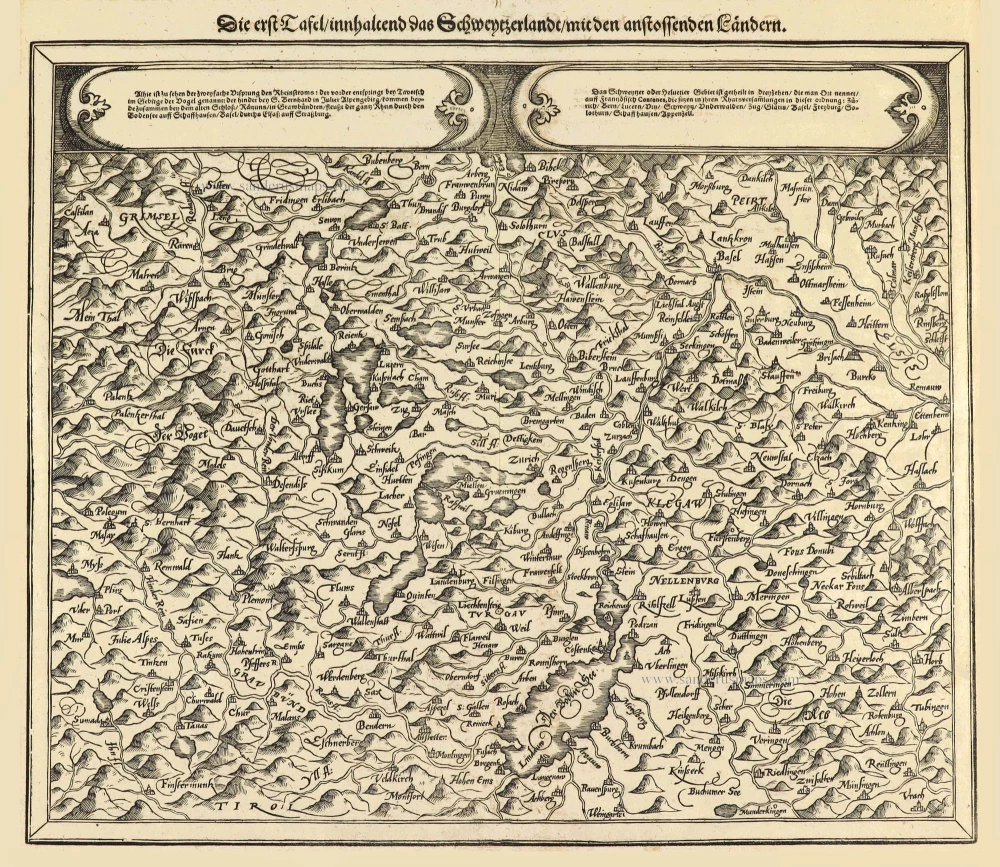
Die erst Tafel innhaltend das Schweytzerlandt mit den anstossenden Ländern. 1588
Switzerland by Sebastian Münster.
[Item number: 14631]

Helvetia Prima Rheni et V Nova Tabula. 1542
Switzerland by Sebastian Munster.
[Item number: 14925]

Exactissima Helvetiae Rhaetiae, Valesiae ... 1683-1696
Switzerland, by Visscher N.
[Item number: 18692]

Helvetia Tredecim Statibus Liberis quos Cantones vocant Composita ... c. 1757.
Switzerland, by Homann Heirs.
[Item number: 22480]

Helvetiae Descriptio Aegidio Tschudo Auct. 1612
Switzerland, by Ortelius A.
[Item number: 22945]

Helvetiae Descriptio Aegidio Tschudo Auct. 1579
SWITZERLAND by Abraham Ortelius
[Item number: 23164]

Novissima et Acuratissima Helvetiae, Rhaetiae, Valesiae et Partis Sabaudiae Tabula 1756
Antique map of Switzerland by Ottens R. & J.
[Item number: 23506]

Carte de la Souverainete de Neuchatel et Vallangin ... 1721-41
Switzerland - Lake of Neuchâtel by Guillaume Delisle, published by Covens & Mortier.
[Item number: 23877]

Exactissima Helvetiae Rhaetiae, Valesiae C. terorumq Confoederatorum ut et finitimorum Populorum Regionum Tabula. 1683-1696
Switzerland by Nicolaas Visscher.
[Item number: 24384]

Nova Helvetiae, Foederatarumque cum ea, nec non Subditarum Regionum Tabula ... 1730
Switzerland by Guillaume Delisle, published by Covens & Mortier.
[Item number: 25699]

La Suisse. 1713
Switzerland, by Pieter Van der Aa.
[Item number: 26174]

Helvetia cum finitimis regionibus confoederatis. 1641
Switzerland, by Henricus Hondius
[Item number: 26292]

La Suisse Divisee en ses Treize Cantons et ses Allies. 1776-79
Switzerland, by Francesco Santini.
[Item number: 26957]

Zurichgow. [Lettering in lower right quadrant.] 1628.
Northern Switzerland, by Gerard Mercator.
[Item number: 27450]

Helvetia cum finitimis regionibus confoederatis. 1623
Switzerland, by Gerard Mercator.
[Item number: 27884]

Nova Helvetiae Tabula. c. 1634
Switzerland, by Jodocus Hondius.
[Item number: 28003]

Ta . Here . Helve. [From verso] 1525
Switzerland by Lorenz Fries.
[Item number: 28199]

Helvetia Divisa in Tredicem Cantones sive Regiones, Bernam nempe Fruburgum, Solodurum, Basileam, Schafhusiam; Tigurum et Lucernam, cum foederatis Regionibus, numirum Comitatu Neoburgensi, urbe Biela, Resp. Genevensi Abbatia S. Galleni et Vallesia. c. 1702
Switzerland by Gerard & Leonard Valck.
[Item number: 28270]

Helvetiae Rhetiae & Valesiae cum omnibus finitimis regionibus Tabula Vulgo Schweitzerland. c. 1678
Switzerland by Johannes Janssonius.
[Item number: 28538]

La Suisse divisée en ses Treze Cantons, Ses Alliez & Ses Sujets, c. 1709
Switzerland by Hubert Jaillot, published by Pierre Mortier.
[Item number: 29566]

Affligenium Vulgo Affligem Primaria ac nobilissima in Ducatu Brabantiae, ordinis S. Benedicti Abbatia. 1726
Benedictine Abbey of Affligem, by Antonius Sanderus.
[Item number: 30779]
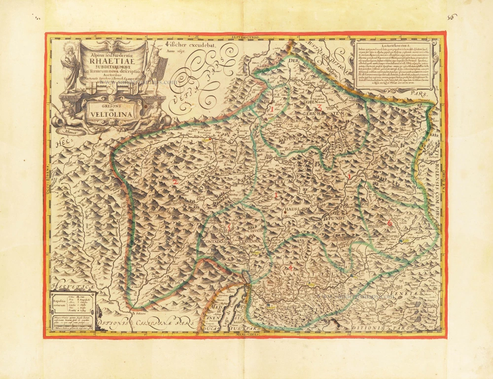
The first modern map of the Canton of Graubunden.
Alpinae seu foederatae Rhaetiae subdirarumque ei Terrarum nova descriptio. Grisons en Veltolina. 1630
Italian and Swiss Alps by C.J. Visscher, after Philipp Cluverius.
[Item number: 30936]
new

Very rare.
Raetiae veteris et exterae pars Orientalis, qua Comitatus Tyrolis cum Regionibus finitimis, continetur. 1616
Switzerland - Eastern Rhaetia by Matthias Hirtzgarter.
[Item number: 31190]

Helvetia. 1618
Switzerland by Petrus Bertius, published by Jodocus Hondius II.
[Item number: 31585]

L'Elvezia divisa ne suoi tredici cantoni e suoi Alleati 1779-1785
Switzerland, by Antonio Zatta.
[Item number: 31893]

Parte Occidentale dell' Elvezia Divisa ne' suoi Cantoni [and] Parte Orientale dell' Elvezia 1779-1785
Switzerland in two maps, by Antonio Zatta.
[Item number: 31894]

La Suisse. 1633
Switzerland by Christophe Tassin.
[Item number: 32007]

La Suisse divisée en ses Treze Cantons, Ses Alliez & Ses Sujets, 1692
Switzerland by Nicolas Sanson, published by Hubert Jaillot.
[Item number: 32294]

Potentissimae Helvetiorum Reipublicae Cantones Tredecim cum Foederatis et Subjectis Provinciis c. 1720
Switzerland, by J.B. Homann.
[Item number: 32406]

Helvetiorum Reipublicae Cantones XIII; ut et Faederata Rhaetia; Quique Iis Cocii, ac Subditi: Adkunctis una Comitatibus Vallesiae, et Neocomi/ c. 1696-1700
Switzerland, by Gerard Valk.
[Item number: 32503]

Tabula Geographica qua pars Meridionalis sive Superior Rheni, Mosae, et Mosellae, ac minores influentes Fluvii nec non mediae partes Archiepiscopatus et Electoratus Moguntini et Palatinatus Rheni, Lotharingia Helvetia Alsatia Suevia Ducatus et Comitatus Burgindiae, aliaque Galliae et Italiae 1683-1702
Switzerland, Eastern France, and south-western Germany, by N. Visscher
[Item number: 32630]

L' Helvetia o Paese de Suizzeri con li Stati, che sono à medesimi collegati, e sogetti 1686
Switzerland by Giacomo Cantelli da Vignola, published by Giovanni de Rossi.
[Item number: 32901]