
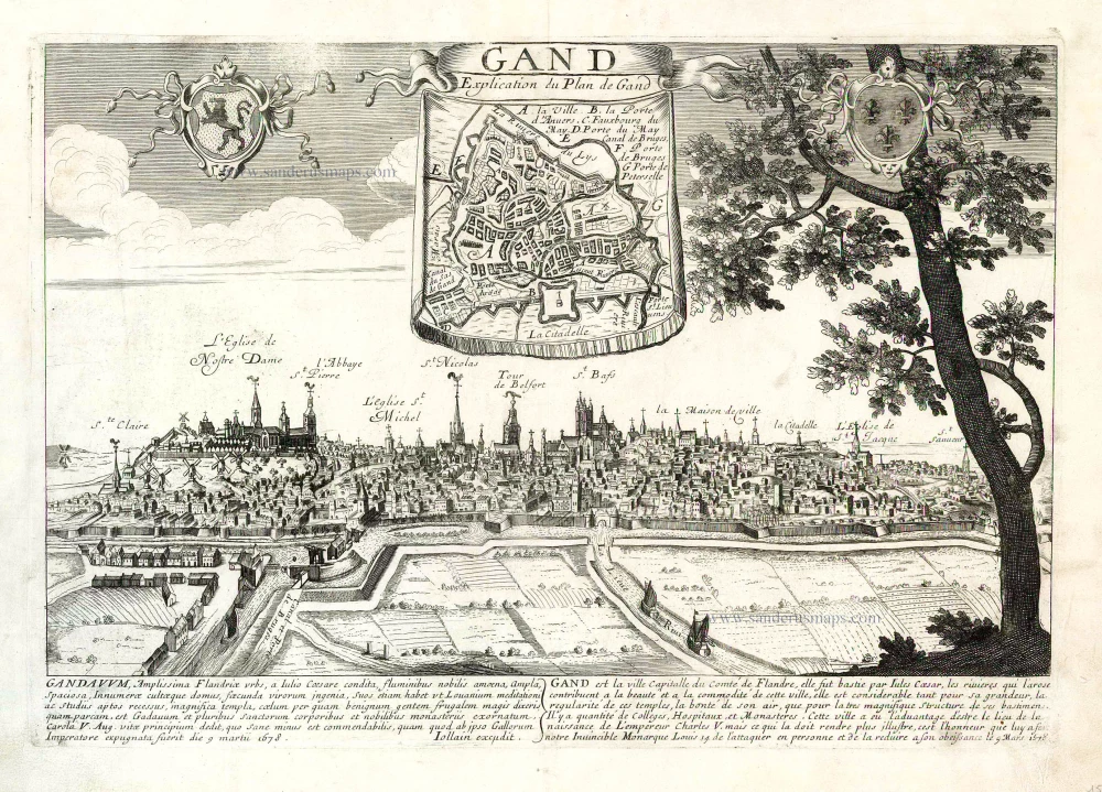
GENT by Fricx E. 1712
The item displayed on this page has been sold. However, we have a similar map in stock:
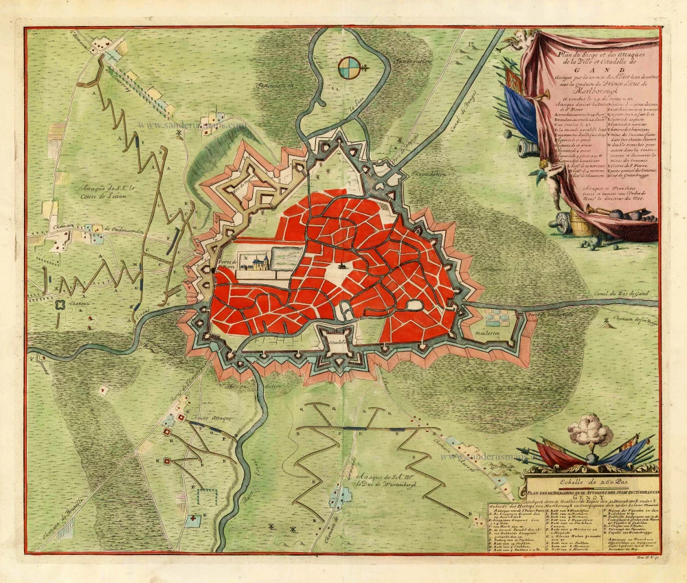
Gent by Eugène Fricx. 1712
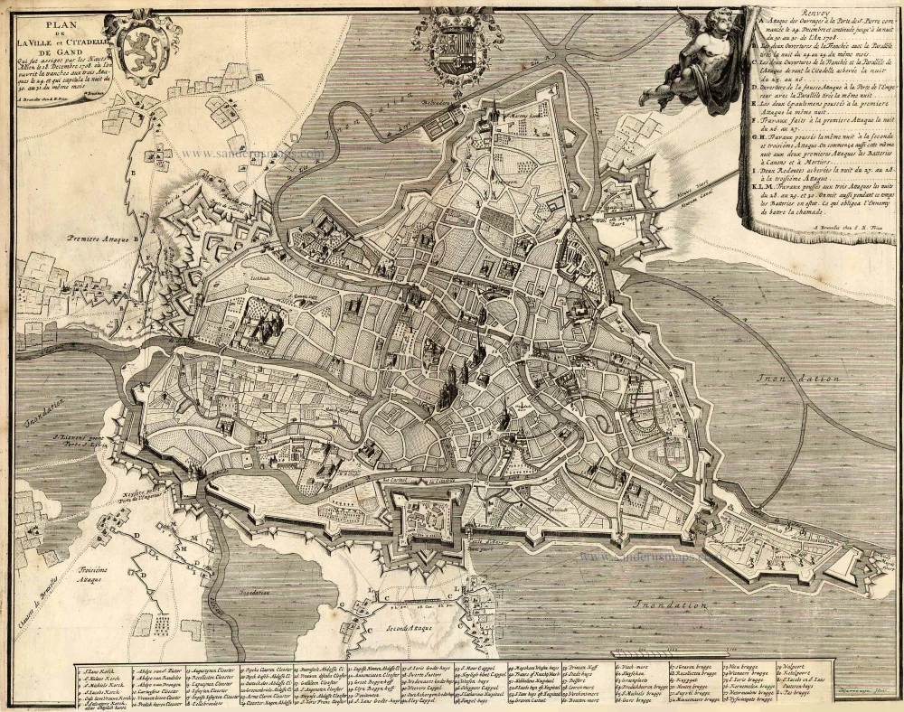
Plan de la Ville et Citadelle de Gand . . .
[Item number: 29542]

Fricx Eugène (1644-c.1740)
The bookseller and printer Eugène Henri Fricx was one of the most crucial map publishers of the Southern Netherlands in the 18th century. He lived in Brussels, where he had his shop on the Rue de la Madeleine. His activities in this field started in 1706 with the production of military plans of battles and sieges of the War of Succession. In the same year, he also started the publication of the map of the Southern Netherlands in 24 sheets; it was finished in 1712, apart from the sheet Luxembourg, which was engraved in 1727. He employed Jean Harrewijn of Brussels as an engraver and Cornelis Marke of Middelburg as a contractor for the 'enluminators'. Although he had children, his business was not continued after his death.
Plan de la Ville et Citadelle de Gand . . .
Item Number: 27433 Authenticity Guarantee
Category: Antique maps > Europe > Belgium - Cities
Old, antique map of Ghent, by Eugene Fricx.
Oud, antiek plan van Gent, door Eugene Fricx.
Cartographer: Bruckman
Date of the first edition: 1712
Date of this map: 1712
Copper engraving, printed on paper.
Size (not including margins): 47.5 x 60cm (18.5 x 23.4 inches)
Verso: Blank
Condition: Old coloured, excellent.
Condition Rating: A+
References: Koeman, Fri 1 (42).
From: Table des cartes des Pays Bas et des Frontières de France, Avec un recueil des plans des villes, sièges et battailles données entre les Hauts Alliés et la France. Bruxelles, H. Fricx, 1712.
Fricx Eugène (1644-c.1740)
The bookseller and printer Eugène Henri Fricx was one of the most crucial map publishers of the Southern Netherlands in the 18th century. He lived in Brussels, where he had his shop on the Rue de la Madeleine. His activities in this field started in 1706 with the production of military plans of battles and sieges of the War of Succession. In the same year, he also started the publication of the map of the Southern Netherlands in 24 sheets; it was finished in 1712, apart from the sheet Luxembourg, which was engraved in 1727. He employed Jean Harrewijn of Brussels as an engraver and Cornelis Marke of Middelburg as a contractor for the 'enluminators'. Although he had children, his business was not continued after his death.
Related items
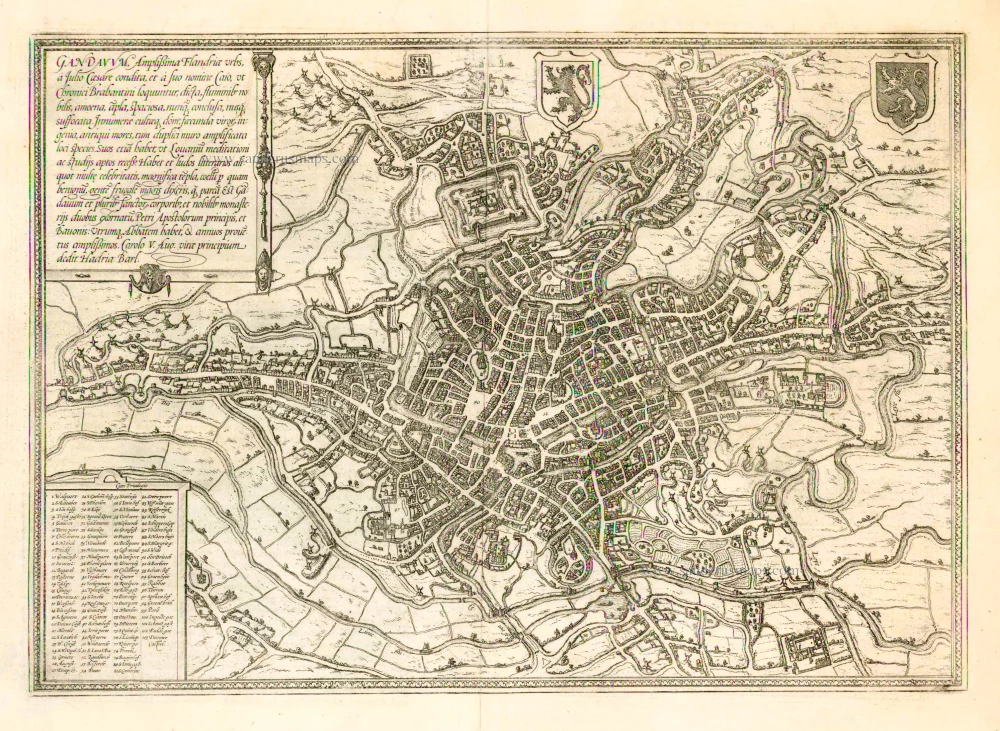
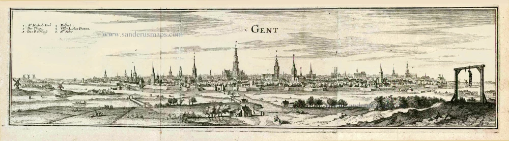
Gandavum, Amplißima Flandria Urbs ... 1657
Ghent (Gent) by Georg Braun & Frans Hogenberg, published by Johannes Janssonius.
[Item number: 2687]
With 'Gravensteen'.
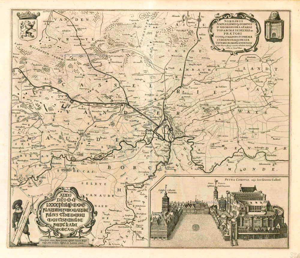
Hanc Veteris Burgis novam tabulam. 1641-1644
Ghent (Gent), by A. Sanderus.
[Item number: 5533]
Rare.
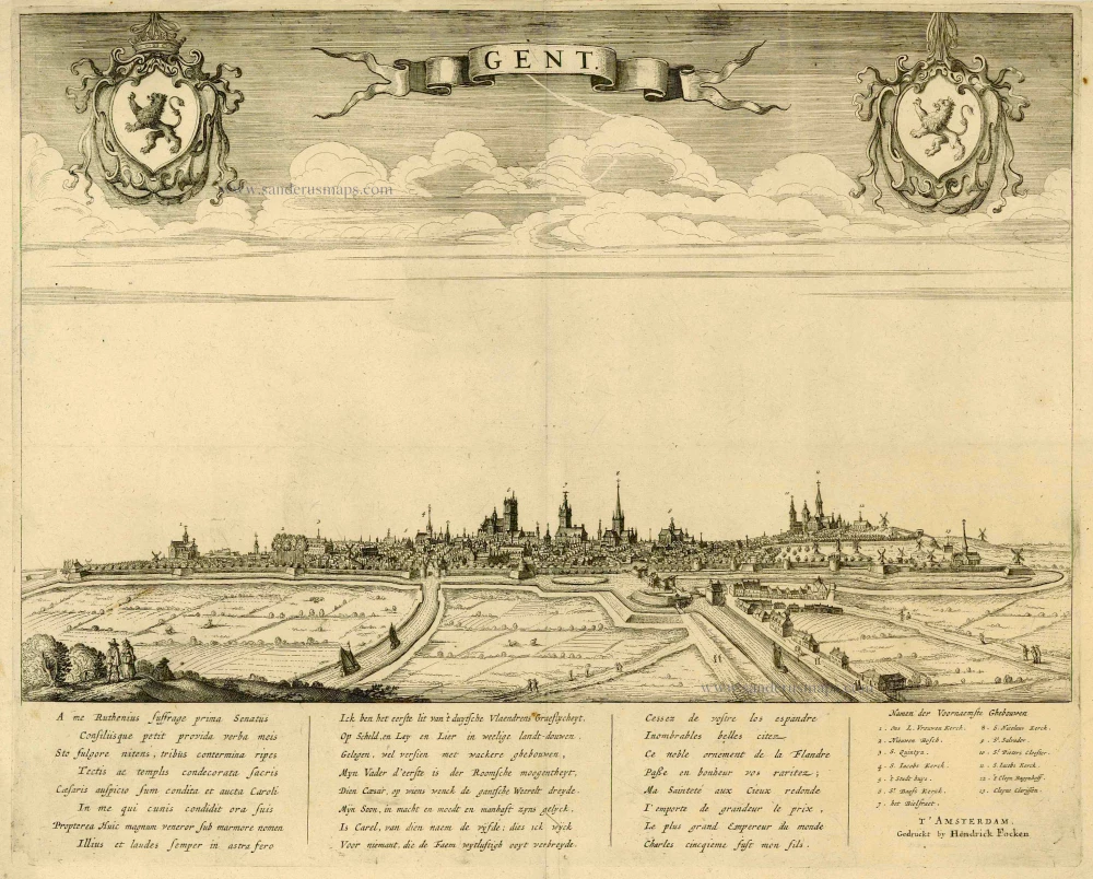
Gent. c. 1660
Gent, by Focken Hendrick
[Item number: 21312]

Rare.
Gent ca. 1650
Gent by Schnitzer Lucas
[Item number: 21998]
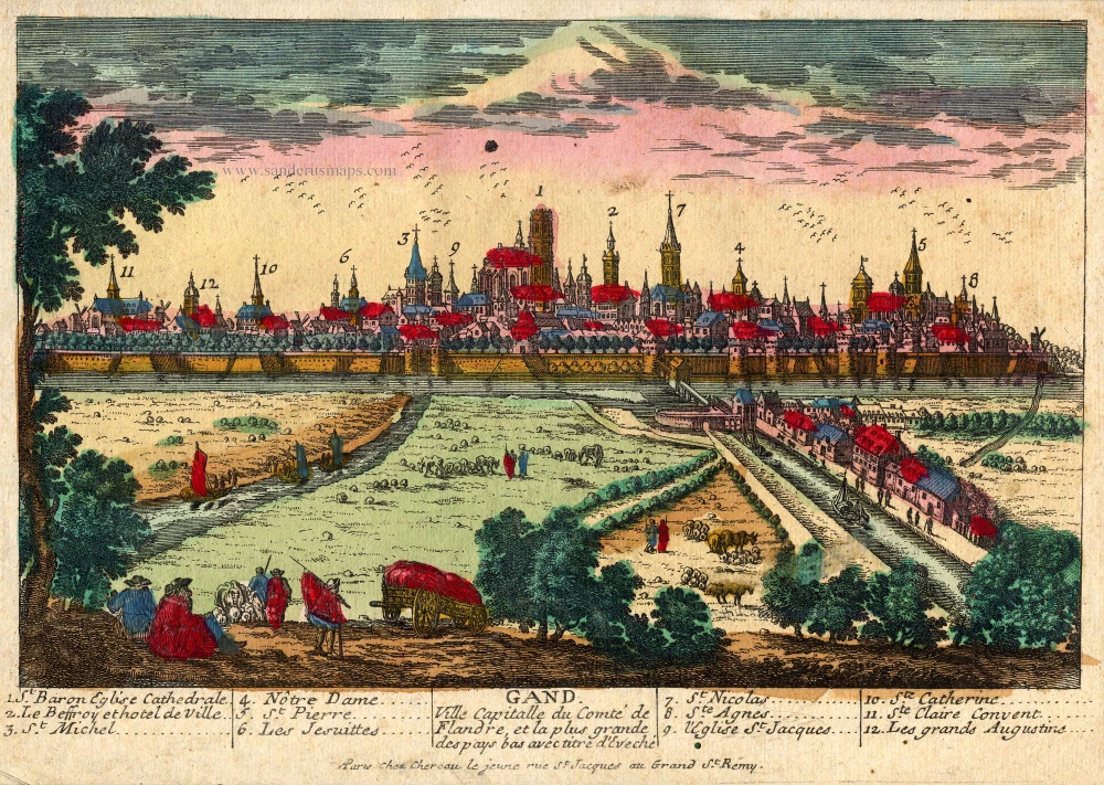
Gand. Ville Capitalle du Comté de Flandre, et la plus grande des pays bas avec titre d'Eveché c. 1720
Gent, by Chéreau.
[Item number: 22537]
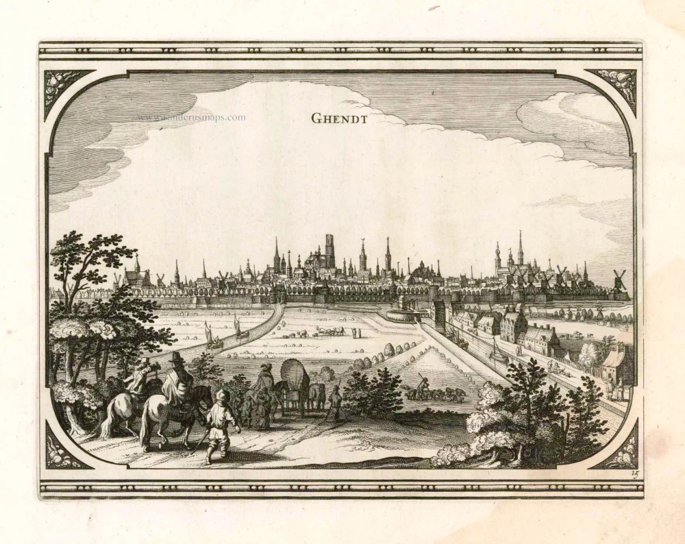
Ghendt 1656
Gent, by Visscher N. - Schut P.H.
[Item number: 25397]
Rare!
Gand. c. 1678
Ghent (Gent) by Gerard Jollain.
[Item number: 26705]
Gent. 1659
Gent, by Matthäus Merian.
[Item number: 27411]
Plan du siège et des attaques de la ville et citadelle de Gand assiégée par les armées des alliez le 22 décembre 1708. ... 1729
Gent, by Jean Dumont.
[Item number: 27430]