
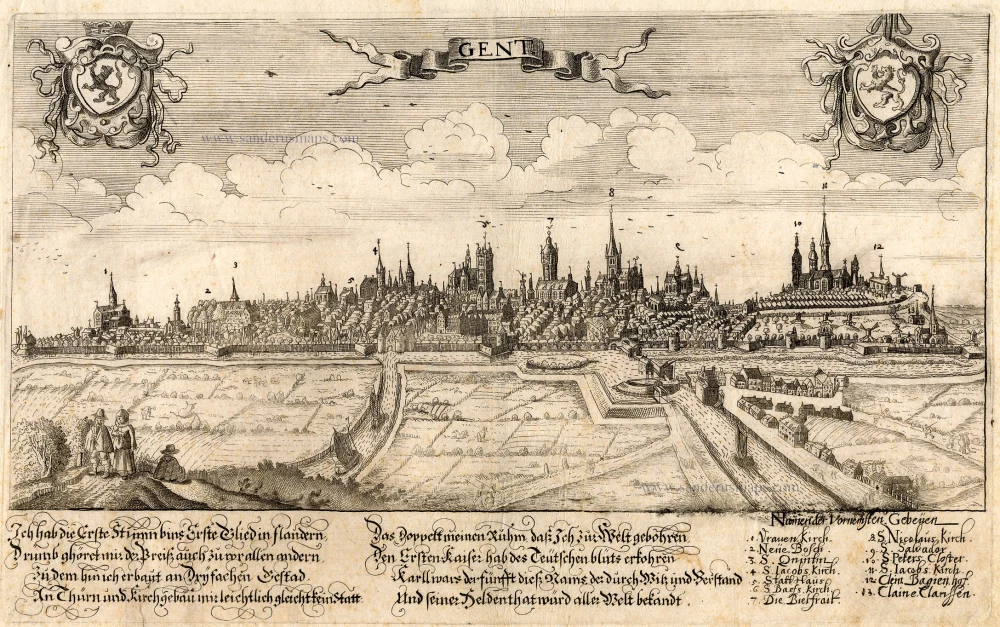
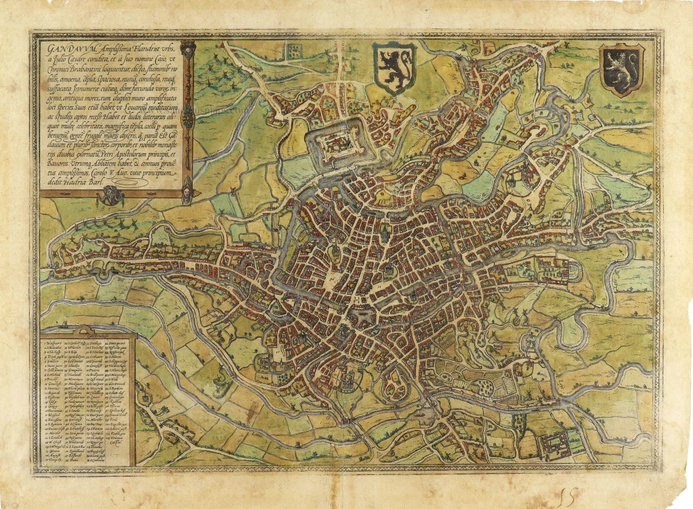
Ghent (Gent) by Georg Braun & Frans Hogenberg, published by Johannes Janssonius. 1657

TRANSLATION OF CARTOUCHE TEXT: Ghent, the most splendid city in Flanders, was founded by Julius Caesar and called Gaius after his forename, as the Brabant chroniclers relate. The city is distinguished by its rivers, altogether delightful, magnificent, spacious, never confined, nowhere stifling. The houses are innumerable and well-kept, the men richly talented, the customs venerable. A double wall amplifies the beautiful appearance of the place, which - like Louvain - also has quiet corners for reflection and study. Ghent also possesses famous schools and magnificent churches; the climate is excellent. The people, it can be said, are more frugal than parsimonious. Ghent is embellished by the relics of several saints and two famous monasteries dedicated to St Peter, Prince of the Apostles, and St Bavo; each has an abbot and a sizeable annual rental income.
COMMENTARY BY BRAUN: "Ghent has a circumference of three German miles, possesses 20 islands, which lie in the surrounding lakes and rivers and are also inhabited, 98 bridges, including three that have more than two spans and beneath which even the biggest ships can pass. There are 100 windmills that can grind even the largest produce. In this city alone there are seven parish churches, five abbeys, two collegiate churches, 25 monasteries and seven general hospices. On the site where the new castle now stands, lay in olden times the village of Ganden, from which the city also took its name, and a magnificent Benedictine monastery of St Bavo, which was constructed from an old fortress and which in 1540 was enlarged by Emperor Charles V into an even bigger palace."
The view of Ghent shows the city from the northwest in plan view from a great height. The historical core of the city occupies the peninsula between the two Rivers Schelde and Leie. The cathedral of Sint-Baafs (51) is almost at the very centre of the map: it houses the famous Ghent Altarpiece painted by Hubert and Jan van Eyck. Together with the Gothic church of Sint-Niklaas (57) lower down and the nearby Sint-Jacobskerk (43), Sint-Baafs serves as one of the three main orientation points inside the city centre. Within this triangle stands the 14th-century belfry (55), 118 m high, which forms part of the cloth hall. The former Sint-Baafs monastery lies somewhat outside the city centre and is surrounded by fortifications and moats (103). Ghent, which is situated to the northwest of Brussels, derives its name from the Celtic ganda , meaning "confluence". As a leading centre of cloth production, in the High Middle Ages, Ghent rose to become a major power with a flourishing economy and together with Bruges was the most important centre of commerce in Flanders. From the 13th to the middle of the 14th century Ghent was the second-largest city in northern Europe after Paris, with some 60,000 inhabitants, but in the second half of the 14th century these numbers began to decline. Flemish-speaking Ghent is today the third-largest city in Belgium, with a population of around 230,000. (Taschen)
Braun G. & Hogenberg F. and the Civitates Orbis Terrarum.
The Civitates Orbis Terrarum, also known as the 'Braun & Hogenberg', is a six-volume town atlas and the most excellent book of town views and plans ever published: 363 engravings, sometimes beautifully coloured. It was one of the best-selling works in the last quarter of the 16th century. Georg Braun, a skilled writer, wrote the text accompanying the plans and views on the verso. Many plates were engraved after the original drawings of a professional artist, Joris Hoefnagel (1542-1600). The first volume was published in Latin in 1572 and the sixth in 1617. Frans Hogenberg, a talented engraver, created the tables for volumes I through IV, and Simon van den Neuwel made those for volumes V and VI. Other contributors were cartographers Daniel Freese and Heinrich Rantzau, who provided valuable geographical information. Works by Jacob van Deventer, Sebastian Münster, and Johannes Stumpf were also used as references. Translations appeared in German and French, making the atlas accessible to a broader audience.
Since its original publication of volume 1 in 1572, the Civitates Orbis Terrarum has left an indelible mark on the history of cartography. Seven more editions followed the first volume in 1575, 1577, 1582, 1588, 1593, 1599, and 1612. Vol.2, initially released in 1575, saw subsequent editions in 1597 and 1612. The subsequent volumes, each a treasure trove of historical insights, graced the world in 1581, 1588, 1593, 1599, and 1606. The German translation of the first volume, a testament to its widespread appeal, debuted in 1574, followed by the French edition in 1575.
Several printers were involved: Theodor Graminaeus, Heinrich von Aich, Gottfried von Kempen, Johannis Sinniger, Bertram Buchholtz, and Peter von Brachel, all of whom worked in Cologne.
Georg Braun (1541-1622)
Georg Braun, the author of the text accompanying the plans and views in the Civitates Orbis Terrarum, was born in Cologne in 1541. After his studies in Cologne, he entered the Jesuit Order as a novice, indicating his commitment to learning and intellectual pursuits. In 1561, he obtained his bachelor's degree; in 1562, he received his Magister Artium, further demonstrating his academic achievements. Although he left the Jesuit Order, he continued his studies in theology, gaining a licentiate in theology. His theological background likely influenced the content and tone of the text in the Civitates Orbis Terrarum, adding a unique perspective to the work.
Frans Hogenberg (1535-1590)
Frans Hogenberg was a Flemish and German painter, engraver, and mapmaker. He was born in Mechelen as the son of Nicolaas Hogenberg.
By the end of the 1560s, Frans Hogenberg was employed upon Abraham Ortelius's Theatrum Orbis Terrarum, published in 1570; he is named an engraver of numerous maps. In 1568, he was banned from Antwerp by the Duke of Alva and travelled to London, where he stayed a few years before emigrating to Cologne. He immediately embarked on his two most important works, the Civitates, published in 1572 and the Geschichtsblätter, which appeared in several series from 1569 until about 1587.
Thanks to large-scale projects like the Geschichtsblätter and the Civitates, Hogenberg's social circumstances improved with each passing year. He died as a wealthy man in Cologne in 1590.
The Janssonius Family
Joannes Janssonius (Arnhem, 1588-1664), son of the Arnhem publisher Jan Janssen, married Elisabeth Hondius, daughter of Jodocus Hondius, in Amsterdam in 1612. After his marriage, he settled down in this town as a bookseller and publisher of cartographic material. In 1618, he established himself in Amsterdam next door to Blaeu’s bookshop. He entered into serious competition with Willem Jansz. Blaeu when copying Blaeu’s Licht der Zeevaert after the expiration of the privilege in 1620. His activities concerned the publication of atlases, books, single maps, and an extensive book trade with branches in Frankfurt, Danzig, Stockholm, Copenhagen, Berlin, Koningsbergen, Geneva, and Lyon. In 1631, he began publishing atlases together with Henricus Hondius.
In the early 1640s, Henricus Hondius left the atlas publishing business to Janssonius. Competition with Joan Blaeu, Willem’s son and successor, in atlas production, prompted Janssonius to enlarge his Atlas Novus finally into a work of six volumes, into which a sea atlas and an atlas of the Old World were inserted. Other atlases published by Janssonius are Mercator’s Atlas Minor, Hornius’s historical atlas (1652), the townbooks in eight volumes (1657), Cellarius’s Atlas Coelestis and several sea atlases and pilot guides.
After the death of Joannes Janssonius, the shop and publishing firm were continued by the heirs under the direction of Johannes van Waesbergen (c. 1616-1681), son-in-law of Joannes Janssonius. Van Waesbergen added Janssonius's name to his own.
In 1676, Joannes Janssonius’s heirs sold by auction “all the remaining Atlases in Latin, French, High and Low German, as well as the Stedeboecken in Latin, in 8 volumes, bound and unbound, maps, plates belonging to the Atlas and Stedeboecken.” The copperplates from Janssonius’s atlases were afterwards sold to Schenk and Valck.
Gandavum, Amplißima Flandria Urbs ...
Item Number: 2687 Authenticity Guarantee
Category: Antique maps > Europe > Belgium - Cities
Old, antique bird’s-eye view plan of Gent, by Georg Braun & Frans Hogenberg, published by J. Janssonius.
Title: Gandavum, Amplißima Flandria Urbs ...
Cum Privilegio.
Date of the first edition: 1572.
Date of this map: 1657.
Copper engraving, printed on paper.
Map size: 340 x 485mm (13.39 x 19.09 inches).
Sheet size: 450 x 540mm (17.72 x 21.26 inches).
Verso: Latin text.
Condition: Uncoloured, lower centrefold split reinforced (outside the image).
Condition Rating: A.
References: Van der Krogt 4, 1503 State 2; Fausern #4545
From: Janssonius J.Theatrum Urbium Celebriorum totius Belgii sive Germaniae Inferioris.Amsterdam, 1657. (Koeman, Ja 12)
TRANSLATION OF CARTOUCHE TEXT: Ghent, the most splendid city in Flanders, was founded by Julius Caesar and called Gaius after his forename, as the Brabant chroniclers relate. The city is distinguished by its rivers, altogether delightful, magnificent, spacious, never confined, nowhere stifling. The houses are innumerable and well-kept, the men richly talented, the customs venerable. A double wall amplifies the beautiful appearance of the place, which - like Louvain - also has quiet corners for reflection and study. Ghent also possesses famous schools and magnificent churches; the climate is excellent. The people, it can be said, are more frugal than parsimonious. Ghent is embellished by the relics of several saints and two famous monasteries dedicated to St Peter, Prince of the Apostles, and St Bavo; each has an abbot and a sizeable annual rental income.
COMMENTARY BY BRAUN: "Ghent has a circumference of three German miles, possesses 20 islands, which lie in the surrounding lakes and rivers and are also inhabited, 98 bridges, including three that have more than two spans and beneath which even the biggest ships can pass. There are 100 windmills that can grind even the largest produce. In this city alone there are seven parish churches, five abbeys, two collegiate churches, 25 monasteries and seven general hospices. On the site where the new castle now stands, lay in olden times the village of Ganden, from which the city also took its name, and a magnificent Benedictine monastery of St Bavo, which was constructed from an old fortress and which in 1540 was enlarged by Emperor Charles V into an even bigger palace."
The view of Ghent shows the city from the northwest in plan view from a great height. The historical core of the city occupies the peninsula between the two Rivers Schelde and Leie. The cathedral of Sint-Baafs (51) is almost at the very centre of the map: it houses the famous Ghent Altarpiece painted by Hubert and Jan van Eyck. Together with the Gothic church of Sint-Niklaas (57) lower down and the nearby Sint-Jacobskerk (43), Sint-Baafs serves as one of the three main orientation points inside the city centre. Within this triangle stands the 14th-century belfry (55), 118 m high, which forms part of the cloth hall. The former Sint-Baafs monastery lies somewhat outside the city centre and is surrounded by fortifications and moats (103). Ghent, which is situated to the northwest of Brussels, derives its name from the Celtic ganda , meaning "confluence". As a leading centre of cloth production, in the High Middle Ages, Ghent rose to become a major power with a flourishing economy and together with Bruges was the most important centre of commerce in Flanders. From the 13th to the middle of the 14th century Ghent was the second-largest city in northern Europe after Paris, with some 60,000 inhabitants, but in the second half of the 14th century these numbers began to decline. Flemish-speaking Ghent is today the third-largest city in Belgium, with a population of around 230,000. (Taschen)
Braun G. & Hogenberg F. and the Civitates Orbis Terrarum.
The Civitates Orbis Terrarum, also known as the 'Braun & Hogenberg', is a six-volume town atlas and the most excellent book of town views and plans ever published: 363 engravings, sometimes beautifully coloured. It was one of the best-selling works in the last quarter of the 16th century. Georg Braun, a skilled writer, wrote the text accompanying the plans and views on the verso. Many plates were engraved after the original drawings of a professional artist, Joris Hoefnagel (1542-1600). The first volume was published in Latin in 1572 and the sixth in 1617. Frans Hogenberg, a talented engraver, created the tables for volumes I through IV, and Simon van den Neuwel made those for volumes V and VI. Other contributors were cartographers Daniel Freese and Heinrich Rantzau, who provided valuable geographical information. Works by Jacob van Deventer, Sebastian Münster, and Johannes Stumpf were also used as references. Translations appeared in German and French, making the atlas accessible to a broader audience.
Since its original publication of volume 1 in 1572, the Civitates Orbis Terrarum has left an indelible mark on the history of cartography. Seven more editions followed the first volume in 1575, 1577, 1582, 1588, 1593, 1599, and 1612. Vol.2, initially released in 1575, saw subsequent editions in 1597 and 1612. The subsequent volumes, each a treasure trove of historical insights, graced the world in 1581, 1588, 1593, 1599, and 1606. The German translation of the first volume, a testament to its widespread appeal, debuted in 1574, followed by the French edition in 1575.
Several printers were involved: Theodor Graminaeus, Heinrich von Aich, Gottfried von Kempen, Johannis Sinniger, Bertram Buchholtz, and Peter von Brachel, all of whom worked in Cologne.
Georg Braun (1541-1622)
Georg Braun, the author of the text accompanying the plans and views in the Civitates Orbis Terrarum, was born in Cologne in 1541. After his studies in Cologne, he entered the Jesuit Order as a novice, indicating his commitment to learning and intellectual pursuits. In 1561, he obtained his bachelor's degree; in 1562, he received his Magister Artium, further demonstrating his academic achievements. Although he left the Jesuit Order, he continued his studies in theology, gaining a licentiate in theology. His theological background likely influenced the content and tone of the text in the Civitates Orbis Terrarum, adding a unique perspective to the work.
Frans Hogenberg (1535-1590)
Frans Hogenberg was a Flemish and German painter, engraver, and mapmaker. He was born in Mechelen as the son of Nicolaas Hogenberg.
By the end of the 1560s, Frans Hogenberg was employed upon Abraham Ortelius's Theatrum Orbis Terrarum, published in 1570; he is named an engraver of numerous maps. In 1568, he was banned from Antwerp by the Duke of Alva and travelled to London, where he stayed a few years before emigrating to Cologne. He immediately embarked on his two most important works, the Civitates, published in 1572 and the Geschichtsblätter, which appeared in several series from 1569 until about 1587.
Thanks to large-scale projects like the Geschichtsblätter and the Civitates, Hogenberg's social circumstances improved with each passing year. He died as a wealthy man in Cologne in 1590.
The Janssonius Family
Joannes Janssonius (Arnhem, 1588-1664), son of the Arnhem publisher Jan Janssen, married Elisabeth Hondius, daughter of Jodocus Hondius, in Amsterdam in 1612. After his marriage, he settled down in this town as a bookseller and publisher of cartographic material. In 1618, he established himself in Amsterdam next door to Blaeu’s bookshop. He entered into serious competition with Willem Jansz. Blaeu when copying Blaeu’s Licht der Zeevaert after the expiration of the privilege in 1620. His activities concerned the publication of atlases, books, single maps, and an extensive book trade with branches in Frankfurt, Danzig, Stockholm, Copenhagen, Berlin, Koningsbergen, Geneva, and Lyon. In 1631, he began publishing atlases together with Henricus Hondius.
In the early 1640s, Henricus Hondius left the atlas publishing business to Janssonius. Competition with Joan Blaeu, Willem’s son and successor, in atlas production, prompted Janssonius to enlarge his Atlas Novus finally into a work of six volumes, into which a sea atlas and an atlas of the Old World were inserted. Other atlases published by Janssonius are Mercator’s Atlas Minor, Hornius’s historical atlas (1652), the townbooks in eight volumes (1657), Cellarius’s Atlas Coelestis and several sea atlases and pilot guides.
After the death of Joannes Janssonius, the shop and publishing firm were continued by the heirs under the direction of Johannes van Waesbergen (c. 1616-1681), son-in-law of Joannes Janssonius. Van Waesbergen added Janssonius's name to his own.
In 1676, Joannes Janssonius’s heirs sold by auction “all the remaining Atlases in Latin, French, High and Low German, as well as the Stedeboecken in Latin, in 8 volumes, bound and unbound, maps, plates belonging to the Atlas and Stedeboecken.” The copperplates from Janssonius’s atlases were afterwards sold to Schenk and Valck.
Related items

Casino, pour les Sociétés de Botanique et Ste. Cécile, à Gand. - Casono, for the Botanical and Ste Cecilia Sociétes, at Gent. ca. 1840
Gent - Casino by Henri Borremans.
[Item number: 359]

Vue de l'Entrépôt Général de Libre Réexportation en Construction à Gand 1844. c. 1850
Ghent (Gent) by Charles Le Clerc, after Louis Roelandt.
[Item number: 5604]

1842
GENT - Stadhuis & Belfort by Louis Haghe.
[Item number: 5844]
new

Rare.
Gent. c. 1660
Gent, by Focken Hendrick
[Item number: 21312]
Rare.
Gent ca. 1650
Gent by Schnitzer Lucas
[Item number: 21998]

Eglise de St. Nicolas à Gand. - The Church of S. Nicholas, in Ghent. c. 1840
Ghent - Church of St. Nicholas by Henri Borremans.
[Item number: 22002]
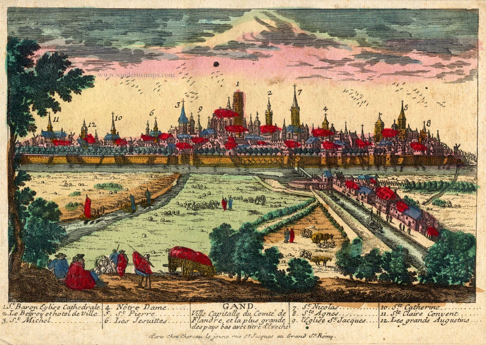
Gand. Ville Capitalle du Comté de Flandre, et la plus grande des pays bas avec titre d'Eveché c. 1720
Gent, by Chéreau.
[Item number: 22537]
Rare!
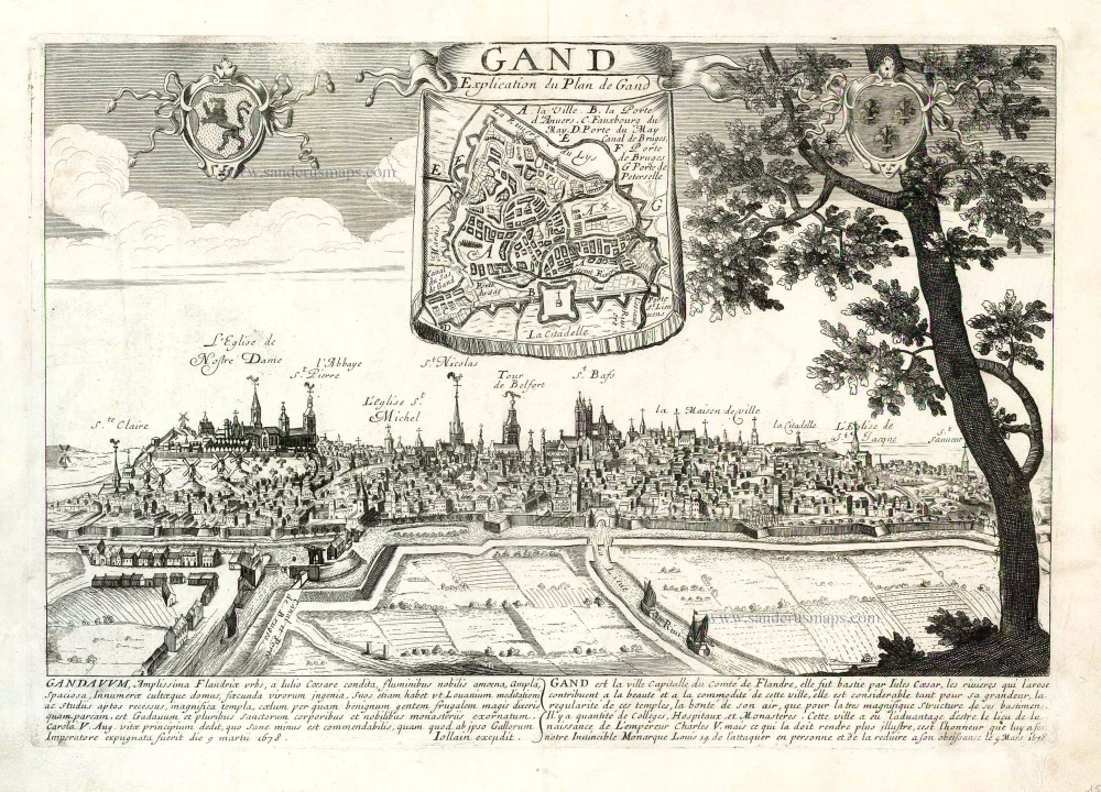
Gand. c. 1678
Ghent by Gerard Jollain. (Gent)
[Item number: 26705]
Gandavum vulgo Gent. c. 1700
Gent by Frederick de Wit.
[Item number: 29517]

Ghendt. 1613
Gent by Ludovico Guicciardini.
[Item number: 29558]

Ghent. 1833
Ghent (Gent) Three towers - Drie torens, by S. Prout.
[Item number: 30027]

Extremely rare map of Ghent and surroundings.
Praenobili Magnifico Amplissimoq[ue] Magistratui inclytae civitatis Gandavensis
Ghent (Gent), by Henricus Hondius.
[Item number: 30121]
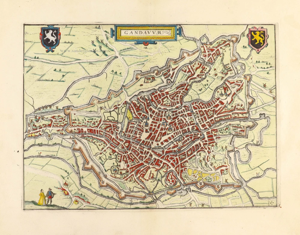
Gandavum, Amplissima Flandriae urbs, ... 1599
Gent by Georg Braun & Frans Hogenberg.
[Item number: 31325]
Gandavum. 1612
Gent by Lodovico Guicciardini.
[Item number: 31373]

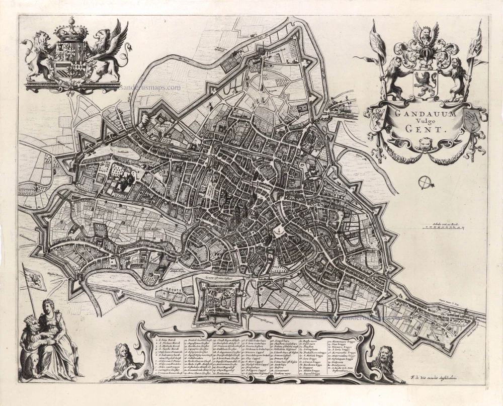
Gandavum vulgo Gent. 1641
Gent (Ghent) by Antonius Sanderus.
[Item number: 31606]

Curia Antiqua Gandavensis - Curia Nova Gandavensis 1641
Oude gotische en het nieuwe renaissance stadhuis van Gent, door Antonius Sanderus.
[Item number: 31608]

Ecclesia Collegiata Divi Pharahildis. - Petra Comitis vulgo Het Graven Casteel. 1641
Gent - Gravenkasteel en omgeving door Antonius Sanderus.
[Item number: 31609]

Macellum maius cum foro Piscario. 1641
Gent - Vleeshalle en Vismarkt door Antonius Sanderus.
[Item number: 31610]

Ecclesia Divo Ioanni Baptistae Sacra. 1641
Gent - St.-Baafskathedraal door Antonius Sanderus.
[Item number: 31612]

Praetorium Reverendißimi ac perillistris Domini Dñi Antonii Triest Episcopi Gandavensis, in agro Paraeciae Ackergemiensis, vulgo Belvedere. 1641
Gent - Akkergem - Kasteel Belvedere, door Antonius Sanderus.
[Item number: 31614]

Forum Veneris Vulgo De Vrydach Maert et Ecclesia S. Iacobi. - Ecclesia Parochialis Sti Nicolai. Iuxta forum frumentarium Gandavi. 1641
Gent - Vrijdagmarkt & St.-Jacobskerk - Korenmarkt & St.-Niklaaskerk, door Antonius Sanderus.
[Item number: 31615]

Nova Cartusiae Vallis Regalis intra terminos civitatis Gandavensis delin. 1641
Gent - Kartuizerklooster Koningsdal, door Antonius Sanderus.
[Item number: 31622]
![Gent - Kouter en St.-Sebastiaanshof [Verso:] Gildehuis St.-Joris, door Antonius Sanderus.](https://sanderusmaps.com/assets/IMG/webp/m31623.webp)
Hippodromus Gandavensis cum adiacentibus aedificiis et Aula Sti Sebastiani. [Verso:] Domus Gildae S. Georgii Vulgo St Ioris Hoff 1641
Gent - Kouter en St.-Sebastiaanshof [Verso:] Gildehuis St.-Joris, door Antonius Sanderus.
[Item number: 31623]

Gandavum vulgo Gent. 1649
Gent by Joan Blaeu.
[Item number: 32006]

With train station
Panorama von Gent / Panorama de Gand.. c. 1840
Ghent, by F.C. Eisen.
[Item number: 32083]

Ghent's monks at the stake in 1578
Execution uber Sodomitigsche Buben binnen der Statt Gendt. c. 1583
Burning of gay monks in Ghent (Gent), 28 June 1578, by Frans Hogenberg.
[Item number: 32278]

Exceptional beautiful colour
Gandavum, Amplissima Flandriae urbs, ... 1693
Gent by Georg Braun & Frans Hogenberg.
[Item number: 32474]

Laudum Monumenta tuarum Ferdinande vides. 1636
Gent - Vrijdagmarkt by G. Becanus.
[Item number: 32536]

Rare city plan
Plan de la ville de Gand et de ses Faubourgs. 1830
Gent by M. Delhoungne. (Ghent)
[Item number: 32618]

Porte d'Eau à Gand. 1823
Gent - Rabot, lithograph by Dewasme, after Prosper de la Barrière.
[Item number: 32811]

Eglise St. Pierre à Gand. 1823
Gent - St.-Pietersabdij, lithograph by Dewasme, after Prosper de la Barrière.
[Item number: 32812]

Le Vieux Bourg à Gand; 1823
Gent - Gravenkasteel, lithograph by Dewasme, after Prosper de la Barrière.
[Item number: 33048]

Entrée de la Cour du Prince à Gand. 1823
Gent - Prinsenhof, lithograph by Dewasme, after Prosper de la Barrière.
[Item number: 33105]
new
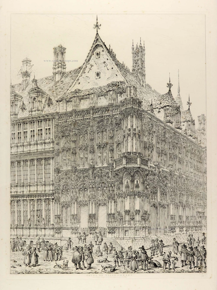
Hotel de Ville - Ghent. 1829
Ghent (Gent), City Hall, by J. Coney.
[Item number: 33111]
new