
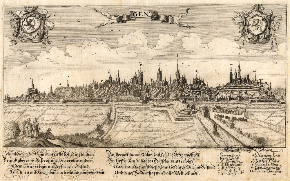
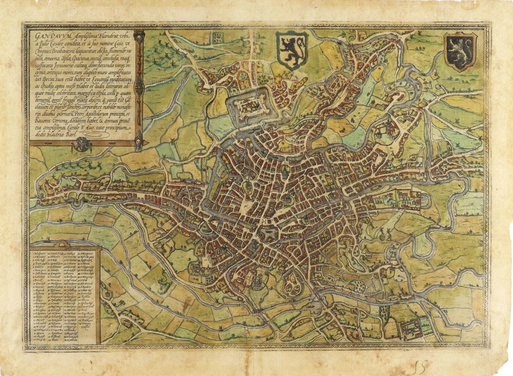
Extremely rare map of Ghent and surroundings.
Ghent (Gent), by Henricus Hondius.

In het midden: een naar het westen georiënteerde kaart van Gent (waterlopen, bruggen en stadsversterkingen) en de omgeving van de stad (waterlopen, wegen, kastelen, kerken, windmolens, galgen, Rietgracht). Rondom de kaart een band met vijftien cartouches met tekeningen, twee met de wapens van Vlaanderen en Gent en de dertien andere met kastelen in de omgeving van Gent:
De kaart werd gemaakt om te verschijnen in Sanderus' Flandria Illustrata, 1641, maar is er nooit in opgenomen geweest.
Caullet schrijft hierover: "La Carte du district de Gand gravée par Henri Hondius 1641, deze kaart was eene eerste maal uitgegeven, maar zonder de afbeeldingen in omlijsting, in een cartouche van het groot plan der stad van 1641. In de omlijsting zijn afgebeeld 13 kasteelen uit den omtrek van Gent: die van de heeren van Overwale, ... De opdracht is geteekend: Henricus Hondius. Die kaart was wellicht bestemd voor de Flandria. Uit een door den heer Van der Haeghen aangehaalden brief van Hondius vernemen wij dat deze op 22 Maart 1641 de kaart van het district Gent, naar zijne aanwijzigingen gewijzigd, ontvangen had; toch is hij niet voldaan. ...".
Het exemplaar beschreven door Caullet maakte deel uit van de Collectie van Pierre-Jacques Goetghebeur (1788-1866). Na diens overlijden werd de verzameling prenten betreffende Gent door de stad Gent aangekocht. Dit is het exemplaar dat nu in het Gents stadsarchief zit.
The Hondius Family
Jodocus Hondius the Elder (1563-1612)
Joost d’Hondt was born at Wakken (Flanders) in 1563. Two years later, his family settled down in Ghent, where young Joost displayed a great gift for drawing and calligraphy. By study and lessons, he developed his talents and became an engraver with a good reputation.
Due to the circumstances of war, he moved in 1584 to London where he settled down as an engraver, instrument-maker and map-maker. In 1587, he married Coletta van den Keere, sister of the well-known engraver, Pieter van den Keere (Petrus Kaerius); some years earlier his sister, Jacomina, had married Pieter van den Berghe (Petrus Montanus). Joost, who had latinized his name to Jodocus Hondius, closely co-operated with his two brothers-in-law.
The political situation in the Northern Netherlands in 1593 was such that Jodocus seemed to be justified in establishing himself in Amsterdam, where so many Antwerp printers, publishers, and engravers had gone. In this new centre of cartography, Jodocus Hondius set up his business “In de Wackere Hondt” (in the vigilant dog), this name being an allusion to his birthplace and name. Here he engraved many maps and published atlases and many other works such as his continuation of Gerard Mercator’s Atlas.
He suddenly passed away in February 1612. The publishing firm of Jodocus Hondius was continued by his widow; later on by his two sons Jodocus Jr., and Henricus, and by his son-in-law, J. Janssonius.
Jodocus Hondius II (1594-1629) & Henricus Hondius (1597-1651)
After the father’s death, the widow with her seven children continued publishing the atlases under the name of Jodocus Hondius till 1620. The firm was reinforced by the very welcome help of Joannes Janssonius (1588-1664), who married 24-year-old Elisabeth Hondius in 1612. After 1619 Mercator’s Atlas was published under the name of Henricus Hondius.
One of the most dramatic events in the early history of commercial cartography in Amsterdam was the sale of Jodocus Hondius Jr.’s copper-plates to Willem Jansz. Blaeu in 1629, the year of his death. At least 34 plates, from which Jodocus II had printed single-sheet maps for his own benefit, passed into the hands of his great competitor. Immediately after that, his brother, Henricus, and Joannes Janssonius ordered the engraving of identical plates.
During a long period, Henricus devoted all his energy to the publication of the Atlas. He saw its growth up to, and including, the fourth part in 1646; after that, his name does not figure any more on the title-pages. After 1638, the title of the Atlas was changed to Atlas Novus; it was mainly carried on by Joannes Janssonius.
The competition with the Blaeus dates from 1630. In 1630, Willem Janszoon (=Blaeu) made the first attack with his Atlantis Appendix. In 1635, Blaeu completed his Theatrum orbis terrarum in two volumes with texts in French, Latin, Dutch, and German, which prompted Henricus Hondius to speed up the enlargement of his Atlas.
Antonius Sanderus (Antwerpen, 1586 – Affligem, 1664)
Antoon Sanders (in Latin Antonius Sanderus) came from a distinguished Ghent family that briefly stayed in Antwerp after temporarily fleeing the Ghent Republic.
Antonius Sanderus, a man of exceptional intellectual prowess, began his Latin studies at the renowned Jesuit college of Oudenaarde and further honed his knowledge in Ghent. His thirst for knowledge led him to pursue philosophy at the Jesuit College of Douai, where he earned a Master's Artium in 1609, a testament to his scholarly dedication.
In 1611, Sanderus was ordained a priest in Ghent and became a pastor in a few hamlets near Eeklo. However, despite the relative calm of the Twelve Years' Truce, the region was not without its tensions. Sanderus found himself in a precarious position due to his controversial writings, which included critiques of Anabaptism in Flanders. These critiques sparked heated debates and raised eyebrows among his peers.
In 1615, he became Baccalaureus in theology at the University of Leuven, and in 1619, he returned to Douai, where he obtained a degree in theology at the University of Douai.
In 1621, he returned to Ghent, where Bishop Antonius Triest protected him. In 1623, he was appointed chaplain and secretary to Cardinal Alfonso de la Cueva, the governor of the Southern Netherlands under Philip IV of Spain.
1625, he became a canon at St. Martin's Church in Ypres.
In the meantime, he conducted extensive research for a prestigious history of the county of Flanders, the Flandria Illustrata. For these searches, he visited monasteries and castles to consult the archives, a testament to his dedication and thoroughness as a historian. However, this meticulous approach to research was not always appreciated by the other canons of Ypres, who felt he was neglecting his other duties.
That is why he resigned from his religious functions in 1654 and was appointed Censor Librorum in Brussels, a position of significant influence in controlling and regulating printed materials. In this role, he played a crucial part in shaping the city's intellectual and cultural life.
In 1668, he resigned as a canon of the Ypres chapter. The reasons for this decision are not entirely clear. Still, it is believed that his increasing focus on his historical research and the offer of a more suitable environment for his work at the Affligem Abbey were contributing factors. Finally, he left the city to settle at the Affligem Abbey, where he was warmly received by the abbot Benedictus van Haeften.
He died there on January 16, 1664, and was buried in the abbey church.
Antonius Sanderus published historical works from 1610, but his magnum opus is the richly illustrated Flandria Illustrata, sive Descriptio Comitatus Istius per Totum Terrarum Orbis Terrarum. The publication was begun by Henricus Hondius, who had a publication contract with Sanderus as early as 1634. It was a landmark in the study of Flanders' history, featuring numerous portraits, plans, views, and maps. In 1641, Hondius published the first volume as the Theatrum Flandriae in Leiden, but immediately sold the rights to Joan Blaeu. They published two volumes of the work in 1641 and 1644, respectively, with a fake publisher's address in Cologne. The work's influence extended beyond its initial publication, with Blaeu using 15 maps from the Flandria Illustrata for his Atlas Maior, and most of the plans were used in the town book of the Royal Netherlands.
In 1659, he published a history of the abbeys and monasteries of Brabant: the Chorographia sacra Brabantiae.
Praenobili Magnifico Amplissimoq[ue] Magistratui inclytae civitatis Gandavensis
Item Number: 30121 Authenticity Guarantee
Category: Antique maps > Europe > Belgium
Old, antique map of the vicinity of Ghent (Gent), by Henricus Hondius.
Map with decorative borders at four sides showing views of 13 castles and the coat of arms of Ghent (with virgin, lion and flag).
Title: Praenobili Magnifico Amplissimoq[ue] Magistratui inclytae civitatis Gandavensis
hanc Territoy eisudem accuratam tabulam.
Dedicat Dicatq[ue] Henricus Hondius.
Oriented to the west.
Date: c. 1641.
Copper engraving, printed on paper.
Image size: 380 x 465mm (14.96 x 18.31 inches).
Sheet size: 430 x 535mm (16.93 x 21.06 inches).
Verso: Blank.
Condition: Excellent.
Condition Rating: A+.
Separate publication.
In het midden: een naar het westen georiënteerde kaart van Gent (waterlopen, bruggen en stadsversterkingen) en de omgeving van de stad (waterlopen, wegen, kastelen, kerken, windmolens, galgen, Rietgracht). Rondom de kaart een band met vijftien cartouches met tekeningen, twee met de wapens van Vlaanderen en Gent en de dertien andere met kastelen in de omgeving van Gent:
De kaart werd gemaakt om te verschijnen in Sanderus' Flandria Illustrata, 1641, maar is er nooit in opgenomen geweest.
Caullet schrijft hierover: "La Carte du district de Gand gravée par Henri Hondius 1641, deze kaart was eene eerste maal uitgegeven, maar zonder de afbeeldingen in omlijsting, in een cartouche van het groot plan der stad van 1641. In de omlijsting zijn afgebeeld 13 kasteelen uit den omtrek van Gent: die van de heeren van Overwale, ... De opdracht is geteekend: Henricus Hondius. Die kaart was wellicht bestemd voor de Flandria. Uit een door den heer Van der Haeghen aangehaalden brief van Hondius vernemen wij dat deze op 22 Maart 1641 de kaart van het district Gent, naar zijne aanwijzigingen gewijzigd, ontvangen had; toch is hij niet voldaan. ...".
Het exemplaar beschreven door Caullet maakte deel uit van de Collectie van Pierre-Jacques Goetghebeur (1788-1866). Na diens overlijden werd de verzameling prenten betreffende Gent door de stad Gent aangekocht. Dit is het exemplaar dat nu in het Gents stadsarchief zit.
The Hondius Family
Jodocus Hondius the Elder (1563-1612)
Joost d’Hondt was born at Wakken (Flanders) in 1563. Two years later, his family settled down in Ghent, where young Joost displayed a great gift for drawing and calligraphy. By study and lessons, he developed his talents and became an engraver with a good reputation.
Due to the circumstances of war, he moved in 1584 to London where he settled down as an engraver, instrument-maker and map-maker. In 1587, he married Coletta van den Keere, sister of the well-known engraver, Pieter van den Keere (Petrus Kaerius); some years earlier his sister, Jacomina, had married Pieter van den Berghe (Petrus Montanus). Joost, who had latinized his name to Jodocus Hondius, closely co-operated with his two brothers-in-law.
The political situation in the Northern Netherlands in 1593 was such that Jodocus seemed to be justified in establishing himself in Amsterdam, where so many Antwerp printers, publishers, and engravers had gone. In this new centre of cartography, Jodocus Hondius set up his business “In de Wackere Hondt” (in the vigilant dog), this name being an allusion to his birthplace and name. Here he engraved many maps and published atlases and many other works such as his continuation of Gerard Mercator’s Atlas.
He suddenly passed away in February 1612. The publishing firm of Jodocus Hondius was continued by his widow; later on by his two sons Jodocus Jr., and Henricus, and by his son-in-law, J. Janssonius.
Jodocus Hondius II (1594-1629) & Henricus Hondius (1597-1651)
After the father’s death, the widow with her seven children continued publishing the atlases under the name of Jodocus Hondius till 1620. The firm was reinforced by the very welcome help of Joannes Janssonius (1588-1664), who married 24-year-old Elisabeth Hondius in 1612. After 1619 Mercator’s Atlas was published under the name of Henricus Hondius.
One of the most dramatic events in the early history of commercial cartography in Amsterdam was the sale of Jodocus Hondius Jr.’s copper-plates to Willem Jansz. Blaeu in 1629, the year of his death. At least 34 plates, from which Jodocus II had printed single-sheet maps for his own benefit, passed into the hands of his great competitor. Immediately after that, his brother, Henricus, and Joannes Janssonius ordered the engraving of identical plates.
During a long period, Henricus devoted all his energy to the publication of the Atlas. He saw its growth up to, and including, the fourth part in 1646; after that, his name does not figure any more on the title-pages. After 1638, the title of the Atlas was changed to Atlas Novus; it was mainly carried on by Joannes Janssonius.
The competition with the Blaeus dates from 1630. In 1630, Willem Janszoon (=Blaeu) made the first attack with his Atlantis Appendix. In 1635, Blaeu completed his Theatrum orbis terrarum in two volumes with texts in French, Latin, Dutch, and German, which prompted Henricus Hondius to speed up the enlargement of his Atlas.
Antonius Sanderus (Antwerpen, 1586 – Affligem, 1664)
Antoon Sanders (in Latin Antonius Sanderus) came from a distinguished Ghent family that briefly stayed in Antwerp after temporarily fleeing the Ghent Republic.
Antonius Sanderus, a man of exceptional intellectual prowess, began his Latin studies at the renowned Jesuit college of Oudenaarde and further honed his knowledge in Ghent. His thirst for knowledge led him to pursue philosophy at the Jesuit College of Douai, where he earned a Master's Artium in 1609, a testament to his scholarly dedication.
In 1611, Sanderus was ordained a priest in Ghent and became a pastor in a few hamlets near Eeklo. However, despite the relative calm of the Twelve Years' Truce, the region was not without its tensions. Sanderus found himself in a precarious position due to his controversial writings, which included critiques of Anabaptism in Flanders. These critiques sparked heated debates and raised eyebrows among his peers.
In 1615, he became Baccalaureus in theology at the University of Leuven, and in 1619, he returned to Douai, where he obtained a degree in theology at the University of Douai.
In 1621, he returned to Ghent, where Bishop Antonius Triest protected him. In 1623, he was appointed chaplain and secretary to Cardinal Alfonso de la Cueva, the governor of the Southern Netherlands under Philip IV of Spain.
1625, he became a canon at St. Martin's Church in Ypres.
In the meantime, he conducted extensive research for a prestigious history of the county of Flanders, the Flandria Illustrata. For these searches, he visited monasteries and castles to consult the archives, a testament to his dedication and thoroughness as a historian. However, this meticulous approach to research was not always appreciated by the other canons of Ypres, who felt he was neglecting his other duties.
That is why he resigned from his religious functions in 1654 and was appointed Censor Librorum in Brussels, a position of significant influence in controlling and regulating printed materials. In this role, he played a crucial part in shaping the city's intellectual and cultural life.
In 1668, he resigned as a canon of the Ypres chapter. The reasons for this decision are not entirely clear. Still, it is believed that his increasing focus on his historical research and the offer of a more suitable environment for his work at the Affligem Abbey were contributing factors. Finally, he left the city to settle at the Affligem Abbey, where he was warmly received by the abbot Benedictus van Haeften.
He died there on January 16, 1664, and was buried in the abbey church.
Antonius Sanderus published historical works from 1610, but his magnum opus is the richly illustrated Flandria Illustrata, sive Descriptio Comitatus Istius per Totum Terrarum Orbis Terrarum. The publication was begun by Henricus Hondius, who had a publication contract with Sanderus as early as 1634. It was a landmark in the study of Flanders' history, featuring numerous portraits, plans, views, and maps. In 1641, Hondius published the first volume as the Theatrum Flandriae in Leiden, but immediately sold the rights to Joan Blaeu. They published two volumes of the work in 1641 and 1644, respectively, with a fake publisher's address in Cologne. The work's influence extended beyond its initial publication, with Blaeu using 15 maps from the Flandria Illustrata for his Atlas Maior, and most of the plans were used in the town book of the Royal Netherlands.
In 1659, he published a history of the abbeys and monasteries of Brabant: the Chorographia sacra Brabantiae.
Related items

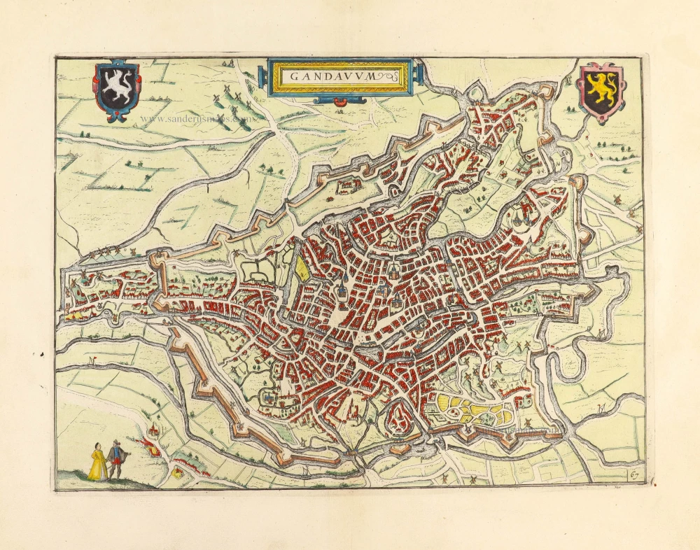
Gandavum, Amplißima Flandria Urbs ... 1657
Ghent (Gent) by Georg Braun & Frans Hogenberg, published by Johannes Janssonius.
[Item number: 2687]

1842
GENT - Stadhuis & Belfort by Louis Haghe.
[Item number: 5844]
new

Rare.
Gent. c. 1660
Gent, by Focken Hendrick
[Item number: 21312]
Rare.
Gent ca. 1650
Gent by Schnitzer Lucas
[Item number: 21998]
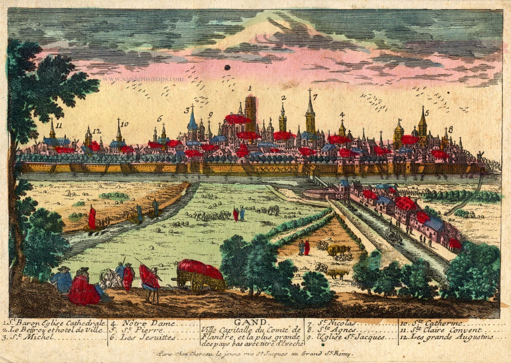
Gand. Ville Capitalle du Comté de Flandre, et la plus grande des pays bas avec titre d'Eveché c. 1720
Gent, by Chéreau.
[Item number: 22537]

Ghendt 1656
Gent, by Visscher N. - Schut P.H.
[Item number: 25397]
Rare!
Gand. c. 1678
Ghent by Gerard Jollain. (Gent)
[Item number: 26705]

Gent. 1659
Gent, by Matthäus Merian.
[Item number: 27411]

Plan du siège et des attaques de la ville et citadelle de Gand assiégée par les armées des alliez le 22 décembre 1708. ... 1729
Gent, by Jean Dumont.
[Item number: 27430]

With 'Gravensteen'.
... Hanc Veteris Burgis novam tabulam ... 1662
Gent (Castellania) by Antonius Sanderus, published by Joan Blaeu.
[Item number: 28138]
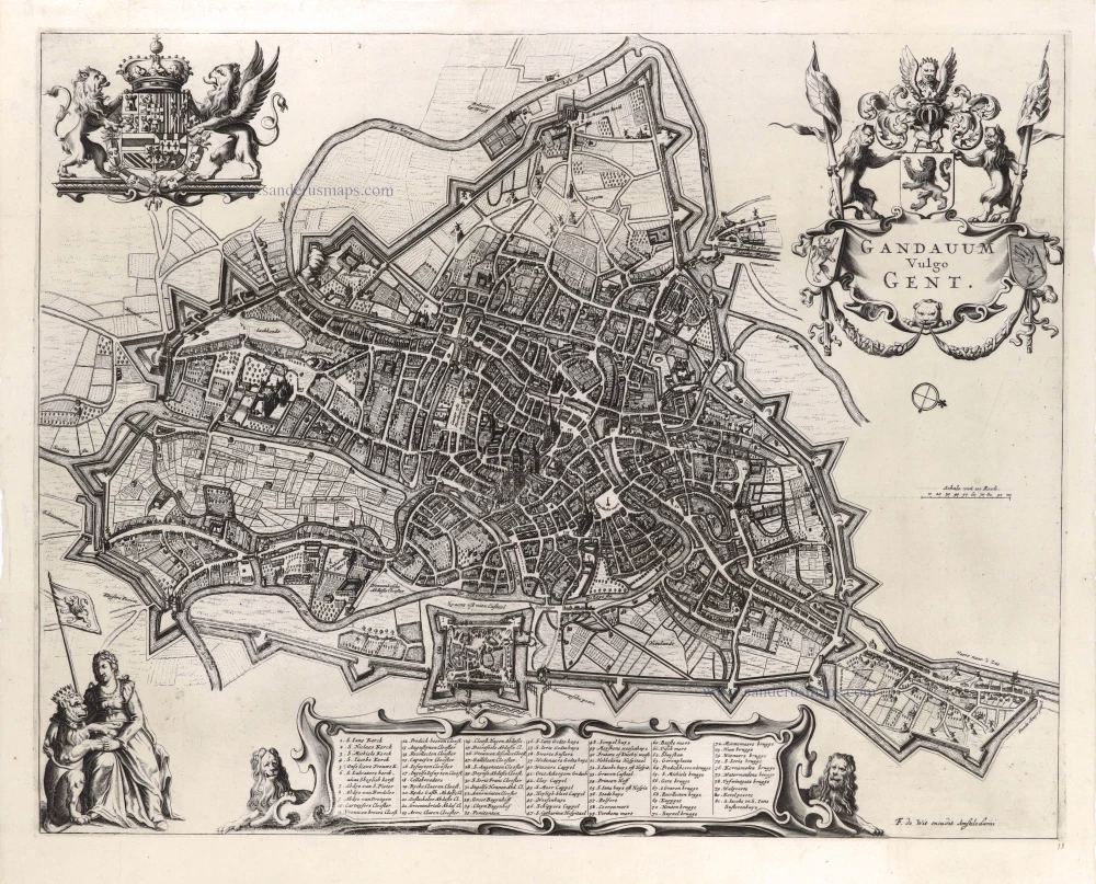
Gandavum vulgo Gent. c. 1700
Gent by Frederick de Wit.
[Item number: 29517]

Ghendt. 1613
Gent by Ludovico Guicciardini.
[Item number: 29558]

Ghent. 1833
Ghent (Gent) Three towers - Drie torens, by S. Prout.
[Item number: 30027]
Gandavum, Amplissima Flandriae urbs, ... 1599
Gent by Georg Braun & Frans Hogenberg.
[Item number: 31325]
Gandavum. 1612
Gent by Lodovico Guicciardini.
[Item number: 31373]

Gandavum vulgo Gent. 1641
Gent (Ghent) by Antonius Sanderus.
[Item number: 31606]

Curia Antiqua Gandavensis - Curia Nova Gandavensis 1641
Oude gotische en het nieuwe renaissance stadhuis van Gent, door Antonius Sanderus.
[Item number: 31608]

Ecclesia Collegiata Divi Pharahildis. - Petra Comitis vulgo Het Graven Casteel. 1641
Gent - Gravenkasteel en omgeving door Antonius Sanderus.
[Item number: 31609]

Macellum maius cum foro Piscario. 1641
Gent - Vleeshalle en Vismarkt door Antonius Sanderus.
[Item number: 31610]

Ecclesia Divo Ioanni Baptistae Sacra. 1641
Gent - St.-Baafskathedraal door Antonius Sanderus.
[Item number: 31612]

Praetorium Reverendißimi ac perillistris Domini Dñi Antonii Triest Episcopi Gandavensis, in agro Paraeciae Ackergemiensis, vulgo Belvedere. 1641
Gent - Akkergem - Kasteel Belvedere, door Antonius Sanderus.
[Item number: 31614]

Forum Veneris Vulgo De Vrydach Maert et Ecclesia S. Iacobi. - Ecclesia Parochialis Sti Nicolai. Iuxta forum frumentarium Gandavi. 1641
Gent - Vrijdagmarkt & St.-Jacobskerk - Korenmarkt & St.-Niklaaskerk, door Antonius Sanderus.
[Item number: 31615]

Nova Cartusiae Vallis Regalis intra terminos civitatis Gandavensis delin. 1641
Gent - Kartuizerklooster Koningsdal, door Antonius Sanderus.
[Item number: 31622]
![Gent - Kouter en St.-Sebastiaanshof [Verso:] Gildehuis St.-Joris, door Antonius Sanderus.](https://sanderusmaps.com/assets/IMG/webp/m31623.webp)
Hippodromus Gandavensis cum adiacentibus aedificiis et Aula Sti Sebastiani. [Verso:] Domus Gildae S. Georgii Vulgo St Ioris Hoff 1641
Gent - Kouter en St.-Sebastiaanshof [Verso:] Gildehuis St.-Joris, door Antonius Sanderus.
[Item number: 31623]
![Bellem (Aalter) [verso:] Afsnee, door Antonius Sanderus.](https://sanderusmaps.com/assets/IMG/webp/m31627.webp)
Cast. D. Caroli Rijm, Eq. aur. Toparchae in Bellem Eeckensbeke, Rammelraets in Castellania Audenborgensi. [verso:] Idewalle. 1641
Bellem (Aalter) [verso:] Afsnee, door Antonius Sanderus.
[Item number: 31627]

Episcopatus Gandavensis. 1641
Gent Bisdom (Diocese of Ghent)
[Item number: 31788]

Gandavum vulgo Gent. 1649
Gent by Joan Blaeu.
[Item number: 32006]

With train station
Panorama von Gent / Panorama de Gand.. c. 1840
Ghent, by F.C. Eisen.
[Item number: 32083]

Porte d'Eau à Gand. 1823
Gent - Rabot, lithograph by Dewasme, after Prosper de la Barrière.
[Item number: 32811]

Eglise St. Pierre à Gand. 1823
Gent - St.-Pietersabdij, lithograph by Dewasme, after Prosper de la Barrière.
[Item number: 32812]

Le Vieux Bourg à Gand; 1823
Gent - Gravenkasteel, lithograph by Dewasme, after Prosper de la Barrière.
[Item number: 33048]

Entrée de la Cour du Prince à Gand. 1823
Gent - Prinsenhof, lithograph by Dewasme, after Prosper de la Barrière.
[Item number: 33105]
new
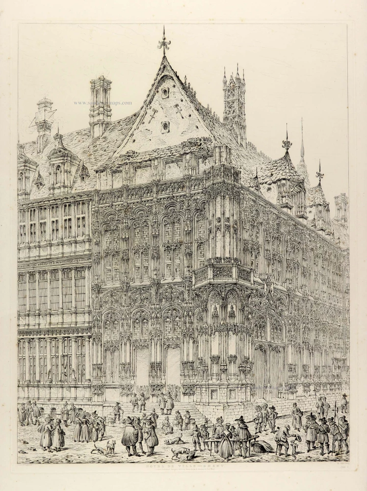
Hotel de Ville - Ghent. 1829
Ghent (Gent), City Hall, by J. Coney.
[Item number: 33111]
new