
Mons - Arras, by Georg Braun & Frans Hogenberg 1612
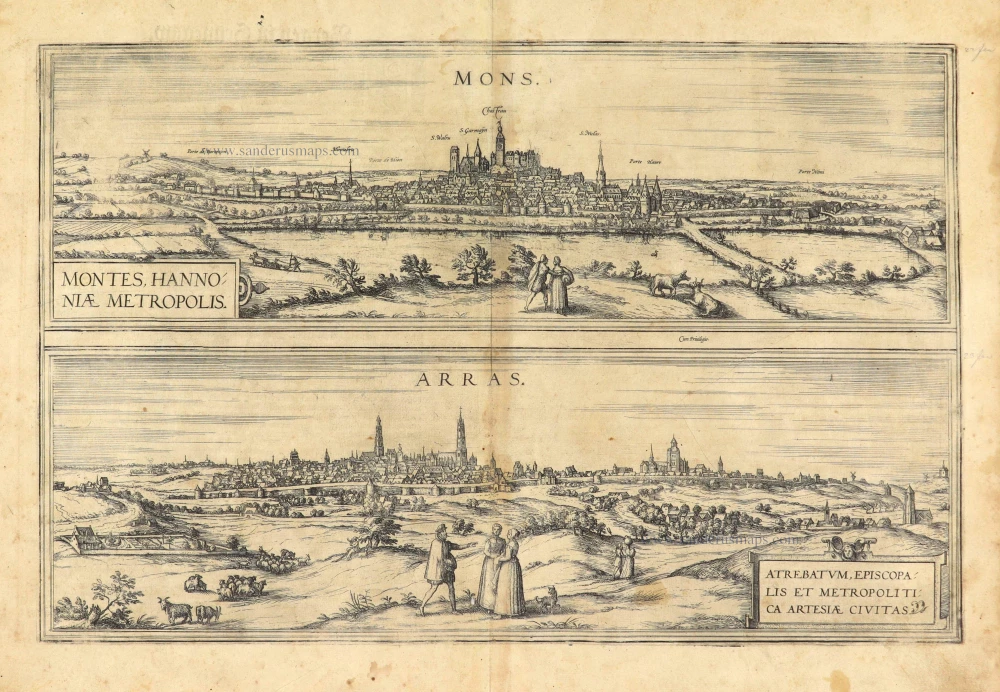
MONS
CARTOUCHE: Mons, or Bergen, capital of the Haunault.
COMMENTARY BY BRAUN: "It is said that Emperor Charlemagne made Mons his capital and granted it imperial privileges. And he is supposed to have taken its name from its setting, which is namely hilly. Mons has grown substantially in numbers of inhabitants and in buildings in a short space of time. From here, a lively trade is conducted with Frankfurt and Antwerp, above all is a sort of cloth that they call Saye and which is made in the many weaving workshops here. Thanks to its natural setting and its fortifications, it is an extremely secure city, surrounded on all sides by a moat and hence not easy to besiege."
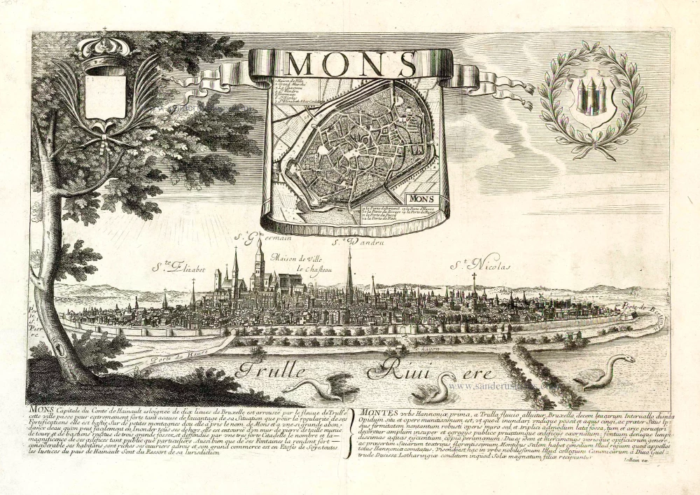
The city of Mons lies on a slight hill beside the River Haine southwest of Brussels. Mons dates back to Roman times, when Caesar erected a military camp on one of its hills during the Gallic Wars. The historical centre gradually spread outwards around a monastery founded in the 7th century by the city's patron saint, Waltrude of Mons. To protect Mons from attack, the count of Hainaut has a castle erected on the top of the hill. Emphasis falls upon the fields and meadows surrounding the city, in reference to the productive local farming and livestock industries. Another sphere of economic activity was weaving; amongst the textiles manufactured in Mons was the famous green Saye, a woollen cloth that derived its name from southern England.
ARRAS
CARTOUCHE: Arras, episcopal city and capital of Artois.
COMMENTARY BY BRAUN: "This city is divided into two parts by its city walls, with one city assigned to the bishop, the other to the prince. Although the episcopal city is smaller, it is very beautiful and distinguished by the main church dedicated to the Virgin Mary; it also has a magnificent library of written and printed theological books. The other part of the city is characterized by broad streets, very well-appointed houses and a second large market. In this part lies the abbey of Saint-Vaast, an extremely wealthy monastery."
The city of Arras (Dutch: Atrecht) in northern France is shown here in side view and in volume III from a bird's-eye perspective. Since it lay for many centuries on the border between France and the Low Countries, it frequently changed hands. The episcopal city contains the church of Notre-Dame. The grander prince's city includes the Benedictine abbey of Saint-Vaast (B), founded in AD 667 and dedicated to the city's patron saint. The abbey played an important role in the High Middle Ages as a religious centre, with an important scriptorum producing liturgical and theological manuscripts. Distributed via the Benedictine network, these manuscripts can today be found all over Europe. To its right lies the Gothic town hall (A) with its 75-m-high bell tower, begun in 1463 in the Gothic style, surrounded by impressive market squares that reflect the city's lively trading activities. Arras conducted business above all with Flanders and gained importance as one of the chief centres of the tapestry industry, its tapestries becoming known in English as "arras" and in Italian as "arazzi".
Braun G. & Hogenberg F. and the Civitates Orbis Terrarum.
The Civitates Orbis Terrarum, also known as the 'Braun & Hogenberg', is a six-volume town atlas and the most excellent book of town views and plans ever published: 363 engravings, sometimes beautifully coloured. It was one of the best-selling works in the last quarter of the 16th century. Georg Braun, a skilled writer, wrote the text accompanying the plans and views on the verso. Many plates were engraved after the original drawings of a professional artist, Joris Hoefnagel (1542-1600). The first volume was published in Latin in 1572 and the sixth in 1617. Frans Hogenberg, a talented engraver, created the tables for volumes I through IV, and Simon van den Neuwel made those for volumes V and VI. Other contributors were cartographers Daniel Freese and Heinrich Rantzau, who provided valuable geographical information. Works by Jacob van Deventer, Sebastian Münster, and Johannes Stumpf were also used as references. Translations appeared in German and French, making the atlas accessible to a broader audience.
Since its original publication of volume 1 in 1572, the Civitates Orbis Terrarum has left an indelible mark on the history of cartography. Seven more editions followed the first volume in 1575, 1577, 1582, 1588, 1593, 1599, and 1612. Vol.2, initially released in 1575, saw subsequent editions in 1597 and 1612. The subsequent volumes, each a treasure trove of historical insights, graced the world in 1581, 1588, 1593, 1599, and 1606. The German translation of the first volume, a testament to its widespread appeal, debuted in 1574, followed by the French edition in 1575.
Several printers were involved: Theodor Graminaeus, Heinrich von Aich, Gottfried von Kempen, Johannis Sinniger, Bertram Buchholtz, and Peter von Brachel, all of whom worked in Cologne.
Georg Braun (1541-1622)
Georg Braun, the author of the text accompanying the plans and views in the Civitates Orbis Terrarum, was born in Cologne in 1541. After his studies in Cologne, he entered the Jesuit Order as a novice, indicating his commitment to learning and intellectual pursuits. In 1561, he obtained his bachelor's degree; in 1562, he received his Magister Artium, further demonstrating his academic achievements. Although he left the Jesuit Order, he continued his studies in theology, gaining a licentiate in theology. His theological background likely influenced the content and tone of the text in the Civitates Orbis Terrarum, adding a unique perspective to the work.
Frans Hogenberg (1535-1590)
Frans Hogenberg was a Flemish and German painter, engraver, and mapmaker. He was born in Mechelen as the son of Nicolaas Hogenberg.
By the end of the 1560s, Frans Hogenberg was employed upon Abraham Ortelius's Theatrum Orbis Terrarum, published in 1570; he is named an engraver of numerous maps. In 1568, he was banned from Antwerp by the Duke of Alva and travelled to London, where he stayed a few years before emigrating to Cologne. He immediately embarked on his two most important works, the Civitates, published in 1572 and the Geschichtsblätter, which appeared in several series from 1569 until about 1587.
Thanks to large-scale projects like the Geschichtsblätter and the Civitates, Hogenberg's social circumstances improved with each passing year. He died as a wealthy man in Cologne in 1590.
Mons - Montes Hannoniae Metropolis [on sheet with] Arras - Atrebatum, episcopalis et metropolitica Artesiae Civitas
Item Number: 28025 Authenticity Guarantee
Category: Antique maps > Europe > Belgium - Cities
Two bird's-eye views on one sheet: Mons and Arras, by Georg Braun & Frans Hogenberg.
Title: Mons - Montes Hannoniae Metropolis [on sheet with] Arras - Atrebatum, episcopalis et metropolitica Artesiae Civitas.
Cum Privilegio.
Date of the first edition: 1572.
Date of this map: 1612.
Copper engraving, printed on paper.
Size (not including margins): 320 x 485mm (12.6 x 19.09 inches).
Verso: Latin text.
Condition: Age-toned, good.
Condition Rating: A+.
References: Van der Krogt 4, #2829, St.2; Taschen, Br. Hog., p.61; Fauser, #9039 & #692
From: Civitates Orbis Terrarum, Liber Primus. Cologne, Petrus von Brachel, 1612. (Van der Krogt 4, 41:1.1(1612))
MONS
CARTOUCHE: Mons, or Bergen, capital of the Haunault.
COMMENTARY BY BRAUN: "It is said that Emperor Charlemagne made Mons his capital and granted it imperial privileges. And he is supposed to have taken its name from its setting, which is namely hilly. Mons has grown substantially in numbers of inhabitants and in buildings in a short space of time. From here, a lively trade is conducted with Frankfurt and Antwerp, above all is a sort of cloth that they call Saye and which is made in the many weaving workshops here. Thanks to its natural setting and its fortifications, it is an extremely secure city, surrounded on all sides by a moat and hence not easy to besiege."
The city of Mons lies on a slight hill beside the River Haine southwest of Brussels. Mons dates back to Roman times, when Caesar erected a military camp on one of its hills during the Gallic Wars. The historical centre gradually spread outwards around a monastery founded in the 7th century by the city's patron saint, Waltrude of Mons. To protect Mons from attack, the count of Hainaut has a castle erected on the top of the hill. Emphasis falls upon the fields and meadows surrounding the city, in reference to the productive local farming and livestock industries. Another sphere of economic activity was weaving; amongst the textiles manufactured in Mons was the famous green Saye, a woollen cloth that derived its name from southern England.
ARRAS
CARTOUCHE: Arras, episcopal city and capital of Artois.
COMMENTARY BY BRAUN: "This city is divided into two parts by its city walls, with one city assigned to the bishop, the other to the prince. Although the episcopal city is smaller, it is very beautiful and distinguished by the main church dedicated to the Virgin Mary; it also has a magnificent library of written and printed theological books. The other part of the city is characterized by broad streets, very well-appointed houses and a second large market. In this part lies the abbey of Saint-Vaast, an extremely wealthy monastery."
The city of Arras (Dutch: Atrecht) in northern France is shown here in side view and in volume III from a bird's-eye perspective. Since it lay for many centuries on the border between France and the Low Countries, it frequently changed hands. The episcopal city contains the church of Notre-Dame. The grander prince's city includes the Benedictine abbey of Saint-Vaast (B), founded in AD 667 and dedicated to the city's patron saint. The abbey played an important role in the High Middle Ages as a religious centre, with an important scriptorum producing liturgical and theological manuscripts. Distributed via the Benedictine network, these manuscripts can today be found all over Europe. To its right lies the Gothic town hall (A) with its 75-m-high bell tower, begun in 1463 in the Gothic style, surrounded by impressive market squares that reflect the city's lively trading activities. Arras conducted business above all with Flanders and gained importance as one of the chief centres of the tapestry industry, its tapestries becoming known in English as "arras" and in Italian as "arazzi".
Braun G. & Hogenberg F. and the Civitates Orbis Terrarum.
The Civitates Orbis Terrarum, also known as the 'Braun & Hogenberg', is a six-volume town atlas and the most excellent book of town views and plans ever published: 363 engravings, sometimes beautifully coloured. It was one of the best-selling works in the last quarter of the 16th century. Georg Braun, a skilled writer, wrote the text accompanying the plans and views on the verso. Many plates were engraved after the original drawings of a professional artist, Joris Hoefnagel (1542-1600). The first volume was published in Latin in 1572 and the sixth in 1617. Frans Hogenberg, a talented engraver, created the tables for volumes I through IV, and Simon van den Neuwel made those for volumes V and VI. Other contributors were cartographers Daniel Freese and Heinrich Rantzau, who provided valuable geographical information. Works by Jacob van Deventer, Sebastian Münster, and Johannes Stumpf were also used as references. Translations appeared in German and French, making the atlas accessible to a broader audience.
Since its original publication of volume 1 in 1572, the Civitates Orbis Terrarum has left an indelible mark on the history of cartography. Seven more editions followed the first volume in 1575, 1577, 1582, 1588, 1593, 1599, and 1612. Vol.2, initially released in 1575, saw subsequent editions in 1597 and 1612. The subsequent volumes, each a treasure trove of historical insights, graced the world in 1581, 1588, 1593, 1599, and 1606. The German translation of the first volume, a testament to its widespread appeal, debuted in 1574, followed by the French edition in 1575.
Several printers were involved: Theodor Graminaeus, Heinrich von Aich, Gottfried von Kempen, Johannis Sinniger, Bertram Buchholtz, and Peter von Brachel, all of whom worked in Cologne.
Georg Braun (1541-1622)
Georg Braun, the author of the text accompanying the plans and views in the Civitates Orbis Terrarum, was born in Cologne in 1541. After his studies in Cologne, he entered the Jesuit Order as a novice, indicating his commitment to learning and intellectual pursuits. In 1561, he obtained his bachelor's degree; in 1562, he received his Magister Artium, further demonstrating his academic achievements. Although he left the Jesuit Order, he continued his studies in theology, gaining a licentiate in theology. His theological background likely influenced the content and tone of the text in the Civitates Orbis Terrarum, adding a unique perspective to the work.
Frans Hogenberg (1535-1590)
Frans Hogenberg was a Flemish and German painter, engraver, and mapmaker. He was born in Mechelen as the son of Nicolaas Hogenberg.
By the end of the 1560s, Frans Hogenberg was employed upon Abraham Ortelius's Theatrum Orbis Terrarum, published in 1570; he is named an engraver of numerous maps. In 1568, he was banned from Antwerp by the Duke of Alva and travelled to London, where he stayed a few years before emigrating to Cologne. He immediately embarked on his two most important works, the Civitates, published in 1572 and the Geschichtsblätter, which appeared in several series from 1569 until about 1587.
Thanks to large-scale projects like the Geschichtsblätter and the Civitates, Hogenberg's social circumstances improved with each passing year. He died as a wealthy man in Cologne in 1590.
Related items

Mons 1726
Mons by D. Fassmann.
[Item number: 6111]

Bergen. 1576-1612
Siege of Bergen (Mons).
[Item number: 7750]

Montes Hannoniae. Mons en Hainaut. Bergen in Henegouwen. 1649
Mons, by Blaeu J.
[Item number: 13100]

Mons, Hannonia Urbs PotenS & Ampla, ... 1616
Mons, by Georg Braun & Frans Hogenberg.
[Item number: 16462]

Atrebatum, Gallis Arras, Belgis Atrecht dicta. 1649
Arras, by Blaeu J.
[Item number: 22843]

Arras - Atrebatum, fertilissimae Artesiae Urbs primaria, elegantissimo situ, . . . 1599
Arras, by Braun & Hogenberg.
[Item number: 23345]

Arras - Atrebatum, fertilissimae Artesiae Urbs primaria, elegantissimo situ, . . . 1599
Arras, by Georg Braun and Frans Hogenberg.
[Item number: 24037]
Rare.
Mons. c. 1678
Mons, by Gerard Jollain.
[Item number: 26706]
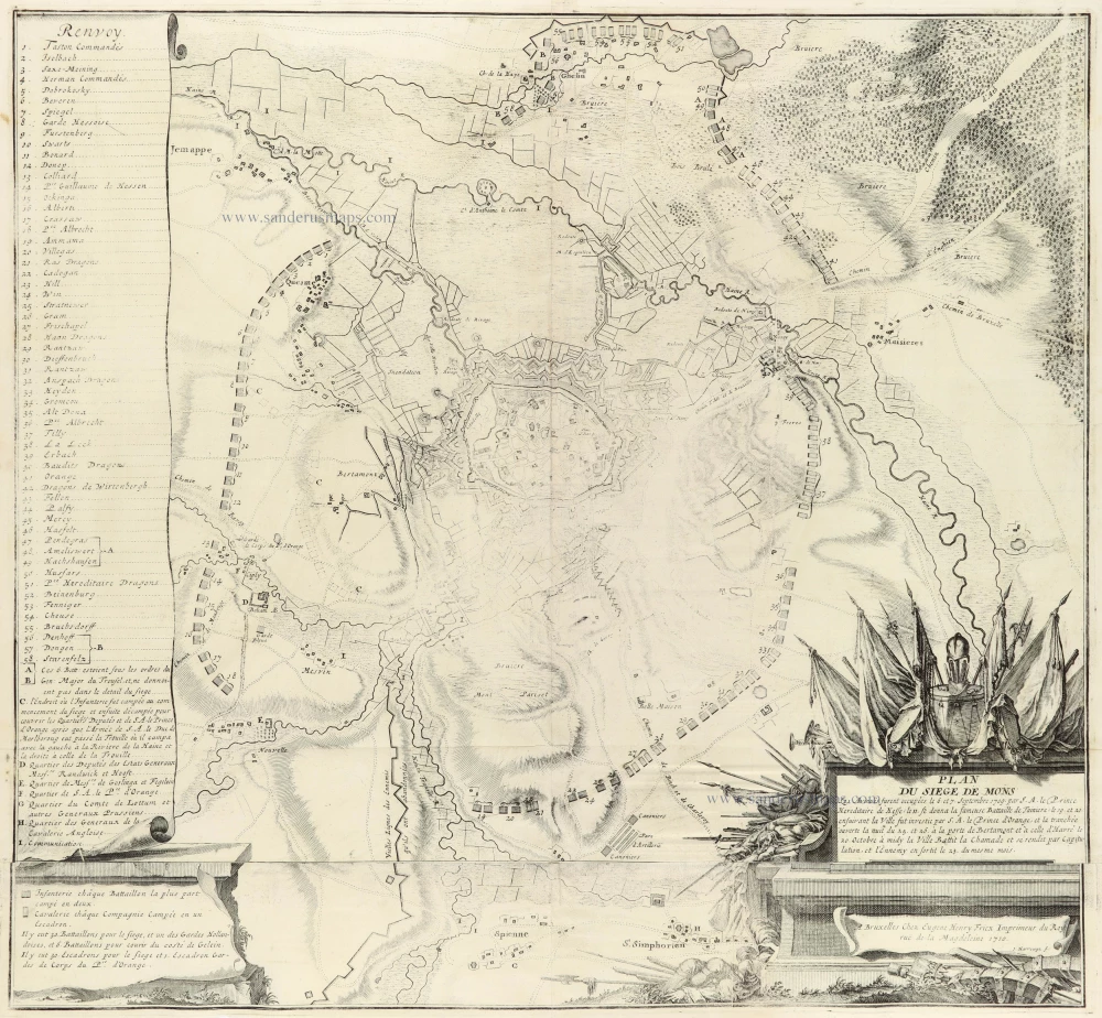
Plan du Siege de Mons 1712
Mons by Eugène Fricx.
[Item number: 30791]

Cour de l'Hôtel de Ville de Mons 1823
Mons, lithograph by Dewasme, after L. Haghe.
[Item number: 32815]
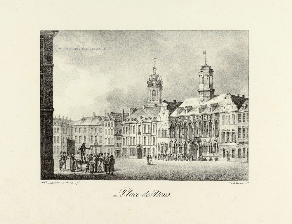
Place de Mons. 1823
Mons, lithograph by Dewasme, after Prosper de La Barrière & Haghe.
[Item number: 33134]