
Mons, by Georg Braun and Frans Hogenberg. 1599
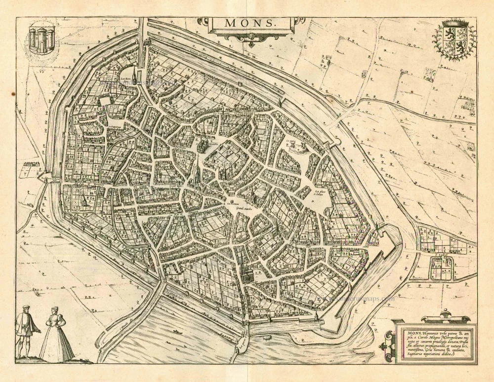
TRANSLATION OF CARTOUCHE TEXT: Mons, the powerful and wealthy city in Hainaut, was endowed with imperial privileges by Charlemagne and the River Trulla flows around it; it is well protected by its fortifications and natural setting; the civilized and affluent population trades mostly in livestock.
COMMENTARY BY BRAUN: "It is said that Emperor Charlemagne made Mons his capital and granted it imperial privileges. And he is supposed to have taken its name from its setting, namely hilly. Mons has grown substantially in the number of inhabitants and buildings quickly. From here, a lively trade is conducted with Frankfurt and Antwerp; above all, it is a sort of cloth that they call Saye and made in the many weaving workshops here. Thanks to its natural setting and fortifications, it is an extremely secure city, surrounded on all sides by a moat and hence not easy to besiege."
Mons lies on a slight hill beside the River Haine southwest of Brussels. Its surrounding moat and well-fortified ramparts are recognizable. Mons dates back to Roman times when Caesar erected a military camp on one of its hills during the Gallic Wars. The historical centre gradually spread around a monastery founded in the 7th century by the city's patron saint, Waltrude of Mons. The Count of Hainaut erected a castle on top of the hill to protect Mons from attack. Rising from the middle of an open square left of the centre is the church of Sainte-Waudru; below it, at the city's centre, lies the main marketplace with the town hall. Emphasis falls upon the city's fields and meadows about the productive local farming and livestock industries. Another sphere of economic activity was weaving; among the textiles manufactured in Mons was the famous green Saye, a woollen cloth derived from southern England.
Braun G. & Hogenberg F. and the Civitates Orbis Terrarum.
The Civitates Orbis Terrarum, also known as the 'Braun & Hogenberg', is a six-volume town atlas and the most excellent book of town views and plans ever published: 363 engravings, sometimes beautifully coloured. It was one of the best-selling works in the last quarter of the 16th century. Georg Braun, a skilled writer, wrote the text accompanying the plans and views on the verso. Many plates were engraved after the original drawings of a professional artist, Joris Hoefnagel (1542-1600). The first volume was published in Latin in 1572 and the sixth in 1617. Frans Hogenberg, a talented engraver, created the tables for volumes I through IV, and Simon van den Neuwel made those for volumes V and VI. Other contributors were cartographers Daniel Freese and Heinrich Rantzau, who provided valuable geographical information. Works by Jacob van Deventer, Sebastian Münster, and Johannes Stumpf were also used as references. Translations appeared in German and French, making the atlas accessible to a broader audience.
Since its original publication of volume 1 in 1572, the Civitates Orbis Terrarum has left an indelible mark on the history of cartography. Seven more editions followed the first volume in 1575, 1577, 1582, 1588, 1593, 1599, and 1612. Vol.2, initially released in 1575, saw subsequent editions in 1597 and 1612. The subsequent volumes, each a treasure trove of historical insights, graced the world in 1581, 1588, 1593, 1599, and 1606. The German translation of the first volume, a testament to its widespread appeal, debuted in 1574, followed by the French edition in 1575.
Several printers were involved: Theodor Graminaeus, Heinrich von Aich, Gottfried von Kempen, Johannis Sinniger, Bertram Buchholtz, and Peter von Brachel, all of whom worked in Cologne.
Georg Braun (1541-1622)
Georg Braun, the author of the text accompanying the plans and views in the Civitates Orbis Terrarum, was born in Cologne in 1541. After his studies in Cologne, he entered the Jesuit Order as a novice, indicating his commitment to learning and intellectual pursuits. In 1561, he obtained his bachelor's degree; in 1562, he received his Magister Artium, further demonstrating his academic achievements. Although he left the Jesuit Order, he continued his studies in theology, gaining a licentiate in theology. His theological background likely influenced the content and tone of the text in the Civitates Orbis Terrarum, adding a unique perspective to the work.
Frans Hogenberg (1535-1590)
Frans Hogenberg was a Flemish and German painter, engraver, and mapmaker. He was born in Mechelen as the son of Nicolaas Hogenberg.
By the end of the 1560s, Frans Hogenberg was employed upon Abraham Ortelius's Theatrum Orbis Terrarum, published in 1570; he is named an engraver of numerous maps. In 1568, he was banned from Antwerp by the Duke of Alva and travelled to London, where he stayed a few years before emigrating to Cologne. He immediately embarked on his two most important works, the Civitates, published in 1572 and the Geschichtsblätter, which appeared in several series from 1569 until about 1587.
Thanks to large-scale projects like the Geschichtsblätter and the Civitates, Hogenberg's social circumstances improved with each passing year. He died as a wealthy man in Cologne in 1590.
Mons, Hannonia Urbs potens & ampla, a Carolo Magno, Metropolitano muneze et caesareis privilegijs donata, ...
Item Number: 24039 Authenticity Guarantee
Category: Antique maps > Europe > Belgium - Cities
Old, antique bird’s-eye view plan of Mons, by Georg Braun and Frans Hogenberg.
Title: Mons, Hannonia Urbs potens & ampla, a Carolo Magno, Metropolitano muneze et caesareis privilegijs donata, ...
Date of the first edition: 1581.
Date of this map: 1599.
Copper engraving, printed on paper.
Size (not including margins): 350 x 465mm (13.78 x 18.31 inches).
Verso: Latin text.
Condition: Uncoloured, excellent.
Condition Rating: A+.
From: Civitates Orbis Terrarum. Liber tertius. Köln, Bertram Buchholtz, 1599. (Koeman, B&H3)
TRANSLATION OF CARTOUCHE TEXT: Mons, the powerful and wealthy city in Hainaut, was endowed with imperial privileges by Charlemagne and the River Trulla flows around it; it is well protected by its fortifications and natural setting; the civilized and affluent population trades mostly in livestock.
COMMENTARY BY BRAUN: "It is said that Emperor Charlemagne made Mons his capital and granted it imperial privileges. And he is supposed to have taken its name from its setting, namely hilly. Mons has grown substantially in the number of inhabitants and buildings quickly. From here, a lively trade is conducted with Frankfurt and Antwerp; above all, it is a sort of cloth that they call Saye and made in the many weaving workshops here. Thanks to its natural setting and fortifications, it is an extremely secure city, surrounded on all sides by a moat and hence not easy to besiege."
Mons lies on a slight hill beside the River Haine southwest of Brussels. Its surrounding moat and well-fortified ramparts are recognizable. Mons dates back to Roman times when Caesar erected a military camp on one of its hills during the Gallic Wars. The historical centre gradually spread around a monastery founded in the 7th century by the city's patron saint, Waltrude of Mons. The Count of Hainaut erected a castle on top of the hill to protect Mons from attack. Rising from the middle of an open square left of the centre is the church of Sainte-Waudru; below it, at the city's centre, lies the main marketplace with the town hall. Emphasis falls upon the city's fields and meadows about the productive local farming and livestock industries. Another sphere of economic activity was weaving; among the textiles manufactured in Mons was the famous green Saye, a woollen cloth derived from southern England.
Braun G. & Hogenberg F. and the Civitates Orbis Terrarum.
The Civitates Orbis Terrarum, also known as the 'Braun & Hogenberg', is a six-volume town atlas and the most excellent book of town views and plans ever published: 363 engravings, sometimes beautifully coloured. It was one of the best-selling works in the last quarter of the 16th century. Georg Braun, a skilled writer, wrote the text accompanying the plans and views on the verso. Many plates were engraved after the original drawings of a professional artist, Joris Hoefnagel (1542-1600). The first volume was published in Latin in 1572 and the sixth in 1617. Frans Hogenberg, a talented engraver, created the tables for volumes I through IV, and Simon van den Neuwel made those for volumes V and VI. Other contributors were cartographers Daniel Freese and Heinrich Rantzau, who provided valuable geographical information. Works by Jacob van Deventer, Sebastian Münster, and Johannes Stumpf were also used as references. Translations appeared in German and French, making the atlas accessible to a broader audience.
Since its original publication of volume 1 in 1572, the Civitates Orbis Terrarum has left an indelible mark on the history of cartography. Seven more editions followed the first volume in 1575, 1577, 1582, 1588, 1593, 1599, and 1612. Vol.2, initially released in 1575, saw subsequent editions in 1597 and 1612. The subsequent volumes, each a treasure trove of historical insights, graced the world in 1581, 1588, 1593, 1599, and 1606. The German translation of the first volume, a testament to its widespread appeal, debuted in 1574, followed by the French edition in 1575.
Several printers were involved: Theodor Graminaeus, Heinrich von Aich, Gottfried von Kempen, Johannis Sinniger, Bertram Buchholtz, and Peter von Brachel, all of whom worked in Cologne.
Georg Braun (1541-1622)
Georg Braun, the author of the text accompanying the plans and views in the Civitates Orbis Terrarum, was born in Cologne in 1541. After his studies in Cologne, he entered the Jesuit Order as a novice, indicating his commitment to learning and intellectual pursuits. In 1561, he obtained his bachelor's degree; in 1562, he received his Magister Artium, further demonstrating his academic achievements. Although he left the Jesuit Order, he continued his studies in theology, gaining a licentiate in theology. His theological background likely influenced the content and tone of the text in the Civitates Orbis Terrarum, adding a unique perspective to the work.
Frans Hogenberg (1535-1590)
Frans Hogenberg was a Flemish and German painter, engraver, and mapmaker. He was born in Mechelen as the son of Nicolaas Hogenberg.
By the end of the 1560s, Frans Hogenberg was employed upon Abraham Ortelius's Theatrum Orbis Terrarum, published in 1570; he is named an engraver of numerous maps. In 1568, he was banned from Antwerp by the Duke of Alva and travelled to London, where he stayed a few years before emigrating to Cologne. He immediately embarked on his two most important works, the Civitates, published in 1572 and the Geschichtsblätter, which appeared in several series from 1569 until about 1587.
Thanks to large-scale projects like the Geschichtsblätter and the Civitates, Hogenberg's social circumstances improved with each passing year. He died as a wealthy man in Cologne in 1590.
Related items
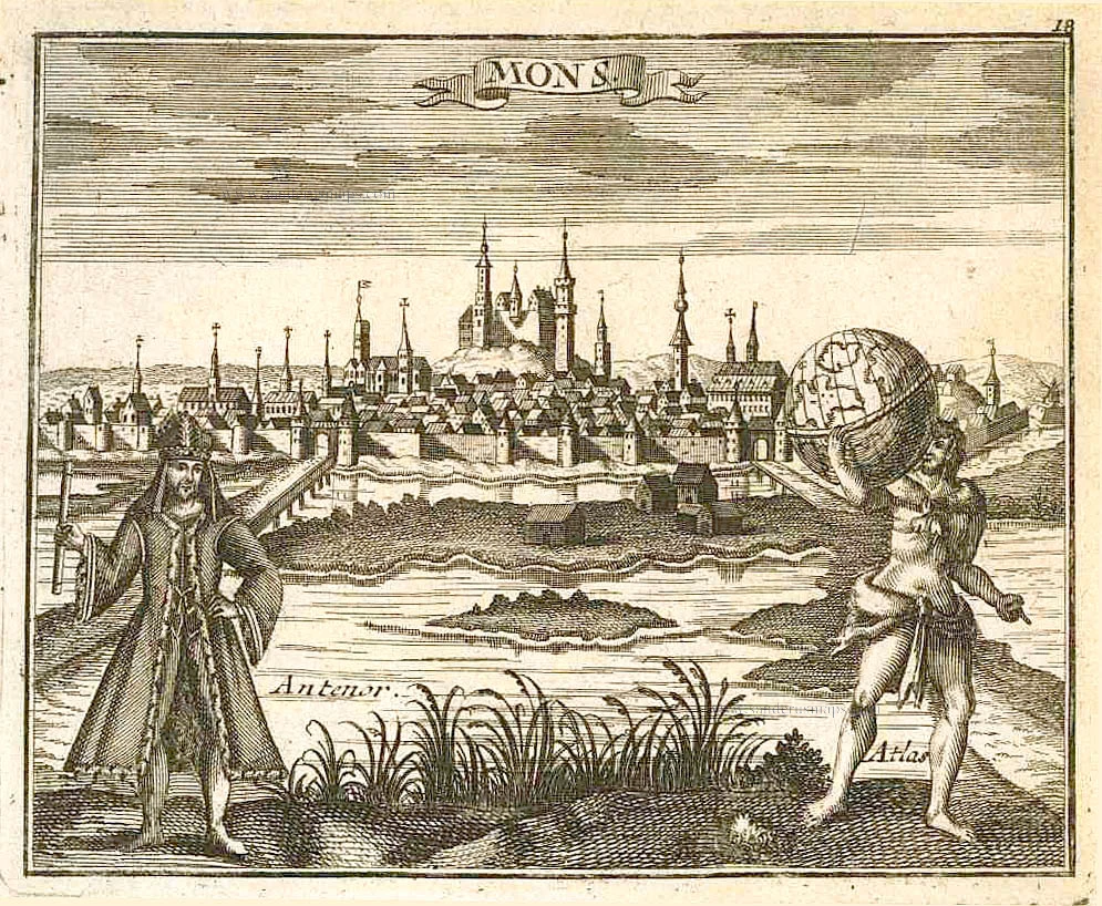
Mons 1726
Mons by D. Fassmann.
[Item number: 6111]
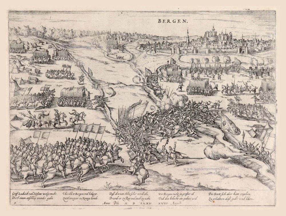
Bergen. 1576-1612
Siege of Bergen (Mons).
[Item number: 7750]
Rare.
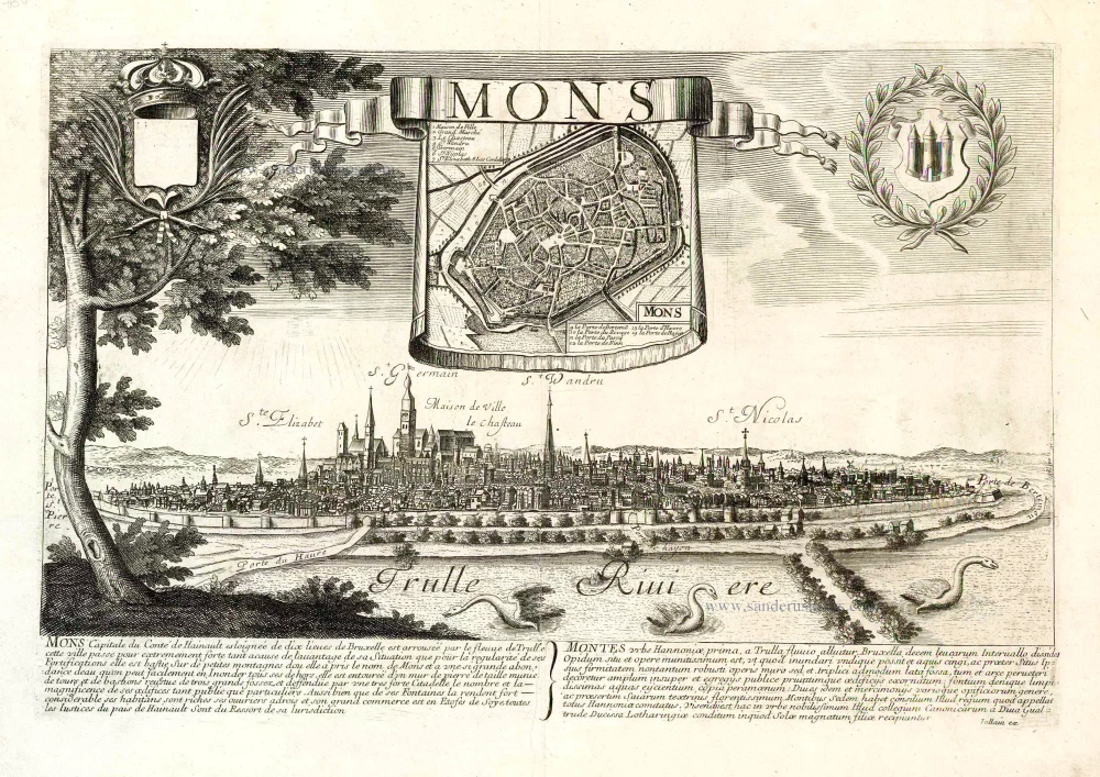
Mons. c. 1678
Mons, by Gerard Jollain.
[Item number: 26706]
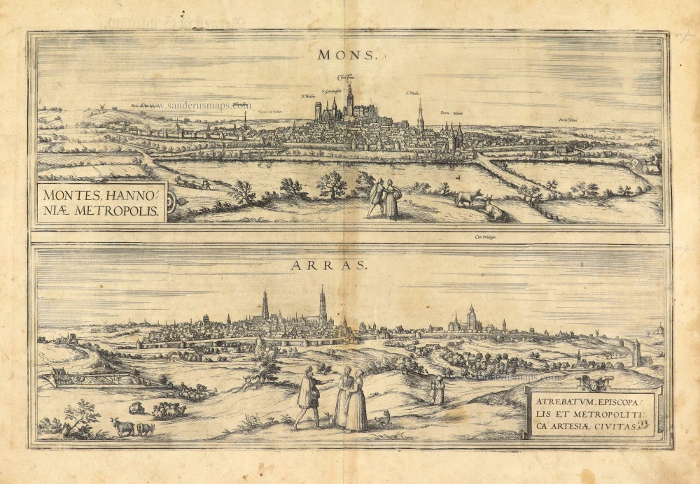
Mons - Montes Hannoniae Metropolis [on sheet with] Arras - Atrebatum, episcopalis et metropolitica Artesiae Civitas 1612
Mons - Arras, by Georg Braun & Frans Hogenberg
[Item number: 28025]
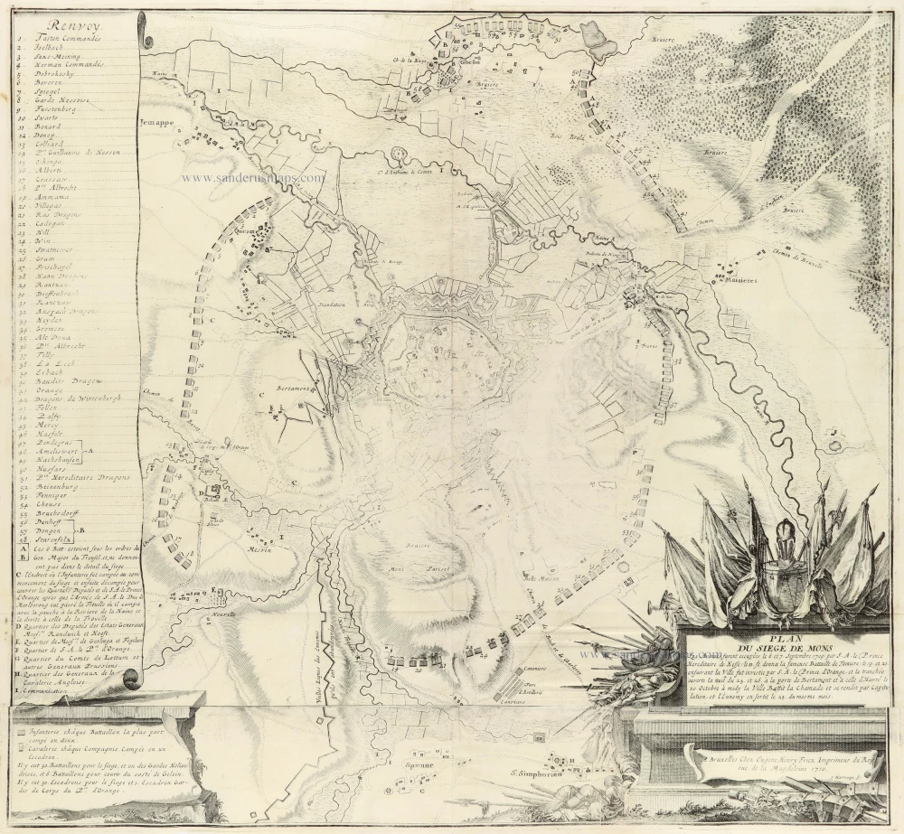
Plan du Siege de Mons 1712
Mons by Eugène Fricx.
[Item number: 30791]