
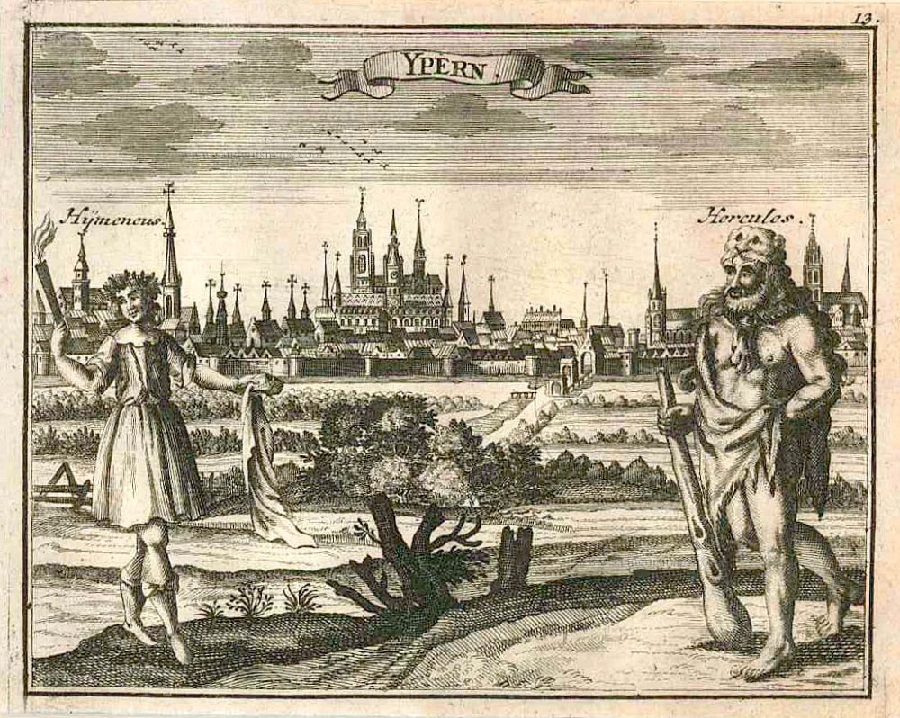
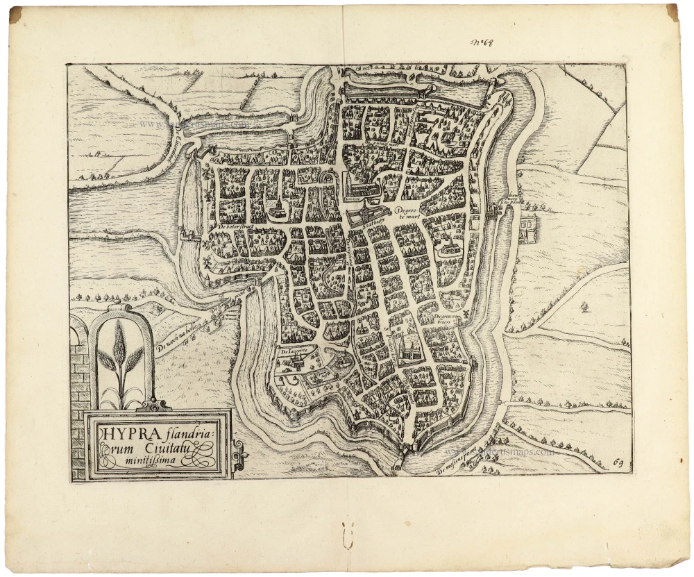
Ypres (Ieper), by Georg Braun and Frans Hogenberg. 1597

CARTOUCHE: Ypres, one of the best-fortified cities in Flanders.
COMMENTARY BY BRAUN: "Ypres is a city in Flanders with a big and long town hall, located on the marketplace, a magnificent building with a big square tower. It is a remarkable fact that no one has ever seen a spider or a spider's web in this building. As some believe, the reason for this is that the wooden beams were brought here over the sea from Norway and Sweden and that the salt water does not tolerate rot and vermin. Twice a year a great fair is held here, especially in cloth and wool, with which the Flemings have always carried on a lively trade."
Ypres in Flanders was one of the most important cloth production centres in Europe in the 13th century. With a population of 200,000 and 4,000 weaving looms, it surpassed even Ghent and Bruges. Cloth from Ypres has been found in central Russia, North Africa and Syria. The city suffered an economic decline in the 15th century when English wool became established on the market. (Taschen)
Braun G. & Hogenberg F. and the Civitates Orbis Terrarum.
The Civitates Orbis Terrarum, also known as the 'Braun & Hogenberg', is a six-volume town atlas and the most excellent book of town views and plans ever published: 363 engravings, sometimes beautifully coloured. It was one of the best-selling works in the last quarter of the 16th century. Georg Braun, a skilled writer, wrote the text accompanying the plans and views on the verso. Many plates were engraved after the original drawings of a professional artist, Joris Hoefnagel (1542-1600). The first volume was published in Latin in 1572 and the sixth in 1617. Frans Hogenberg, a talented engraver, created the tables for volumes I through IV, and Simon van den Neuwel made those for volumes V and VI. Other contributors were cartographers Daniel Freese and Heinrich Rantzau, who provided valuable geographical information. Works by Jacob van Deventer, Sebastian Münster, and Johannes Stumpf were also used as references. Translations appeared in German and French, making the atlas accessible to a broader audience.
Since its original publication of volume 1 in 1572, the Civitates Orbis Terrarum has left an indelible mark on the history of cartography. Seven more editions followed the first volume in 1575, 1577, 1582, 1588, 1593, 1599, and 1612. Vol.2, initially released in 1575, saw subsequent editions in 1597 and 1612. The subsequent volumes, each a treasure trove of historical insights, graced the world in 1581, 1588, 1593, 1599, and 1606. The German translation of the first volume, a testament to its widespread appeal, debuted in 1574, followed by the French edition in 1575.
Several printers were involved: Theodor Graminaeus, Heinrich von Aich, Gottfried von Kempen, Johannis Sinniger, Bertram Buchholtz, and Peter von Brachel, all of whom worked in Cologne.
Georg Braun (1541-1622)
Georg Braun, the author of the text accompanying the plans and views in the Civitates Orbis Terrarum, was born in Cologne in 1541. After his studies in Cologne, he entered the Jesuit Order as a novice, indicating his commitment to learning and intellectual pursuits. In 1561, he obtained his bachelor's degree; in 1562, he received his Magister Artium, further demonstrating his academic achievements. Although he left the Jesuit Order, he continued his studies in theology, gaining a licentiate in theology. His theological background likely influenced the content and tone of the text in the Civitates Orbis Terrarum, adding a unique perspective to the work.
Frans Hogenberg (1535-1590)
Frans Hogenberg was a Flemish and German painter, engraver, and mapmaker. He was born in Mechelen as the son of Nicolaas Hogenberg.
By the end of the 1560s, Frans Hogenberg was employed upon Abraham Ortelius's Theatrum Orbis Terrarum, published in 1570; he is named an engraver of numerous maps. In 1568, he was banned from Antwerp by the Duke of Alva and travelled to London, where he stayed a few years before emigrating to Cologne. He immediately embarked on his two most important works, the Civitates, published in 1572 and the Geschichtsblätter, which appeared in several series from 1569 until about 1587.
Thanks to large-scale projects like the Geschichtsblätter and the Civitates, Hogenberg's social circumstances improved with each passing year. He died as a wealthy man in Cologne in 1590.
Hypra Flandriarum Civitas Munitissima
Item Number: 23976 Authenticity Guarantee
Category: Antique maps > Europe > Belgium - Cities
Old, antique map - bird's-eye view plan of Ypres (Ieper) by Braun and Hogenberg.
Date of the first edition: 1575
Date of this map: 1597
Copper engraving
Size: 34 x 32.5cm (13.3 x 12.6 inches)
Verso text: Latin
Condition: Uncoloured, excellent.
Condition Rating: A
References: Van der Krogt 4, 1862; Taschen, Br. Hog., p.148; Verbouwe (Ieper), #133.
From: Civitates Orbis Terrarum, ... Part 2: De Praecipuis, Totius Universi Urbibus, Liber Secundus. Köln, Bertram Buchholz, 1597. (Van der Krogt 4, 41:1.2)
CARTOUCHE: Ypres, one of the best-fortified cities in Flanders.
COMMENTARY BY BRAUN: "Ypres is a city in Flanders with a big and long town hall, located on the marketplace, a magnificent building with a big square tower. It is a remarkable fact that no one has ever seen a spider or a spider's web in this building. As some believe, the reason for this is that the wooden beams were brought here over the sea from Norway and Sweden and that the salt water does not tolerate rot and vermin. Twice a year a great fair is held here, especially in cloth and wool, with which the Flemings have always carried on a lively trade."
Ypres in Flanders was one of the most important cloth production centres in Europe in the 13th century. With a population of 200,000 and 4,000 weaving looms, it surpassed even Ghent and Bruges. Cloth from Ypres has been found in central Russia, North Africa and Syria. The city suffered an economic decline in the 15th century when English wool became established on the market. (Taschen)
Braun G. & Hogenberg F. and the Civitates Orbis Terrarum.
The Civitates Orbis Terrarum, also known as the 'Braun & Hogenberg', is a six-volume town atlas and the most excellent book of town views and plans ever published: 363 engravings, sometimes beautifully coloured. It was one of the best-selling works in the last quarter of the 16th century. Georg Braun, a skilled writer, wrote the text accompanying the plans and views on the verso. Many plates were engraved after the original drawings of a professional artist, Joris Hoefnagel (1542-1600). The first volume was published in Latin in 1572 and the sixth in 1617. Frans Hogenberg, a talented engraver, created the tables for volumes I through IV, and Simon van den Neuwel made those for volumes V and VI. Other contributors were cartographers Daniel Freese and Heinrich Rantzau, who provided valuable geographical information. Works by Jacob van Deventer, Sebastian Münster, and Johannes Stumpf were also used as references. Translations appeared in German and French, making the atlas accessible to a broader audience.
Since its original publication of volume 1 in 1572, the Civitates Orbis Terrarum has left an indelible mark on the history of cartography. Seven more editions followed the first volume in 1575, 1577, 1582, 1588, 1593, 1599, and 1612. Vol.2, initially released in 1575, saw subsequent editions in 1597 and 1612. The subsequent volumes, each a treasure trove of historical insights, graced the world in 1581, 1588, 1593, 1599, and 1606. The German translation of the first volume, a testament to its widespread appeal, debuted in 1574, followed by the French edition in 1575.
Several printers were involved: Theodor Graminaeus, Heinrich von Aich, Gottfried von Kempen, Johannis Sinniger, Bertram Buchholtz, and Peter von Brachel, all of whom worked in Cologne.
Georg Braun (1541-1622)
Georg Braun, the author of the text accompanying the plans and views in the Civitates Orbis Terrarum, was born in Cologne in 1541. After his studies in Cologne, he entered the Jesuit Order as a novice, indicating his commitment to learning and intellectual pursuits. In 1561, he obtained his bachelor's degree; in 1562, he received his Magister Artium, further demonstrating his academic achievements. Although he left the Jesuit Order, he continued his studies in theology, gaining a licentiate in theology. His theological background likely influenced the content and tone of the text in the Civitates Orbis Terrarum, adding a unique perspective to the work.
Frans Hogenberg (1535-1590)
Frans Hogenberg was a Flemish and German painter, engraver, and mapmaker. He was born in Mechelen as the son of Nicolaas Hogenberg.
By the end of the 1560s, Frans Hogenberg was employed upon Abraham Ortelius's Theatrum Orbis Terrarum, published in 1570; he is named an engraver of numerous maps. In 1568, he was banned from Antwerp by the Duke of Alva and travelled to London, where he stayed a few years before emigrating to Cologne. He immediately embarked on his two most important works, the Civitates, published in 1572 and the Geschichtsblätter, which appeared in several series from 1569 until about 1587.
Thanks to large-scale projects like the Geschichtsblätter and the Civitates, Hogenberg's social circumstances improved with each passing year. He died as a wealthy man in Cologne in 1590.
Related items

Ipern. 1659
Ieper, by Matthäus Merian & Martin Zeiller.
[Item number: 2241]

Yperen. 1656
Ieper, by N. Visscher & P.H. Schut.
[Item number: 2774]
Ypern. 1726
Ypres (Ieper), by D. Fassmann.
[Item number: 5959]

Ypre. - Carte du Gouvernement d'Ypre. - Plan de la Ville d'Ipre. ca. 1668
Ypres (Ieper) by Sr. S. de Beaulieu - three plates.
[Item number: 30299]
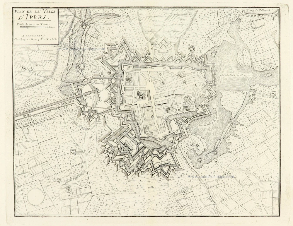
Plan de la ville d'Ipres 1712
Ieper by Eugène Fricx.
[Item number: 30797]

Hollebeke 1641
Ieper - Hollebeke, by Antonius Sanderus
[Item number: 32721]
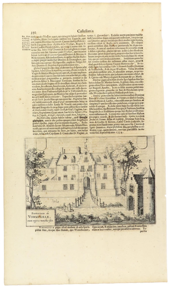
Praetorium de Vormizele, utante nuperos tumultus fuit. 1641
Ieper - Voormezele, by Antonius Sanderus
[Item number: 32723]
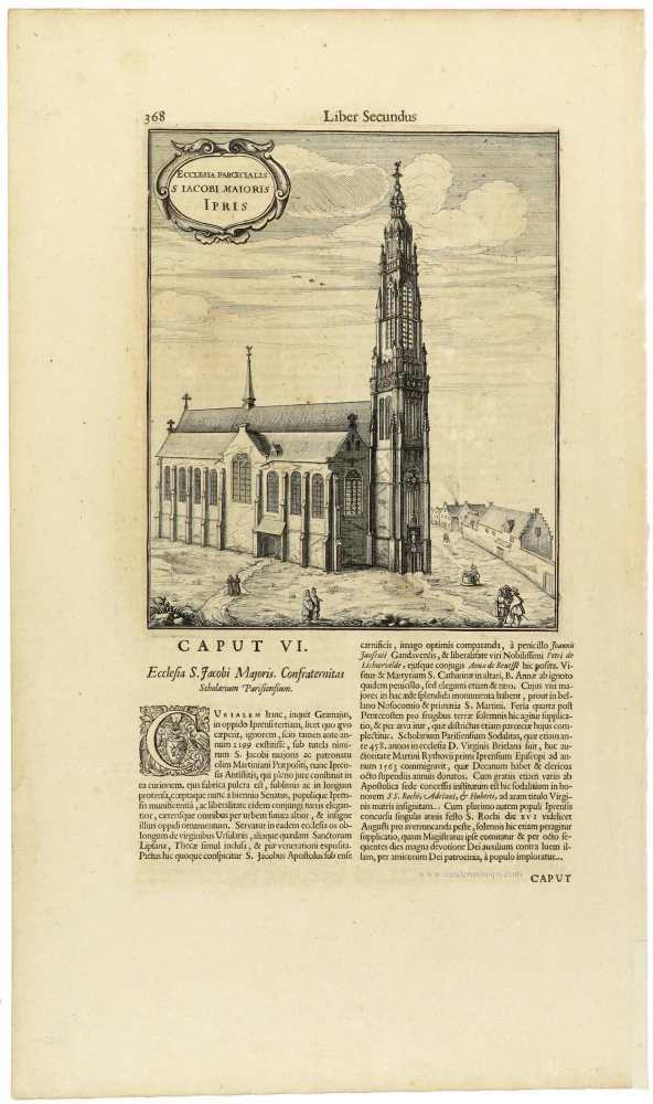
Ecclesia Parcecialis S Iacobi Maioris Ipris. 1641
Ieper - Kerk St.-Jacob, by Antonius Sanderus
[Item number: 32724]

Nova Et Exacta Tabula Geographica Salae Et Castellaniae Iprensis - De Casselrie Van Ipre - La Chastelenie D'ipre Anno MDCXXXXI. 1641
Ieper (Castellania), by A. Sanderus.
[Item number: 32725]

Praetorium Iprense Vulgo De Halle van Yperen 1641
Ieper - Halle met belfort & Marktplein, door Antonius Sanderus.
[Item number: 32726]

Ypra. 1641-1644
Ypres (Ieper), by Antonius Sanderus.
[Item number: 32729]

Rare first state
Iprensis Episcopatus. 1641-1644
The bishopric of Ypres (Ieper), by Antonius Sanderus, published by Henricus Hondius.
[Item number: 32850]
Hypra flandriarum Civitatu minitißima; 1612
Ieper (Ypres) by Guicciardini Lodovico
[Item number: 33003]
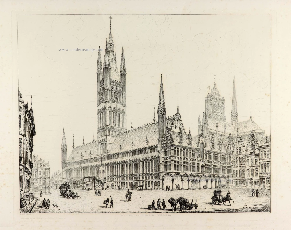
Hotel de Ville - Ypres 1832
Ieper (Ypres) , City Hall, by J. Coney.
[Item number: 33112]
new