
Louvain by Braun & Hogenberg 1599
The item displayed on this page has been sold. However, we have a similar map in stock:
Louvain by Georg Braun & Frans Hogenberg. 1599
Loeven - Lovanium, Brabanticarum urbium caput,...
[Item number: 29977]
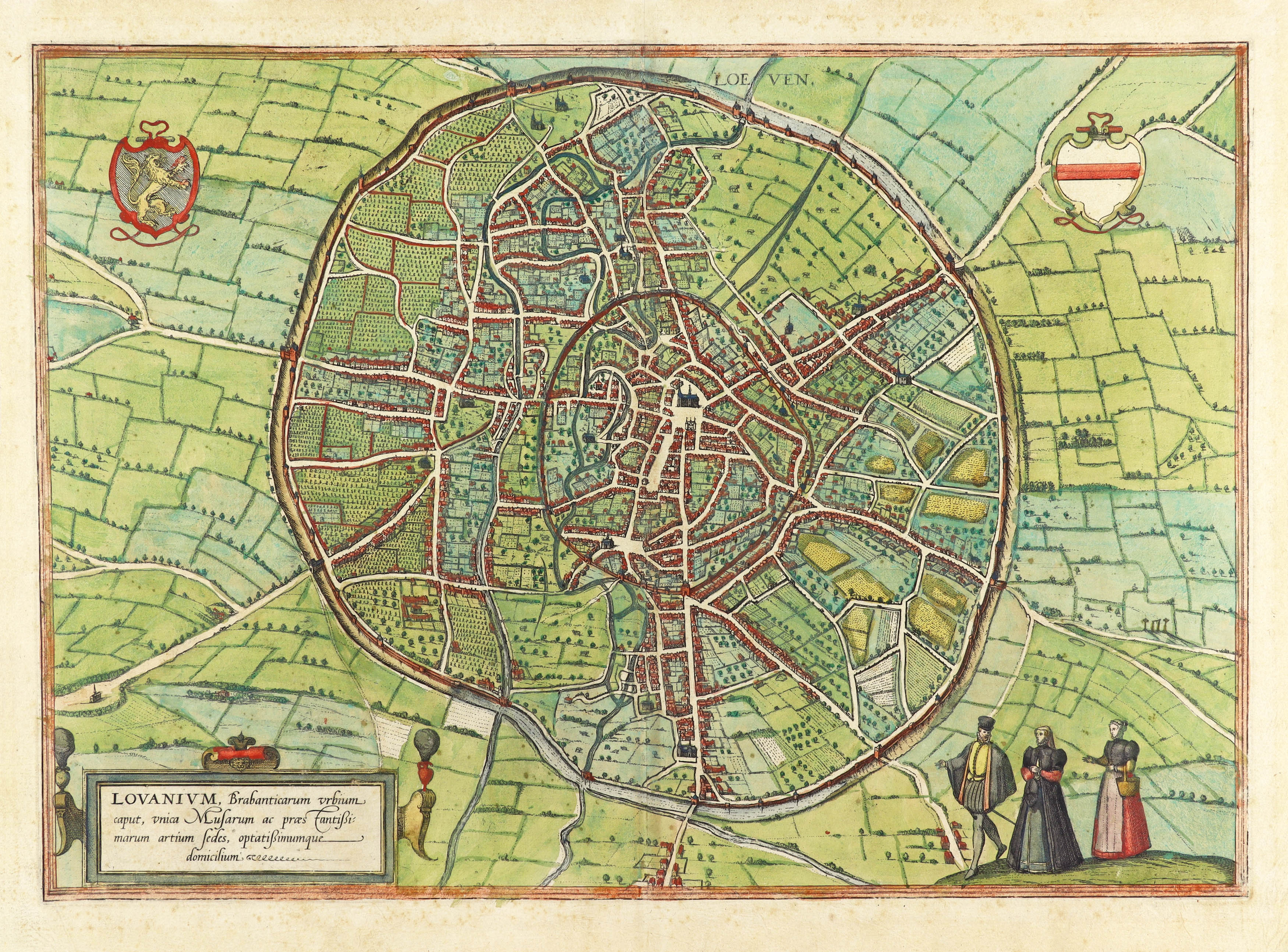
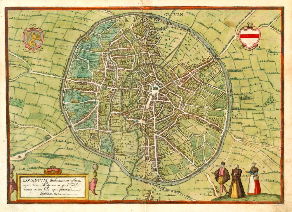


TRANSLATION OF CARTOUCHE TEXT: Louvain, capital of Brabant, unrivalled site of the muses and the most distinguished arts and sciences; a highly desirable place of residence.
COMMENTARY BY BRAUN (on verso): "Louvain is the capital of Brabant and an important trade city, but also the seat of learned men and the Liberal Arts. It was established around 1422 by John, Duke of Brabant, and is a large and liberal city. Inside the city walls, it also has open meadows, vineyards, other large gardens, arable fields, orchards, fields, bushes, forest and pastures and very sizeable woods for walking in. There is nowhere better suited to accommodate the muses and scholarship than this city."
From a detailed bird's-eye perspective, Louvain appears less organized within its circular boundary than other cities and is crisscrossed by a network of labyrinthine medieval streets. Few prominent buildings are documented; only the church of Sint-Pieter on the large marketplace opposite the late Gothic town hall can be easily recognized at the centre. The aerial view reveals the double city wall. While the inner wall surrounds the historical centre, the outer wall encloses not only streets and houses but also undeveloped fallow areas, fields and vineyards. The origin of the city's name is disputed: one theory claims that the name was created from the combination of the words woods (lo) and marsh (ven). From AD 870, Louvain was the capital of a county that was elevated to a duchy in 1183. Conveniently located on the ancient Roman road that linked Boulogne-sur-Mer, Bavay, Tongeren and Cologne, Louvain constituted a centre of cloth manufacturing in the Middle Ages. Despite intermittent economic problems from the mid-14th century onwards, the city was one of the centres of humanism during the Renaissance. In 1425 the distinguished University of Louvain was founded. (Taschen)
Braun G. & Hogenberg F. and the Civitates Orbis Terrarum.
The Civitates Orbis Terrarum, also known as the 'Braun & Hogenberg', is a six-volume town atlas and the most excellent book of town views and plans ever published: 363 engravings, sometimes beautifully coloured. It was one of the best-selling works in the last quarter of the 16th century. Georg Braun, a skilled writer, wrote the text accompanying the plans and views on the verso. Many plates were engraved after the original drawings of a professional artist, Joris Hoefnagel (1542-1600). The first volume was published in Latin in 1572 and the sixth in 1617. Frans Hogenberg, a talented engraver, created the tables for volumes I through IV, and Simon van den Neuwel made those for volumes V and VI. Other contributors were cartographers Daniel Freese and Heinrich Rantzau, who provided valuable geographical information. Works by Jacob van Deventer, Sebastian Münster, and Johannes Stumpf were also used as references. Translations appeared in German and French, making the atlas accessible to a broader audience.
Since its original publication of volume 1 in 1572, the Civitates Orbis Terrarum has left an indelible mark on the history of cartography. Seven more editions followed the first volume in 1575, 1577, 1582, 1588, 1593, 1599, and 1612. Vol.2, initially released in 1575, saw subsequent editions in 1597 and 1612. The subsequent volumes, each a treasure trove of historical insights, graced the world in 1581, 1588, 1593, 1599, and 1606. The German translation of the first volume, a testament to its widespread appeal, debuted in 1574, followed by the French edition in 1575.
Several printers were involved: Theodor Graminaeus, Heinrich von Aich, Gottfried von Kempen, Johannis Sinniger, Bertram Buchholtz, and Peter von Brachel, all of whom worked in Cologne.
Georg Braun (1541-1622)
Georg Braun, the author of the text accompanying the plans and views in the Civitates Orbis Terrarum, was born in Cologne in 1541. After his studies in Cologne, he entered the Jesuit Order as a novice, indicating his commitment to learning and intellectual pursuits. In 1561, he obtained his bachelor's degree; in 1562, he received his Magister Artium, further demonstrating his academic achievements. Although he left the Jesuit Order, he continued his studies in theology, gaining a licentiate in theology. His theological background likely influenced the content and tone of the text in the Civitates Orbis Terrarum, adding a unique perspective to the work.
Frans Hogenberg (1535-1590)
Frans Hogenberg was a Flemish and German painter, engraver, and mapmaker. He was born in Mechelen as the son of Nicolaas Hogenberg.
By the end of the 1560s, Frans Hogenberg was employed upon Abraham Ortelius's Theatrum Orbis Terrarum, published in 1570; he is named an engraver of numerous maps. In 1568, he was banned from Antwerp by the Duke of Alva and travelled to London, where he stayed a few years before emigrating to Cologne. He immediately embarked on his two most important works, the Civitates, published in 1572 and the Geschichtsblätter, which appeared in several series from 1569 until about 1587.
Thanks to large-scale projects like the Geschichtsblätter and the Civitates, Hogenberg's social circumstances improved with each passing year. He died as a wealthy man in Cologne in 1590.
Loeven - Lovanium, Brabanticarum urbium caput, unica Musarum ac praestantissimorum artium sedes, optatissimimque domicilium.
Item Number: 25895 Authenticity Guarantee
Category: Antique maps > Europe > Belgium - Cities
Old antique plan of Leuven (Louvain) by Braun & Hogenberg.
Title: Loeven - Lovanium, Brabanticarum urbium caput, unica Musarum ac praestantissimorum artium sedes, optatissimimque domicilium.
Date of the first edition: 1581.
Date of this map: 1599.
Copper engraving, printed on paper.
Map size: 350 x 490mm (13.78 x 19.29 inches).
Sheet size: 385 x 520mm (15.16 x 20.47 inches).
Verso: Latin text.
Condition: Original coloured, lower centrefold split reinforced.
Condition Rating: A.
From: Civitates Orbis Terrarum. Liber tertius. Köln, Bertram Buchholtz, 1599. (Koeman, B&H3)
TRANSLATION OF CARTOUCHE TEXT: Louvain, capital of Brabant, unrivalled site of the muses and the most distinguished arts and sciences; a highly desirable place of residence.
COMMENTARY BY BRAUN (on verso): "Louvain is the capital of Brabant and an important trade city, but also the seat of learned men and the Liberal Arts. It was established around 1422 by John, Duke of Brabant, and is a large and liberal city. Inside the city walls, it also has open meadows, vineyards, other large gardens, arable fields, orchards, fields, bushes, forest and pastures and very sizeable woods for walking in. There is nowhere better suited to accommodate the muses and scholarship than this city."
From a detailed bird's-eye perspective, Louvain appears less organized within its circular boundary than other cities and is crisscrossed by a network of labyrinthine medieval streets. Few prominent buildings are documented; only the church of Sint-Pieter on the large marketplace opposite the late Gothic town hall can be easily recognized at the centre. The aerial view reveals the double city wall. While the inner wall surrounds the historical centre, the outer wall encloses not only streets and houses but also undeveloped fallow areas, fields and vineyards. The origin of the city's name is disputed: one theory claims that the name was created from the combination of the words woods (lo) and marsh (ven). From AD 870, Louvain was the capital of a county that was elevated to a duchy in 1183. Conveniently located on the ancient Roman road that linked Boulogne-sur-Mer, Bavay, Tongeren and Cologne, Louvain constituted a centre of cloth manufacturing in the Middle Ages. Despite intermittent economic problems from the mid-14th century onwards, the city was one of the centres of humanism during the Renaissance. In 1425 the distinguished University of Louvain was founded. (Taschen)
Braun G. & Hogenberg F. and the Civitates Orbis Terrarum.
The Civitates Orbis Terrarum, also known as the 'Braun & Hogenberg', is a six-volume town atlas and the most excellent book of town views and plans ever published: 363 engravings, sometimes beautifully coloured. It was one of the best-selling works in the last quarter of the 16th century. Georg Braun, a skilled writer, wrote the text accompanying the plans and views on the verso. Many plates were engraved after the original drawings of a professional artist, Joris Hoefnagel (1542-1600). The first volume was published in Latin in 1572 and the sixth in 1617. Frans Hogenberg, a talented engraver, created the tables for volumes I through IV, and Simon van den Neuwel made those for volumes V and VI. Other contributors were cartographers Daniel Freese and Heinrich Rantzau, who provided valuable geographical information. Works by Jacob van Deventer, Sebastian Münster, and Johannes Stumpf were also used as references. Translations appeared in German and French, making the atlas accessible to a broader audience.
Since its original publication of volume 1 in 1572, the Civitates Orbis Terrarum has left an indelible mark on the history of cartography. Seven more editions followed the first volume in 1575, 1577, 1582, 1588, 1593, 1599, and 1612. Vol.2, initially released in 1575, saw subsequent editions in 1597 and 1612. The subsequent volumes, each a treasure trove of historical insights, graced the world in 1581, 1588, 1593, 1599, and 1606. The German translation of the first volume, a testament to its widespread appeal, debuted in 1574, followed by the French edition in 1575.
Several printers were involved: Theodor Graminaeus, Heinrich von Aich, Gottfried von Kempen, Johannis Sinniger, Bertram Buchholtz, and Peter von Brachel, all of whom worked in Cologne.
Georg Braun (1541-1622)
Georg Braun, the author of the text accompanying the plans and views in the Civitates Orbis Terrarum, was born in Cologne in 1541. After his studies in Cologne, he entered the Jesuit Order as a novice, indicating his commitment to learning and intellectual pursuits. In 1561, he obtained his bachelor's degree; in 1562, he received his Magister Artium, further demonstrating his academic achievements. Although he left the Jesuit Order, he continued his studies in theology, gaining a licentiate in theology. His theological background likely influenced the content and tone of the text in the Civitates Orbis Terrarum, adding a unique perspective to the work.
Frans Hogenberg (1535-1590)
Frans Hogenberg was a Flemish and German painter, engraver, and mapmaker. He was born in Mechelen as the son of Nicolaas Hogenberg.
By the end of the 1560s, Frans Hogenberg was employed upon Abraham Ortelius's Theatrum Orbis Terrarum, published in 1570; he is named an engraver of numerous maps. In 1568, he was banned from Antwerp by the Duke of Alva and travelled to London, where he stayed a few years before emigrating to Cologne. He immediately embarked on his two most important works, the Civitates, published in 1572 and the Geschichtsblätter, which appeared in several series from 1569 until about 1587.
Thanks to large-scale projects like the Geschichtsblätter and the Civitates, Hogenberg's social circumstances improved with each passing year. He died as a wealthy man in Cologne in 1590.
Related items

Loeven. 1656
Leuven, by N. Visscher & P.H. Schut.
[Item number: 6995]
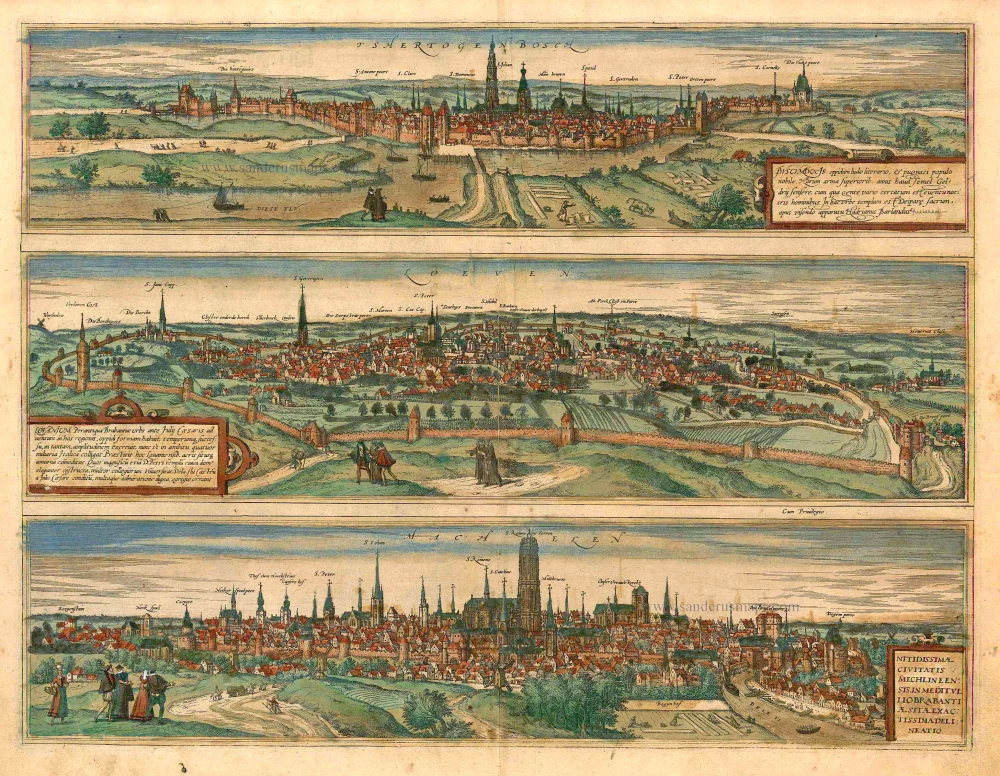
Tshertogenbosch - Buscumducis oppidum ludo Literario, ... [on sheet with] Loeven - Lovanium Perantiqua Brabantiae urbs ... [and] Machelen - Nitidissimae Civitatis Mechlin ... 1582
's Hertogenbosch, Leuven (Louvain) and Mechelen, by Georg Braun and Frans Hogenberg.
[Item number: 16669]
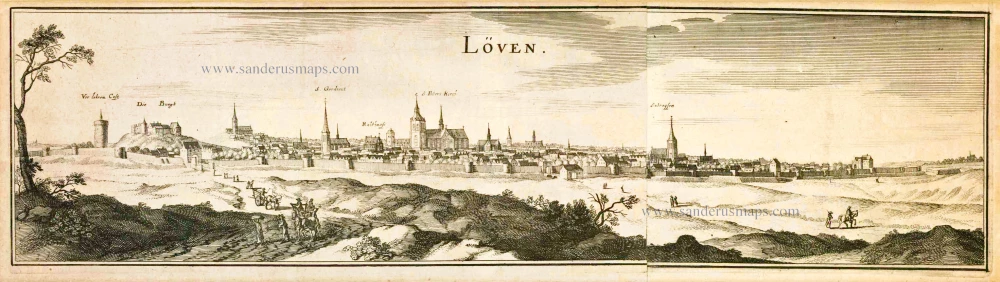
Löven. 1659
Leuven (Louvain) by Merian C.
[Item number: 18393]

Tshertogenbosch - Buscumducis oppidum ludo Literario, ... [on sheet with] Loeven - Lovanium Perantiqua Brabantiae urbs ... [and] Machelen - Nitidissimae Civitatis Mechlin ... 1599
's Hertogenbosch, Leuven (Louvain), and Mechelen, by Georg Braun and Frans Hogenberg.
[Item number: 23224]

Lovanium vulgo Loven. 1657
Leuven by J. Janssonius.
[Item number: 25892]

Louvain. 1567
Leuven (Louvain) by Ludovico Guicciardini.
[Item number: 28305]

Haag. 1686
Den Haag by Christoph Riegel.
[Item number: 32108]

La ville de Louvain - De Stad Leuven. 1769
Leuven by J.B. Christyn
[Item number: 32619]