
British Isles by Petrus Bertius, published by Jodocus Hondius II. 1618

Petrus Bertius (1565-1629)
Petrus Bertius, born at Beveren, Flanders, in 1565, was related to Pieter van den Keere (Kaerius) and Jodocus Hondius. Both famous cartographers were brothers-in-law of Petrus Bertius. As a refugee, he settled in Amsterdam, and after finishing his studies, he became a professor of mathematics and librarian at the University of Leiden. In 1618, he became a cosmographer and historiographer for Louis XIII of France. He lived in Paris, where he died in 1629.
Petrus Bertius's remarkable work ethic is evident in the numerous geographical and theological works he produced. His contributions to the works of Clüver and Herrera further solidified his reputation in geography.
His fame among geographers was established by his text in the pocket atlas Tabularum Geographicarum and by his edition of Ptolemy’s Geographia.
The origin of the Tabularum Geographicum lies in the well-known miniature atlas Caert thresoor, published by Barent Langenes in 1598 in Middelburg. Bertius engraved 169 maps for this small but attractive atlas, sold for the first time in 1599 by Cornelis Claesz in Amsterdam. In 1600, Claesz published the pocket atlas with a Latin text composed by Petrus Bertius. From then on, new editions, often enlarged with new maps, regularly appeared, subsequently published by Cornelis Claesz, Jodocus Hondius, Johannes Janssonius and ultimately, in 1649, by Claes Jansz. Visscher.
Koeman divides this series of pocketbooks into two atlases: The Caert-thresoor, published by Langenes and Claesz., with five editions between 1598 and 1609, and the Tabularum Geographicarum Contractarum by Petrus Bertius with ten editions between 1600 and 1650.
The Hondius Family
Jodocus Hondius the Elder (1563-1612)
Joost d’Hondt was born at Wakken (Flanders) in 1563. Two years later, his family settled in Ghent, where young Joost displayed an excellent gift for drawing and calligraphy. Through study and lessons, he developed his talents and became an engraver with a good reputation.
Due to the circumstances of the war, he moved to London in 1584, where he settled down as an engraver, instrument-maker, and map-maker. In 1587, he married Coletta van den Keere, sister of the well-known engraver Pieter van den Keere (Petrus Kaerius); some years earlier, his sister, Jacomina, had married Pieter van den Berghe (Petrus Montanus). Joost, who had Latinized his name to Jodocus Hondius, closely co-operated with his two brothers-in-law.
The political situation in the Northern Netherlands in 1593 was such that Jodocus seemed justified in establishing himself in Amsterdam, where many Antwerp printers, publishers, and engravers had gone. In this new centre of cartography, Jodocus Hondius set up his business “In de Wackere Hondt” (in the vigilant dog), this name being an allusion to his birthplace and name. He engraved many maps and published atlases and many other works, such as his continuation of Gerard Mercator’s Atlas.
He suddenly passed away in February 1612. The publishing firm of Jodocus Hondius was continued by his widow, later on, by his two sons, Jodocus Jr. and Henricus, and by his son-in-law, J. Janssonius.
Jodocus Hondius II (1594-1629) & Henricus Hondius (1597-1651)
After the father’s death, the widow and her seven children continued publishing the atlases under the name of Jodocus Hondius till 1620. The firm was reinforced by the very welcome help of Joannes Janssonius (1588-1664), who married 24-year-old Elisabeth Hondius in 1612. After 1619, Mercator’s Atlas was published under the name of Henricus Hondius.
One of the most dramatic events in the early history of commercial cartography in Amsterdam was the sale of Jodocus Hondius Jr.’s copper plates to Willem Jansz. Blaeu in 1629, the year of his death. At least 34 plates, from which Jodocus II had printed single-sheet maps for his benefit, passed into the hands of his great competitor. Immediately after that, his brother, Henricus, and Joannes Janssonius ordered the engraving of identical plates.
Henricus devoted all his energy to publishing the Atlas for an extended period. He saw its growth up to and including the fourth part in 1646; after that, his name no longer figures on the title pages. After 1638, the title of the Atlas was changed to Atlas Novus; Joannes Janssonius mainly carried it on.
The competition with the Blaeu's dates from 1630. In 1630, Willem Janszoon (=Blaeu) first attacked with his Atlantis Appendix. In 1635, Blaeu completed his Theatrum Orbis Terrarum in two volumes with French, Latin, Dutch, and German texts, prompting Henricus Hondius to speed up the enlargement of his Atlas.
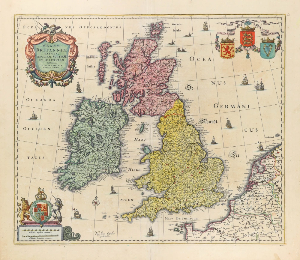
Anglia Scotia et Hibernia.
Item Number: 31531 Authenticity Guarantee
Category: Antique maps > Europe > British Isles
British Isles by Petrus Bertius, published by Jodocus Hondius II.
Title: Anglia Scotia et Hibernia.
Date of the first edition: 1616.
Date of this map: 1618.
Copper engraving, printed on paper.
Image size: 95 x 135mm (3¾ x 5¼ inches).
Sheet size: 120 x 185mm (4¾ x 7¼ inches).
Verso: French text.
Condition: Excellent.
Condition Rating: A+.
From: Bertius P. La Geographie Racourcie de Pierre Bertius. Amsterdam, Jodocus Hondius jr. 1618. (Van der Krogt 3, 342:11)
Petrus Bertius (1565-1629)
Petrus Bertius, born at Beveren, Flanders, in 1565, was related to Pieter van den Keere (Kaerius) and Jodocus Hondius. Both famous cartographers were brothers-in-law of Petrus Bertius. As a refugee, he settled in Amsterdam, and after finishing his studies, he became a professor of mathematics and librarian at the University of Leiden. In 1618, he became a cosmographer and historiographer for Louis XIII of France. He lived in Paris, where he died in 1629.
Petrus Bertius's remarkable work ethic is evident in the numerous geographical and theological works he produced. His contributions to the works of Clüver and Herrera further solidified his reputation in geography.
His fame among geographers was established by his text in the pocket atlas Tabularum Geographicarum and by his edition of Ptolemy’s Geographia.
The origin of the Tabularum Geographicum lies in the well-known miniature atlas Caert thresoor, published by Barent Langenes in 1598 in Middelburg. Bertius engraved 169 maps for this small but attractive atlas, sold for the first time in 1599 by Cornelis Claesz in Amsterdam. In 1600, Claesz published the pocket atlas with a Latin text composed by Petrus Bertius. From then on, new editions, often enlarged with new maps, regularly appeared, subsequently published by Cornelis Claesz, Jodocus Hondius, Johannes Janssonius and ultimately, in 1649, by Claes Jansz. Visscher.
Koeman divides this series of pocketbooks into two atlases: The Caert-thresoor, published by Langenes and Claesz., with five editions between 1598 and 1609, and the Tabularum Geographicarum Contractarum by Petrus Bertius with ten editions between 1600 and 1650.
The Hondius Family
Jodocus Hondius the Elder (1563-1612)
Joost d’Hondt was born at Wakken (Flanders) in 1563. Two years later, his family settled in Ghent, where young Joost displayed an excellent gift for drawing and calligraphy. Through study and lessons, he developed his talents and became an engraver with a good reputation.
Due to the circumstances of the war, he moved to London in 1584, where he settled down as an engraver, instrument-maker, and map-maker. In 1587, he married Coletta van den Keere, sister of the well-known engraver Pieter van den Keere (Petrus Kaerius); some years earlier, his sister, Jacomina, had married Pieter van den Berghe (Petrus Montanus). Joost, who had Latinized his name to Jodocus Hondius, closely co-operated with his two brothers-in-law.
The political situation in the Northern Netherlands in 1593 was such that Jodocus seemed justified in establishing himself in Amsterdam, where many Antwerp printers, publishers, and engravers had gone. In this new centre of cartography, Jodocus Hondius set up his business “In de Wackere Hondt” (in the vigilant dog), this name being an allusion to his birthplace and name. He engraved many maps and published atlases and many other works, such as his continuation of Gerard Mercator’s Atlas.
He suddenly passed away in February 1612. The publishing firm of Jodocus Hondius was continued by his widow, later on, by his two sons, Jodocus Jr. and Henricus, and by his son-in-law, J. Janssonius.
Jodocus Hondius II (1594-1629) & Henricus Hondius (1597-1651)
After the father’s death, the widow and her seven children continued publishing the atlases under the name of Jodocus Hondius till 1620. The firm was reinforced by the very welcome help of Joannes Janssonius (1588-1664), who married 24-year-old Elisabeth Hondius in 1612. After 1619, Mercator’s Atlas was published under the name of Henricus Hondius.
One of the most dramatic events in the early history of commercial cartography in Amsterdam was the sale of Jodocus Hondius Jr.’s copper plates to Willem Jansz. Blaeu in 1629, the year of his death. At least 34 plates, from which Jodocus II had printed single-sheet maps for his benefit, passed into the hands of his great competitor. Immediately after that, his brother, Henricus, and Joannes Janssonius ordered the engraving of identical plates.
Henricus devoted all his energy to publishing the Atlas for an extended period. He saw its growth up to and including the fourth part in 1646; after that, his name no longer figures on the title pages. After 1638, the title of the Atlas was changed to Atlas Novus; Joannes Janssonius mainly carried it on.
The competition with the Blaeu's dates from 1630. In 1630, Willem Janszoon (=Blaeu) first attacked with his Atlantis Appendix. In 1635, Blaeu completed his Theatrum Orbis Terrarum in two volumes with French, Latin, Dutch, and German texts, prompting Henricus Hondius to speed up the enlargement of his Atlas.
Related items

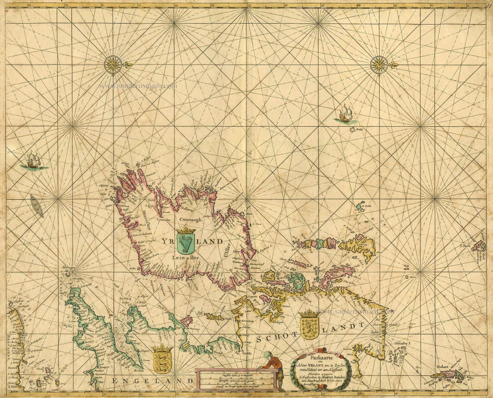
Paskaart van 't Canaal Engelandt Schotlandt en Yrland 1697-1709
British Isles, by Van Keulen Johannes.
[Item number: 5817]

Angliae, Scotiae, et Hiberniae, sive Britannicae Insularum Descriptio. 1572
BRITISH ISLES by Abraham Ortelius
[Item number: 15693]
Paskaarte om achter Yrlant om te Zeylen van Hitlant tot aen Heyssant. 1665
British Isles, by Hendrik Doncker.
[Item number: 18567]

Paskaarte om Achter Yrlandt om te Zeylen van Hitlant tot aen Heyssat Nieuwlycx Uytgegeven 1667
The British Isles, by Pieter Goos.
[Item number: 19046]

Angliae, Scotiae, et Hiberniae, sive Britannicae Insularum Descriptio. 1601
The British Isles, by Ortelius A.
[Item number: 22869]

Anglia, Scotia et Hibernia. 1623
British Isles, by Gerard Mercator.
[Item number: 24894]

Les Isles Britanniques ou sont le Royaume D'Angleterre Tiré de Sped Celuy D'Ecosse Tiré de Th. Pont et Celuy D'Irlande Riré de Petti. 1730
British Isles by Guillaume Delisle, published by Covens & Mortier.
[Item number: 25680]

Magnae Britanniae et Hiberniae Tabulae. - Die Britannischen Insulen. 1638
The British Isles, by M. Merian.
[Item number: 25904]

Insularum Britannicarum Acurata Delineatio ex Geographicis Conatibus Abrahami Ortelii. 1641
The British Isles, by Johannes Janssonius.
[Item number: 26483]

Les Isles Britanniques Comprenant les Royaumes d'Angleterre, d'Ecosse et d'Iralnade, divisés en grandes provinces, ... 1776-79
British Isles, by Francesco Santini.
[Item number: 26959]

Britannicarum Insularum Typus. 1624
The British Isles, by Abraham Ortelius.
[Item number: 27469]

Les Isles Britanniques; qui Contiennent les Royaumes d'Angleterre, Escosse, et Irlande. c. 1705
British Isles, by H. Jaillot
[Item number: 27772]

Britannicae Insulae in quibus Albion Seu Britannia Major, et Ivernia Seu Britannia Minor. 1776-79
British Isles, by Paolo Santini, after Nicolas Sanson & Sr. Robert de Vaugondy.
[Item number: 28105]

Novissima Prae Caeteris aliis Accuratissima Regnorum Angliae, Scotiae, Hiberniae. c. 1691-96
British Isles by Frederik De Wit.
[Item number: 28239]
Magnae Britanniae Tabula, Angliam, Scotiam, et Hiberniam continens. 1677-80
British Isles by Nicolaes Visscher I.
[Item number: 28586]

Les Isles Britanniques; qui contiennent les Royaumes d'Angleterre Escosse, et Irlande. 1730-45
British Isles by Hubert Jaillot, published by Reinier and Josua Ottens.
[Item number: 28747]

Les Isles Britanniques ou sont le Rme d'Angleterre tiré de Sped celuy d'Ecosse tiré de Th.Pont &c. et celuy d'Irlande tire de Petti, c. 1709
The British Isles by G. Delisle, published by Pierre Husson.
[Item number: 29562]

Carte Générale des Royaume d'Angleterre Escosse et Irlande. 1652
British Isles by Nicolas Sanson, published by Melchior Tavernier / Pierre Mariette.
[Item number: 29604]

Brtiannicae [sic] Insulae in quibus Albium sive Britannia Maior Iuernia sive Britannia Minor tum et Orcades, Ebudes, Cassiterides. 1652
Ancient British Isles by Nicolas Sanson.
[Item number: 29623]

Inghilterra. - [Above map :] Descrittione dell'Isola d'Inghilterra. 1590
British Isles, by Thomaso Porcacchi.
[Item number: 29755]

Britannicae Insulae in quibus Albium Sive Britannia Maior Iuernie Sive Bitannia Minor tum et Orcades, Ebudes, Cassiterides. 1659
Ancient British Isles by Melchior Tavernier and Nicolas Sanson.
[Item number: 30014]

Verschiedene Reisen des Auctoris. 1753-55
British Isles by George Edwards.
[Item number: 30331]

Rare 1525 edition in nice old colour.
[No title - On verso:] Principium Europae. 1525
Ptolemy map of the British Isles by Lorenz Fries, after Martin Waldseemüller
[Item number: 30646]

Le Royaume d'Angleterre distingué en ses Provinces. 1692
England and Wales by N. Sanson, so-called published by Hubert Jaillot. (Pirated edition by Pierre Mortier).
[Item number: 31409]

Magna Britannia. 1618
Great Britain by Petrus Bertius, published by Jodocus Hondius II.
[Item number: 31540]

Hibernia Septentr. in qua Ultonia Connatia. [in set with] Hibernia Austral. in qua Momonia Lagenia. 1618
Ireland by Petrus Bertius, published by Jodocus Hondius II.
[Item number: 31543]

L'Isole Britanniche ouero L'Inghilterra Divisa in sette Regni, quattro de Sassoni, e tre dell Inglesi, et il Principato di Galles, ciascuno diviso ne loro Shire, ouero Contadi. La Scotia Regno diviso in due Regni de Pitti, e de Scoti. L' Irlanda Regno diviso in quattro Provincie, e queste ne suoi Contadi. 1677
British Isles by Nicolas Sanson, published by Giovanni de Rossi.
[Item number: 32898]