
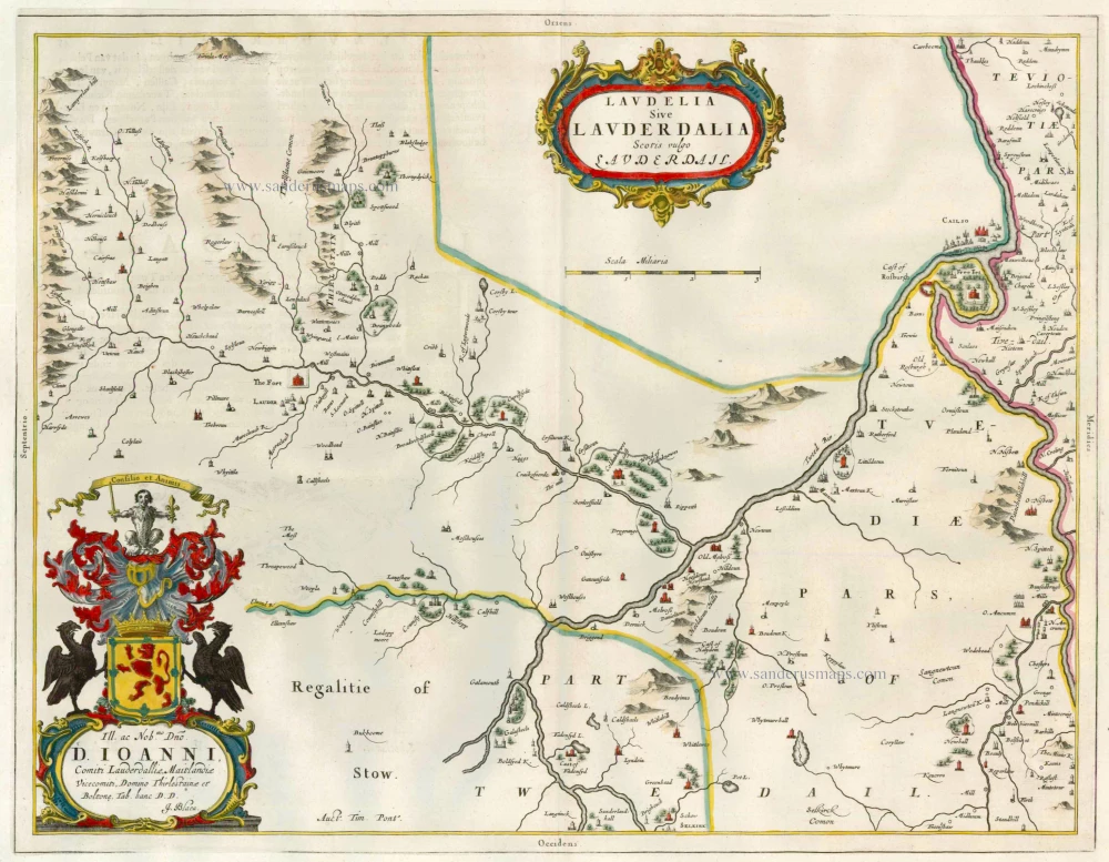
Lauderdale, by Joan Blaeu. 1667

The Blaeus: Willem Janszoon, Cornelis & Joan
Willem Jansz. Blaeu and his son Joan Blaeu are the most widely known cartographic publishers of the seventeenth century.
Willem Jansz. (also written Guilielmus Janssonius) = Willem Janszoon Blaeu, was born in Uitgeest (Netherlands), near Alkmaar in 1571. He studied mathematics under Tycho Brahe and learned the theory and practice of astronomical observations and the art of instrument- and globe making.
In 1596 he came to Amsterdam where he settled down as a globe-, instrument- and map-maker. He published his first cartographic work (a globe) in 1599 and probably published his first printed map (a map of the Netherlands) in 1604. He specialized in maritime cartography and published the first edition of the pilot guide Het Licht der Zeevaert in 1608, and was appointed Hydrographer of the V.O.C. (United East India Company) in 1633. After thirty years of publishing books, wall maps, globes, charts and pilot guides, he brought out his first atlas, Atlas Appendix (1630). This was the beginning of the great tradition of atlas-making by the Blaeus.
In 1618 another mapmaker, bookseller and publisher, Johannes Janssonius established himself in Amsterdam next door to Blaeu's shop. It is no wonder that these two neighbours, who began accusing each other of copying and stealing their information, became fierce competitors who did not have a good word to say about each other. In about 1621 Willem Jansz. decided to put an end to the confusion between his name and his competitor's, and assumed his grandfather's sobriquet, 'blauwe Willem' ('blue Willem'), as the family name; thereafter he called himself Willem Jansz. Blaeu.
Willem Janszoon Blaeu died in 1638, leaving his prospering business to his sons, Cornelis and Joan. Of Cornelis we only know that his name occurs in the prefaces of books and atlases until c. 1645.
Joan Blaeu, born in Amsterdam, 1596, became partner in his father’s book trade and printing business. In 1638 he was appointed his father’s successor in the Hydrographic office of the V.O.C. His efforts culminated in the magnificent Atlas Major and the town-books of the Netherlands and of Italy – works unsurpassed in history and in modern times, which gave eternal fame to the name of the Blaeus.
On February 23, 1672, a fire ruined the business. One year later, Dr. Joan Blaeu died. The fire of 1672 and the passing away of the director gave rise to a complete sale of the stock of the Blaeu House. Five public auctions dispersed the remaining books, atlases, copperplates, globes, etc., among many other map dealers and publishers in Amsterdam. The majority was acquired by a number of booksellers acting in partnership.
In the succeeding years, the remaining printing department was left in the hands of the Blaeu family until 1695 when also the inventory of the printing house was sold at a public auction. That meant the end of the Blaeus as a printing house of world renown.
Laudelia sive Lauderdalia Scotis vulgo Lauderdail.
Item Number: 25589 Authenticity Guarantee
Category: Antique maps > Europe > British Isles
Old, antique map of Scotland - Lauderdale by J. Blaeu, oriented to the East.
Cartographer: Timothy Pont
Date of the first edition: 1654
Date of this map: 1667
Copper engraving
Size (not including margins): 39 x 50.5cm (15.2 x 19.7 inches)
Verso: Blank
Condition: Old coloured, slight shine-through of verso text.
Condition Rating: A
References: Van der Krogt 2, 5814:2.
From: Atlas Major, Das ist, Welt-beschreibung. . . Amsterdam, J. Blaeu, 1667. (Van der Krogt 2, 631)
The Blaeus: Willem Janszoon, Cornelis & Joan
Willem Jansz. Blaeu and his son Joan Blaeu are the most widely known cartographic publishers of the seventeenth century.
Willem Jansz. (also written Guilielmus Janssonius) = Willem Janszoon Blaeu, was born in Uitgeest (Netherlands), near Alkmaar in 1571. He studied mathematics under Tycho Brahe and learned the theory and practice of astronomical observations and the art of instrument- and globe making.
In 1596 he came to Amsterdam where he settled down as a globe-, instrument- and map-maker. He published his first cartographic work (a globe) in 1599 and probably published his first printed map (a map of the Netherlands) in 1604. He specialized in maritime cartography and published the first edition of the pilot guide Het Licht der Zeevaert in 1608, and was appointed Hydrographer of the V.O.C. (United East India Company) in 1633. After thirty years of publishing books, wall maps, globes, charts and pilot guides, he brought out his first atlas, Atlas Appendix (1630). This was the beginning of the great tradition of atlas-making by the Blaeus.
In 1618 another mapmaker, bookseller and publisher, Johannes Janssonius established himself in Amsterdam next door to Blaeu's shop. It is no wonder that these two neighbours, who began accusing each other of copying and stealing their information, became fierce competitors who did not have a good word to say about each other. In about 1621 Willem Jansz. decided to put an end to the confusion between his name and his competitor's, and assumed his grandfather's sobriquet, 'blauwe Willem' ('blue Willem'), as the family name; thereafter he called himself Willem Jansz. Blaeu.
Willem Janszoon Blaeu died in 1638, leaving his prospering business to his sons, Cornelis and Joan. Of Cornelis we only know that his name occurs in the prefaces of books and atlases until c. 1645.
Joan Blaeu, born in Amsterdam, 1596, became partner in his father’s book trade and printing business. In 1638 he was appointed his father’s successor in the Hydrographic office of the V.O.C. His efforts culminated in the magnificent Atlas Major and the town-books of the Netherlands and of Italy – works unsurpassed in history and in modern times, which gave eternal fame to the name of the Blaeus.
On February 23, 1672, a fire ruined the business. One year later, Dr. Joan Blaeu died. The fire of 1672 and the passing away of the director gave rise to a complete sale of the stock of the Blaeu House. Five public auctions dispersed the remaining books, atlases, copperplates, globes, etc., among many other map dealers and publishers in Amsterdam. The majority was acquired by a number of booksellers acting in partnership.
In the succeeding years, the remaining printing department was left in the hands of the Blaeu family until 1695 when also the inventory of the printing house was sold at a public auction. That meant the end of the Blaeus as a printing house of world renown.
Related items

Paskaart vande Noord Cust van Schotland als mede de Eylanden van Hitlandt en Fero 1697-1709
Northern Scotland, by Van Keulen Johannes.
[Item number: 5399]

Evia et Escia, Scotis Eusdail et Eskdail. Auct. Tim. Pont. 1664
Scotland - Eskdale, by Joan Blaeu.
[Item number: 9300]
Laudelia sive Lauderdalia Scotis vulgo Lauderdail 1664-65
Scotland - Lauderdale, by J. Blaeu
[Item number: 12981]

Glottiana Praefectura Superior. Auct. Timoth: Pont. - The Upper Ward of Clyds-Dayl. 1664-65
Scotland - Upper Clydesdal, by J. Blaeu.
[Item number: 13015]

Cathenesia - Caithness. - Auct. TimotheobPont. 1664-65
Scotland - Caithness, by J. Blaeu.
[Item number: 13020]
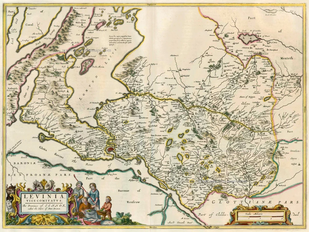
Levinia, vice Comitatus. The Province of Lennox, called the Shyre of Dun-Britton - Auct. Timoth. Pont. 1664-65
Scotland - Lennox, by J. Blaeu.
[Item number: 13025]

Praefectura Renfroana Vulgo dicta Baronia - The Baronie of Renfrow Timotheus Pont auctor. 1664-65
Scotland - Renfrew, by J. Blaeu.
[Item number: 13026]

Glottiana Praefectura Inferior, cum Baronia Glascuensi. The Nether Warde of Clyds-Dail, and Baronie of Glasco - Auct. Timoth. Pont 1664-65
Scotland - Lower Clydesdale, by J. Blaeu.
[Item number: 13031]

Cantyra Chersonesus, Cantyr a Demie-Yland 1664-65
Scotland - Kintyre, by J. Blaeu.
[Item number: 13064]
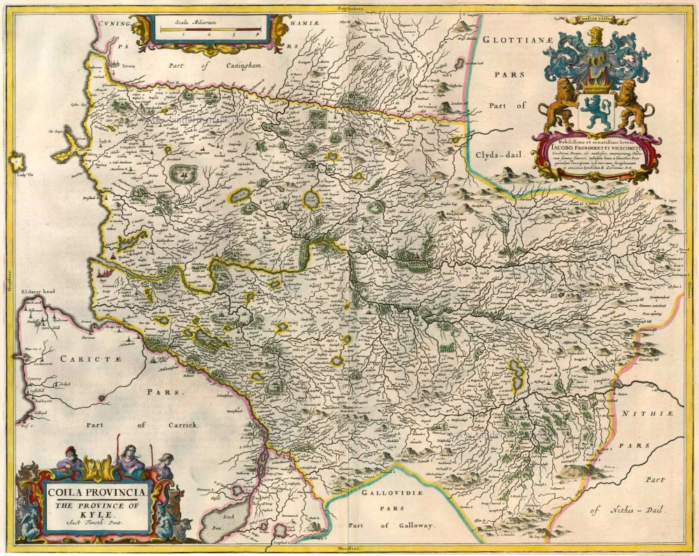
Coila Provincia. The Province of Kyle 1664-65
Scotland - Kyle, by J. Blaeu.
[Item number: 13066]

Carricta Meridionalis. The South part of Carrick. 1664-65
Scotland - Carrick (South) by J. Blaeu
[Item number: 13069]

Tuedia cum Vicecomitatu Etterico Forestrae etiam Selkirkae Dictus. Twee-Dail with the Sherifdome of Etterik-Forrest called also Selkirk 1664-65
Scotland - Selkirk (Tweedail), by J. Blaeu.
[Item number: 13075]
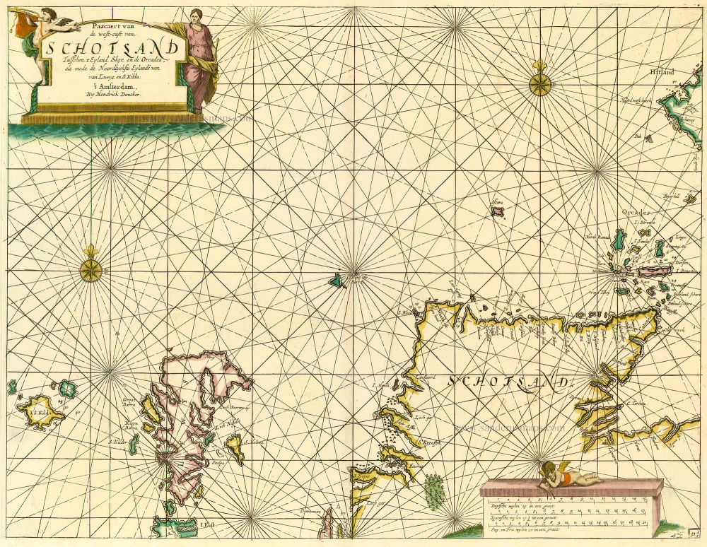
Pascaert van de Westcust van Schotland Tusschen t Eyland Kye en de Orcades, als mede de Noordlyckste Eylande van Lewys en S. Kilda. 1686
Scotland, by Doncker H.
[Item number: 13737]
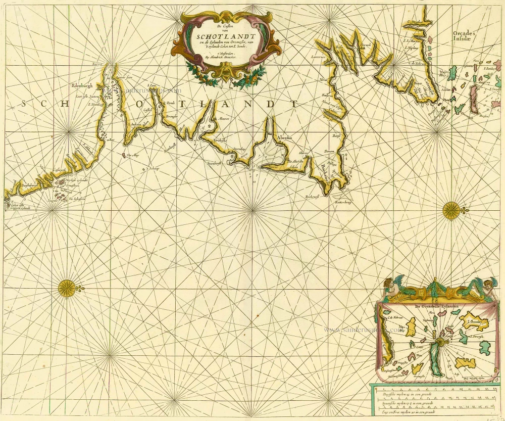
De Custen van Schotlandt en de Eylanden van Orcanese, van 't eylandt Coket tot I. Sande. 1686
Scotland and Orkney Islands, by Doncker H.
[Item number: 15386]
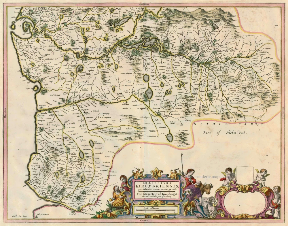
Praefectura Kircubriensis, quae Gallovidiae maxime Orientalis Pars Est. The Steuartrie of Kircubright. The most easterlie part of Galloway. Auct. Tim. Pont. 1664-65
Scotland - Galloway (East), by J. Blaeu.
[Item number: 23148]