
Scotland, by Doncker H. 1686
Hendrick Doncker (1625-1699)
Hendrick Doncker became a member of the bookseller's guild in 1647 and ran his shop successfully for fifty years. He was able to develop one of the most popular sets of maritime works published in Amsterdam during the Golden Age.
In 1651 he bought a house in the Nieuwe Brugsteeg in Amsterdam. It was called 'in 't Stuurmans gereetschap' (in the mariners' instruments) and stood opposite the house where Johannes van Keulen later settled.
Apart from the sea atlases, charts and pilot books, Hendrik Doncker published various editions of textbooks on the art of navigation.
After the death of Hendrick Doncker, the son, Hendrick II (c. 1664-c.1739), continued publishing the sea atlases Zeeatlas and Zeespiegel until 1708.
Doncker's charts were the most up-to-date in the second half of the 17th century. Although there is some similarity to those charts published by Van Loon, Goos, Lootsman, and Doncker, the latter's charts are original.
In 1655, Hendrick Doncker had begun with the publication of a pilot guide, the Lichtende Columne ofte Zeespiegel. In 1659 he published his first sea atlas, the Zee-Atlas of Waeter-waereld, with 19 maps. Between 1659 and 1669, he increased the number of charts from 19 to 30 and in 1669 he came with an edition containing 50, which was soon to be followed by an edition with large maps: the Nieuwe Groote Vermeerderde Zeeatlas, also with 50 charts. This beautiful atlas was reprinted and continually improved for more than 25 years. After the death of Hendrick Doncker in 1699, his son continued the publication and even enlarged and enhanced the sea-atlas.
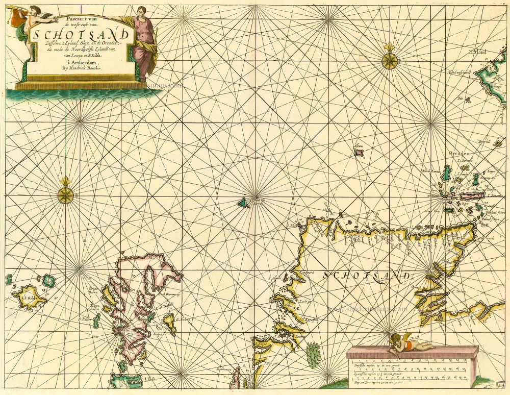
Pascaert van de Westcust van Schotland Tusschen t Eyland Kye en de Orcades, als mede de Noordlyckste Eylande van Lewys en S. Kilda.
Item Number: 13737 Authenticity Guarantee
Category: Antique maps > Europe > British Isles
Antique map of Scotland by Doncker H.
Title: Pascaert van de Westcust van Schotland Tusschen t Eyland Kye en de Orcades, als mede de Noordlyckste Eylande van Lewys en S. Kilda.
Date: 1686.
Copper engraving, printed on paper.
Size (not including margins): 407 x 532mm (16.02 x 20.94 inches).
Verso: Blank.
Condition: Original coloured, excellent.
Condition Rating: A+.
From: Le Grand & Nouveau Miroir ou Flambeau, De la Mer contenant la description de toutes les costes Marines Occidentalled & Septentrionalles, . . . Traduit de Flaman en François par Paul Yvounet. A Amsterdam Chés Henri Donker, . . . l'An 1686.
Hendrick Doncker (1625-1699)
Hendrick Doncker became a member of the bookseller's guild in 1647 and ran his shop successfully for fifty years. He was able to develop one of the most popular sets of maritime works published in Amsterdam during the Golden Age.
In 1651 he bought a house in the Nieuwe Brugsteeg in Amsterdam. It was called 'in 't Stuurmans gereetschap' (in the mariners' instruments) and stood opposite the house where Johannes van Keulen later settled.
Apart from the sea atlases, charts and pilot books, Hendrik Doncker published various editions of textbooks on the art of navigation.
After the death of Hendrick Doncker, the son, Hendrick II (c. 1664-c.1739), continued publishing the sea atlases Zeeatlas and Zeespiegel until 1708.
Doncker's charts were the most up-to-date in the second half of the 17th century. Although there is some similarity to those charts published by Van Loon, Goos, Lootsman, and Doncker, the latter's charts are original.
In 1655, Hendrick Doncker had begun with the publication of a pilot guide, the Lichtende Columne ofte Zeespiegel. In 1659 he published his first sea atlas, the Zee-Atlas of Waeter-waereld, with 19 maps. Between 1659 and 1669, he increased the number of charts from 19 to 30 and in 1669 he came with an edition containing 50, which was soon to be followed by an edition with large maps: the Nieuwe Groote Vermeerderde Zeeatlas, also with 50 charts. This beautiful atlas was reprinted and continually improved for more than 25 years. After the death of Hendrick Doncker in 1699, his son continued the publication and even enlarged and enhanced the sea-atlas.
Related items

Laudelia sive Lauderdalia Scotis vulgo Lauderdail. 1667
Lauderdale, by Joan Blaeu.
[Item number: 25589]

L'Ecosse Divisée en Shires ou Comtés. 1776-79
Scotland, by Francesco Santini.
[Item number: 26961]
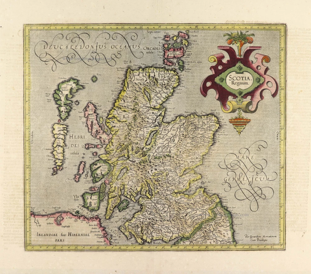
Scotia Regnum. c. 1610-1650
Scotland, by Gerard Mercator.
[Item number: 31015]

Le Royaume d'Escosse Divisé en Parties Septentrionale & Meridionale; Subdivisé en Provinces, Comtez &c. 1692
Scotland by N. Sanson, so-called published by Hubert Jaillot. (Pirated edition by Pierre Mortier).
[Item number: 31173]
Scotia Septentrion. [in set with] Scotia Australis. 1618
Scotland by Petrus Bertius, published by Jodocus Hondius II.
[Item number: 31537]
Scotia. 1618
Scotland by Petrus Bertius, published by Jodocus Hondius II.
[Item number: 31539]
Scotia Regnum. 1633
Scotland, by Gerard Mercator.
[Item number: 32180]

Regnum Scotiae, seu Pars Septent: Magnae Britanniae Divisa ... c. 1700
Scotland, by G. & L. Valck.
[Item number: 32209]

Extremely rare Italian Scotland-map
Scotiae nova et accurata descriptio. - Scotia Britannicae Insule pars septentrionalior, ...
Scotland by an Italian mapmaker, derived from a map by A. Lafreri and Bishop Leslie.
[Item number: 33066]
new