
Scotland, by Francesco Santini. 1776-79

Francesco and Paolo Santini (c.1729-1793)
Francesco Santini, a Venetian publisher, acquired the printing plates of Vaugondy’s Atlas Universel …, a commercial and cartographic success, with widespread influence on mapmakers throughout Europe. Together with his brother Paolo, he commissioned a new set of plates and reissued the atlas in 1776. The following year, Paolo Santini assigned all his publication rights to M. Remondini, who in 1777 reissued the same atlas but with his name.
Gilles and Didier Robert de Vaugondy
Gilles Robert de Vaugondy (1688-1766) and his son Didier Robert de Vaugondy (1723-1786) were leading cartographers in France during the 18th century. They served both as geographer to the king of France. The father, Gilles is also known as ‘Le Sieur’ or ‘Monsieur Robert’. He descended from the Nicolas Sanson family through Sanson's grandson Pierre Moulard-Sanson, from whom he inherited Sanson's cartographic material. After Hubert Jaillot died in 1712, the de Vaugondy's acquired numerous copies of his maps and plates, which formed the basis of their beautiful Atlas Universel (1757).
Their business flourished from 1731 to 1778. They made a substantial contribution to the world of cartography.
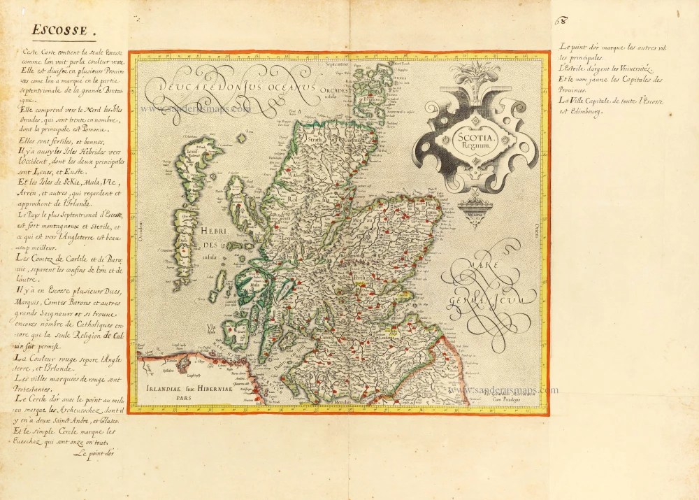
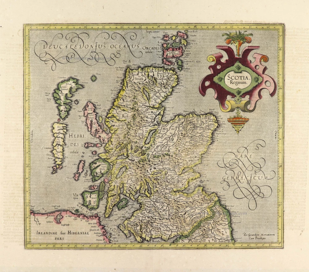
L'Ecosse Divisée en Shires ou Comtés.
Item Number: 26961 Authenticity Guarantee
Category: Antique maps > Europe > British Isles
Old, antique map of Scotland by Francesco Santini
Cartographer: Sr Robert de Vaugondy
First state with the imprint of Remondini: with engraved page numbers in the top right corner: "P.I.42".
Date of the first edition: 1776
Date of this map: 1776
Copper engraving, printed on paper.
Size (not including margins): 48.5 x 56.5cm (18.9 x 22 inches)
Verso: Blank
Condition: Original coloured in outline, excellent.
Condition Rating: A+
From: Atlas Universel dressé sur les meilleures cartes modernes. Venice, Remondini, 1776.
Francesco and Paolo Santini (c.1729-1793)
Francesco Santini, a Venetian publisher, acquired the printing plates of Vaugondy’s Atlas Universel …, a commercial and cartographic success, with widespread influence on mapmakers throughout Europe. Together with his brother Paolo, he commissioned a new set of plates and reissued the atlas in 1776. The following year, Paolo Santini assigned all his publication rights to M. Remondini, who in 1777 reissued the same atlas but with his name.
Gilles and Didier Robert de Vaugondy
Gilles Robert de Vaugondy (1688-1766) and his son Didier Robert de Vaugondy (1723-1786) were leading cartographers in France during the 18th century. They served both as geographer to the king of France. The father, Gilles is also known as ‘Le Sieur’ or ‘Monsieur Robert’. He descended from the Nicolas Sanson family through Sanson's grandson Pierre Moulard-Sanson, from whom he inherited Sanson's cartographic material. After Hubert Jaillot died in 1712, the de Vaugondy's acquired numerous copies of his maps and plates, which formed the basis of their beautiful Atlas Universel (1757).
Their business flourished from 1731 to 1778. They made a substantial contribution to the world of cartography.
Related items

Paskaart vande Noord Cust van Schotland als mede de Eylanden van Hitlandt en Fero 1697-1709
Northern Scotland, by Van Keulen Johannes.
[Item number: 5399]
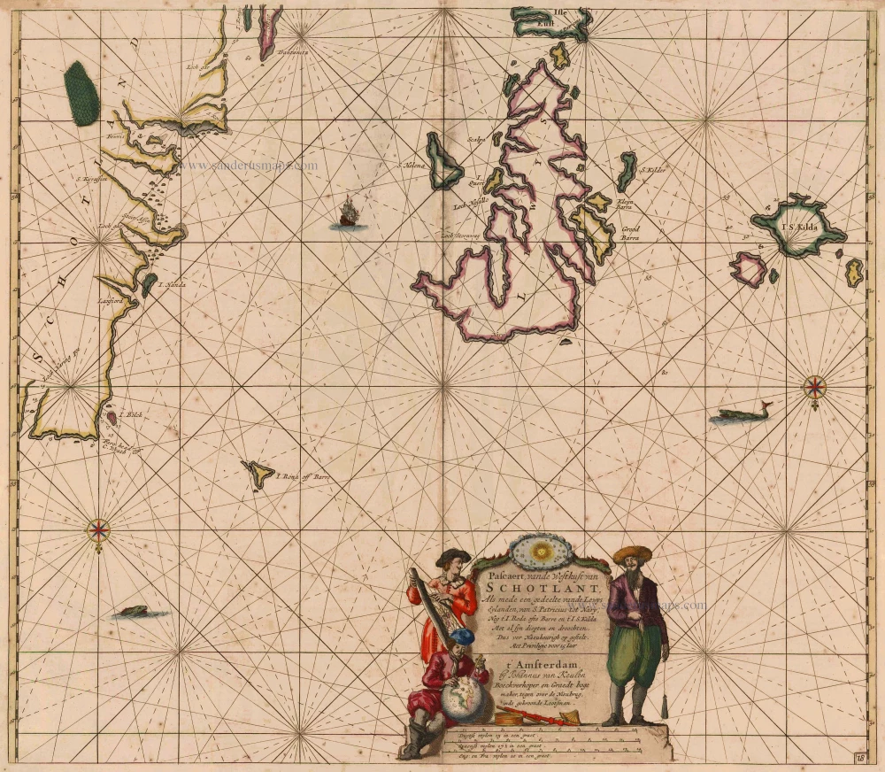
Pascaert, vande Westkust van Schotlant, als mede een Gedeelte vande Lewys Eylanden, van S. Patricius tot Nary, Nog t' I. Roda ofte Barre en t' I. S. Kilda ... 1697-1709
Scotland, with Lewis Island, by J. Van Keulen. Sea chart.
[Item number: 12461]
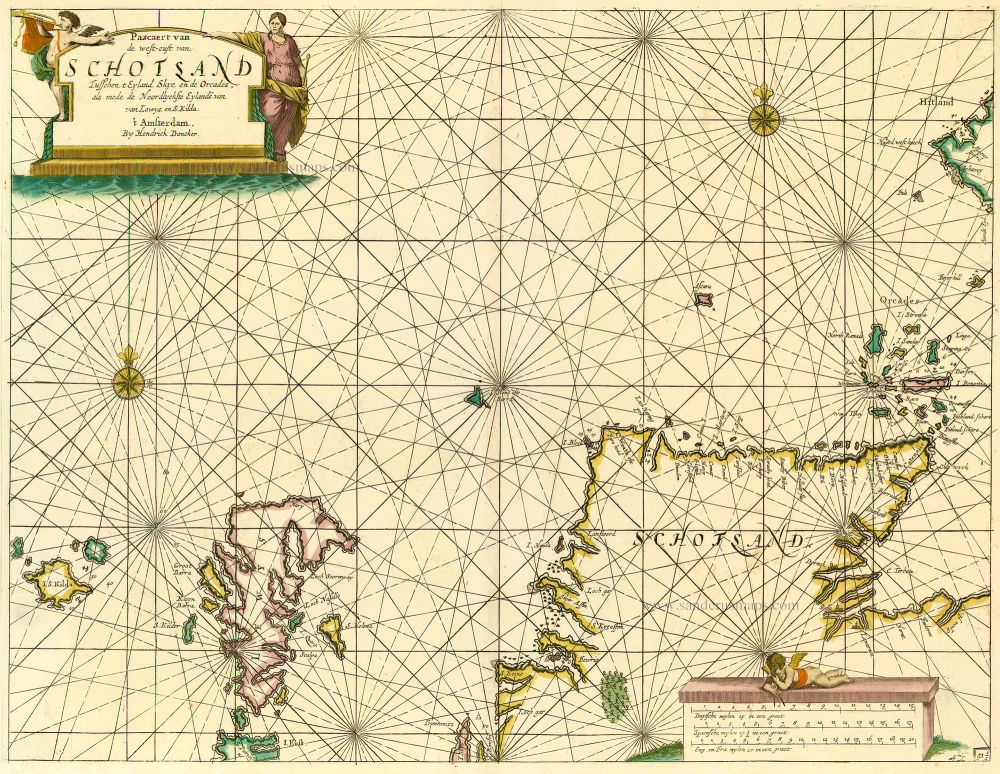
Pascaert van de Westcust van Schotland Tusschen t Eyland Kye en de Orcades, als mede de Noordlyckste Eylande van Lewys en S. Kilda. 1686
Scotland, by Doncker H.
[Item number: 13737]
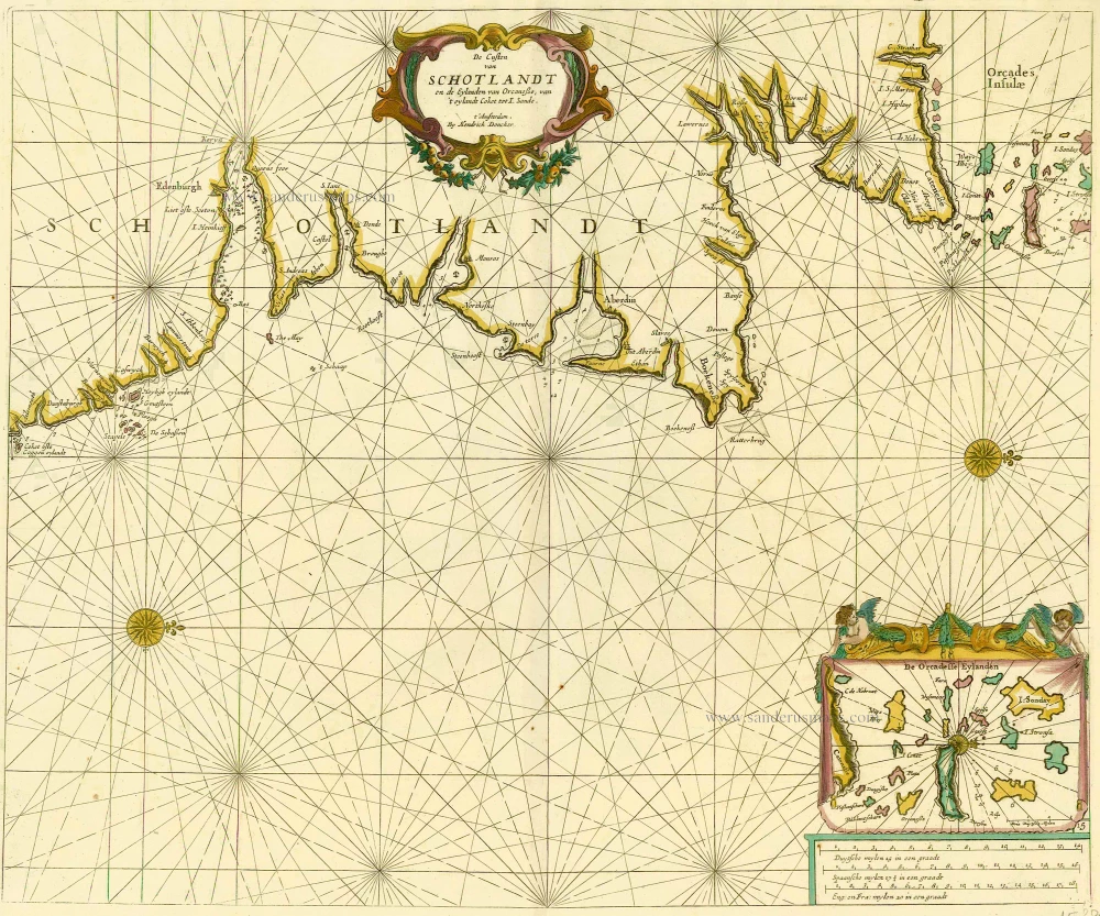
De Custen van Schotlandt en de Eylanden van Orcanese, van 't eylandt Coket tot I. Sande. 1686
Scotland and Orkney Islands, by Doncker H.
[Item number: 15386]
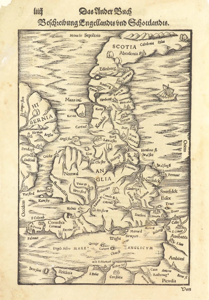
Beschreibung Engellandts und Schottlandts. 1578
Great Brittain by Sebastian Münster.
[Item number: 29468]
Scotia Regnum. c. 1610-1650
Scotland, by Gerard Mercator.
[Item number: 31015]

Le Royaume d'Escosse Divisé en Parties Septentrionale & Meridionale; Subdivisé en Provinces, Comtez &c. 1692
Scotland by N. Sanson, so-called published by Hubert Jaillot. (Pirated edition by Pierre Mortier).
[Item number: 31173]
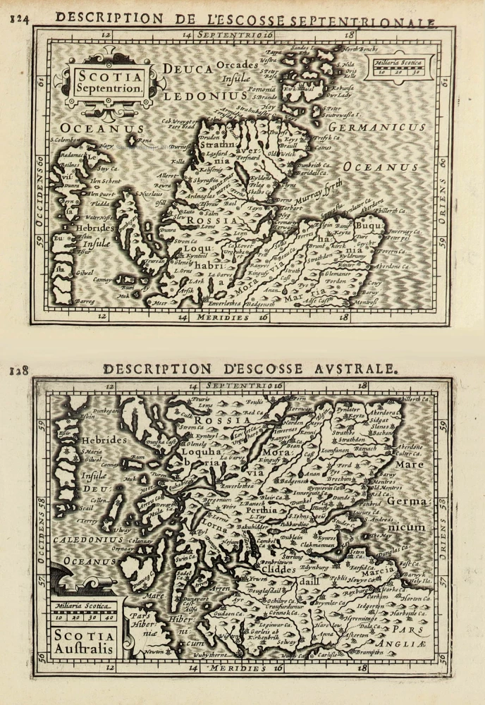
Scotia Septentrion. [in set with] Scotia Australis. 1618
Scotland by Petrus Bertius, published by Jodocus Hondius II.
[Item number: 31537]
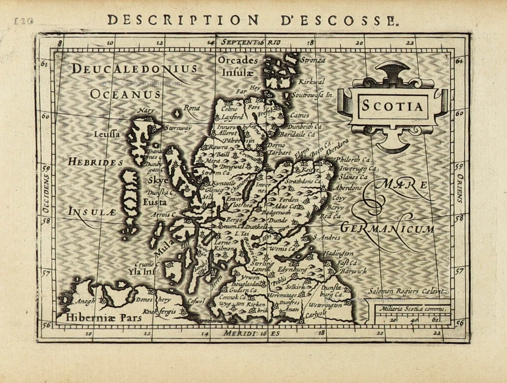
Scotia. 1618
Scotland by Petrus Bertius, published by Jodocus Hondius II.
[Item number: 31539]
Scotia Regnum. 1633
Scotland, by Gerard Mercator.
[Item number: 32180]

Regnum Scotiae, seu Pars Septent: Magnae Britanniae Divisa ... c. 1700
Scotland, by G. & L. Valck.
[Item number: 32209]

Extremely rare Italian Scotland-map
Scotiae nova et accurata descriptio. - Scotia Britannicae Insule pars septentrionalior, ...
Scotland by an Italian mapmaker, derived from a map by A. Lafreri and Bishop Leslie.
[Item number: 33066]
new