
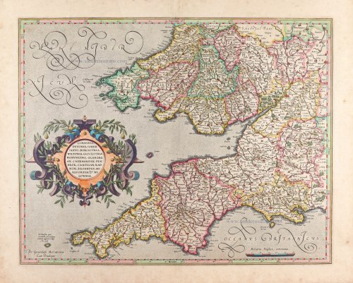
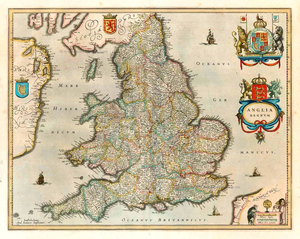
Southwest England and southern Wales, by Gerard Mercator. 1623


Gerard Mercator (1512 – 1594)
Gerard Mercator was born Gerard de Cremere in Rupelmonde (near Antwerp) on 5 March 1512.
Young Gerard learned what Latin he could in Rupelmonde, and when he was about fifteen, his uncle sent him to s'Hertogenbosch to study at a school run by the Brothers of the Common Life. One of Mercator’s teachers was the celebrated humanist Macropedius. After three and a half years with the brothers, Gerard went to Louvain, where he enrolled in the university in 1530 as one of the poor students at Castle College.
By this time, he had Latinized his name to Mercator. He studied philosophy and took his master’s degree in 1532. The problems of the creation of the Universe and the Earth interested him in particular, and this is reflected in his works written in later years.
After spending a few years in Antwerp, he returned to Louvain in c. 1535, where he took courses in mathematics under Gemma Frisius. Soon, he was recognised as an expert on the construction of mathematical instruments, as a land surveyor and, after 1537, as a cartographer. He drew his income from these activities after his marriage on August 3, 1536. He also qualified himself as a copper engraver, the first to introduce italic handwriting to this trade. The first maps, drawn and engraved by Gerard Mercator, are Palestine, 1537; the World in double heart-shaped projection, 1538; and Flanders, 1540.
In 1544, Mercator came into great danger: he was arrested on the accusation of heresy and put into jail. Thanks to the intervention of the University of Louvain, he was released after four months. In 1552, he moved with his family to Duisburg (Germany). In 1560, Mercator became a cosmographer in service of the Duke of Jülich-Cleve-Berge, and in 1563, he became a lecturer at the Grammar School of the new University in Duisburg. During this period, he made wall maps of Europe, 1554; of Loraine, 1564; the British Isles, 1564; and the famous world map with increasing latitudes, 1569. About this time, Mercator was also working on the project for a complete description of the creation, the Heavens, Earth, Sea and world history. This resulted in his Atlas, sive cosmographicae meditationes de fabrica mundi et fabricati figura. He also worked on an edition of Ptolemy’s Geographia in 1578. The first part of his book, which contains modern maps (France, Germany, and the Netherlands), appeared in 1585.
Shortly after the publication of the second part of his map book (not yet called Atlas) with the maps of Italy (1589), he had a stroke that ended his highly significant productivity. The great man passed away on 2 December 1594, leaving the responsibility of finishing the map book to his son Rumold. The final part of it appeared in 1595. Its title is Pars Altera, and it constitutes an essential part of what was then called Mercator’s Atlas.
The map of Europe and the world map in the Atlas are by Rumold Mercator. After Rumold died in 1599, the Atlas was reissued in 1602.
The plates of the maps, both of the Ptolemy edition and the Atlas, were sold in 1604 to Jodocus Hondius of Amsterdam. The following year, Hondius managed to bring out Ptolemy’s Geographia. In 1606, the first Amsterdam edition of the Mercator Atlas appeared in the next year. From then to 1638, the Atlas saw many enlarged editions in various languages.
Cornubia, Devonia, Somersetus, Dorcestria, Wiltonia, Glocestria, Monumetha, Glamorgan, Caermarden, Penbrok, Cardignan, Radnor, Breknoke, Herefordia, & Wigornia.
Item Number: 8472 Authenticity Guarantee
Category: Antique maps > Europe > British Isles
Southwest England and southern Wales, by Gerard Mercator.
Title: Cornubia, Devonia, Somersetus, Dorcestria, Wiltonia, Glocestria, Monumetha, Glamorgan, Caermarden, Penbrok, Cardignan, Radnor, Breknoke, Herefordia, & Wigornia.
Per Gerardum Mercatorem Cum Privilegio.
Date of the first edition: 1595.
Date of this map: 1623.
Copper engraving, printed on paper.
Image size: 370 x 465mm (14.57 x 18.31 inches).
Sheet size: 445 x 540mm (17.52 x 21.26 inches).
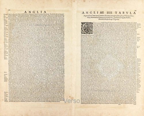
Verso: Latin text.
Condition: Original coloured, excellent.
Condition Rating: A+.
From: Gerardi Mercatoris - Atlas sive Cosmographicae Meditationes de Fabrica Mundi et Fabricati Figura. Denuo auctus Editio Quinta. Henricus Hondius. 1623. (Van der Krogt 1, 105)
Gerard Mercator (1512 – 1594)
Gerard Mercator was born Gerard de Cremere in Rupelmonde (near Antwerp) on 5 March 1512.
Young Gerard learned what Latin he could in Rupelmonde, and when he was about fifteen, his uncle sent him to s'Hertogenbosch to study at a school run by the Brothers of the Common Life. One of Mercator’s teachers was the celebrated humanist Macropedius. After three and a half years with the brothers, Gerard went to Louvain, where he enrolled in the university in 1530 as one of the poor students at Castle College.
By this time, he had Latinized his name to Mercator. He studied philosophy and took his master’s degree in 1532. The problems of the creation of the Universe and the Earth interested him in particular, and this is reflected in his works written in later years.
After spending a few years in Antwerp, he returned to Louvain in c. 1535, where he took courses in mathematics under Gemma Frisius. Soon, he was recognised as an expert on the construction of mathematical instruments, as a land surveyor and, after 1537, as a cartographer. He drew his income from these activities after his marriage on August 3, 1536. He also qualified himself as a copper engraver, the first to introduce italic handwriting to this trade. The first maps, drawn and engraved by Gerard Mercator, are Palestine, 1537; the World in double heart-shaped projection, 1538; and Flanders, 1540.
In 1544, Mercator came into great danger: he was arrested on the accusation of heresy and put into jail. Thanks to the intervention of the University of Louvain, he was released after four months. In 1552, he moved with his family to Duisburg (Germany). In 1560, Mercator became a cosmographer in service of the Duke of Jülich-Cleve-Berge, and in 1563, he became a lecturer at the Grammar School of the new University in Duisburg. During this period, he made wall maps of Europe, 1554; of Loraine, 1564; the British Isles, 1564; and the famous world map with increasing latitudes, 1569. About this time, Mercator was also working on the project for a complete description of the creation, the Heavens, Earth, Sea and world history. This resulted in his Atlas, sive cosmographicae meditationes de fabrica mundi et fabricati figura. He also worked on an edition of Ptolemy’s Geographia in 1578. The first part of his book, which contains modern maps (France, Germany, and the Netherlands), appeared in 1585.
Shortly after the publication of the second part of his map book (not yet called Atlas) with the maps of Italy (1589), he had a stroke that ended his highly significant productivity. The great man passed away on 2 December 1594, leaving the responsibility of finishing the map book to his son Rumold. The final part of it appeared in 1595. Its title is Pars Altera, and it constitutes an essential part of what was then called Mercator’s Atlas.
The map of Europe and the world map in the Atlas are by Rumold Mercator. After Rumold died in 1599, the Atlas was reissued in 1602.
The plates of the maps, both of the Ptolemy edition and the Atlas, were sold in 1604 to Jodocus Hondius of Amsterdam. The following year, Hondius managed to bring out Ptolemy’s Geographia. In 1606, the first Amsterdam edition of the Mercator Atlas appeared in the next year. From then to 1638, the Atlas saw many enlarged editions in various languages.
Related items
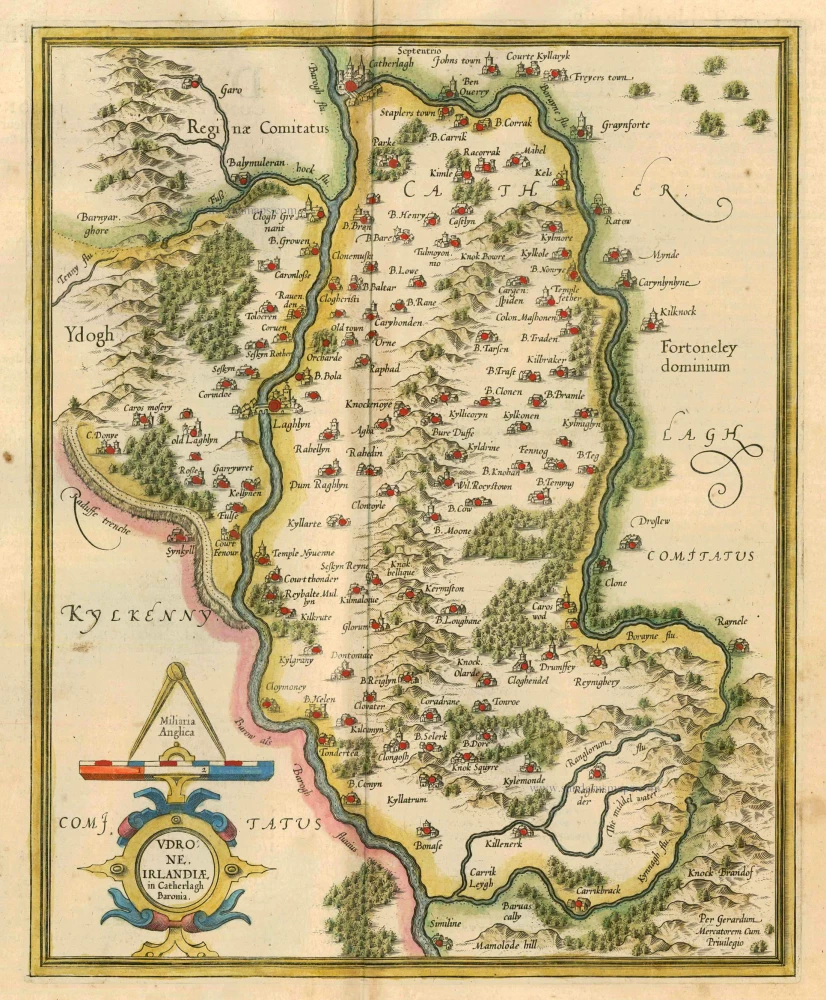
Udrone Irlandiae in Catherlagh Baronia. 1628
Ireland - Carlow by Mercator G. - Hondius J.
[Item number: 6474]

Anglesey [on sheet with] Wight ol. Vectis [and] Garnesay [and] Iarsay 1607
Anglesey, Wight & Channel Islands, by Gerard Mercator.
[Item number: 13705]
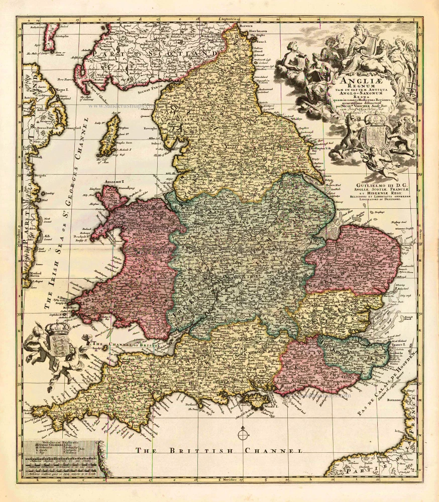
Angliae Regnum tam in septem Antiqua Anglo-Saxonum Regna ... c. 1740
England, by N. Visscher II, published by P. Schenk.
[Item number: 25720]
Anglia Regnum. 1641
England, by Henricus Hondius.
[Item number: 26242]

Northumbria, Cumberlandia, et Dunelmensis Episcopatus. 1641
England (SW) and S. Wales, by Henricus Hondius.
[Item number: 26243]

Cambriae Typus. 1641
Wales, by Henricus Hondius.
[Item number: 26245]

Eboracum, Lincolnia, Derbia, Statfordia, Notinghamia, Lecestria, Rutlandia et Norfolcia. 1641
Western England, by Henricus Hondius.
[Item number: 26247]

Warwicum, Northhamtonia, Huntingdonia, Cantabrigia, Suffolcia, Oxonium, Buckinghamia, Bedfordia, Hartfordia, Essexia, Berceria Middelsexia, Southantonia Surria Cantium et Southsexia. 1641
South-East England, by Henricus Hondius.
[Item number: 26248]

Orientalior Districtus Regni Angliae Comprehendens Comitatus et Provincias c. 1705
East England, by Frederick de Wit.
[Item number: 28990]

Anciens Royaumes de Mercie, et East-Angles ou sont les Comtés, ou Shiries de Chester, Darby, Nottingham, Lincolne, Rutland, Leicester, Stafford, Shrop-Sh, Hereford, Worcester, Warwick, Northampton, Huntington, Bedford, Buckingham, Oxford, et Glocester en Mercie Cambridge, Norfolk, et Suffolk en East-Angles. 1658
Central England by Nicolas Sanson.
[Item number: 29626]

Provinces d'West; autrefois Royaume d'Westsex: ou sont Aujourdhuy les Comtés Hant-Shire, et l'Isle de Wight, Barck-Sh. Wilt-Sh. Dorcet-Sh. Somerset-Sh: Devon-Sh. et Cornwail, &c. 1658
Southwest England by Nicolas Sanson.
[Item number: 29642]

Principauté de Galles: ou sont les Comtés, ou Shiries de Anglesey I. Carnarvan, Denbigh, Flint, Merioneth, et Montgomert en Nort-Walles Cardigan, Radnor, Breknock, Glamoran, Carmarden, et Penbrock en Sout-Walles. 1658
Wales by Nicolas Sanson.
[Item number: 29643]

Angliae Regni Florentissimi nova descriptio. 1584
England by A. Ortelius.
[Item number: 30145]

Cornubia, Devonia, Somersetus, Dorcestria, Wiltonia, Glocestria, Monumetha, Glamorgan, Caermarden, Penbrok, Cardignan, Radnor, Breknoke, Herefordia, & Wigornia. 1623
Southwest England and southern Wales, by Gerard Mercator.
[Item number: 31013]

Cambriae Typus. c. 1610-1650
Wales, by Jodocus Hondius.
[Item number: 31014]